
While most of Japan is served by “National Routes” with the upside-teardrop shape (see the previous Japan post) Tokyo’s Expressways are called “Shuto Expressways” and are managed by a different company, and have different route markers and different construction styles, different signs, all that. The routes even have their own numbering system. You can get a good map here (click) – it’s in Japanese but as maps go, it’s fairly self explanatory and you can run it through google’s translator.
There are two belt roads, called C1 and C2. Numbered routes radiate out clockwise. The B expressway runs along the Bay, while the tunneled Y expressway is buried under the Yaesu Neighborhood – Routes prefixed with a K serve Kanagawa prefecture, while routes prefixed with an S serve Saitama prefecture. Easy, right? Remember, click the smaller images for the larger ones – you’ll need to for these freakishly complex overhead signs. We’ll start with an easy one :
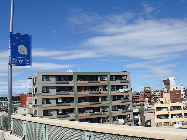
I could not figure out what this sign was for at first – until my friend translated it for me. It means, be quiet! The Japanese politeness culture extends even on to the untamed road network. Don’t play loud music, or honk, or have a loud muffler because people in the very closeby apartments might be asleep.
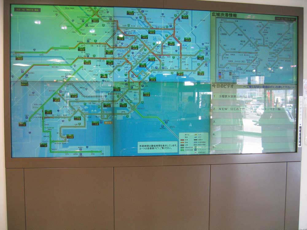
Rest areas all over Japan display large expressway maps with traffic information on them. Tokyo is the largest city in the world, and there really are not that many freeways to go around. Couple the bad traffic with the cultural propensity for punctuality and you have people who are very much into knowing traffic conditions at all times.
If you can’t make it to a rest area, or get the map on your phone, there are these:
LED traffic display signs. Maps of the upcoming junctions and route choices are shown along with an LED display of traffic conditions. This one is currently all black on a Saturday morning – but will light up yellow and red as traffic builds.
Drivers can then make better decisions about which direction to go. How about some of these on Washington’s Beltway, or the 405???

Most of the expressways in the city are two lanes, and wind through skyscrapers and apartments. Each route has a name, and that is used more often than the number. The kanji above the 9 in this route marker translates to “Deep River Line”. Line, as in a train line, but that term translates over to roads here as well.
Route 9 is so named because it was built right over the Sumida River, because there was no where else to build it. We’ll revisit this road from beneath in a future post. The LED sign in the background warms of a traffic jam ahead.
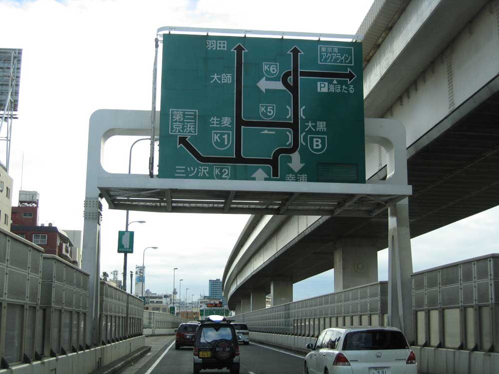
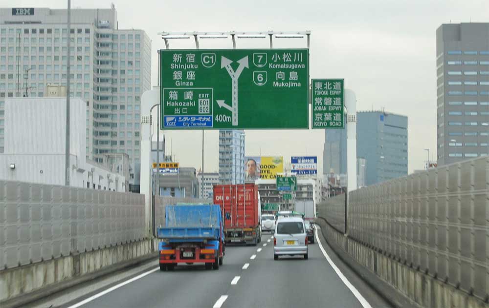
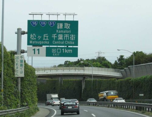
Now for one of the complicated overhead signs. Shuto Expressways’ overhead signs all have the same characteristics, pretty much, although the newest ones are backlit.
Route designations take center stage, if the route is a loop – as in the case of C2 (the second beltway) you’ll get an arrow indicating the direction of travel, in this case it is counter-clockwise. Control point route markers are placed beneath the main shield to indicate that these other freeways can be reached by taking this one. Control points are marked in Kanji (large) and Romanji (smaller) – secondary control points are placed at each end. Sometimes, the important junctions like this one are given a name. Travel times to other destinations are listed in the LED displays up top. This sign assembly is near the port southeast of the city, where the Bayshore Line meets the second Beltway. There is a lot of truck traffic on the B route, as it connects all of the port areas.
This view is on the C1, or the innermost beltway.
This is the most interesting road in Tokyo, in my opinion. It runs through tunnels near the Imperial Palace, between Shinjuku’s skyscrapers, and connects most of the spoke freeways. This view is looking northward on the eastern side of the inner city. The road has two decks, and winds a great deal.

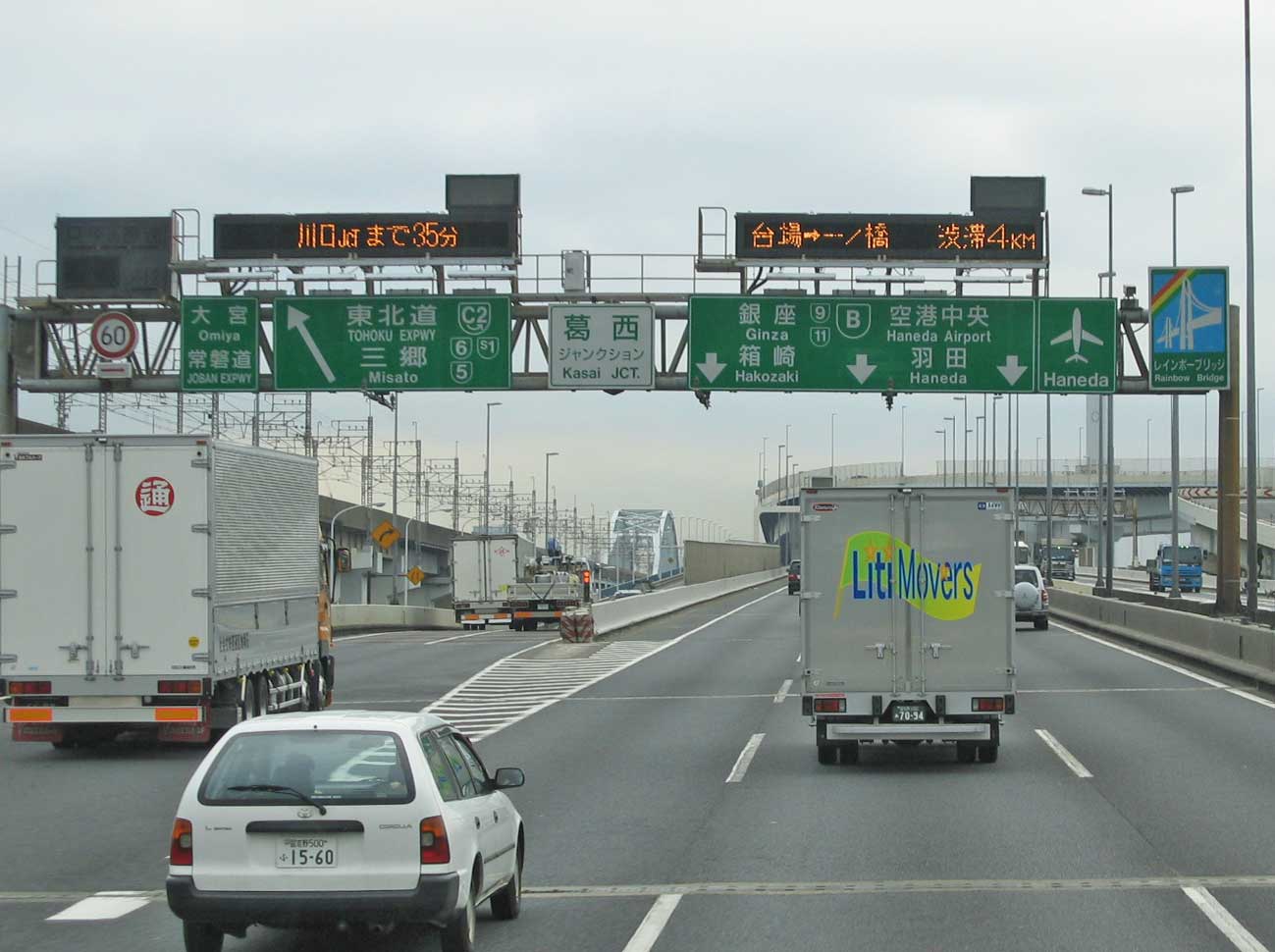
This view is looking towards the C1 junction from Route 6, coming in from the east. Travel choices for the C1 indicate that you can choose between clockwise or counter-clockwise travel around the inner city. Most signs in the densest part of the city omit exit numbers, and because Japan does not use many street names, they usually omit those, too.
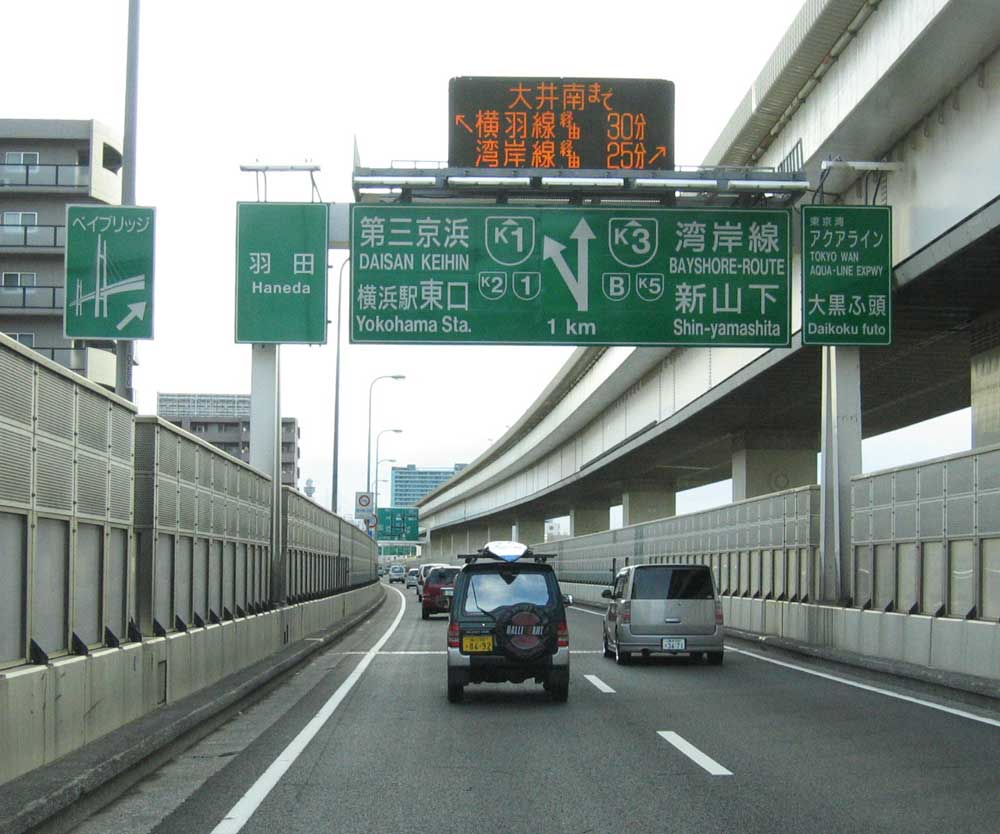
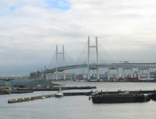
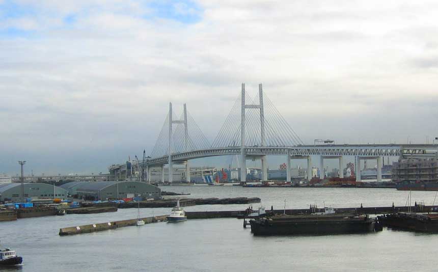
This is a view of Yokohama’s K3 expressway. Most of this route is elevated as well, and runs south of downtown.
Yokohama is Japan’s second largest city, and has its share of really neat road-related things. The leftmost sign points towards the Yokohama Bay Bridge, and the rightmost points towards the Aqua-line – both of which will show up in later posts.
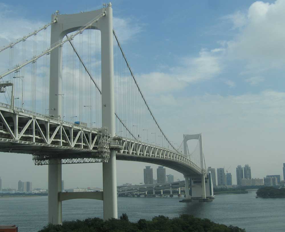
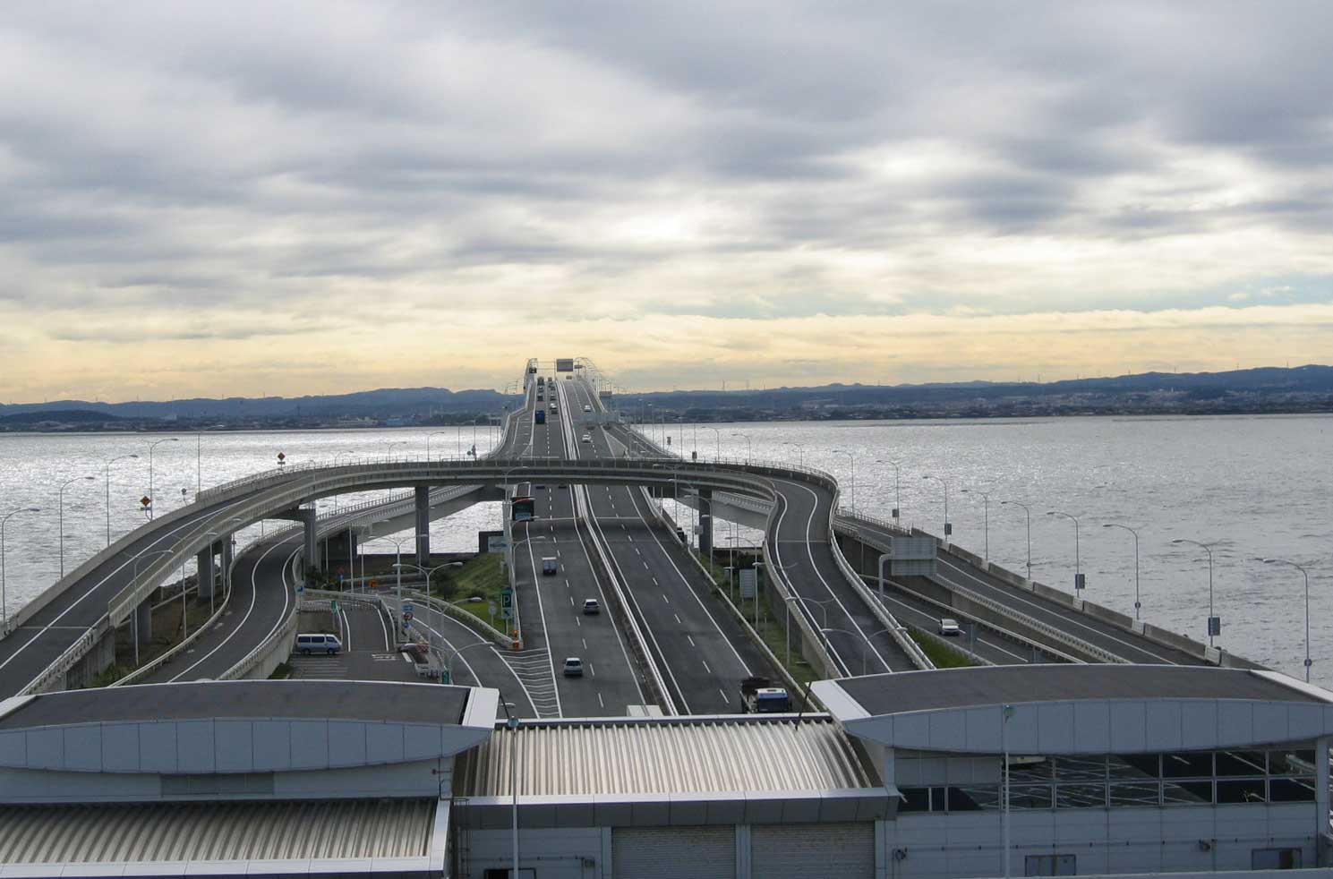
Finally, the Rainbow Bridge. You will not find any “no photography” signs on this one, this is not New York!
The Rainbow Bridge was built in the early 90s and is a beloved local landmark. It links the mainland part of the city with the manmade island city of Odaiba, and the B Expressway. If you’ve ever seen Kill Bill Volume 1, this is the bridge that O-Ren Ishii crosses on her way to the House of Blue Leaves – for the final showdown.
I spent three years in the Tokyo area, and undoubtedly, Japan has the most expensive, and one of the most congested expressway networks in the world.
Big issue is that only until recently, the Government of Japan had no eminant domain laws to acquire the land necessary to build a good road system, which made expressway construction a very long and costly task.
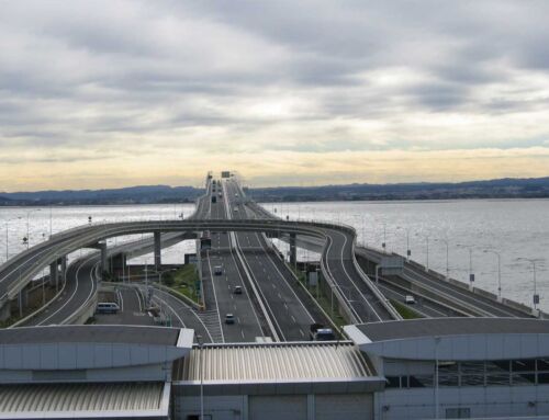
Furthermore, if you want to go from a location north of Tokyo to somewhere south of the city, the only way to do so via expressways is to drive through downtown Tokyo. There is–as of right now–no expressways that bypass Tokyo, although the Keno-do Expressway will serve that purpose once it is completed. About 25% of this 200 km ring road is complete as of 2006.
It all seems so familiar to me. I spent a month in Tokyo last summer. I only used the Wangan B for street racing,all others just to get there. I wonder if you have pictures of Mt. Hakone.
P.S.-Theese highways are the ones I used to get to the Wangan:
Kanjyo C1
Mukojima 6
Fukagawa 9
Here are some other names:
Daiba 11
Yokohane K1
Kariba K3
Haneda 1
Daikoku K5
Shibuya 3
Shinjuku 4
Ikeburo 5
i work in tokyo as a driver before, now that i come back home, i really missed the highway specially in the morning.
When I saw this picture, I remember about a game : Wangan Midnight Maximum Tune…
I am currently writing a book on “Visual Management” for manufacturing industries. I’d like to use your picture above “LED traffic display signs”, to illustrate the issues coming from being immersed in a situation with no instantly readable pictograms.
It is a frequent case in the industry when people are given more or less well written instructions and have to decide what to do by themselves with incomplete data.
Warmest thanks in advance,
Robert