
Presenting: The Aqua Line! Little known outside of Japan and civil engineering circles, it is one of the coolest things in Japan to see. Not just because of the road, but because of the amazing view.
The Aqua-Line is a bridge-tunnel complex that spans Tokyo Bay. It’s a very important part of the regional road network because it connects the country’s major international airport at Narita in Chiba Prefecture (east) with the city’s second and third largest urban areas (Yokohama and Osaka) to the west – bypassing Tokyo and it’s traffic completely. It’s also part of the larger Tokyo freeway network in that it is part of the third beltway project, which is currently under construction. In the center of the span sits the Umi-Hotaru (Ocean-Firefly) – an artificial island with a viewing platform and visitor’s area.
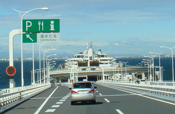
The design of Umi-Hotaru is meant to invoke a ship sailing towards the city. It looks a bit like a ferry, coming from the east (bridge) portion of the span.
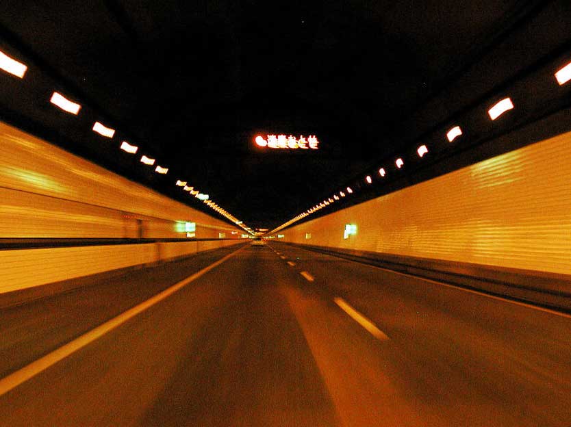
LED signs warn of high winds upon entrance of exit of the tunnel when needed. The bridge portion of the span is 4 km long, while the tunnel section is 9.6 km long, making it one of the world’s longest road tunnels – and the longest road tunnel on earth that runs under a body of water. Large numbers on each side of the tunnel tell the driver how much longer it is to the end (8km……..7km……….etc)
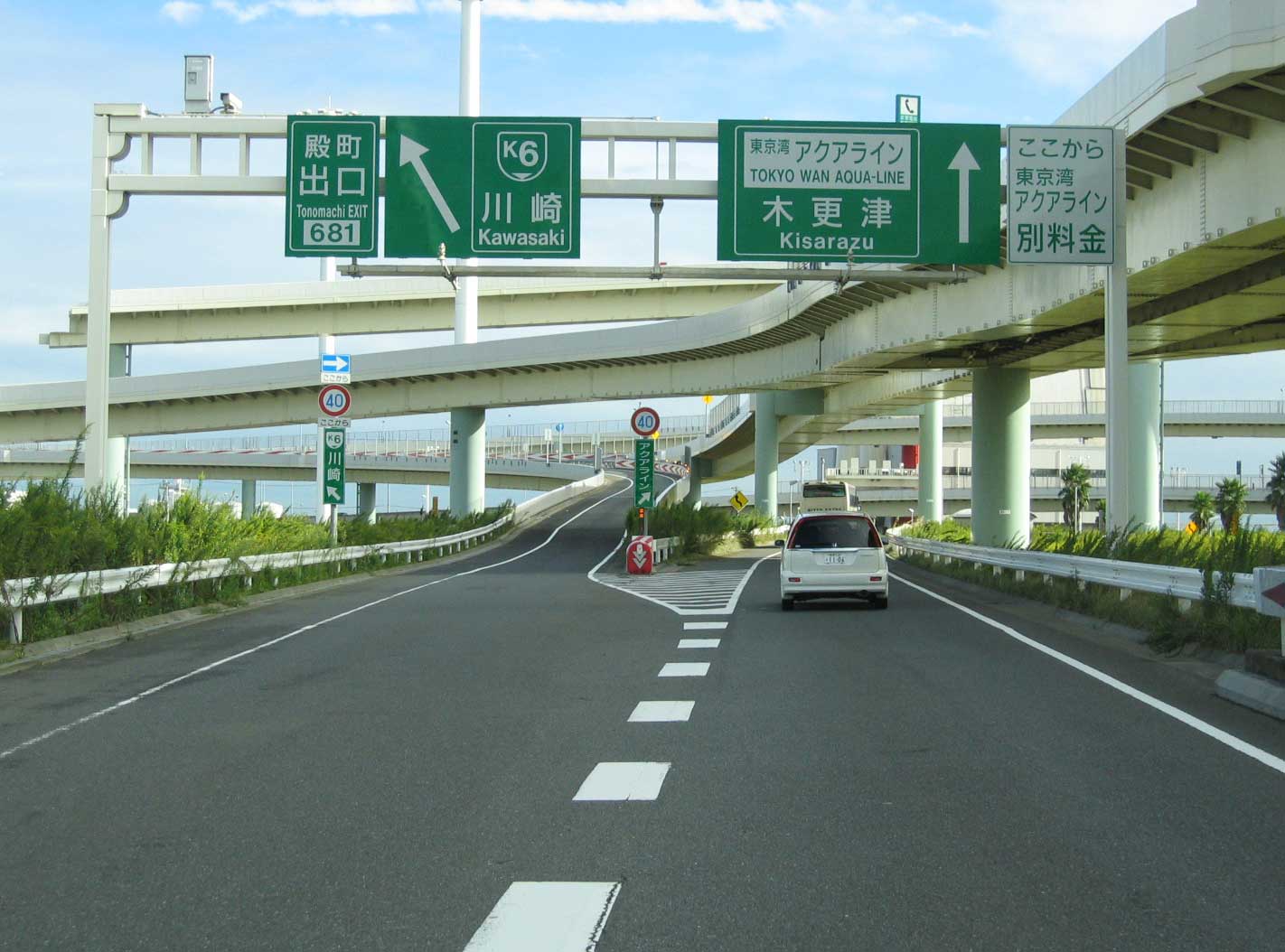
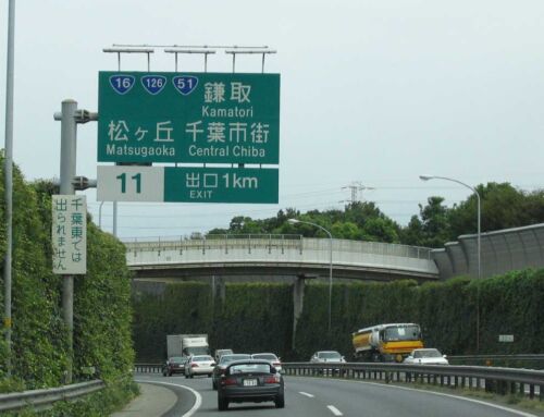
The western entrance to the span consists of a large four-level stack, in which the lowest level is partially buried underground. The entire interchange sits on a manmade island just off the coast of the city of Kawasaki. The aqua line is prominently signed all around the Kawasaki/Yokohama area. Traffic LED signs warn of backups on the road. Occassionally an accident on the aqua line (Japanese drivers speed like mad) will back up traffic for up to 8 hours.
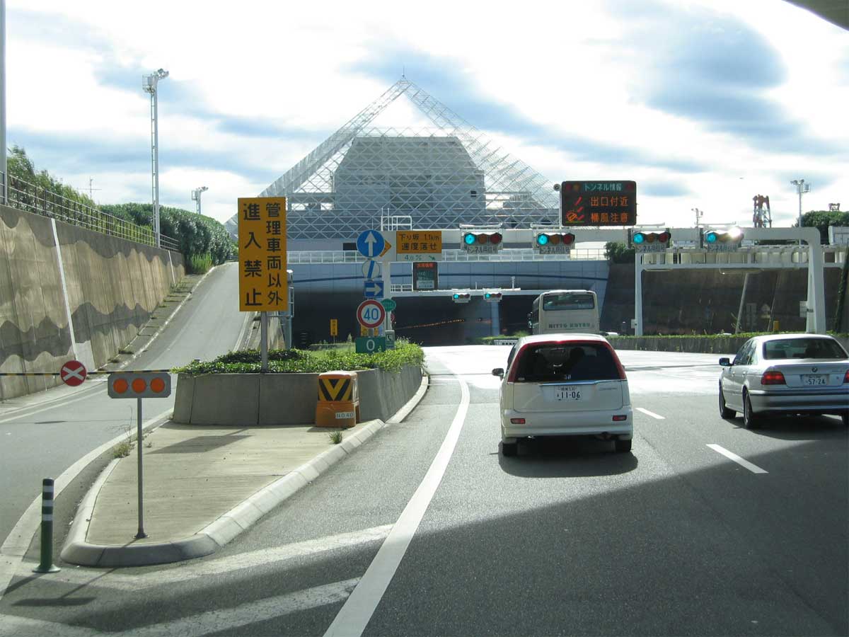
The western entrance to the tunnel, upon leaving the stack. LED signs warn of high winds when exiting. The venting system of the tunnel consists of two large chimney structures. The landside chimney features a pyramid structure sitting above the tunnel entrance.
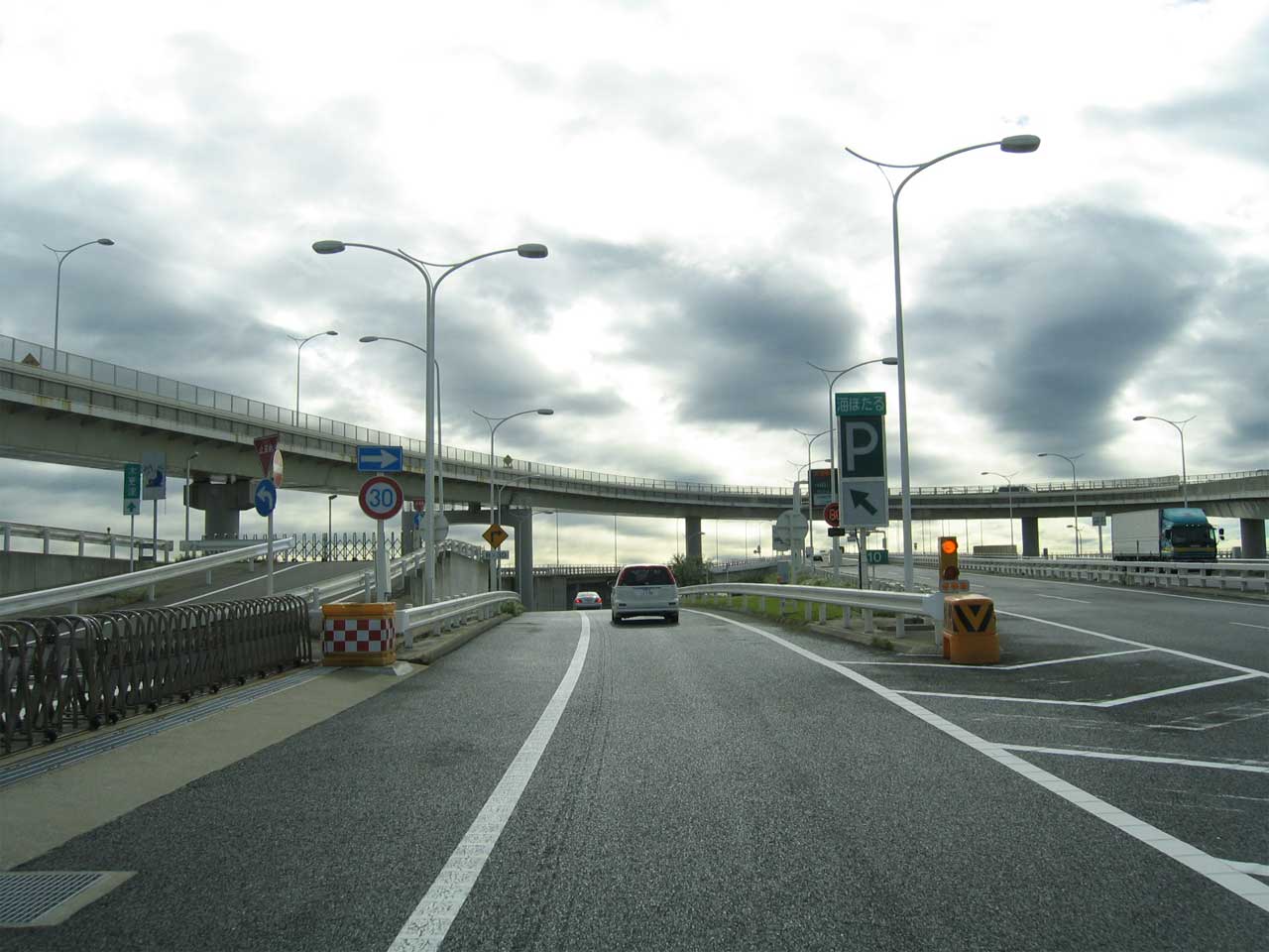
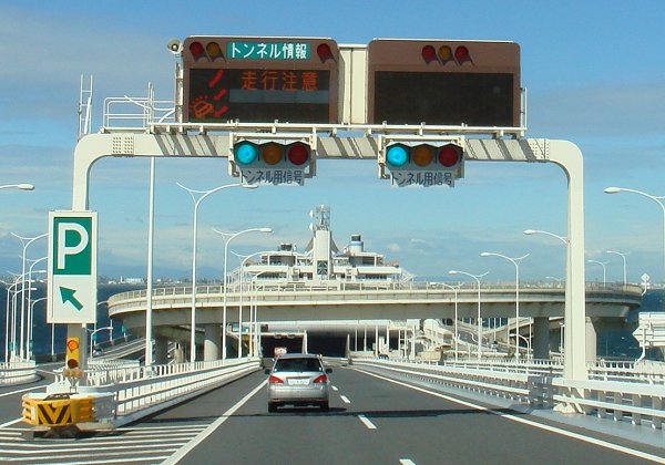
Upon exiting the tunnel, drivers are immediately faced with the decision to exit at Umi-Hotaru or to continue to Chiba Prefecture. Let’s exit. The manmade island features a sweeping flyover.
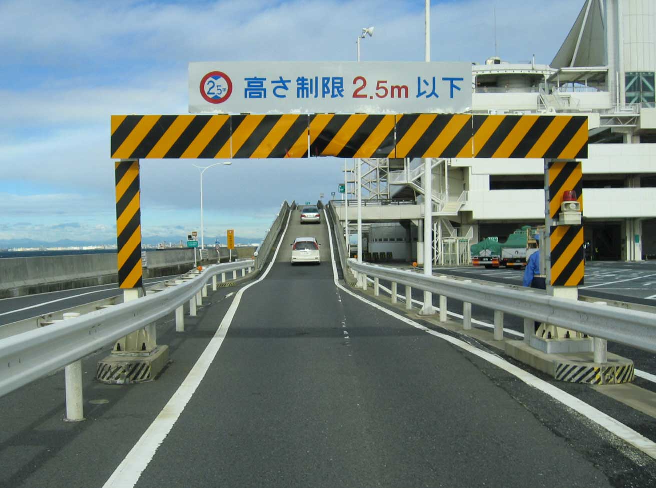
Upon entering Umi-Hotaru, drivers are routed into the central parking structure. The rest area has restaurants and shops, and normally remains pretty crowded even in really windy weather. The entire span opened in December of 1997 after construction delays, and it could use a paint job.
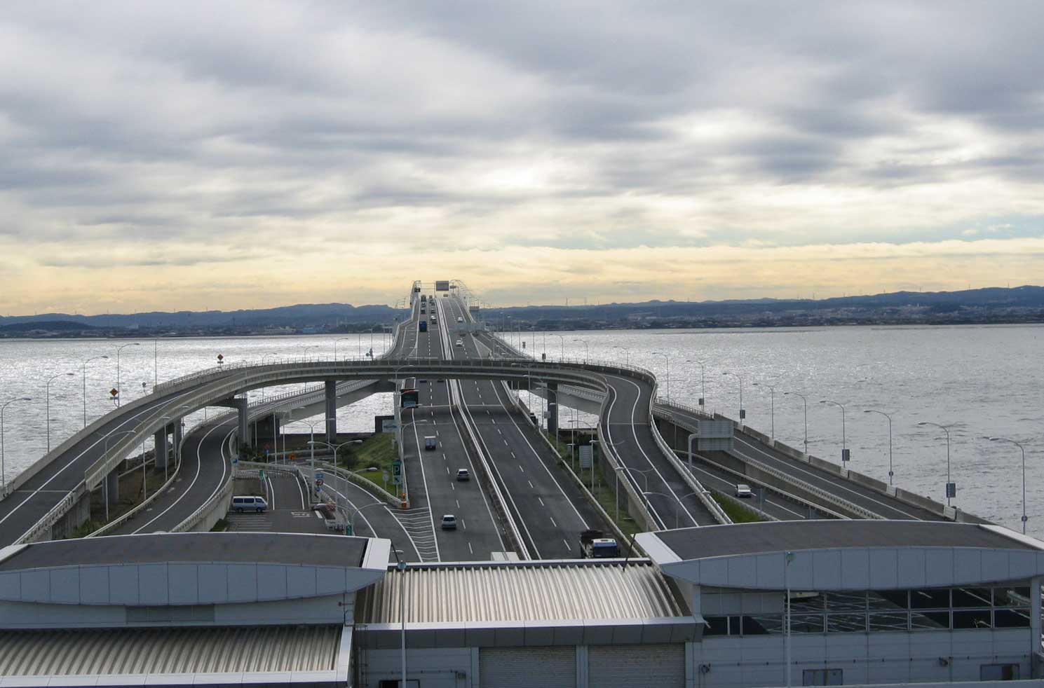
Looking east from the rest area, the network of ramps serving Umi-Hotaru are obvious, as is the short 4km bridge to the mainland.
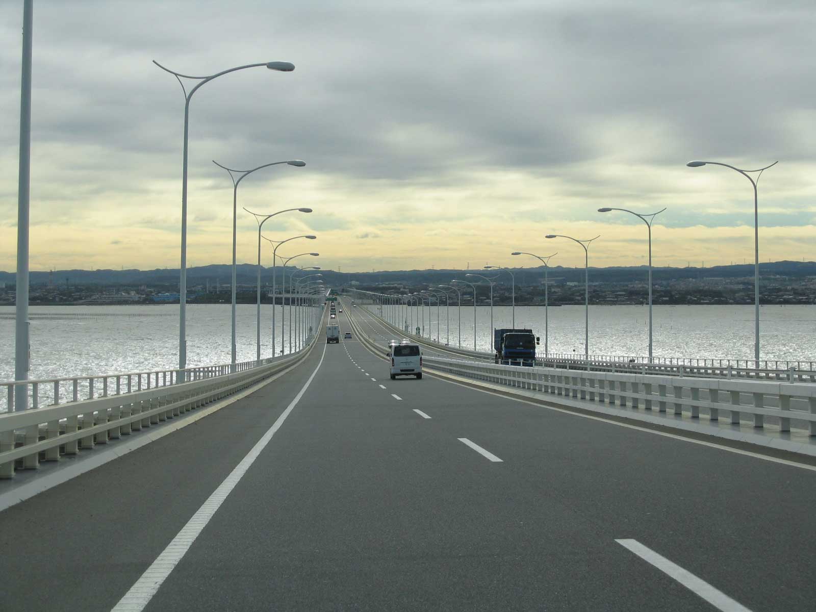
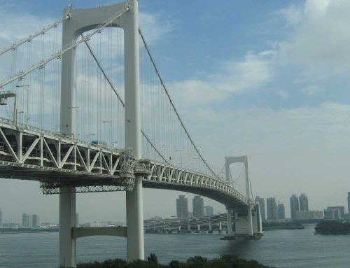
Looking eastward towards Chiba on the bridge portion of the route.
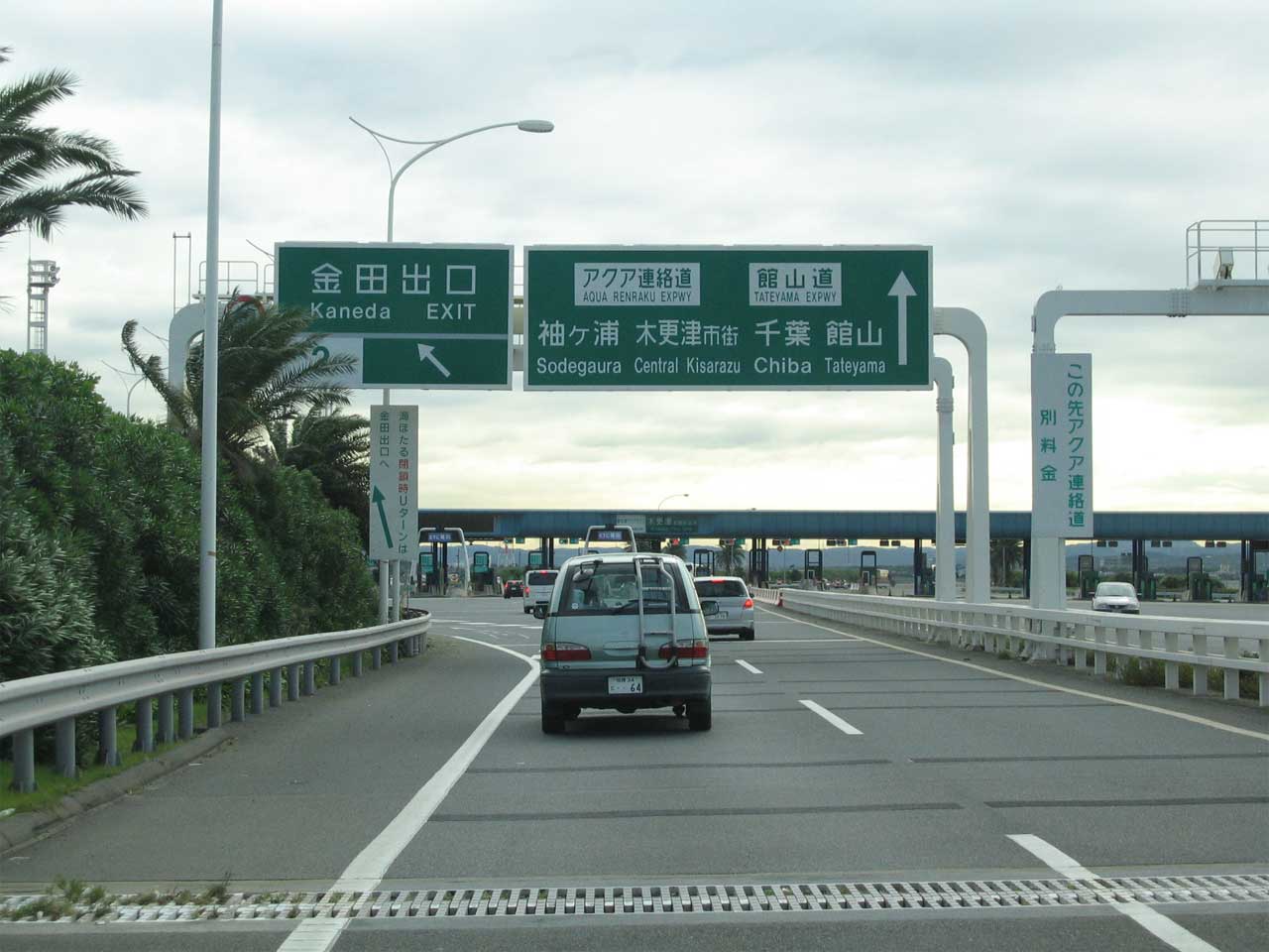
The Aqua Line is a toll facility, and indeed is one of the most expensive toll facilities in the world. When constructed, the road cost 4,000 yen to traverse – which translates to about $40 US dollars. No one used it. In 2000 the toll was reduced to 3,000 yen to increase traffic, but that did not work much either. The Aqua Line continues to be a money pit year after year. Drivers exiting the aqua to the east can continue into Chiba on the Tateyama Expressway, or meader to the Ocean going straight ahead. Its not signed anywhere, but the span sends National Route 409 over the bay, and is signed as Shuto Expressway K3 on the western side.
Now for two views (click for larger)
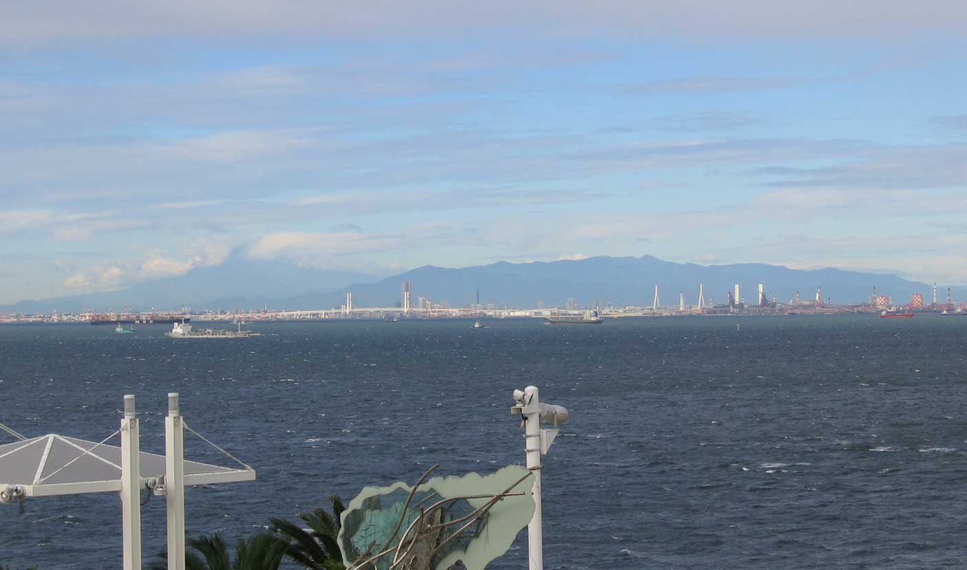
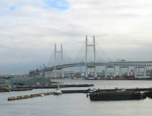
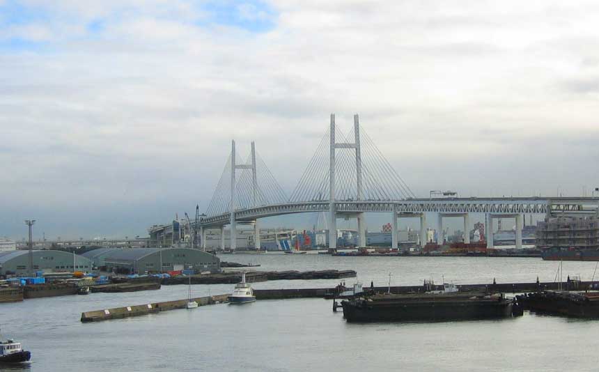
Looking southwest from Umi-Hotaru, Yokohama’s skyline is visible. The cable stayed bay bridges are prominent features, and most prominent is Mount Fuji – which is obscured by clouds (as usual) on the left side of this photo.
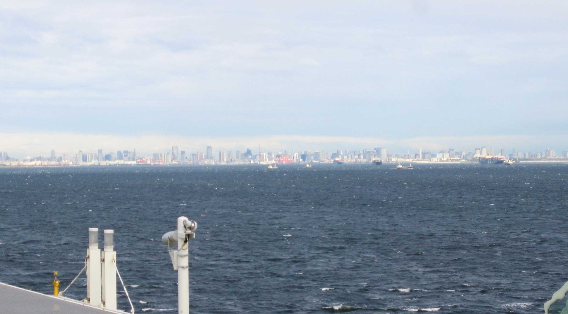
The skyline of Tokyo is extremely visible looking west and north from Umi-Hotaru. The full skyline of the city takes of 40% of the entire horizon, and is unfathomable to look at.
Sounds like Japan’s equivalent (and upgrading) of the Chesapeake Bay Complex in Virginia…Impressive!