
at long last, I am back, with some photos for everyone … highway signs which showed up at Roy Reed’s gas and oil collectible swap meet, and then some scenery from the subsequent days, when I found I had some time on my hands and did a quick trip up to the Bay Area and Sacramento. enjoy!
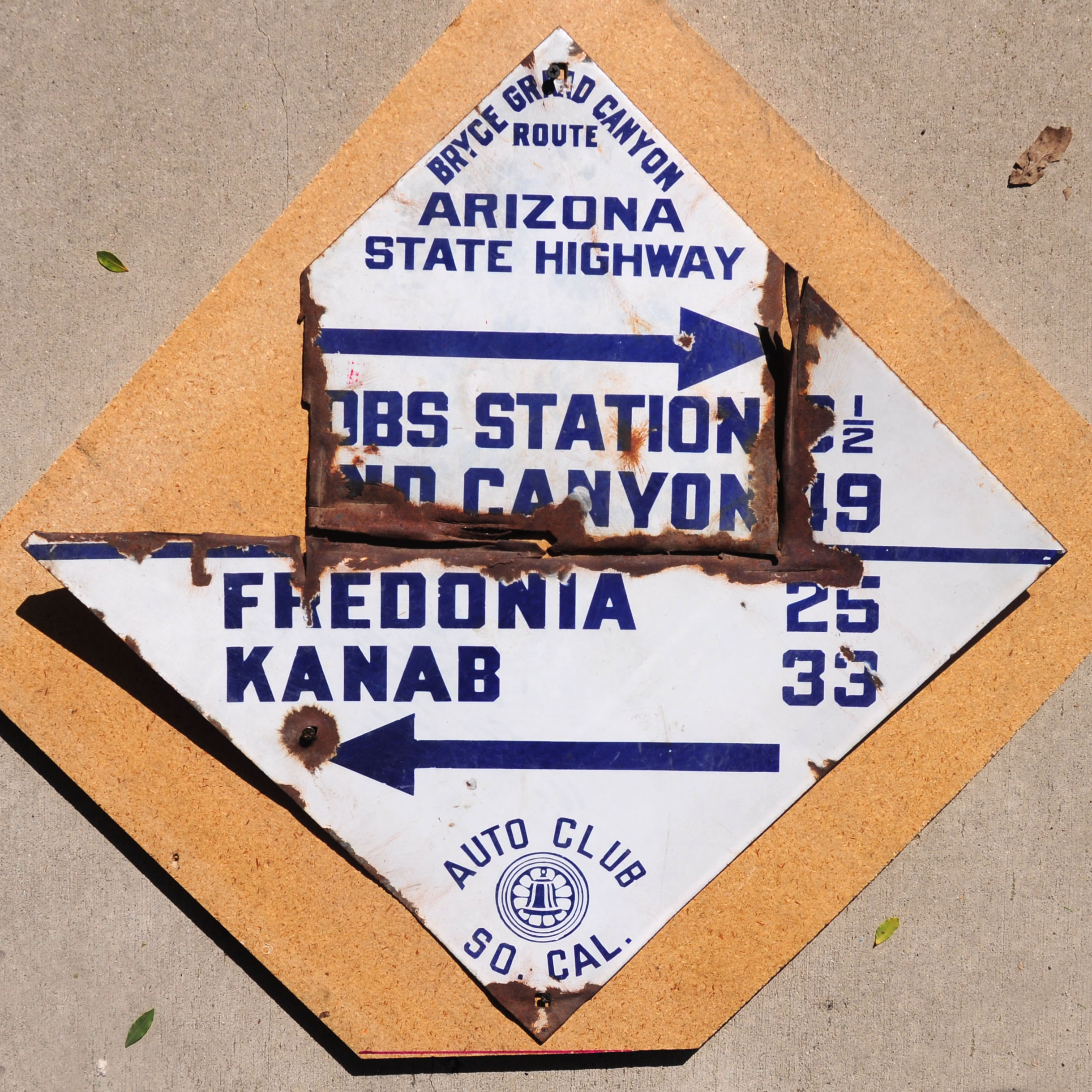
This poor guide sign has been cut into three pieces – and one is missing. But still, this is the only ACSC diamond I have ever seen which mentions “Arizona State Highway” and, even more spectacularly, the Grand Canyon! Certainly unique.
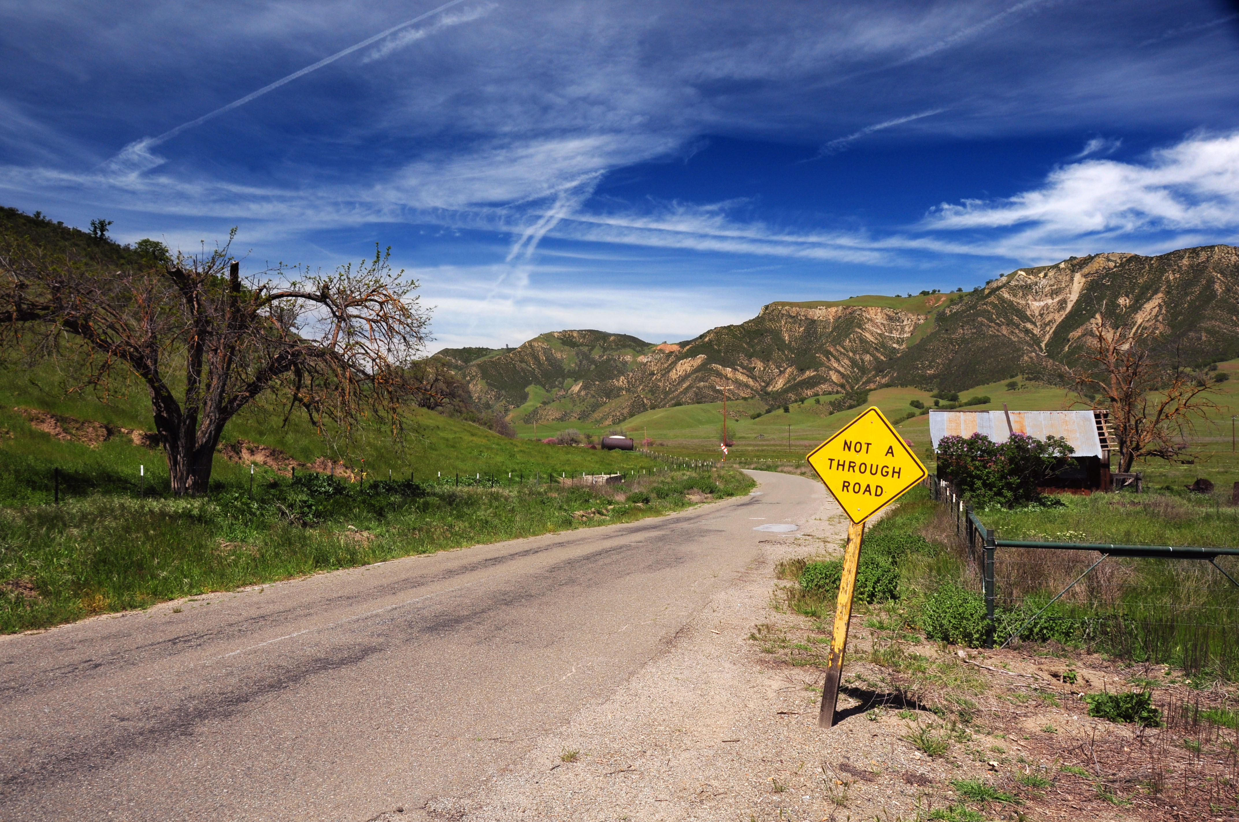
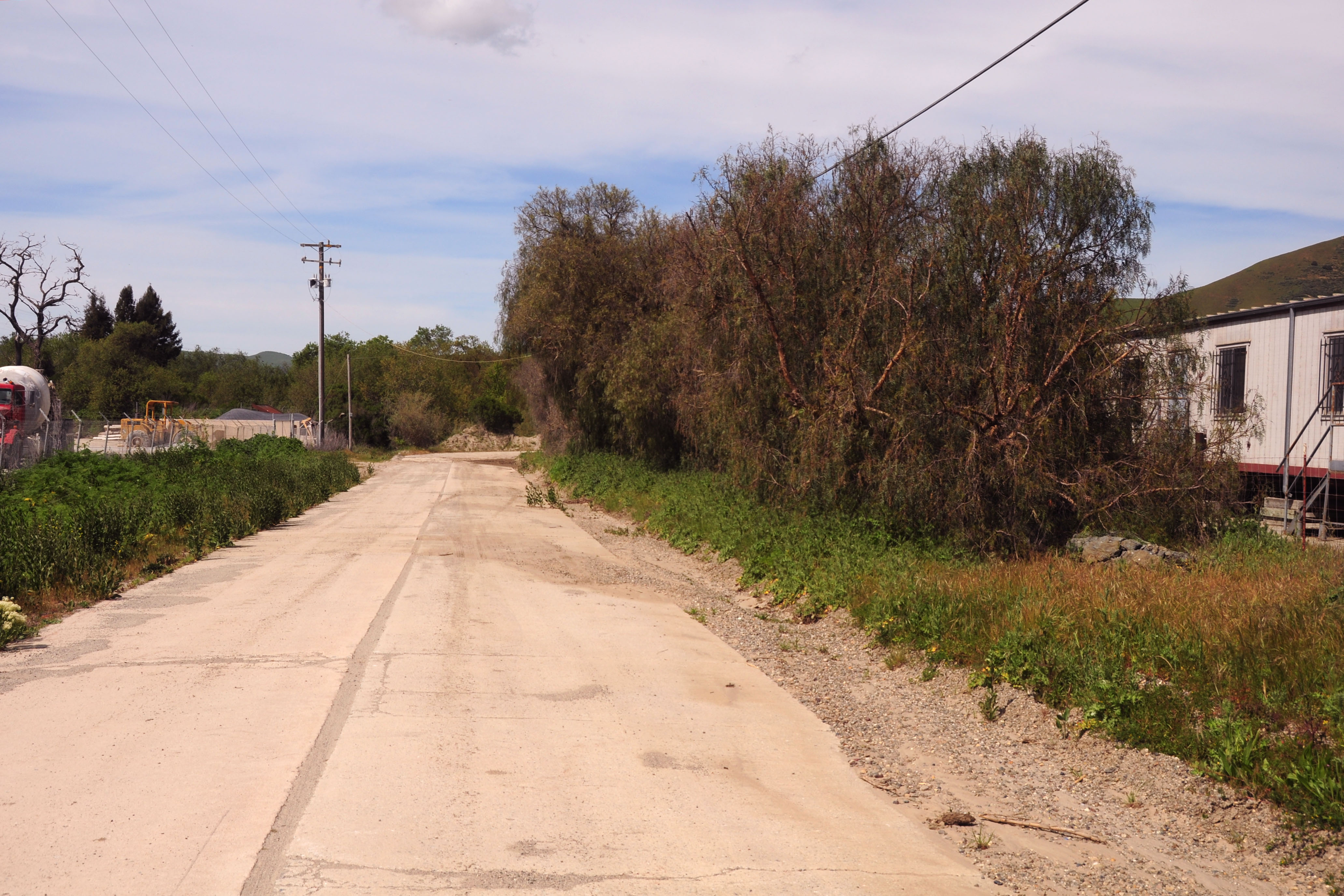
After Roy’s, we explore many roads – not all of which go to any particular place.
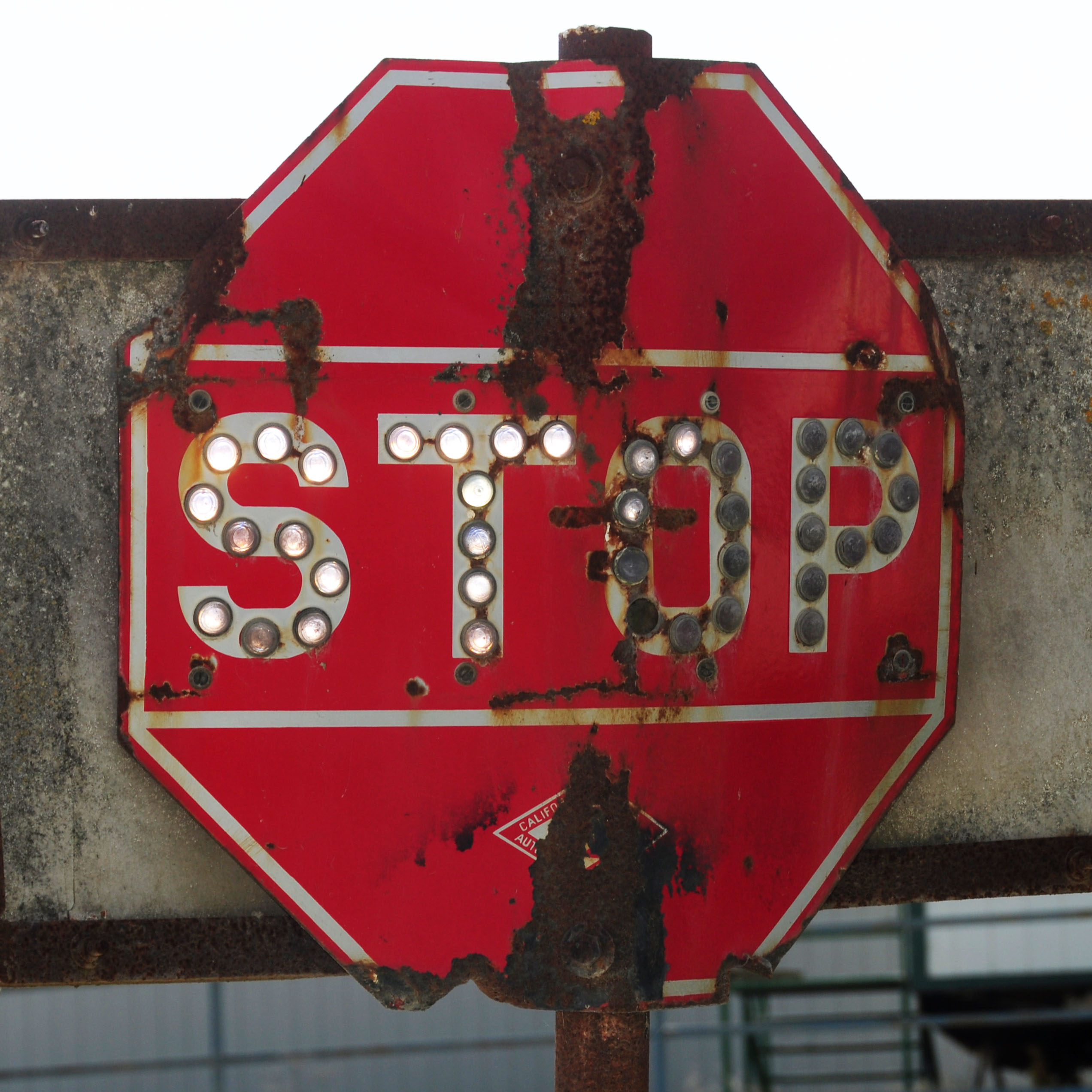
Well, what do we have here? Oh, just the only known surviving cateyed sign in California! This stop sign dates to between 1934 and 1942, and is the first cateyed sign anyone’s seen since the mid-1990s. A miracle that it would survive… and it does!
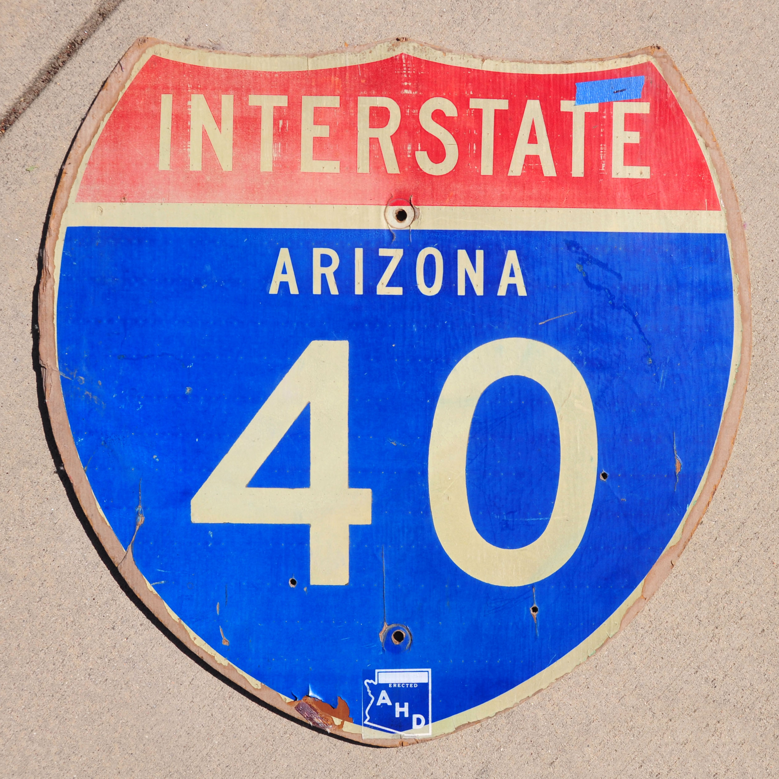
A nice early 1980s wood interstate shield from Arizona.
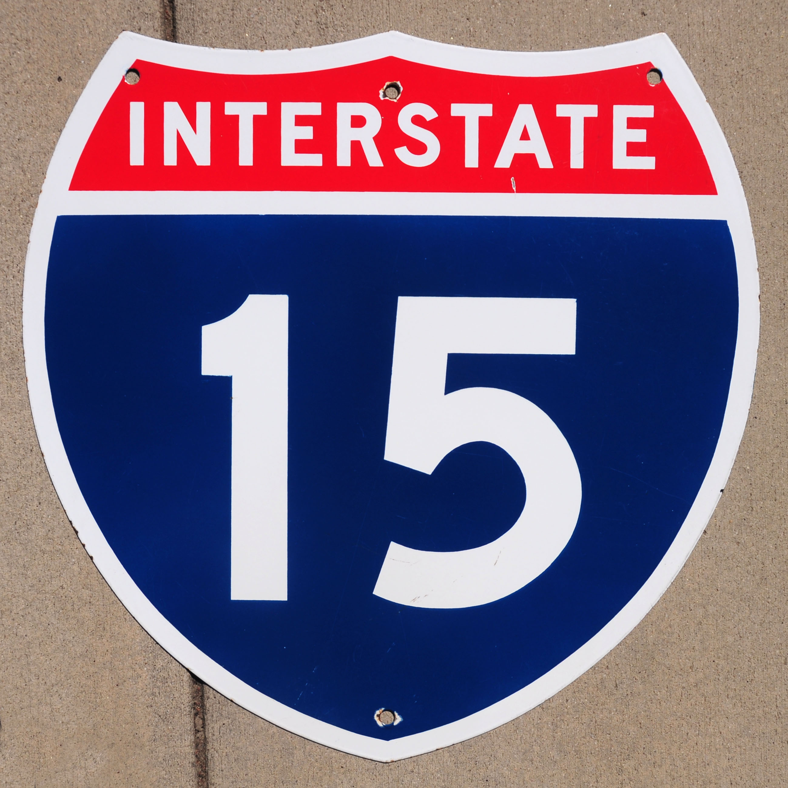
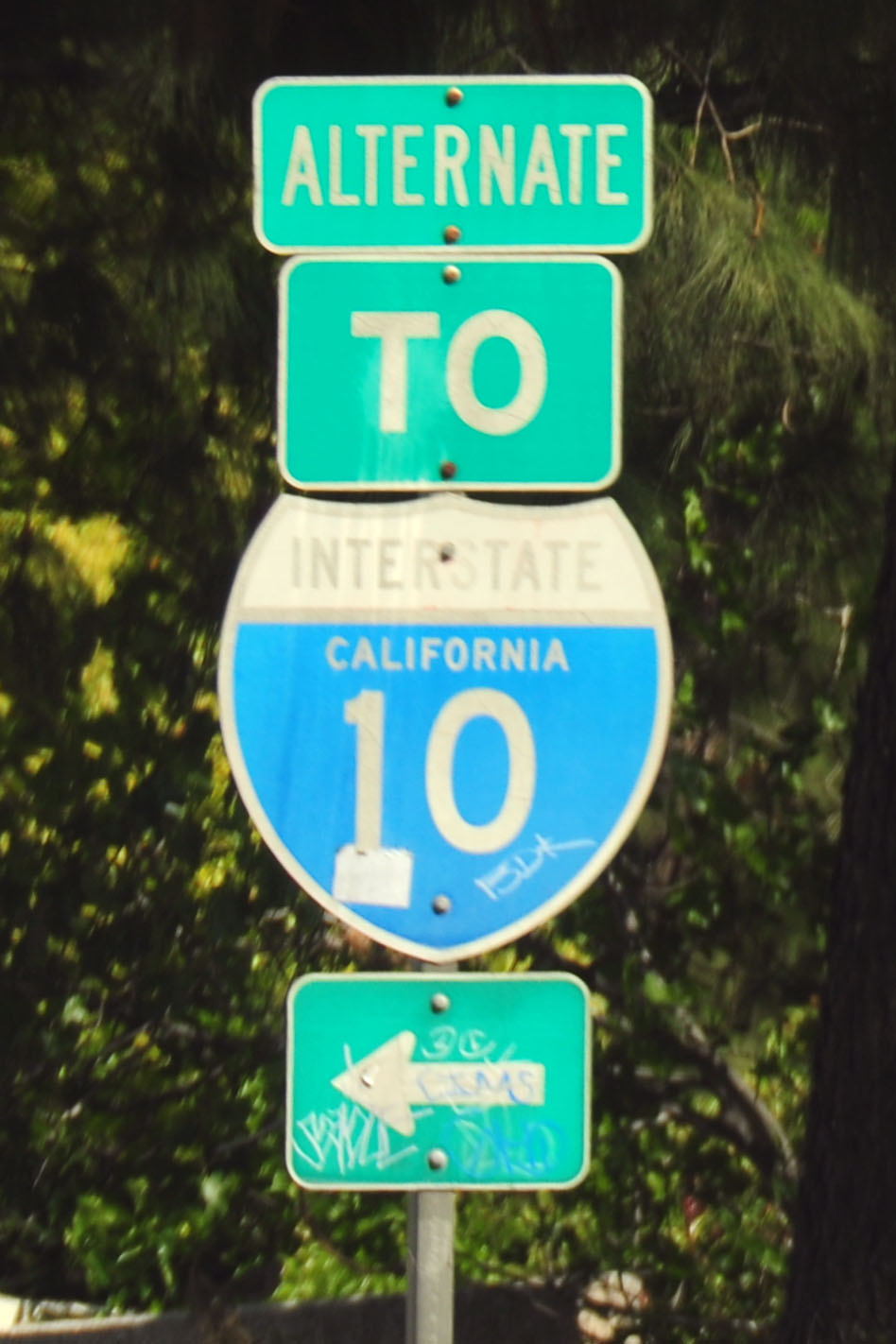
A porcelain interstate marker. California, 1970, intended to be affixed to a green guide sign.
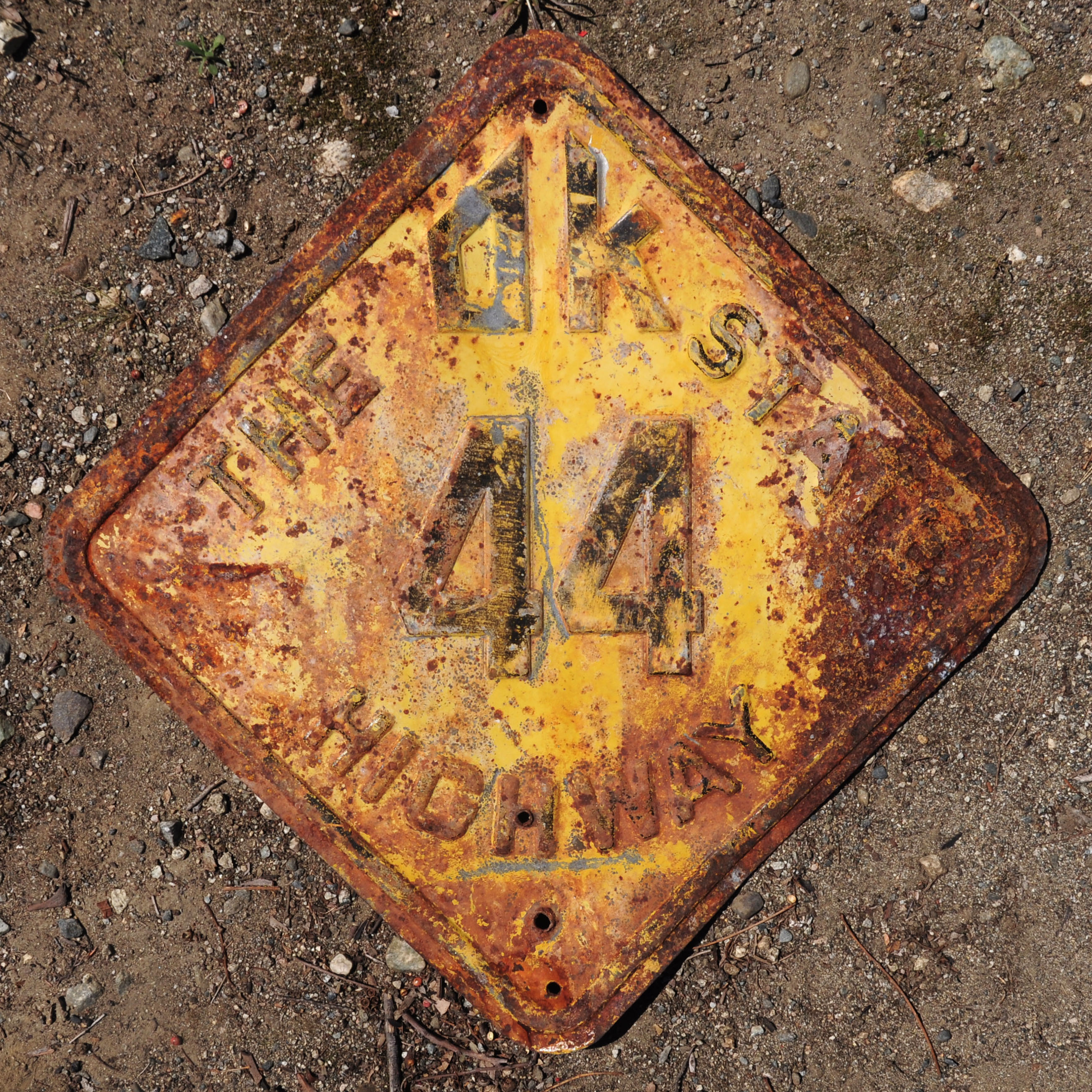
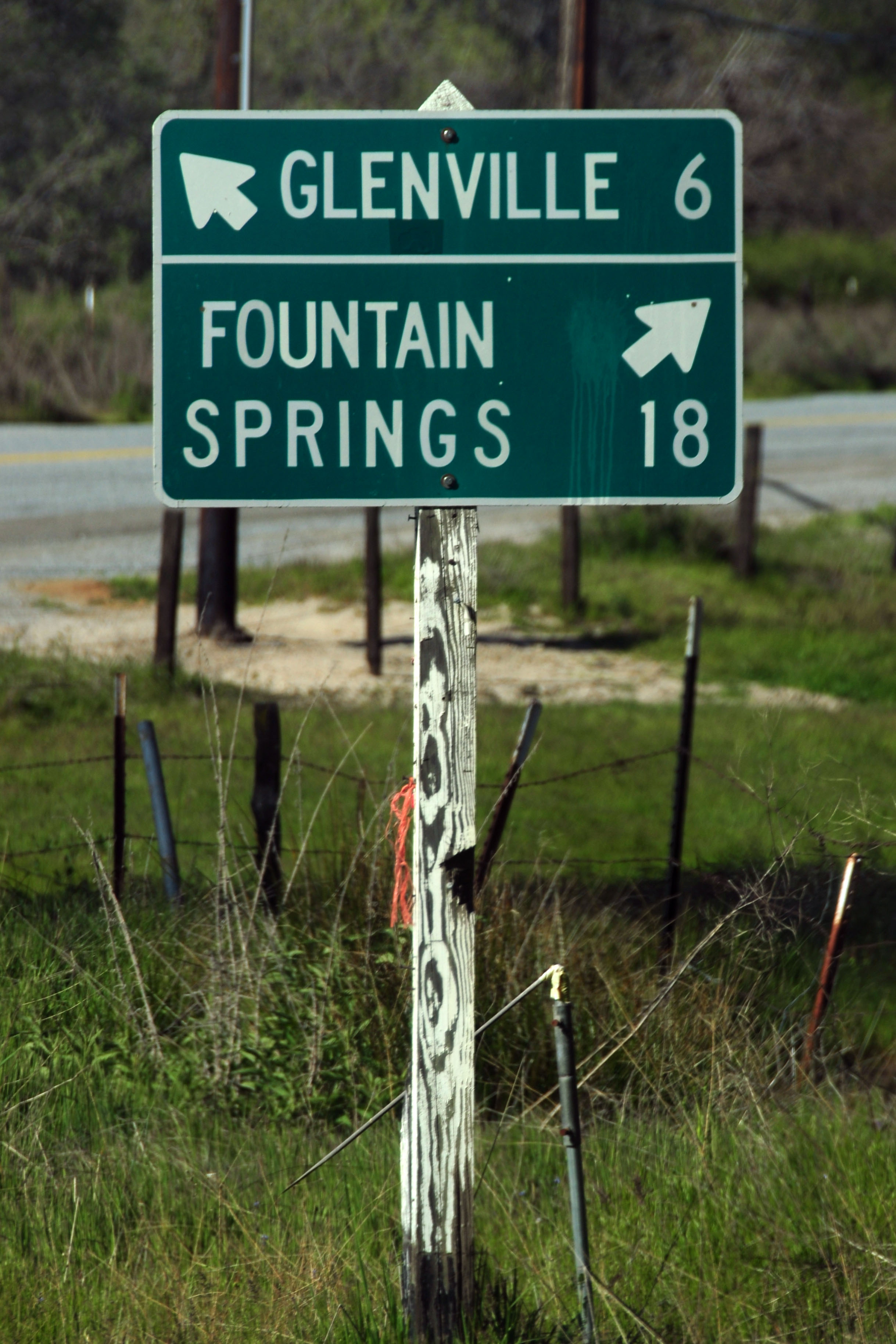
A 1920s or 1930s Oklahoma state route marker.

Route 66 before it was route 66. Foothill Boulevard in Pasadena became US-66 in 1926. This sign dates to 1916 or so, and traces the route between San Bernardino and Los Angeles.
Rectangular guide signs with an inverse-text line at the top, like this 1937-1940 example, are quite a difficult find. I know of just this one, and one other.
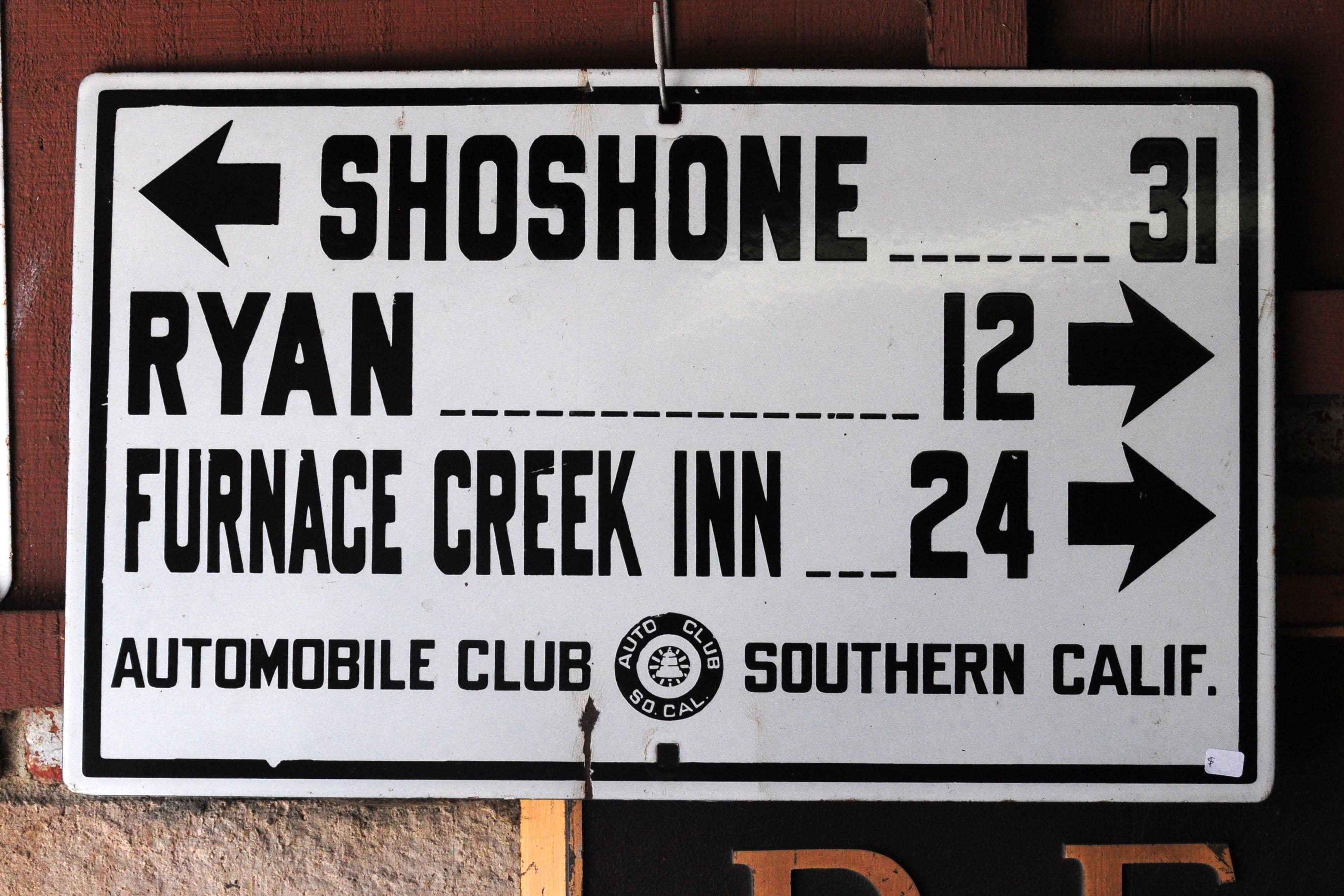
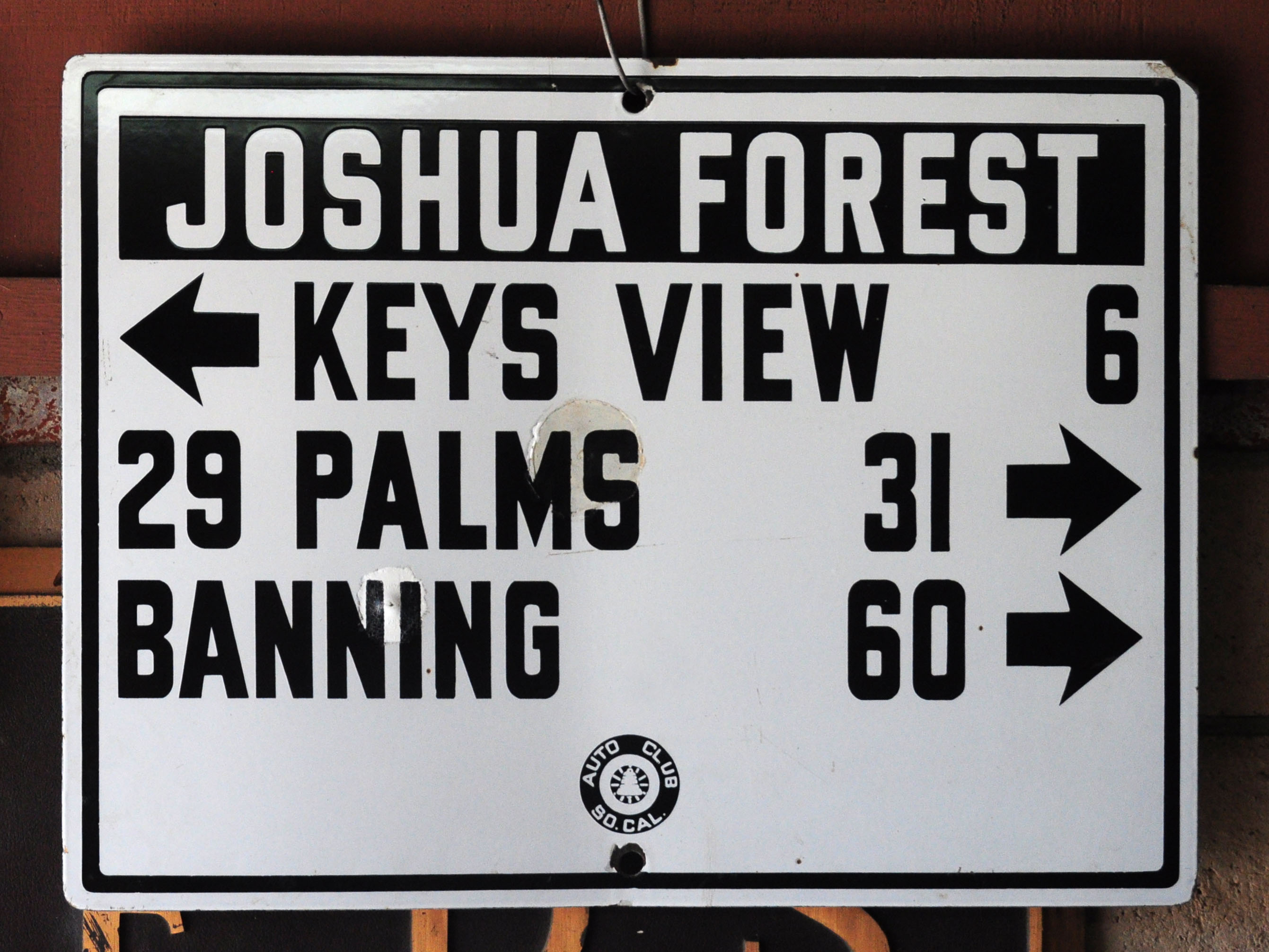
This guide sign from the Death Valley Area dates to 1929-1934.

This Northern California guide sign dates to 1913-14, and is from the first run of the yellow diamonds. No distances, just destinations, marks it as a very early sign. It was posted on what would become US Route 101 in 1926.
Leaving Roy’s. Don’t ask why this gantry has green banners and arrow. I blame the city of Fontana.
If you catch it at the right angle, the new style of reflective sheeting shows why it is called Prismatic High Intensity.

Not at Roy’s, but a remarkable California route marker from 1934.
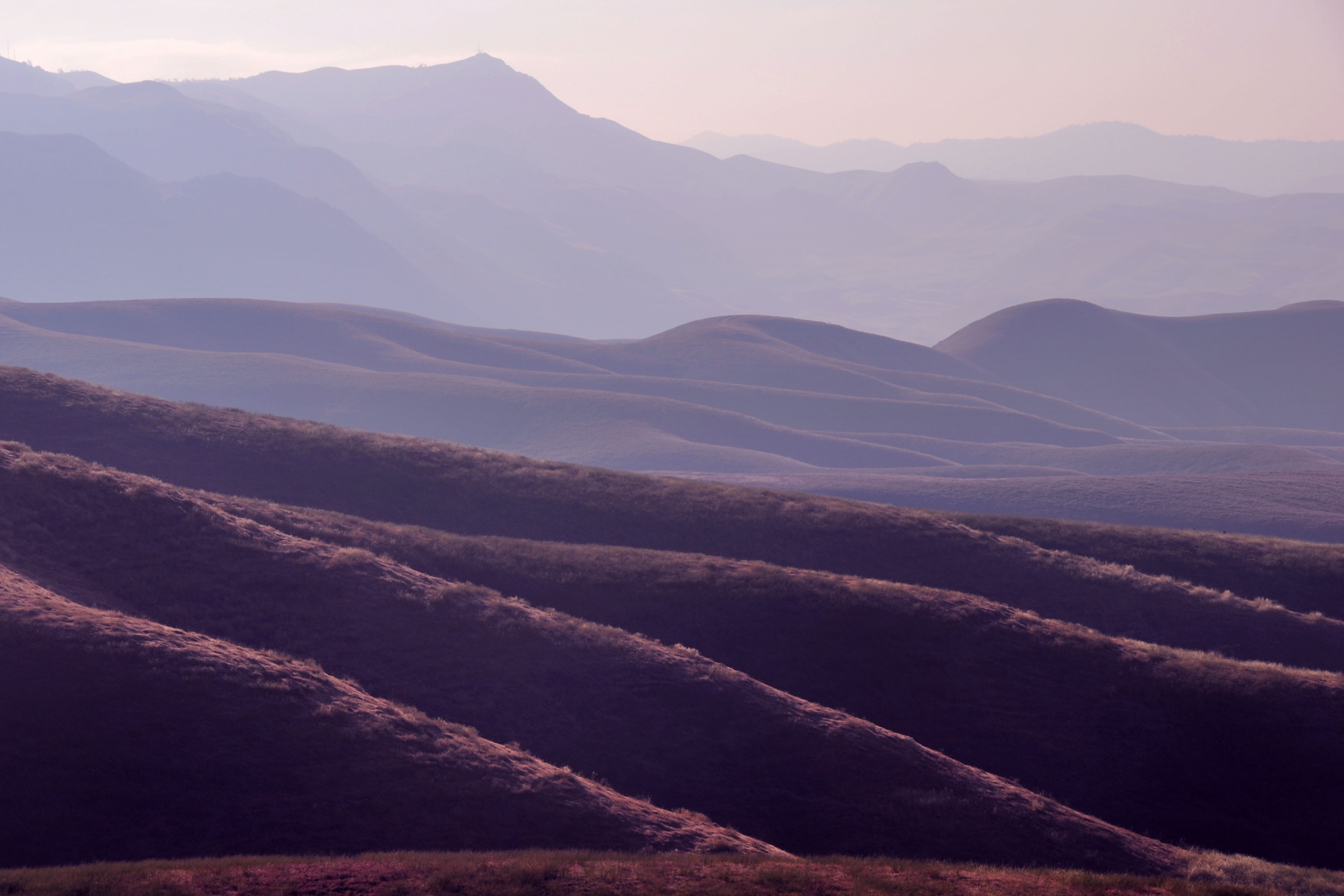
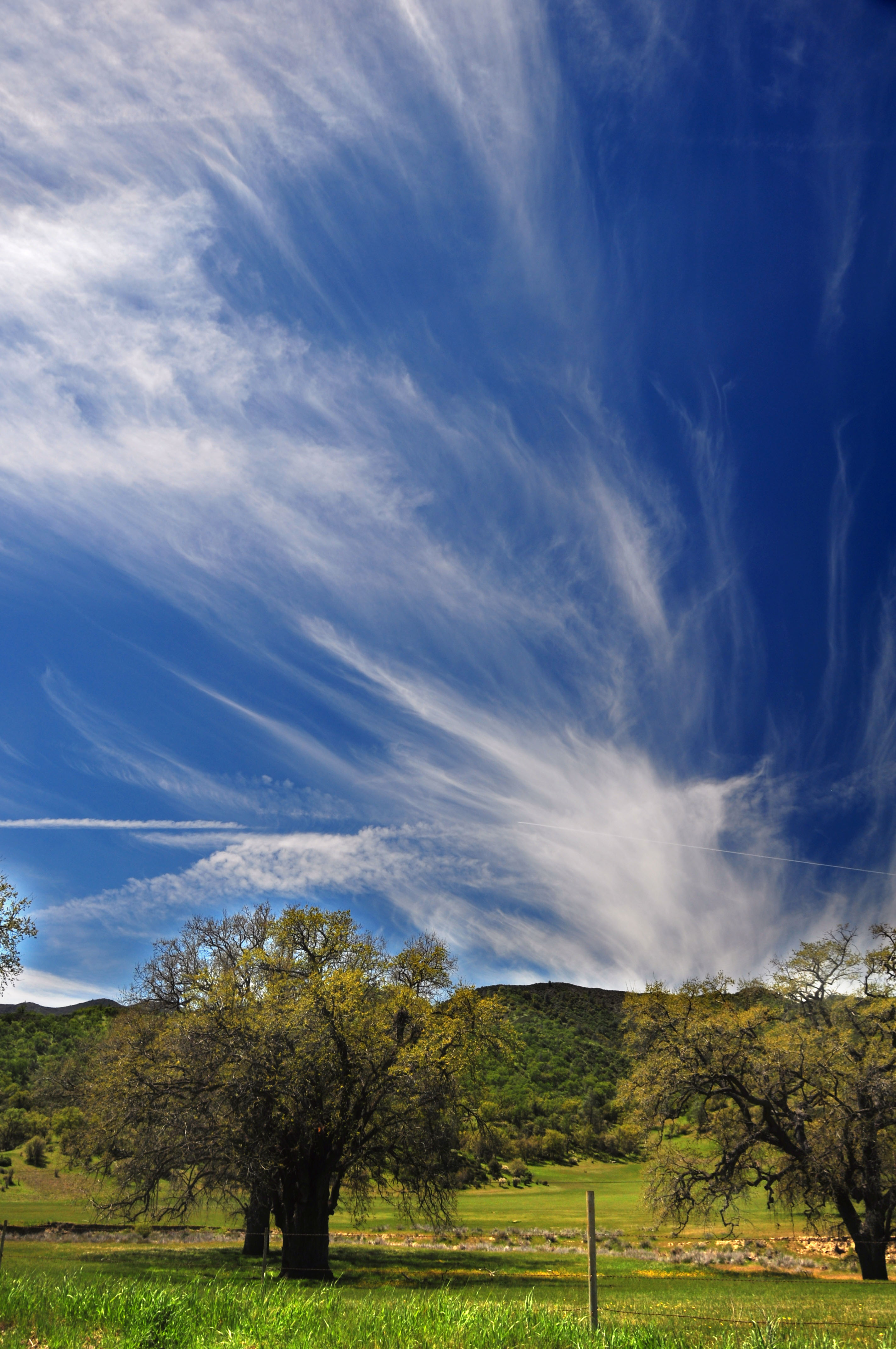
Day two of our travels – sunrise over the hills just east of Bakersfield. Old route 155 gives us this view.
Hills and high clouds off highway 155.
This isn’t an old white guide sign … but the post it is on dates back to the time when it did hold an example of the previous standard.
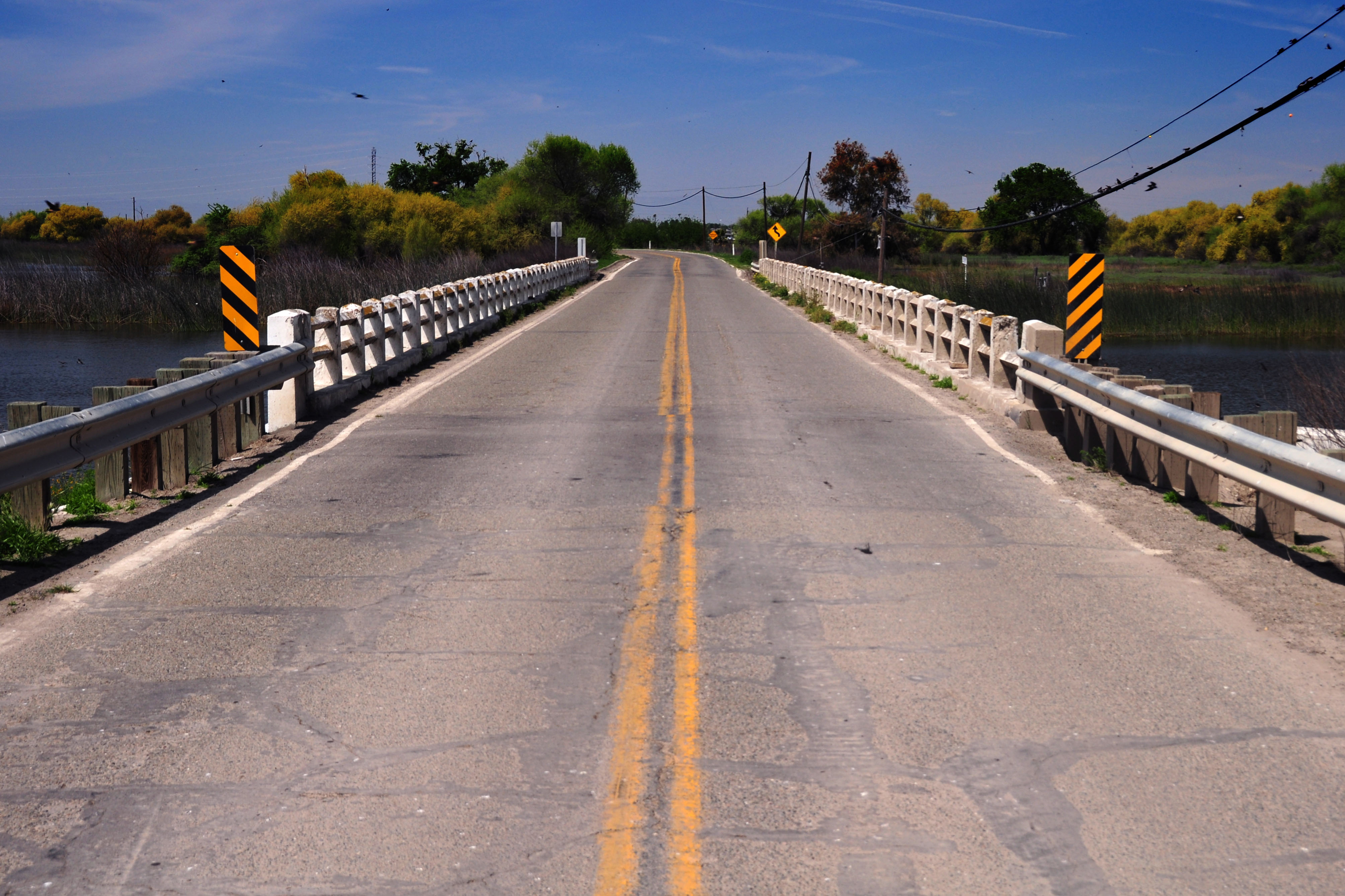
We find this 1930s bridge on an old 198 alignment south of Hanford.
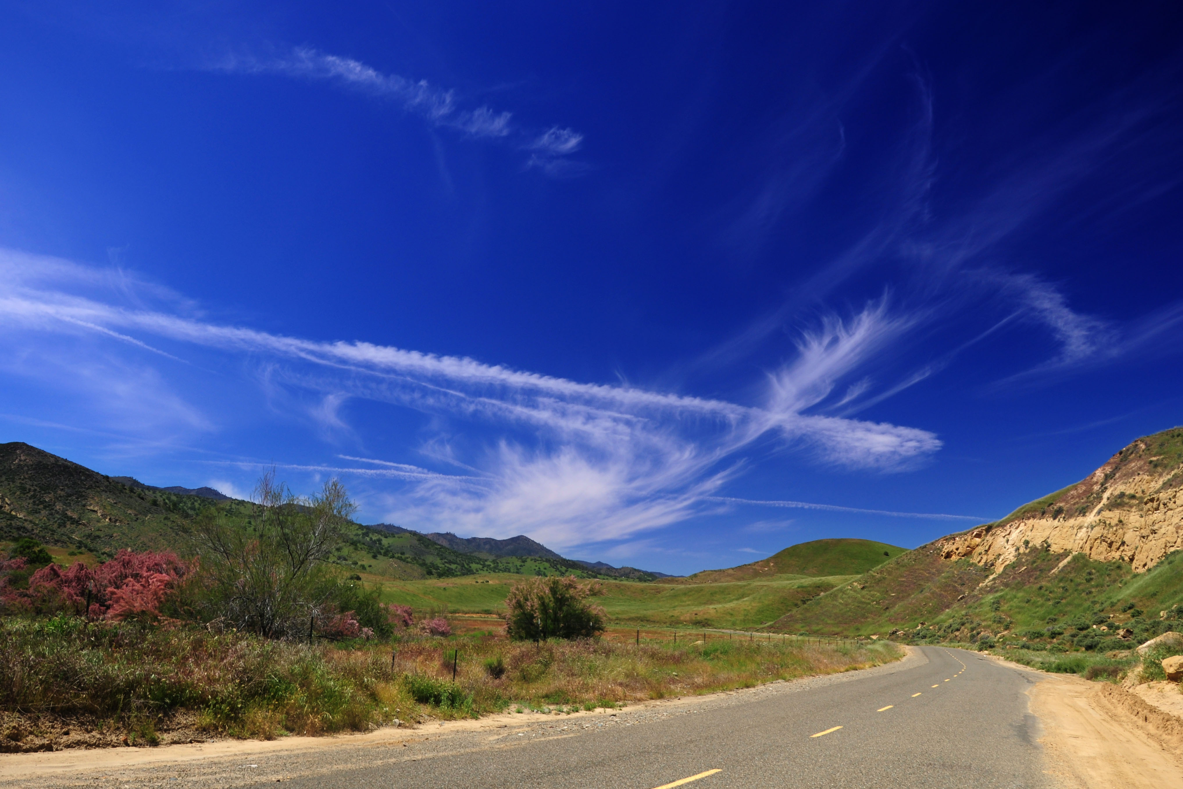
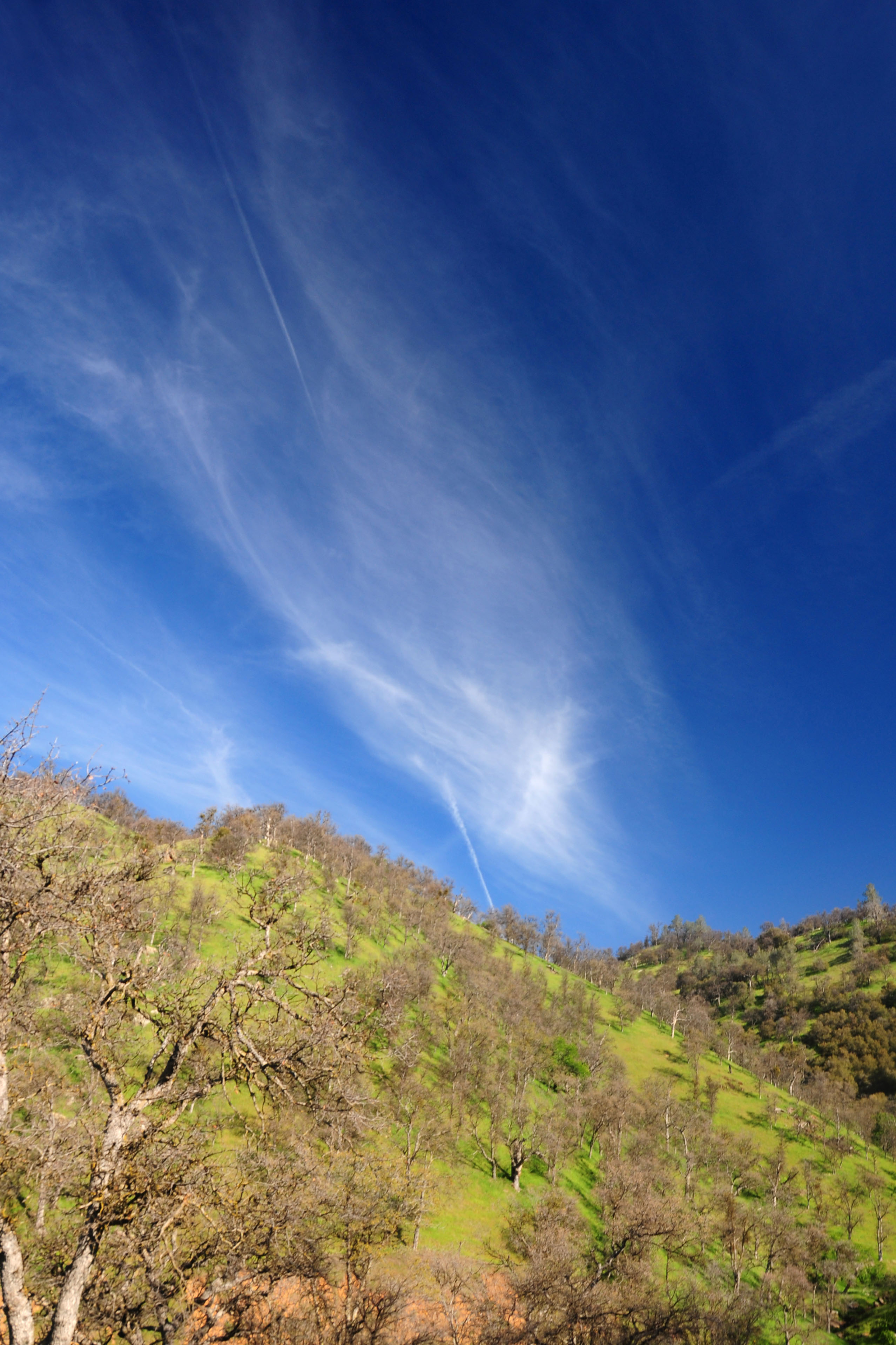
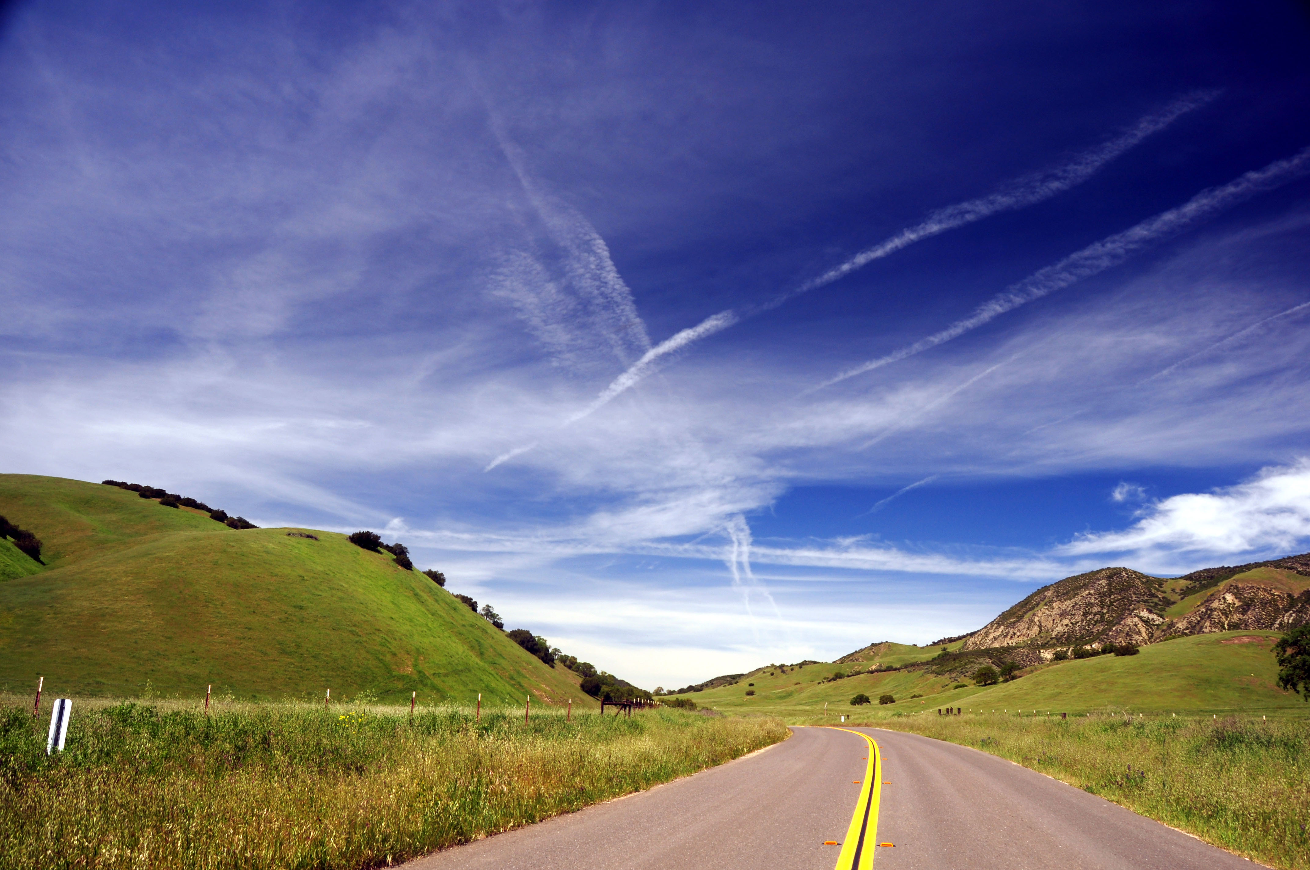
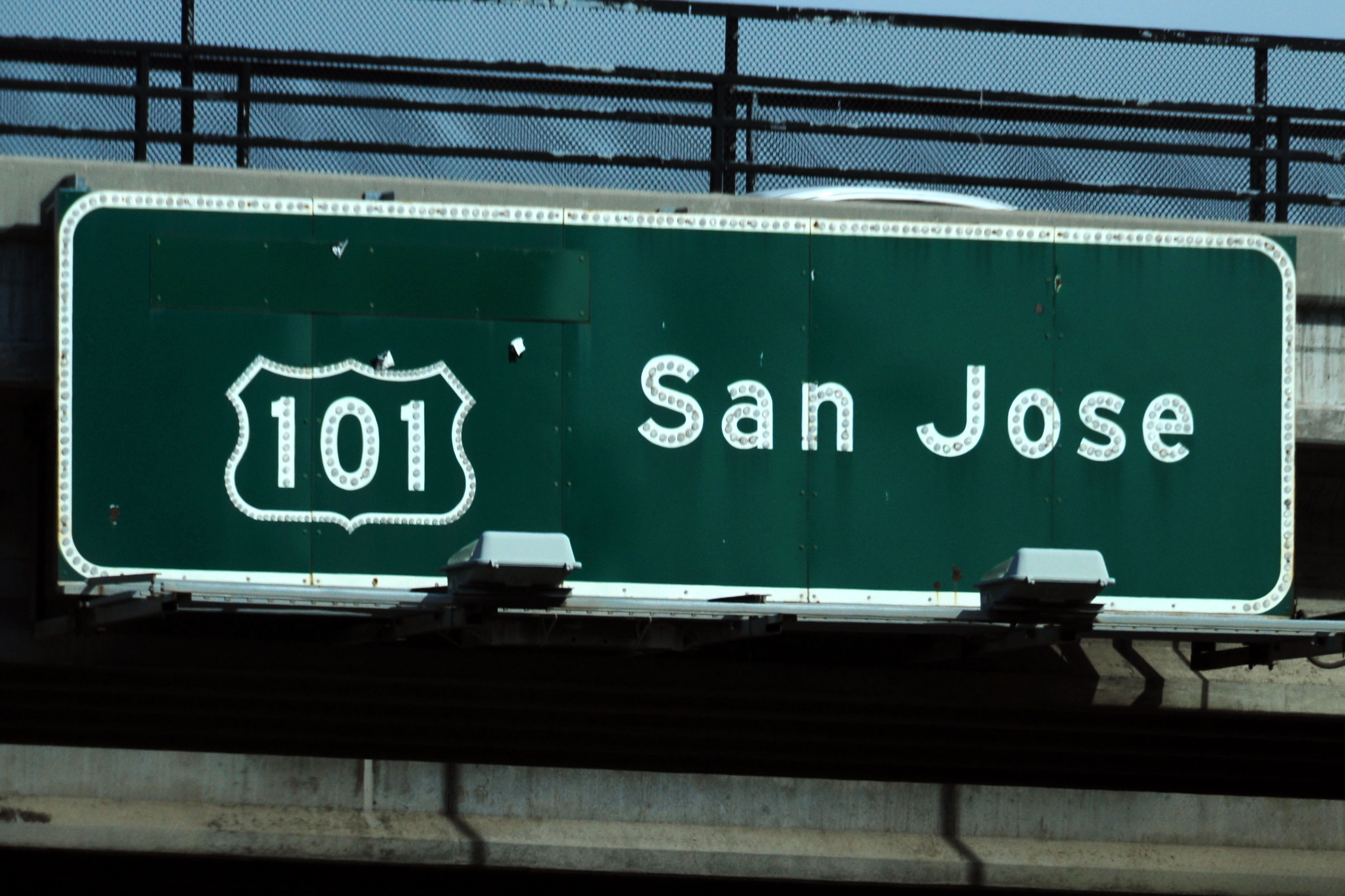
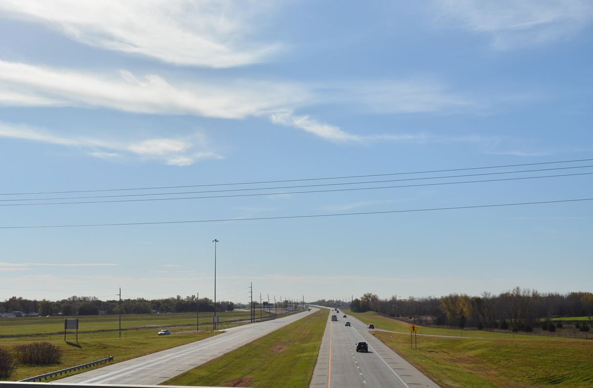
The way to San Jose, under the high cirrus clouds.
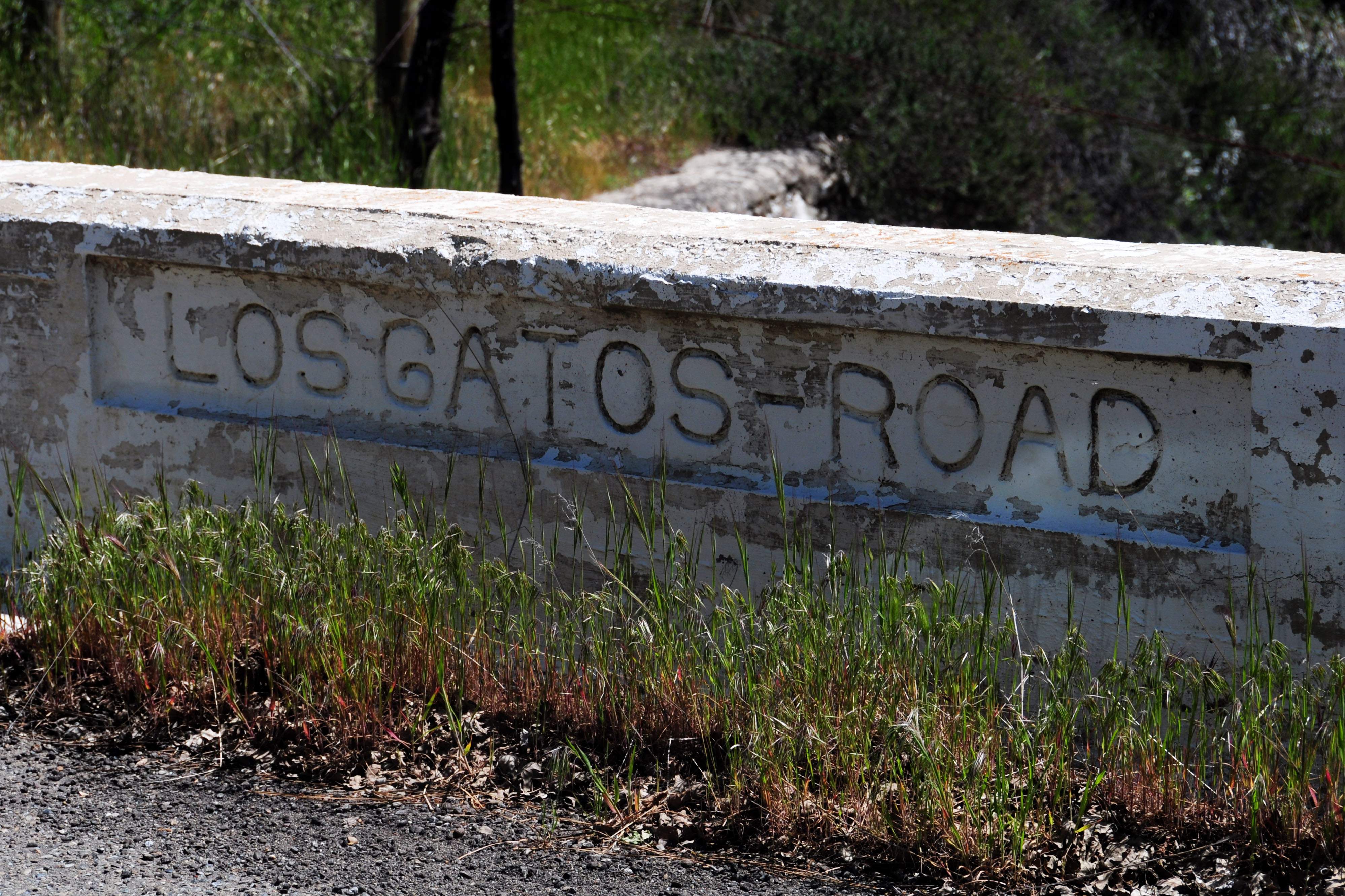
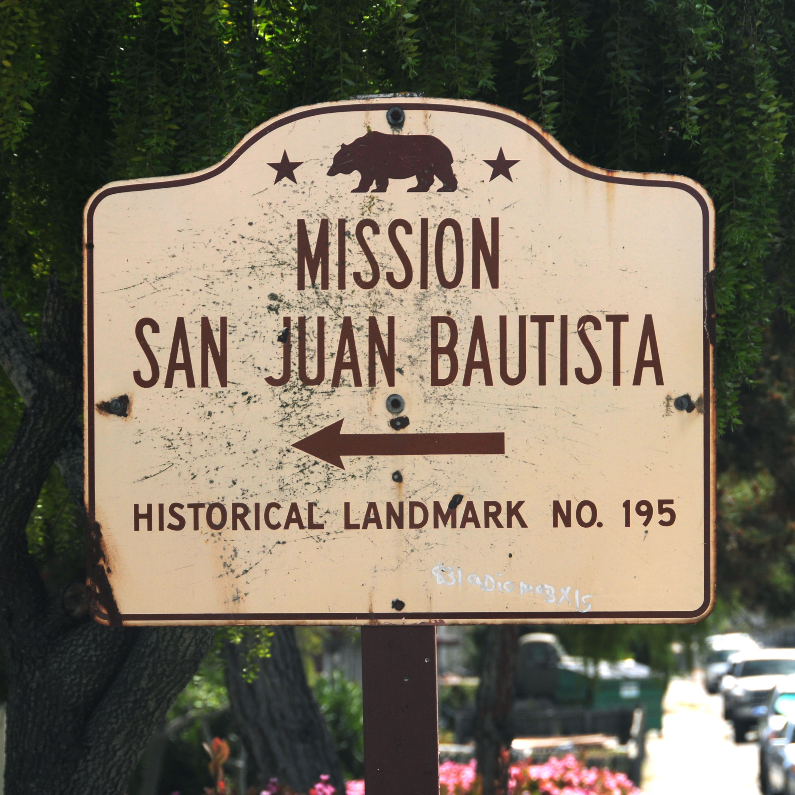
This road connects Coalinga to state highway 25. It was built in the late 1940s.
Did I mention the high clouds? Also, we catch California in the last of its green season. In a month, this will all be dry.
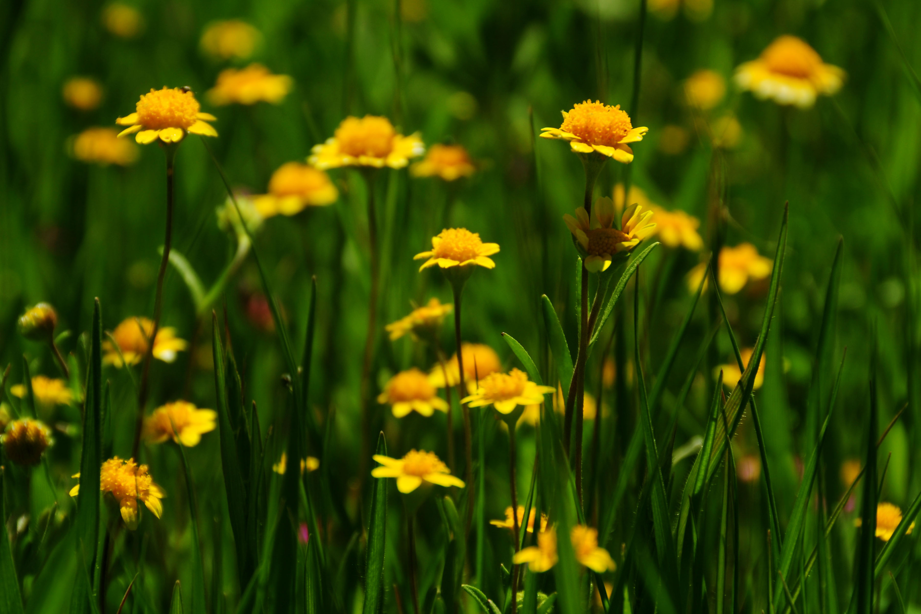
We also get the last of wildflower season.
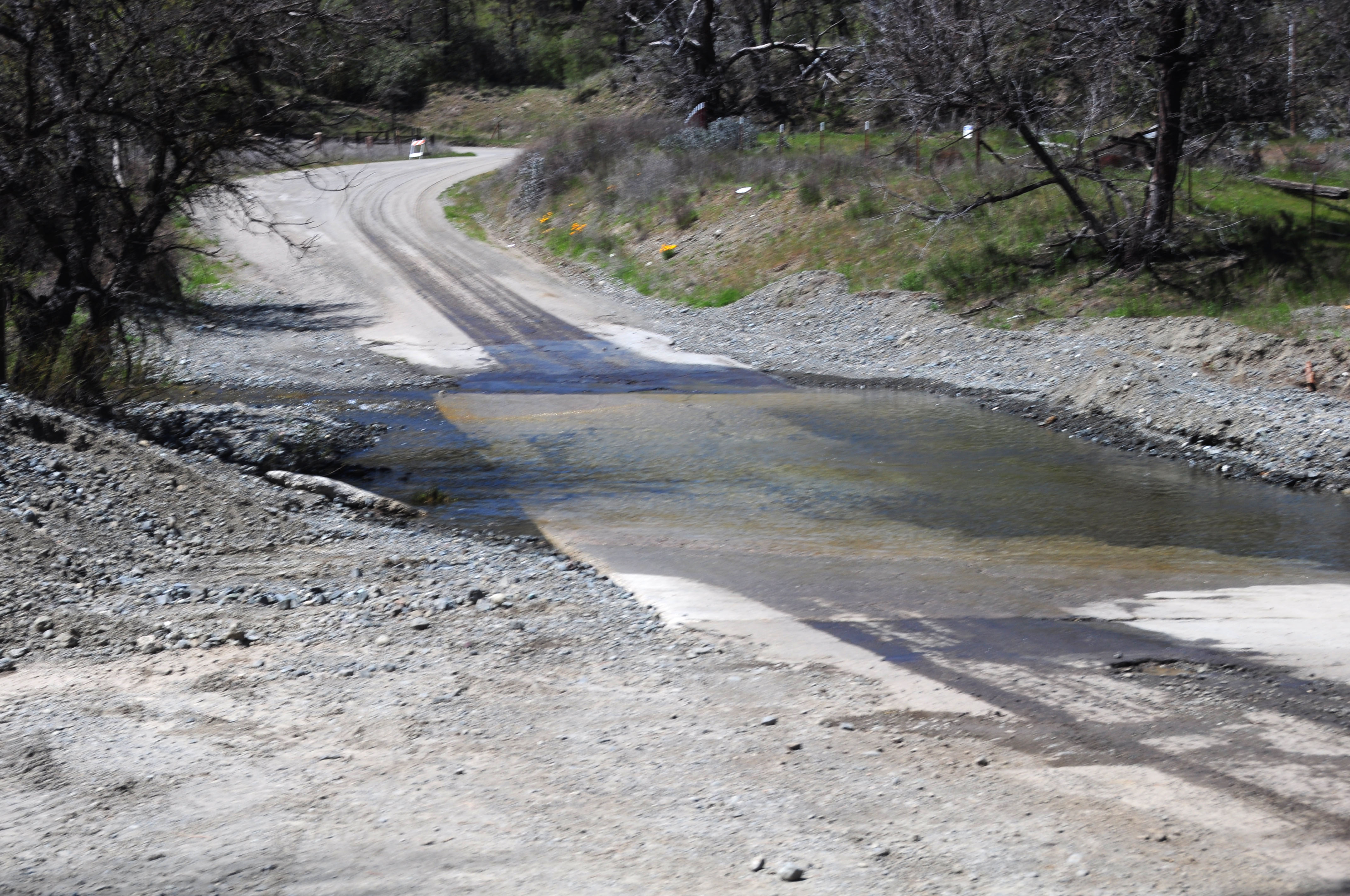
Uh oh, the road is flooded. It’s about 6 inches deep – will my low-clearance rental car make it? (Hint: it does.)

I do not know what kind of flowers these are, but they are across the river we just successfully forded.
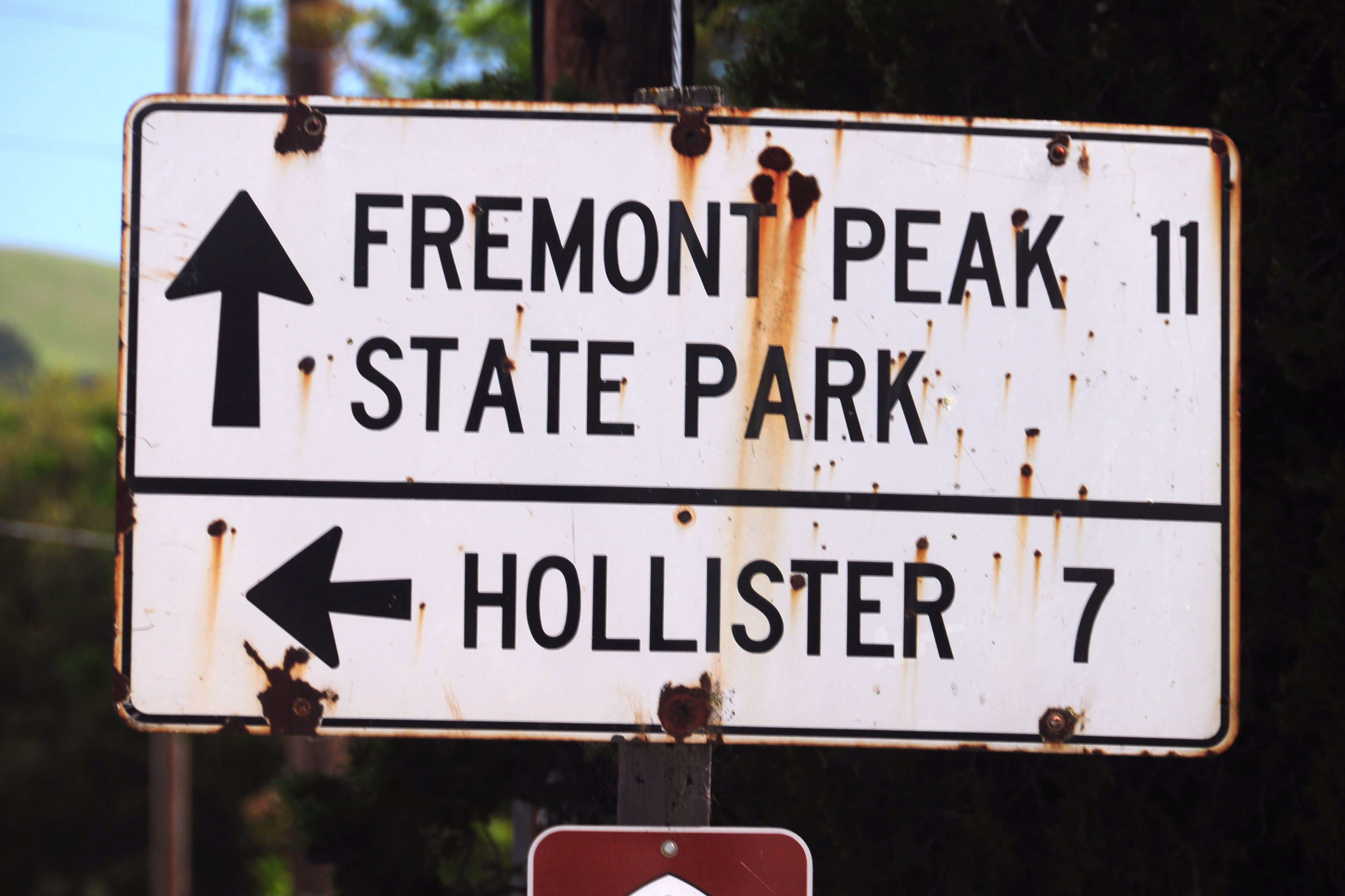
We have made it to highway 25.
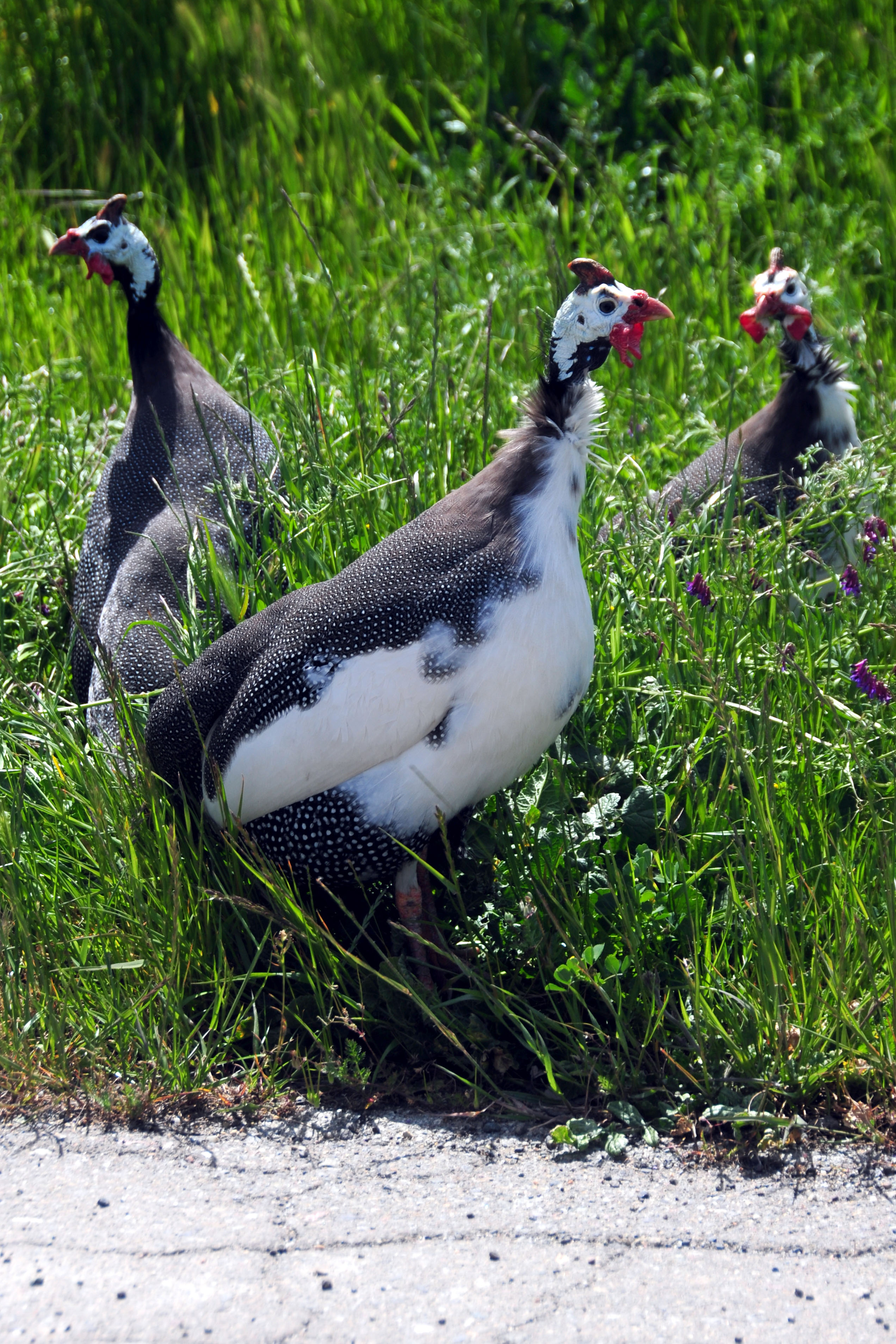
Why did the super fancy spotted chickens cross the road? Well, they didn’t; at least not while I was photographing them.
This 1957 guide sign is still in the wild.
As is this historic marker, also 1957. You can probably figure out approximately where it is.
An abandoned two-lane concrete alignment of US-101.

This experiment in retroreflective signage dates to about 1966. As you can see, it wasn’t a very successful experiment.
This 1960 sign on By-Pass 101 (“By-Pass” designation having been covered up since 1964) is the last known porcelain outline US shield green sign in California. I remember when I first moved to the Bay Area there were about 6 signs like this in this general vicinity – this is the only one which has survived some major construction projects. Apparently, California has the money to replace old signs. Go figure.
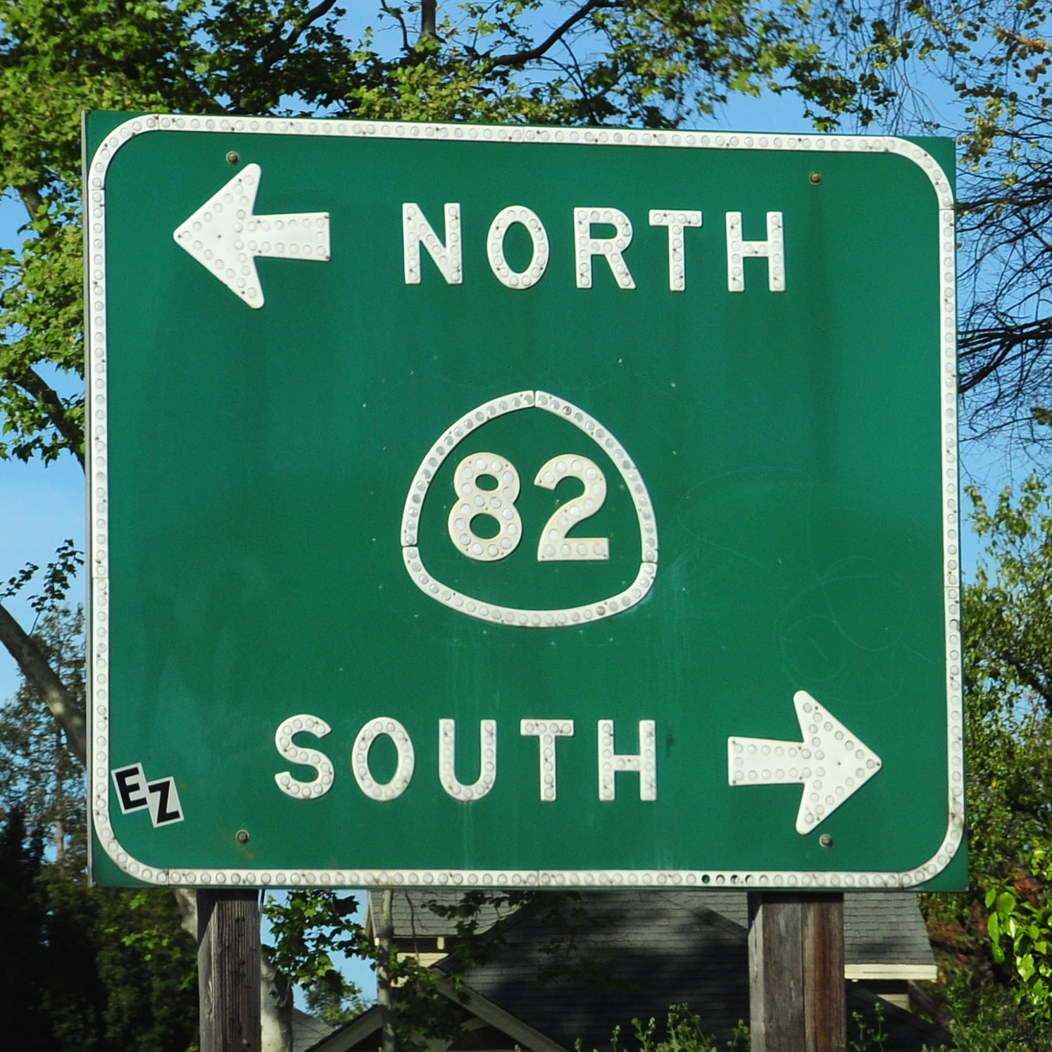
An oddity: green signs are not supposed to have the state name on the route markers.
The rarely seen 21×18 style of interstate shield.
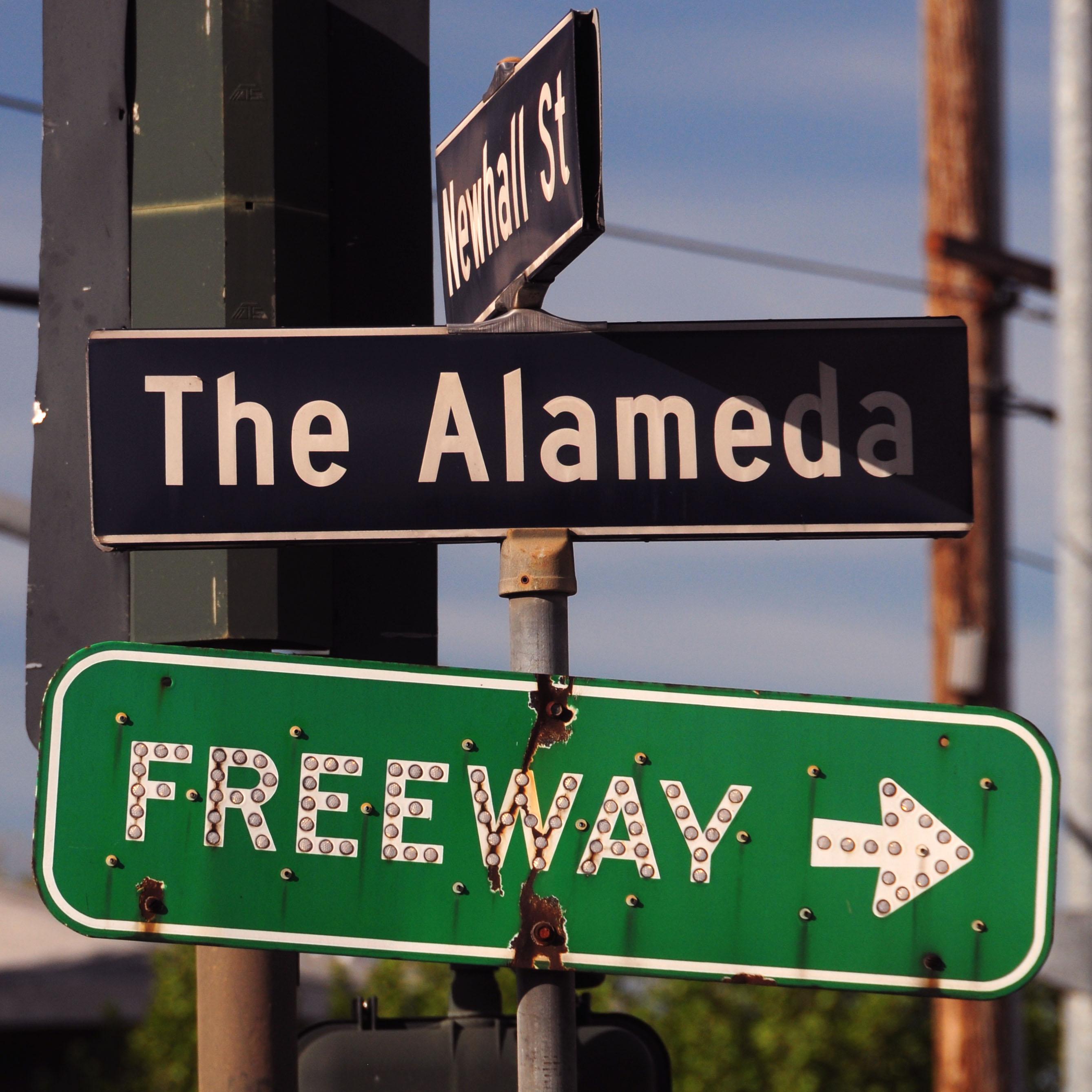
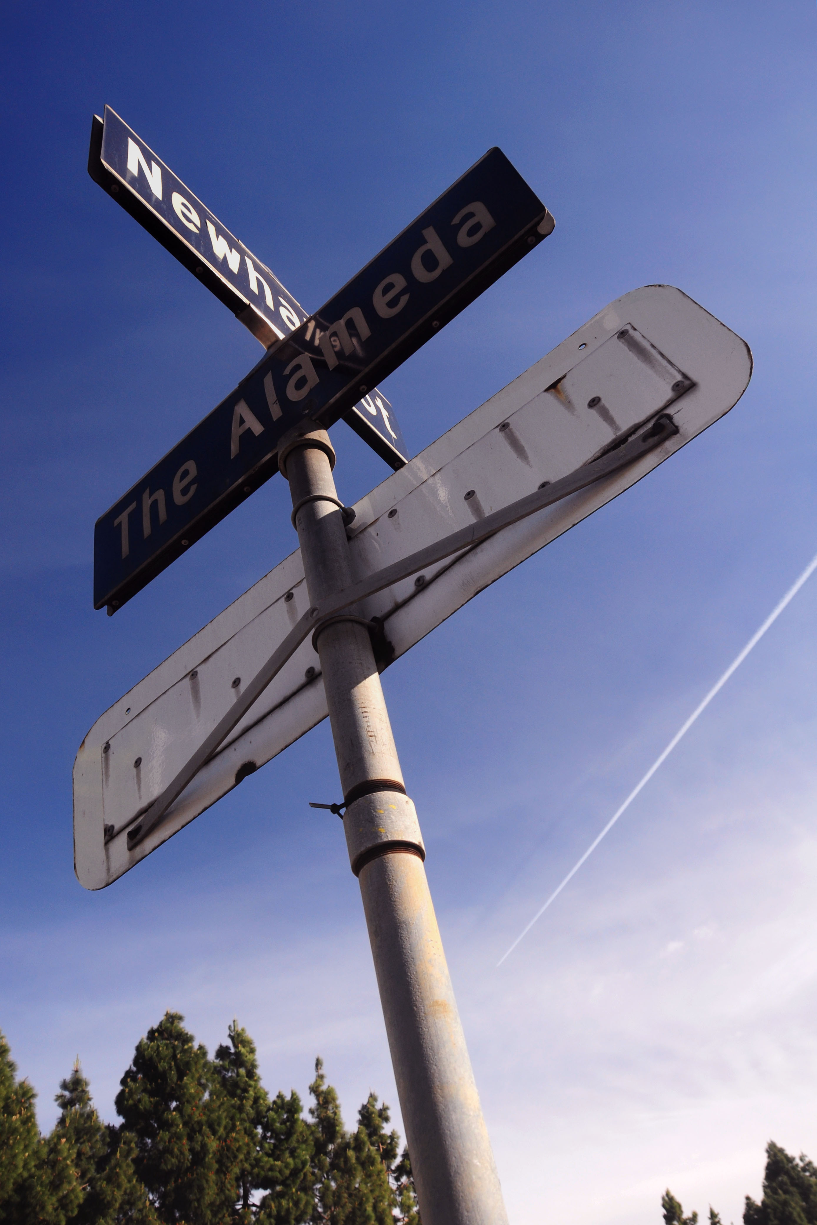
And how about this brilliant emerald green porcelain guide sign? it is a City of San Jose installation, and dates to 1960, when the intersection of The Alameda (old US-101, now highway 82) with nearby highway 17 (now interstate 880) was built.
Just a shot straight into the sun with weird angles that I thought came out well.
This sign dates to 1960. Note the pattern of rivets around the 82 shield: yep, at one point the sign had a US-101 shield instead! Until 1964, this downtown route was US-101, and the freeway was By-Pass US-101.
And now, some photos from the third day of my trip. Why yes, that is a white porcelain CSAA guide sign half-buried in the shrubbery! The sign is from approximately 1948, when this road was built.

What other treasures does this particular intersection reveal? Here’s a CSAA nine-spot end-of-road reflector!
The intersection that keeps on giving! Three 1948-vintage signs to be found here.
A few miles up the road, we come across one more CSAA porcelain white sign.
This sign is notable for inexplicably featuring the wide US route shield for a route number that clearly does not demand it.
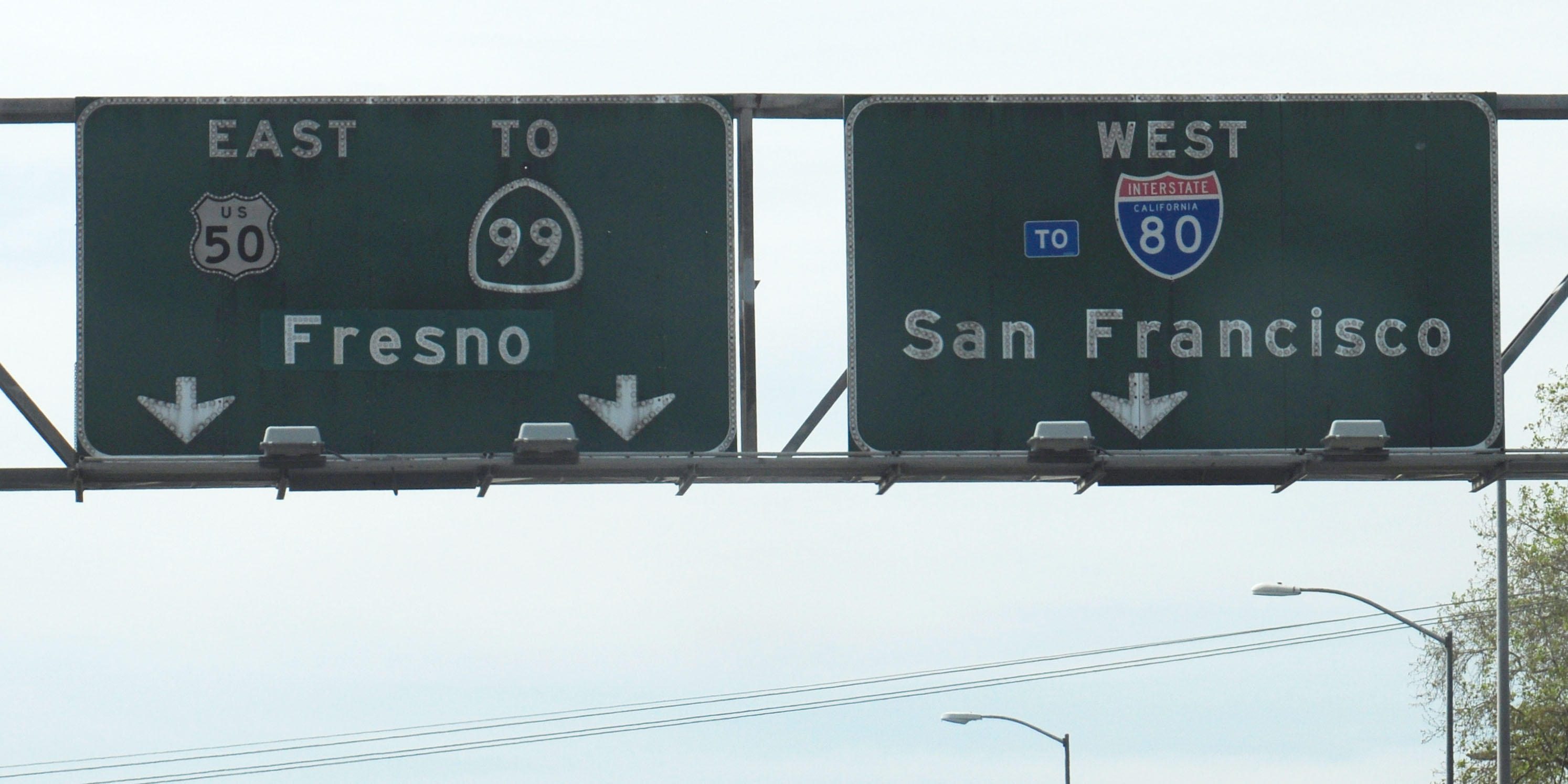
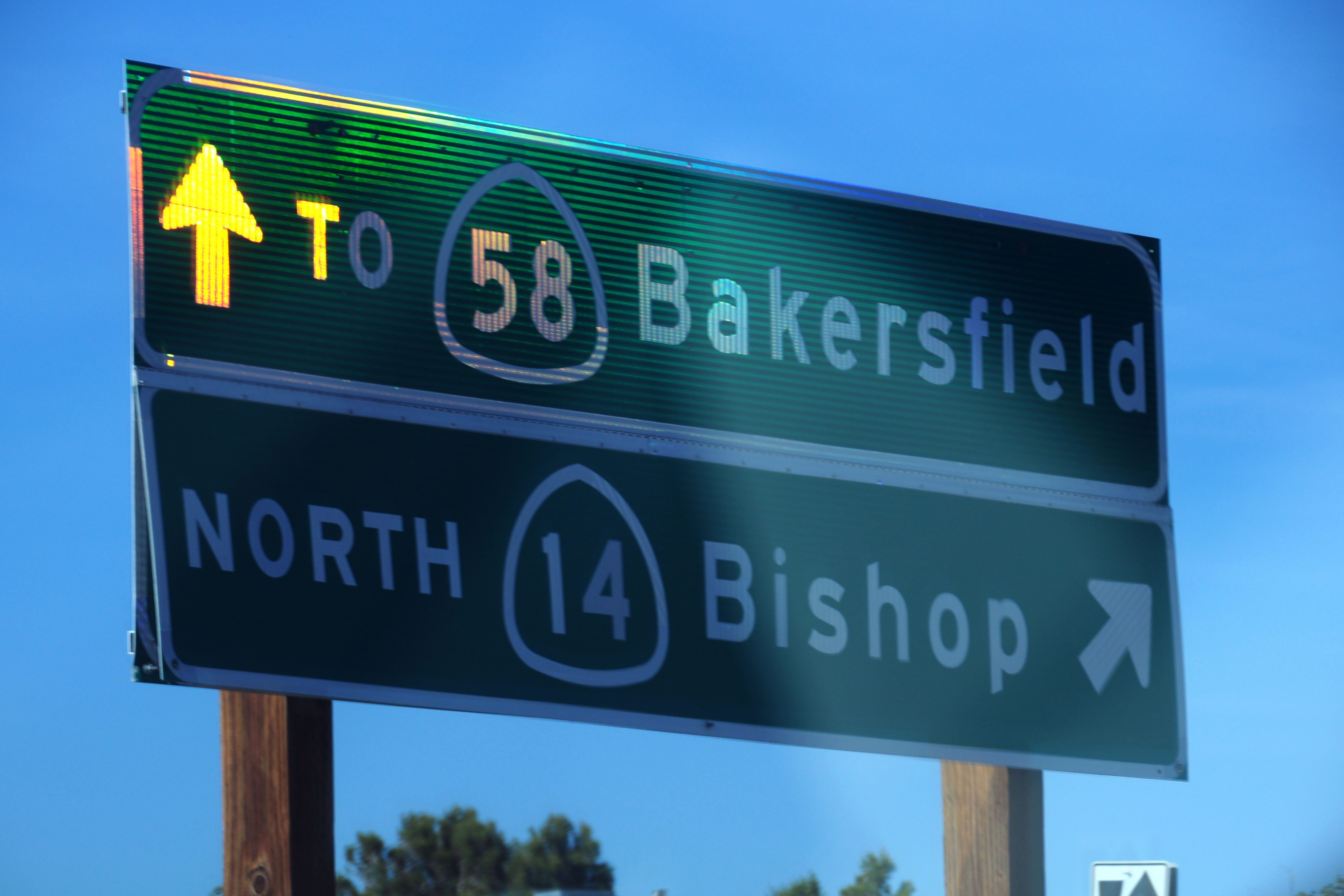
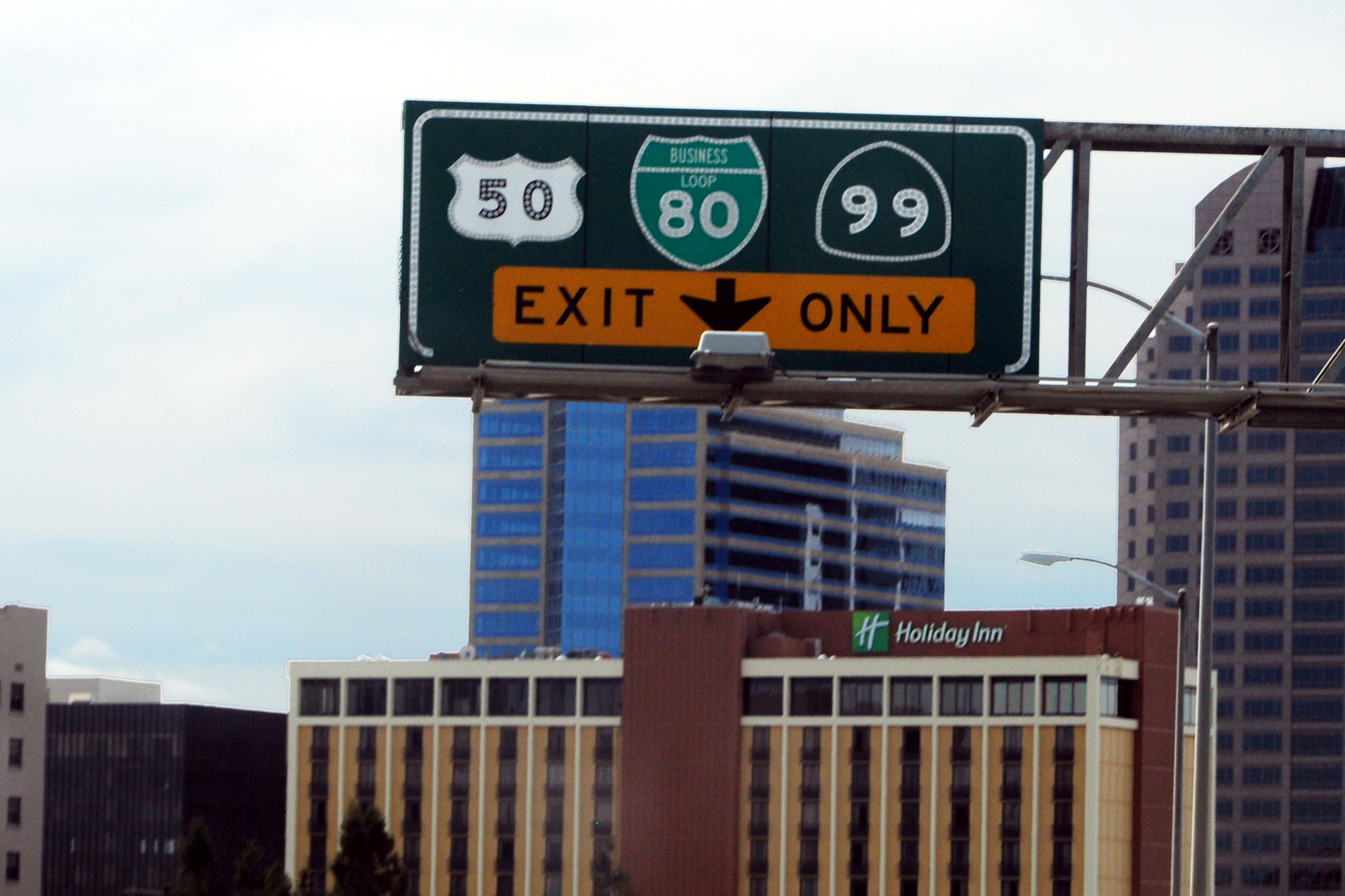
Would anyone like to tell me what this sign says? The pair dates to between 1964 and 1973, and therefore it would likely have, under the US-50 shield … another US-50 shield? And under the I-80 … another I-80? Highly confusing; why would they replace signs with themselves. But those are the logical routes that passed through this junction – US-50 heading south, and I-80 (which is now Business I-80, or “to I-80” as the case may be) heading west. The question remains: why the late-90s patches? (And also, what was under Fresno? Oakland?)
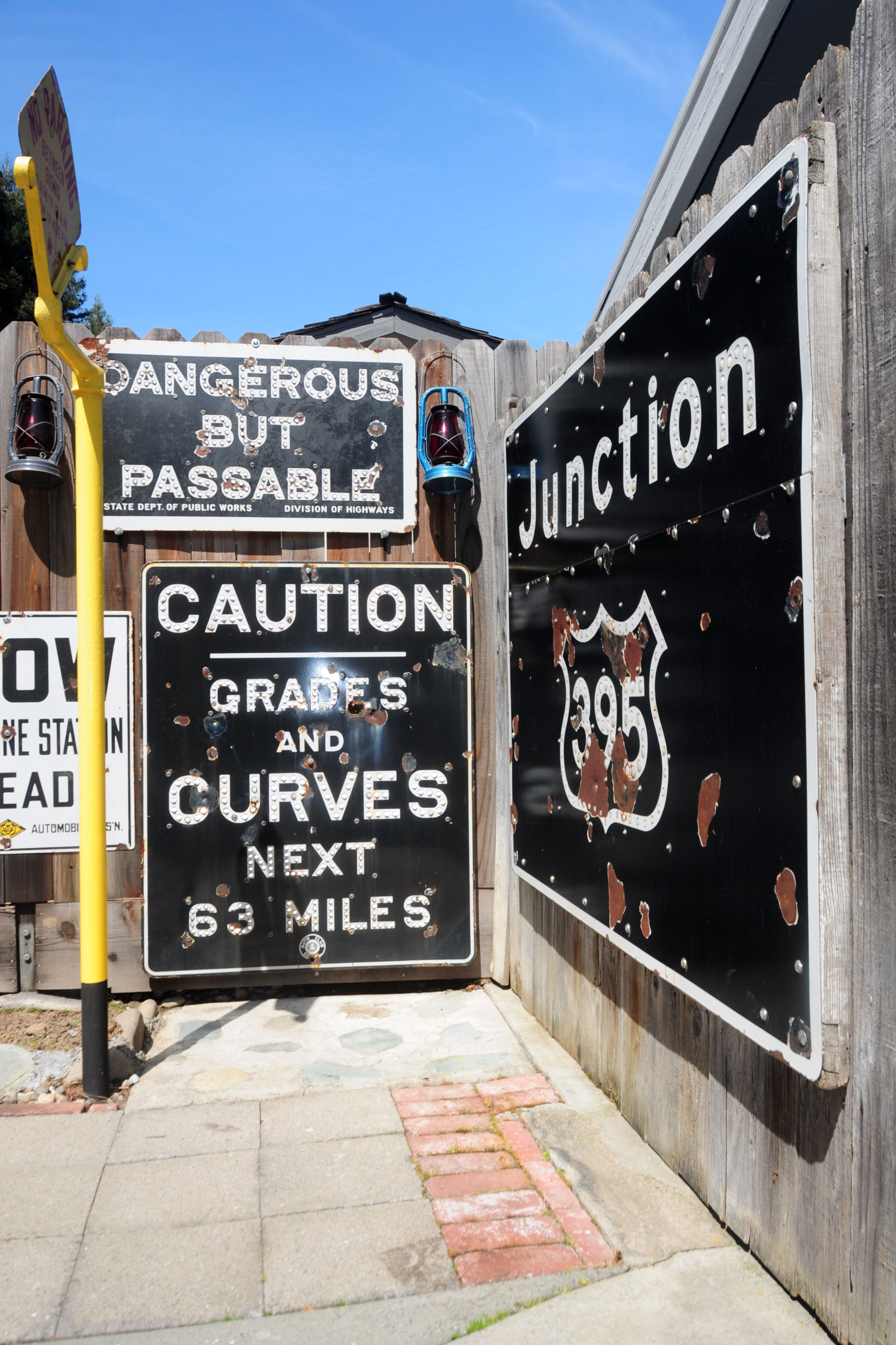
Nothing to see here, just someone’s private collection of some rare and unusual California signs.
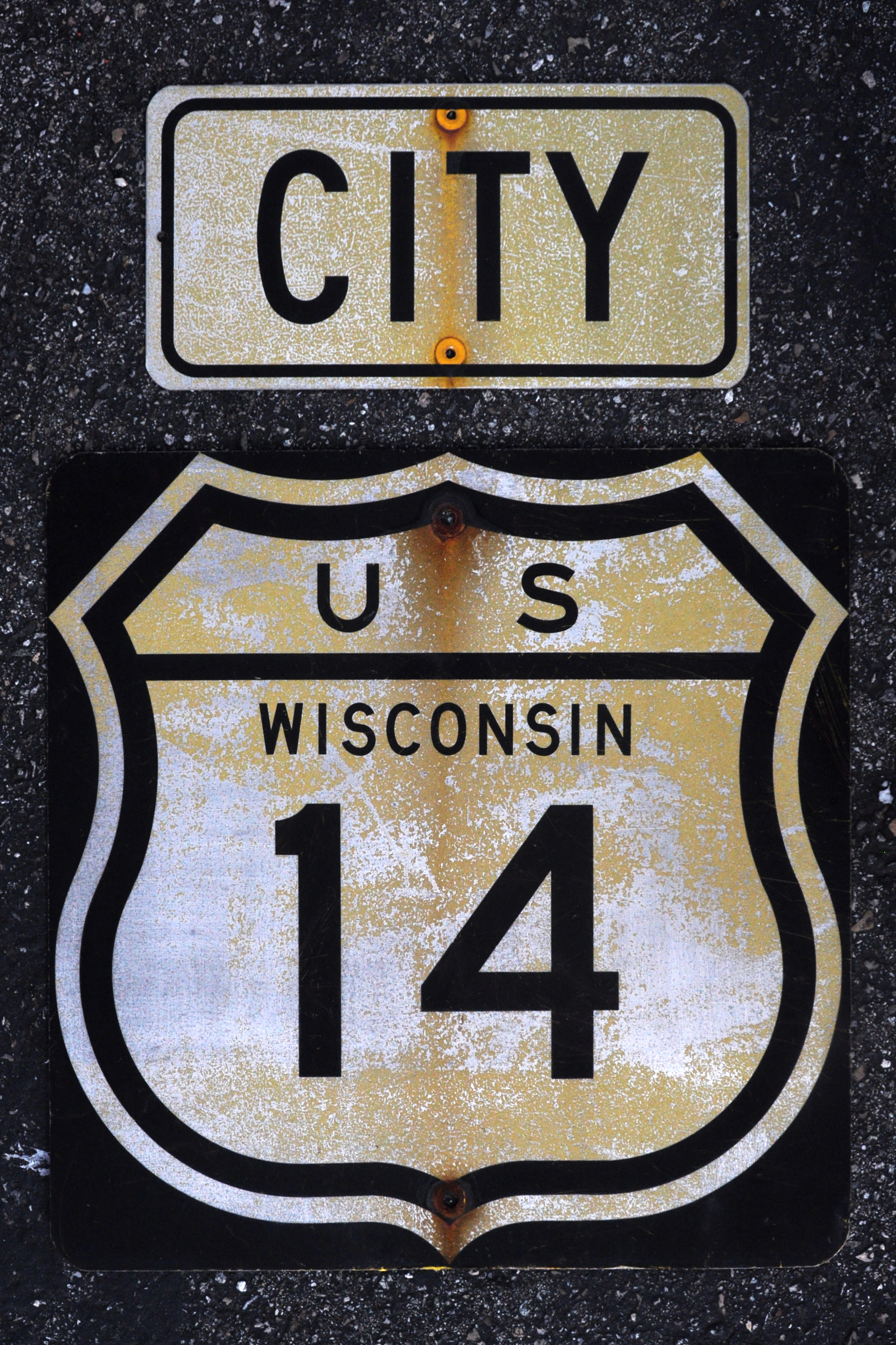
Some more signs out of a private collection. This pair, dating to 1961, once stood in Janesville, Wisconsin.
and that’s all, folks!
absolutely bitchin cloud pictures. is that brian smith’s place in sacto? you gonna come to our bako meet in october at dairen’s? john
On the Fresno/San Francisco sign, the answer I think is that both shields were originally I-80, then replaced with Business I-80. Presumably someone at CalTrans eventually decided it would be less confusing to not sign Business I-80 here, and thus the current shields were put on the sign, bringing back the original I-80 westbound at least, now with a weird stick-on To tab.
That would also suggest that the original control city for the eastbound route would have been Reno, which fits nicely under the greenout (unlike say South Lake Tahoe, which would be US 50’s control city).
@John: yep, I’ll be there in Bakersfield. that may or may not be la casa del Brian.
@Chris: thanks! yes, Reno would make sense for 80 east. where did US-50 run back in the day, turning south? was it multiplexed with CA-99 all the way to Stockton or so?
Some great signage. I especially like the porcelain 1948 signs you found. They are in remarkable shape.
indeed, porcelain preserves itself quite well. the only thing that really harms porcelain is if you bend the underlying metal. usually this is done using, ahem, solid projectile weaponry.
Jake, Keep exploring !! You find the gold still out there for sure. The guy who cut up that Az. diamond ought be strung up, what a shame.
he ought to be drawn and quartered, just like he did to the sign.
Jake, we will see you at Fred’s in Sept.??
you sure will!!!
The yellow flowers that you shot close up (after you forded the river) were California Poppies, which are the state flower.
approximately 76 people have told me that I got photos of the Official State Flower (as seen on the Official Scenic Route Marker!) so now I’m just specifically not updating the post just to get people further mildly rankled :)
I second what Tony says — Poppies Jake, poppies!!! California is a bit famous for them…
California has hundreds of different types of wildflowers!
Jake – My understanding is that US 50 and US 99 multiplexed to south of Stockton, where US 50 then turned west along/parallel to what is now I-205 and I-580.
Underneath the US 50 would probably be I-80 EAST… originally this would have been I 80 east and west. Now it’s US 50, but 50 west to SF is signed as TO I-80. And under Fresno would probably be Reno!
I had great fun puzzling it out. :)