
Started the morning in the quaint town of Cascade Locks, just a stone’s throw away from the Bridge of the Gods. The bridge is tolled and privately run, joining U.S. 30 in Oregon with Washington 14 just west of Stevenson. Stevenson is an equally quaint town along the north banks of the Columbia River. Washington 14 (former U.S. 830) and U.S. 30/Interstate 84 are both also paralleled by busy Union Pacific and Burlington Northern Santa Fe Railroad lines.
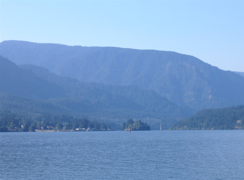
Looking west at the Bridge of the Gods and the Columbia River from a pier at Stevenson, Washington.
We first crossed the Bridge of the Gods and visited Stevenson, soaking in the view along the river’s edge itself for awhile before heading back to Interstate 84 and resuming our eastward push to Interstate 82. Along the way we stopped and Bonneville Dam, home to a hydro-electric power plant and fish ladder. The facility is home to exhibits on both facilities, but only the fish ladder was open the day we were there. It being late August, Steelhead and Chinook were busy swiming upstream, and we saw several fighting against the current through the fish ladder windows. Very fascinating stuff…
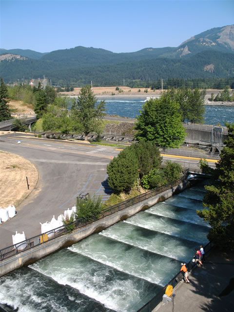
The Bonneville Dam fish ladder.
Once back to Interstate 84, we beelined east to The Dalles, stopping briefly at the Columbia River Interpretive Center, and again in town for gas/lunch. Temperatures rose into the mid 90s as we progressed into the desert, which lead us to U.S. 197 and its fanstastic crossing of the Columbia River, U.S. 730’s western terminus, and the east end of Interstate 82.
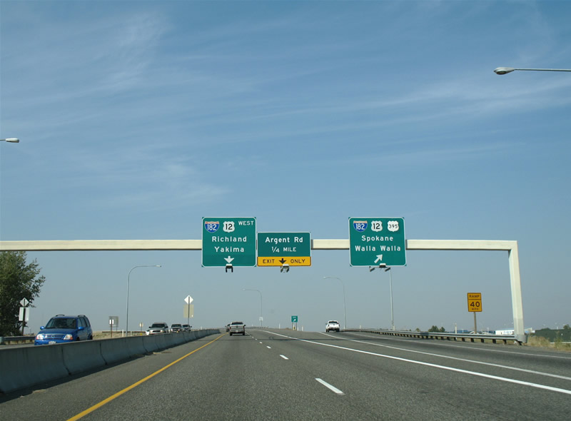
Our later trip would take us to Montana and Idaho via Interstate 82 and 84, but we needed to head back to Seattle to meet up with our frined Chris, so we opted for Interstate 82 west (north) into Washington. A brief stop took us to the final Oregon exit of I-82, that of the overlap between U.S. 395 and 730, that is quite possibly the highest numbered overlap of any U.S. highway.
The bridge that Interstate 82 takes across the Columbia River originally carried no number. In fact the southbound span features superstructure with it being the older bridge, while the northbound bridge is an unremarkable concrete structure. U.S. 395 joins Interstate 82 for the trek to Washington’s tri-cities, and is later replaced by U.S. 12 and 97 as Interstate 82’s companions.
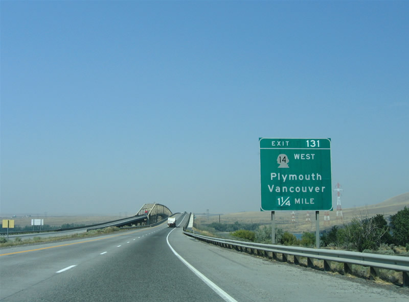
Approaching the Columbia River Bridge along Interstate 82 westbound. Washington 14 ends its long journey at Exit 131, just north of the river. McNary Dam lies just east of the freeway crossing.
As for the Tri-cities themselves, the cities of Kennewick, Pasco, and Richland make up the member cities. Interstate 182 provides access to the communities from Interstate 82 to the east, providing a conduit for suburban sprawl from Richland westward. The freeway itself is around 15 miles in length, and carries a good amount of traffic given its isolation from the rest of the Interstate system. The Columbia and Snake Rivers also pass through the area, and the bridges between Kennewick and Pasco were gems unknown to us as we approached on Interstate 182.
Interstate 182 itself ends just east of the interchange with U.S. 395 along U.S. 12, with U.S. 12 continuing east across the Snake River as an expressway to Burbank. As for other area roads, Washington 240 represents a freeway loop between Interstate 182 at Richland and the U.S. 395 expressway at Kennewick. A reconstruction project is underway involving the entire freeway. U.S. 395 follows a freeway north from the Washington 240 junction across the “Blue Bridge” to Interstate 182 & U.S. 12. Washington 397 meanwhiles spans the Columbia along a 1978-constructed cable-stayed bridge. Who knew right?
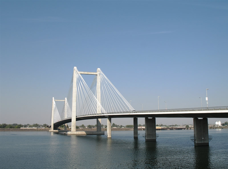
Washington 397 cross the Columbia along the Cable Bridge (Ed Hendler Bridge) between Kennewick and Pasco. The bridge opened on September 16, 1978 at a cost of $23 million.
The U.S. 395 freeway travels north from its interchange with Washington 240 and Columbia Drive along the “Blue Bridge” to a trumpet interchange with Interstate 182 & U.S. 12 at Pasco. U.S. 395 joins Interstate 182 & U.S. 12 briefly to make the dog leg east on its trek toward Spokane. The Blue Bridge derives its name from its colour, and opened July 30, 1954 at a cost of $6.5 million. It originally carried U.S. 410.
After spending a couple of hours in the tri-city area, including a walk along the Columbia River pedestrian/bikeway, we headed back west to Interstate 82 and Yakima. Once in Yakima, we searched in vein for Business Loop I-82, driving the entire length of the former highway through downtown. Parts of Yakima looked like El Centro, with its architecture and streetscape. We also poked around the U.S. 12 freeway spur west from Interstate 82, and found three old bridges with superstructure west of town (two on current U.S. 12, and a steel arch bridge along parallel old U.S. 12) over the Naches River.
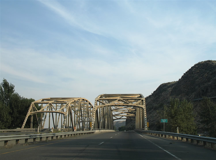
A pair of truss bridges carry U.S. 12 across the Naches River west of Yakima. U.S. 12 upgrades to a freeway from here east to its merge with Interstate 82. West Powerhouse Road (old U.S. 12) spans the same river nearby with a similarly colored bridge.
Continuing north, Interstate 82 travels along its own set of cantilevered truss bridges over the Naches River, before leaving Yakima for open desert. A dramatic ascent, including the longest concrete arch bridge in the United States, awaits Intestate 82 westbound drivers as they ascend to Vanderbilt Gap. The last ten or so miles can be driven with the car in neutral, as the freeway descends dramatically to its west (north) end at Interstate 90 near Ellensburg.
Interstate 90 provides the main route from Seattle to the Cascade Range to the east. The freeway itself also provides the main commerce link from the ports to Midwest and points southeast. Along the route into Seattle is often trecherous Snoqualmie Pass. The Cascade Mountain Pass is often snow covered during the colder months, and a source of travel congestion and other delays during heavy snow events. With that stated, the scenery is spectacular, drawing comparsons to Interstate 80 from Verde, Nevada to Donner Pass. The slow ascent, truck traffic, and advent of snowstorms allow for Interstate 80 to expand to as much as eight lanes in the high country east of Seattle! That’s an important fact, as downtown Seattle lies just 50 or so miles west of the pass.

Interstate 90 westbound at the Exit 53 off-ramp to Washington 906 (Gold Creek Road) at Snoqualmie Pass. Washington 906 parallels Interstate 90 for a short distance at Snoqualmie over the original U.S. 10 alignment. Snoqualmie Pass averages 108 inches of snow in January alone!
Once Interstate 90 descends to Issaquah (Exit 18), suburban Seattle begins and encompasses the landscape through to Interstate 405 and Lake Washington. The freeway becomes more urban as it continues west across Mercer Island, the Lake Washington floating bridges, and then the International District of central Seattle. A system of tunnels lie on both Mercer Island and then at the west end of the floating bridges. A double-decked freeway carries Interstate 90 west from the Int’l District tunnel through its interchange with Interstate 5 toward the western terminus. The freeway draws to a close adjacent to Safeco and Qwest Fields at Edgar Martinez Drive and 4th Avenue South.
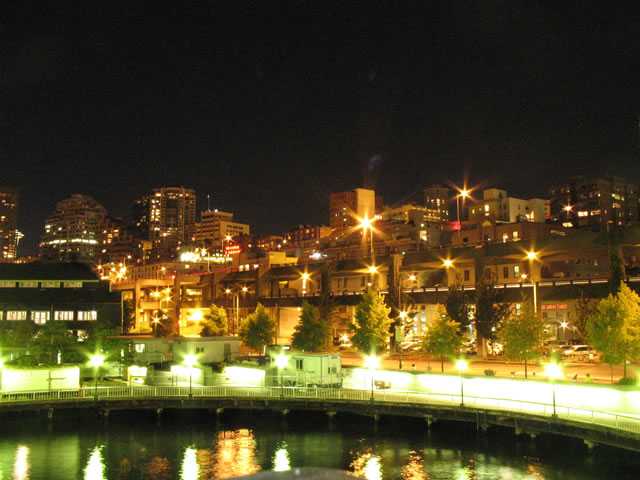
The sunset as we entered Seattle, but with four hours to kill before Chris got off work, we spent that time walking around downtown Seattle and along the waterfront.
The Alaskan Way Viaduct (Washington 99/former U.S. 99) travels parallel to the Alaskan Way surface boulevard along the downtown Seattle waterfront along Elliott Bay. The mayor and other government officials are studying ways to replace the viaduct, which has long since been referred to as both a barrier and eye sore for downtown Seattle. The options considered includ building a new higher viaduct, building a cut and cover tunnel, or replacing the freeway with a Washington 99 surface boulevard. The prohibitively high costs of options one and two are leading officials to consider the no-build option.
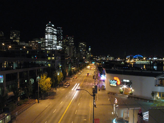
Downtown Seattle and Alaskan Way as seen from a pedestrial overcrossing looking south. The Alaskan Way viaduct descends into a tunnel by this point north along the water front.
Just a note…the Alaskan Way Viaduct will be replaced by a single-bore tunnel 60′ under Seattle’s downtown on a more direct route.