
Began the day on former U.S. 25 (Electric Avenue / Military Street) in Port Huron.
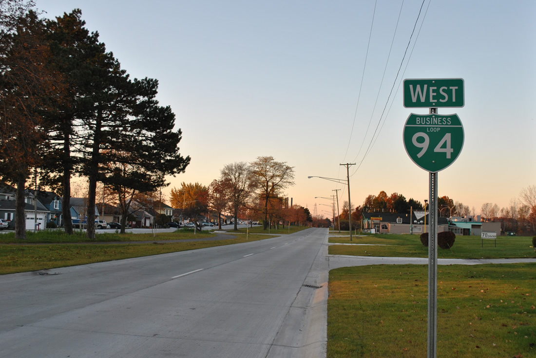
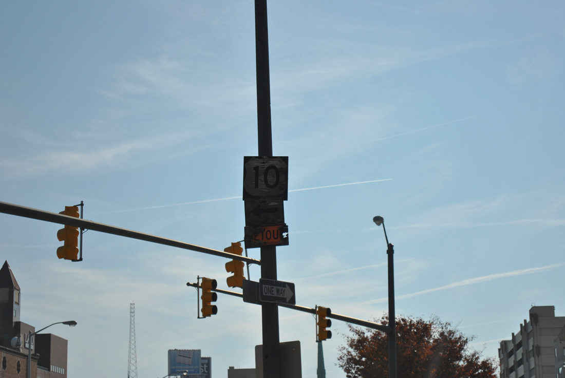
U.S. 25 was decommissioned in Michigan in 1973, leaving former stretches of the road as M-125 (Ohio to just north of Monroe), M-3 (Downtown Detroit to Chesterfield Township), Business Loop I-94 (through Port Huron), and M-25 (north of Port Huron) along with portions of U.S. 24, I-75 and I-94. This view looks at a reassurance shield assembly at Marysville, a town bordering Port Huron.
Business Loop I-94 east combines with Business Loop I-69 south of Downtown Port Huron.
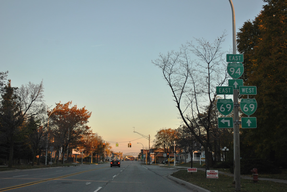
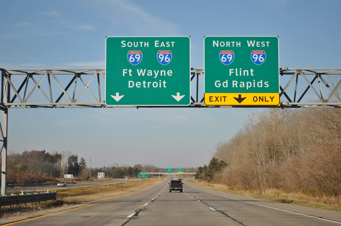
Interstate 69 and 94 combine at Port Huron for an overlap to the Bluewater Bridge to Sarnia, Ontaro. Like, I-94, Interstate 69 sees a business loop of its own. Following an expressway to the one-way street couplet of Oak / Griswold Streets, the loop begins via a wye interchange from where I-94 and 96 combine to a merge with Business Loop I-94 at Main Street. The two continue north to end at I-69/94 by the bridge to Canada. BL-69 in Port Huron follows old M-21 (truncated to Flint by 1985).
Business Loop I-69 defaults onto Interstate 69 west from Griswold Street. A reassurance shield follows the transition from arterial to freeway, but before the ramp onto Interstate 94 to Detroit.
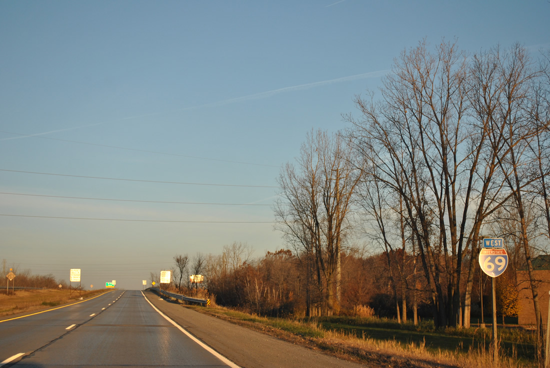
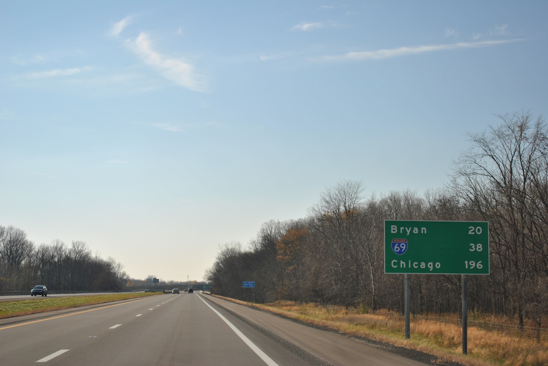
Interstate 69 southbound ahead of I-475 at Flint. Note the custom Michigan font on the Interstate shield for Exit 137.
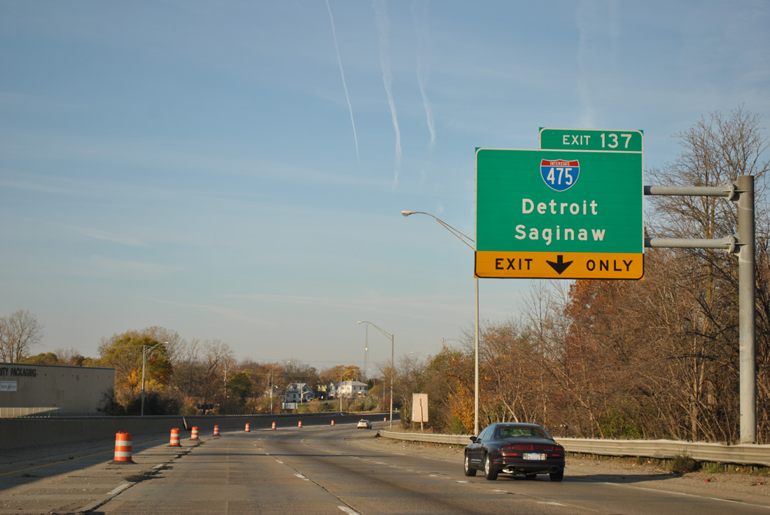
Much of Flint is orientated in a north-south fashion along the Interstate 75 and U.S. 23 corridors. Interstate 69 bisects the area, meeting Interstate 475 southeast of downtown. Interstate 475 travels 16.87 miles and was completed in 1981. It heralds to a time when Flint was a booming automobile manufacturing center.
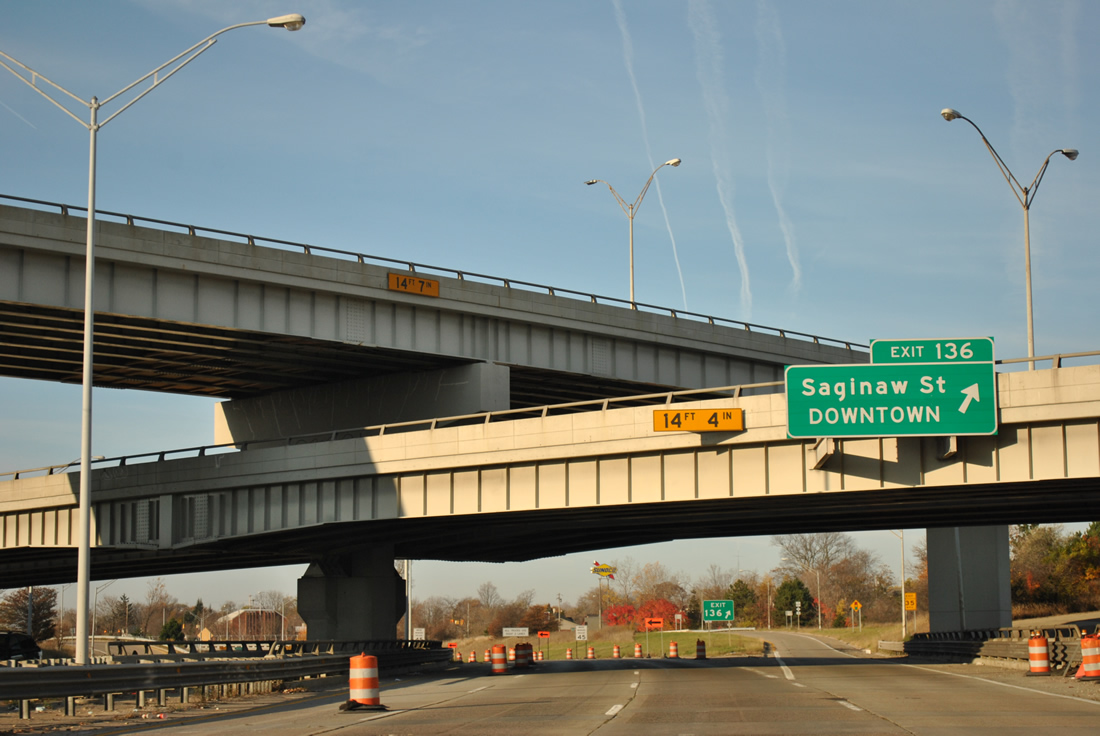
A symmetrical stack interchange joins Interstates 69 and 475 at Flint. Exit 136 to Saginaw Street departs from within the multi-level exchange from westbound I-69.
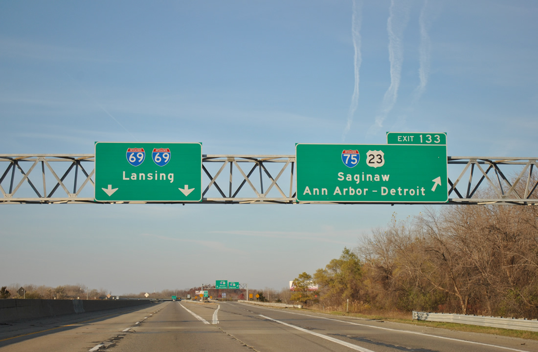
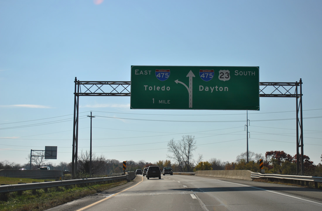
Exit 133 follows and carries all traffic to Interstate 75 & U.S. 23 in unison from Interstate 69 west.
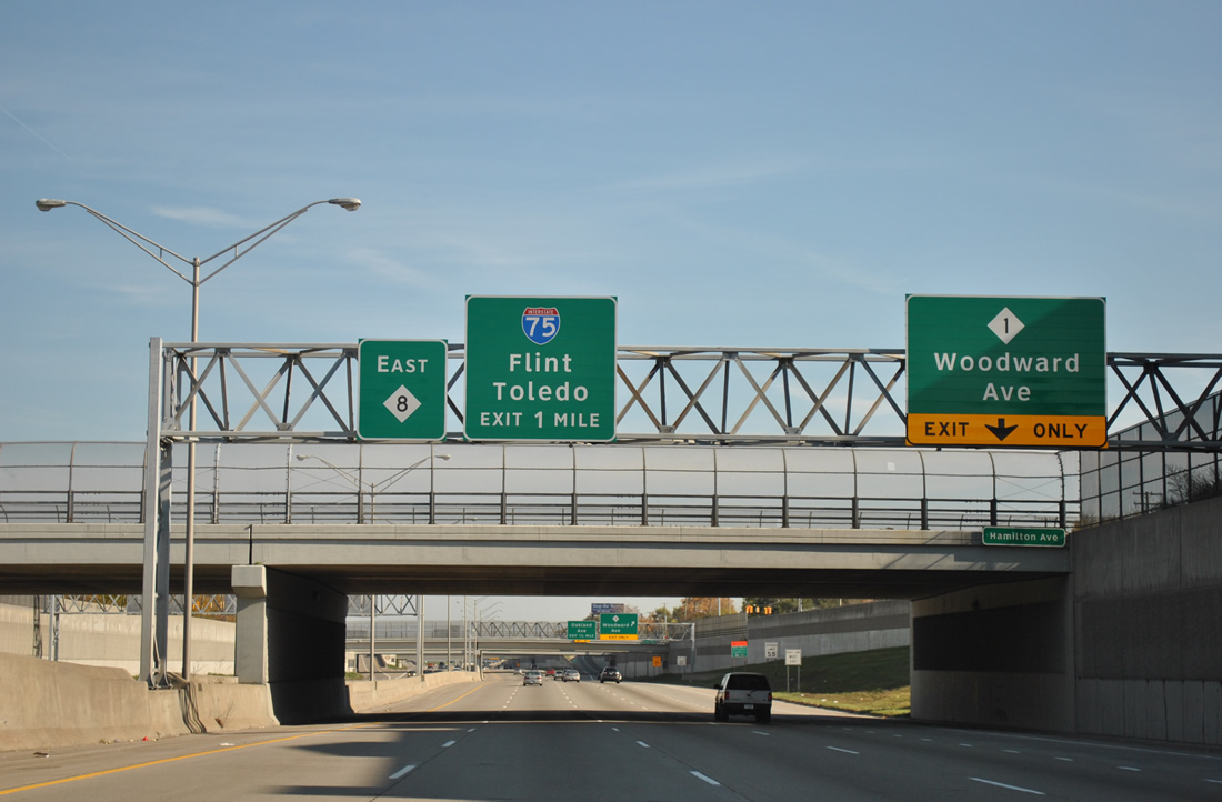
The two share 73 miles of pavement from just south of Flint to Standish. U.S. 23 provides a freeway grade bypass of Detroit via Ann Arbor between Flint and Toledo, Ohio otherwise.
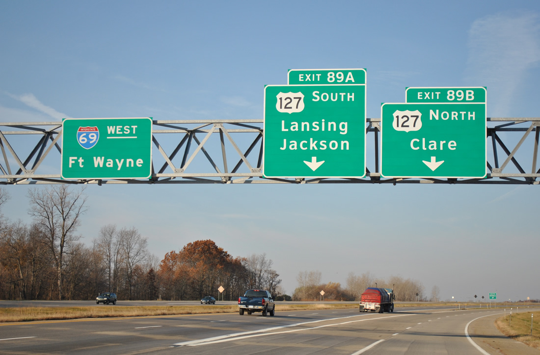
Continuing west to Lansing, Interstate 69 enters a full-cloverleaf interchange with U.S. 127.
U.S. 127 constitutes a freeway from Jackson to St. Johns. By 2002, the designation was extended northward over U.S. 27, as officials from both Indiana and Michigan agreed to truncate the route north of Ft. Wayne. U.S. 127 ends at I-75 near Grayling, MI and Chattanooga, TN, tallying 758 miles.
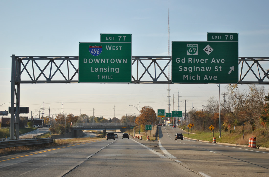
Heading south along U.S. 127 at the off-ramp to Business Loop I-69 and M-43 (Grand River Avenue) in Lansing.
BL-69 follows an old section of M-78 and later TEMP Interstate 69. Interstate 496 merges with U.S. 127 south at the next exit.
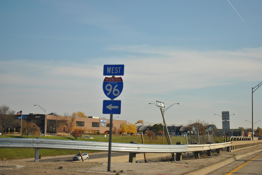
Interstate 496 exits Lansing and enters Eaton County on the approach to Interstates 69 & 96, its western terminus. I-69 & 96 combine for 5.20 miles on the west side of Lansing.

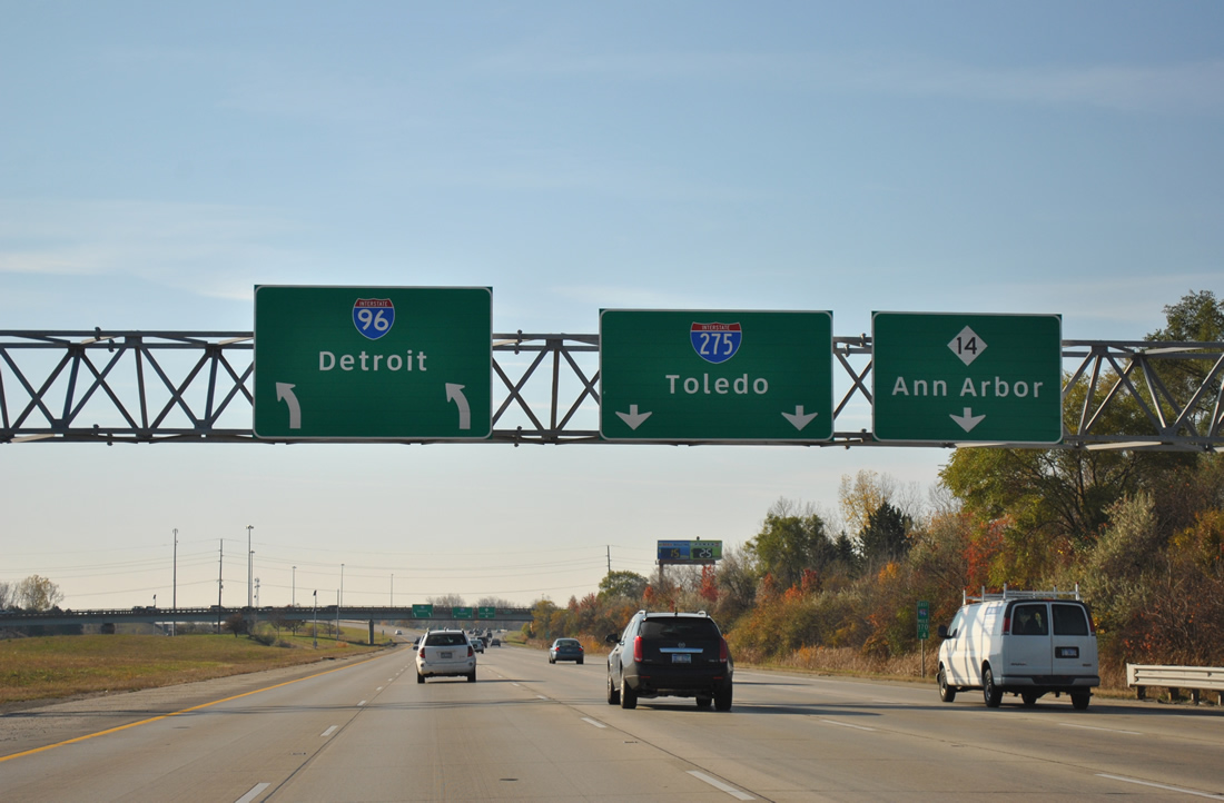
Interstate 96 east at I-275, I-696 and M-5.
Interstate 96 joins Lansing with Detroit by way of an overlap with Interstate 275 between Novi and Plymouth. I-96 merges with I-275 south at a pervasive interchange that joins Interstate 696 (W.P. Reuther Freeway) with M-5 (north and east). Originally I-96 followed the M-5 freeway to Grand River Avenue, ending as Business Spur I-96 leading east to downtown.
Interstate 96 turns east at the Interstate 275 interchange with the M-14 freeway leading east from Ann Arbor.
A few state-named shields remain in service for Interstate 96 in Livonia. Outside of a green box sign or two in Detroit, remaining shields for I-96 across the state are neutered.

Interstate 96 widens to incorporate a local/expressway configuration from Exit 180 (Outer Drive) east to Exit 186B (Davison Avenue).
The express carriageways only see slip ramps onto the local carriageways and otherwise are exit free. Speed limits vary between the two roadways with the express lanes seeing a 70 mph limit and the local lanes a 55 mph limit.
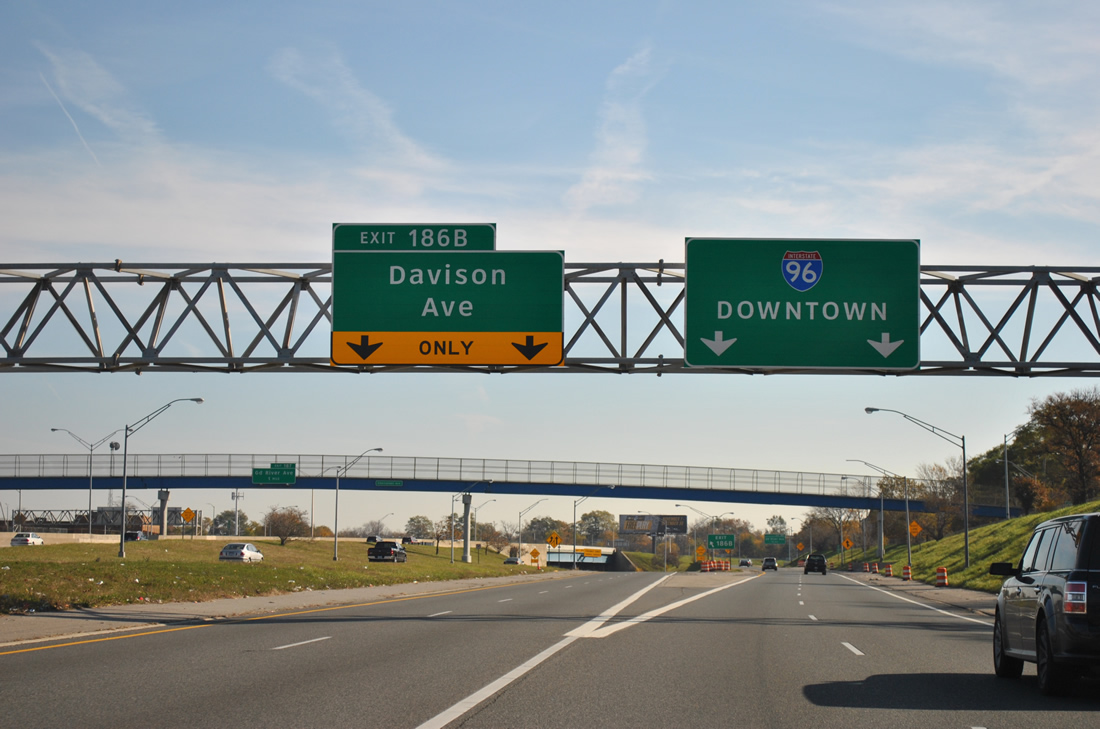
The left-hand ramp to Davison Avenue concludes the local lanes of Interstate 96 east.
A freeway was considered from I-96 to the current M-8 freeway between in the 50s and 60s. While that road never was built, hints of its possible tie in with I-96 remain today at Exit 186B.
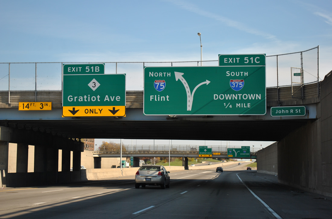
Interstate 75 leaves the Fisher Freeway for the Chrysler Freeway at Exit 51C with Interstate 375 south. The Fisher Freeway spurs to Gratiot Avenue (M-3 / former U.S. 25).
I-375 defaults onto Jefferson Avenue, 0.167 miles of which comprises unsigned Business Spur I-375.
The arterial connects the Chrysler Freeway with the beginning of the John C. Lodge Freeway (M-10). Midway between the two freeway end points is Woodward Avenue (M-1) and the entrance to the Windsor Tunnel to Ontario, Canada. The Tunnel opened in 1930 and carries a $4.00 cash toll.
A series of tunnels carry the beginning of M-10 (John C. Lodge Freeway) under COBO Center and Fort Street (M-3) ahead of the exchange with Interstate 75.
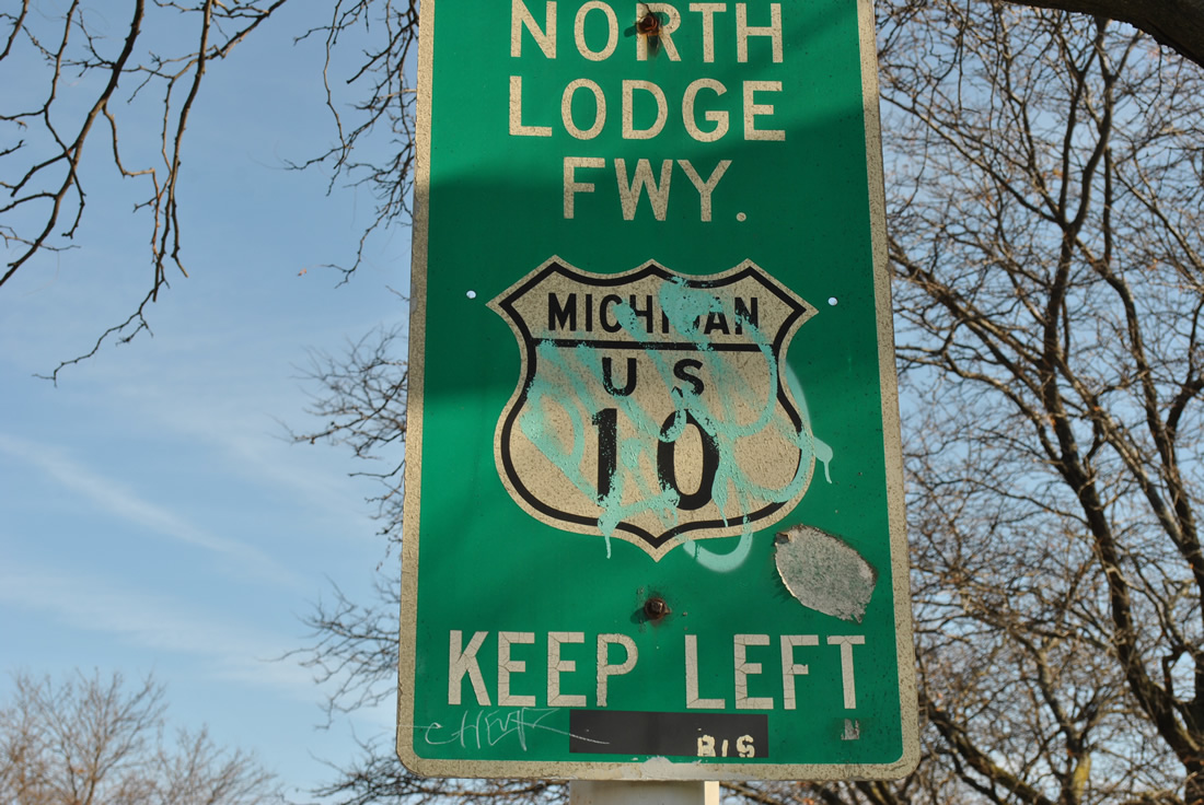
M-10 follows all of the John C. Lodge Freeway from downtown Detroit to Interstate 696. The highway number is a vestige of its days as the final stretch of U.S. 10. U.S. 10 was truncated from Detroit to Bay City in 1986.

State-named trailblazer for I-94 in Detroit.
State-named shields are extremely rare in Michigan as a whole, but they are more of an uncommon occurrence in Detroit, as many city-installs still function today. A crop of Interstate 94 signs referring to the road as the Ford Freeway remain in service near the M-10 freeway.
Even more rare are city-installed signs for the Lodge Freeway retaining the old U.S. 10 designation and 1948 shield specifications.
Outside of the central business district, a wooden sign holds on for life from the days when U.S. 10 traveled to downtown.
Traveling east along the M-8 (Davison Freeway) between Michigan 10 and the Woodward Avenue (M-1) off-ramp.
The Davison Freeway connects two sections of Davison Avenue through Highland Park. Constructed in 1944, the trenched freeway traveled a short distance, but was proposed to run west to the Jeffries at U.S. 16 and east to Mt. Elliot Avenue and south to the current path of Interstate 94.4 The freeway was a locally maintained facility until 1997, when MDOT took control of the route and modernized it.4
A high-speed stack interchange joins Michigan 8 (Davison Freeway)and Interstate 75.
The John Lodge Freeway becomes a trenched freeway from Exit 11 northwest to Exit 14C (Southfield Road).
M-10 was given a face lift and modernized in 2006-07. The route is very reminiscent of the Vine Street Expressway (Interstate 676) in Philadelphia.
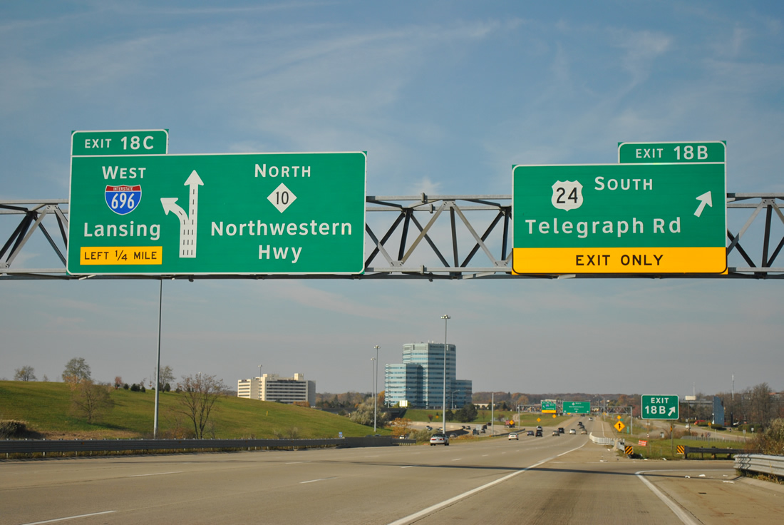
M-10 and Interstate 696 share a brief confluence ahead of U.S. 24 (Exits 18A/B) at Southfield. M-10 leaves the freeway network for Northwestern Highway beyond the “The Mixing Bowl” interchange.
M-39 begins from the M-10 freeway via a wye interchange and leads south along the Southfield Freeway to Dearborn and Allen Park. Modernization of the Southfield Freeway was undertaken in 2011.
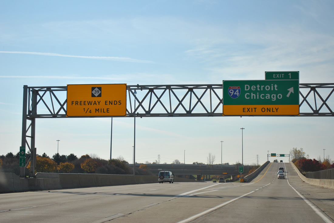
Exit numbers along the Southfield Freeway count down to the interchange with Interstate 94. While the freeway portion of M-39 ends, the trunk highway does not, as the road turns southeast along Southfield Highway to conclude just beyond Interstate 75.
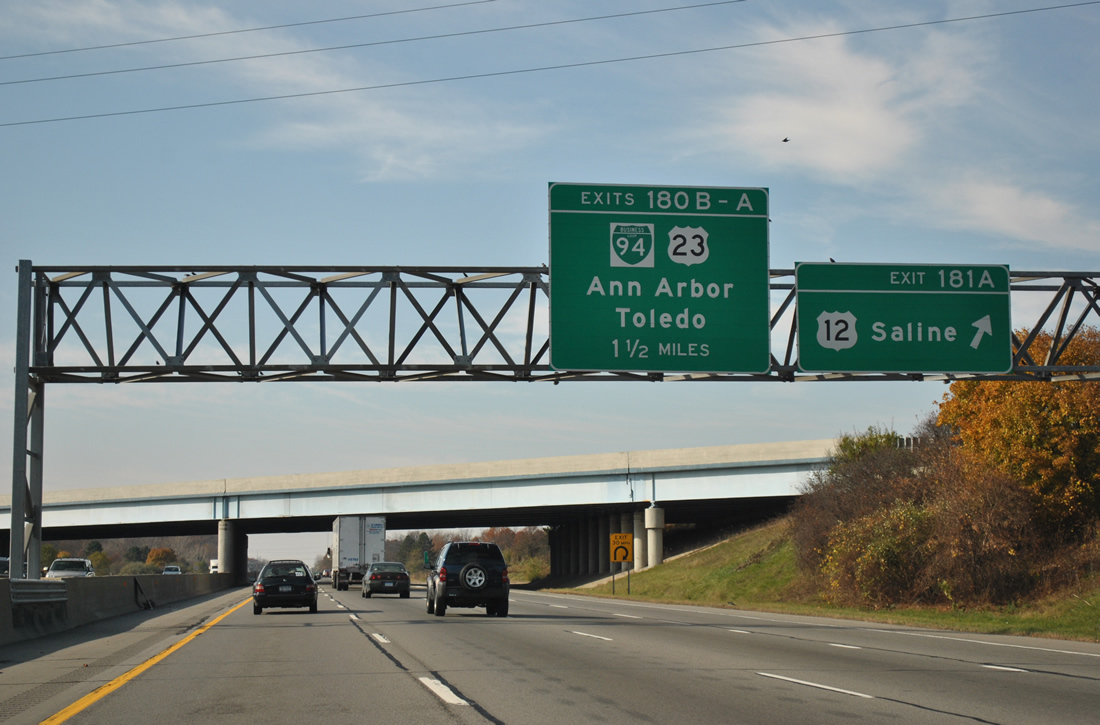
Interstate 94 & U.S. 12 combine for four miles to bypass Ypsilanti. The two part ways at Saline, just east of the I-94 interchange with U.S. 23 at Ann Arbor. Forthcoming Exit 180B doubles as the westbound beginning of Business Loop I-94 through Ann Arbor as well, with the loop following the US 23 freeway briefly north to Washtenaw Avenue.
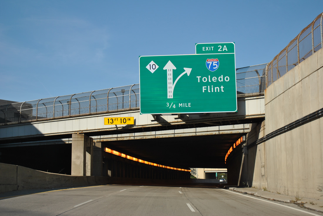
U.S. 23 constitutes a full freeway from Interstate 75 at Flint to the right angle turn of Interstate 475 at Toledo.
Approaching the north end of Interstate 475 in Toledo during construction.
Construction is underway (http://www.dot.state.oh.us/districts/D02/Documents/Misc/07272010InfoMeeting.pdf) along Interstate 475 east leading toward the terminus with Interstate 75 (Exits 20A/B). Work involves upgrading the interchange between the two freeways, widening I-75 north from I-475 to six lanes, and adding a new diamond interchange with ProMedica Parkway that replaces the Exit 19 off-ramps to Ohio 120 (Central Avenue) and on-ramps from Kelly and Upton Avenues. Completion is expected in fall 2013 on the $63.88-million project.
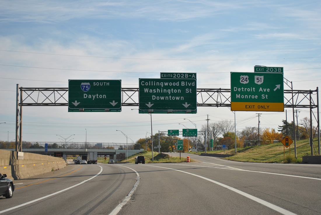
Old button copy signs remain in use along Interstate 75 southbound at the Exit 203B off-ramp to U.S. 24 and Ohio 51.
U.S. 223 once tied into downtown Toledo from Sylvania as well. Ohio 51 follows the alignment truncated by 1987.5
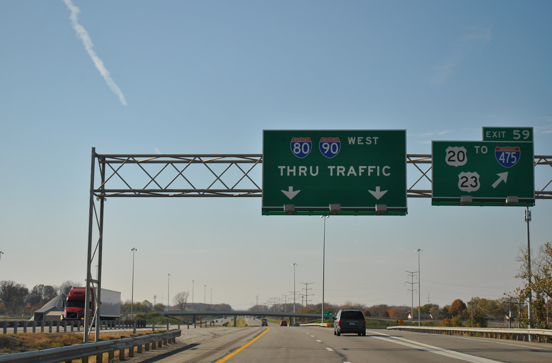
Exit 59 between Interstates 80 & 90 and Interstate 475 lacks a direct connection, despite it being touted as the way to the Ohio Turnpike from U.S. 23 south entering the state. Motorists must use a stretch of U.S. 20 and local road, Dussel Drive to make a link with the Perrysburg to Sylvania route.
Interstate 69 appears for the first, and perhaps one of only three times Ohio, along Interstates 80 & 90 west on a mileage sign posted 38 miles out from Angola, Indiana.
A diamond interchange resides between the Ohio Turnpike Westgate and Indiana Toll Road Eastgate. This exit does not require separate toll facilities due to its placement between the two mainline barriers.
Interstate 69 represents the first exit of the Indiana Toll Road for Interstates 80 & 90 west. A trumpet to trumpet interchange and access road connect the two roads just north of Angola.
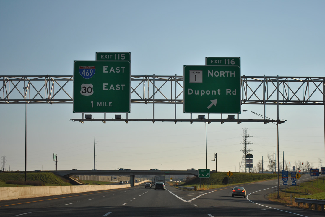
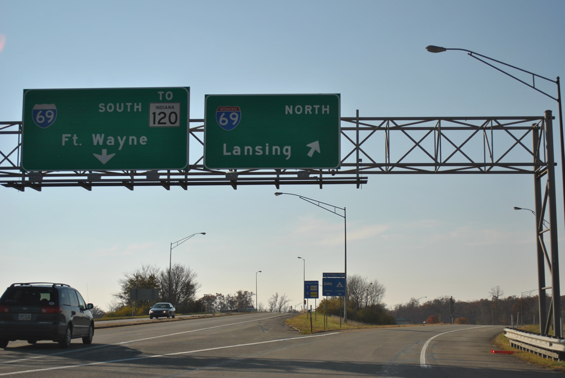
The first of eight interchanges along Interstate 69 south at Fort Wayne joins the route with Indiana 1 (Dupont Road) at Exit 116. The next exit represents the southbound beginning of Interstate 469, a 30.83-mile bypass completed in 1995. U.S. 30 follows the belt loop east to Exit 19 near New Haven.
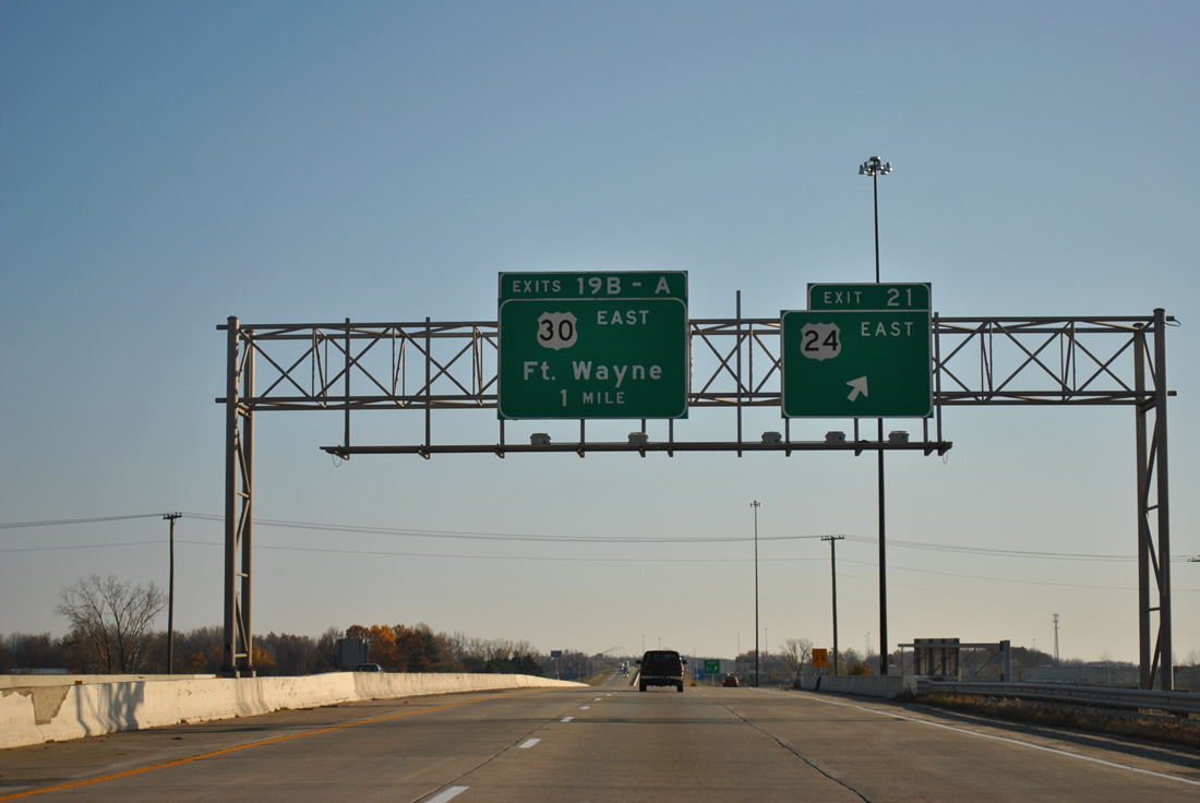
U.S. 24 ties into Interstate 469, one mile north of the southbound split with U.S. 30 east.
U.S. 24 is presently being upgraded to expressway standards from Fort Wayne east to the Ohio State line as part of the Fort to Port corridor. Visible just east of I-469 were concrete carriageways of the future four-lane highway.
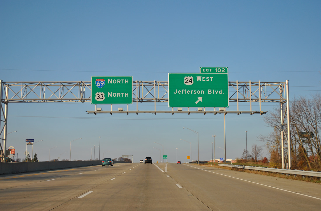
Like many other Indiana cities, the US highway network is confined to area bypasses or adjacent Interstate highways. U.S. 33 and 24 make the connection to their surface routes leading west from Fort Wayne via Interstate 69 north from Interstate 469.
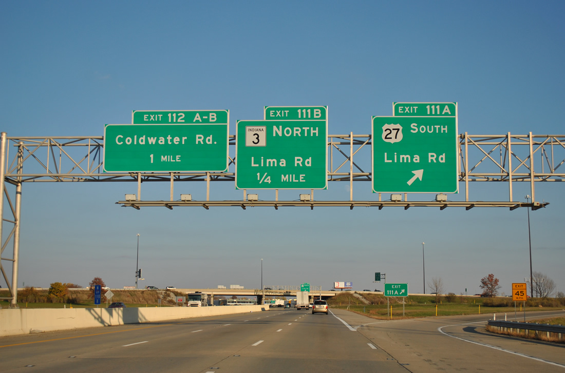
U.S. 27 is the lone holdout remaining within the Interstates 69 and 469 freeway loop.
The US highway however has the distinction of ending in Ft. Wayne, having suffered a lengthy truncation from near Grayling, MI by 2002. Exit 111 represents the north end point of the 1,364 mile route.
Most instances of U.S. 27 signage north of Fort Wayne were removed. However a few signs, such as those posted along Interstate 469 north, allude to the former overlap with I-69 north to Lansing.
Clouds appears on the southern horizon that were ahead of an approaching cold front. As we headed toward Indianapolis, traffic gradually increased as sunlight decreased.
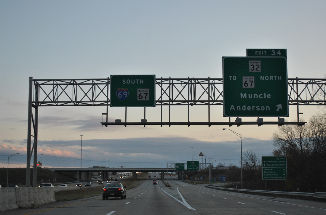
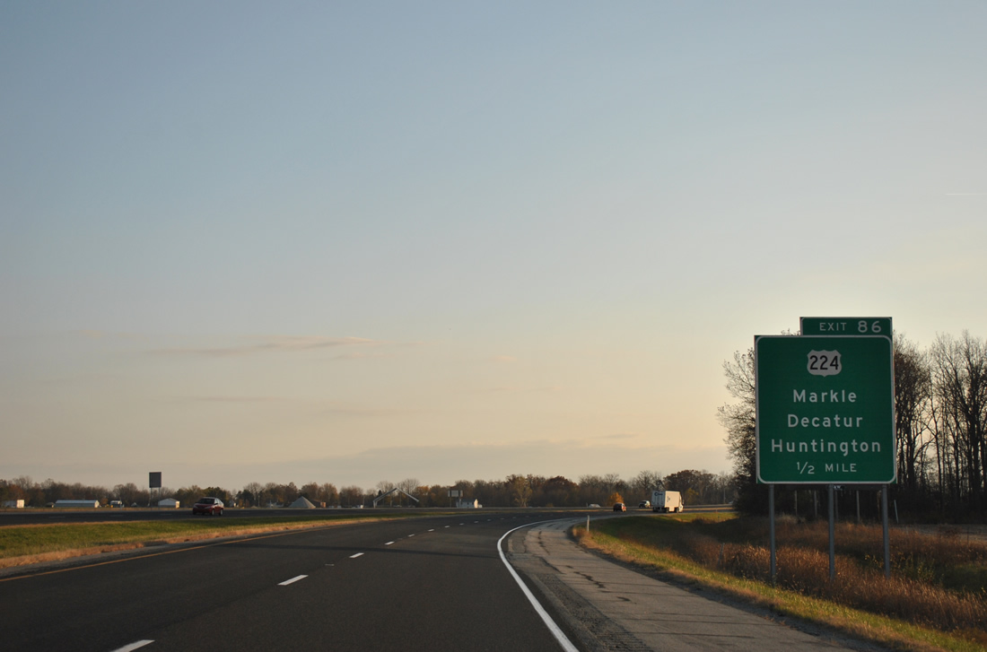
Indiana 67 joins Interstate 69 south from an expressway extending the Muncie Bypass west to Daleville.
Indiana 67 follows I-69 south to Pendleton. See Thomas Decker’s guide on AARoads for photos of the Muncie Bypass.
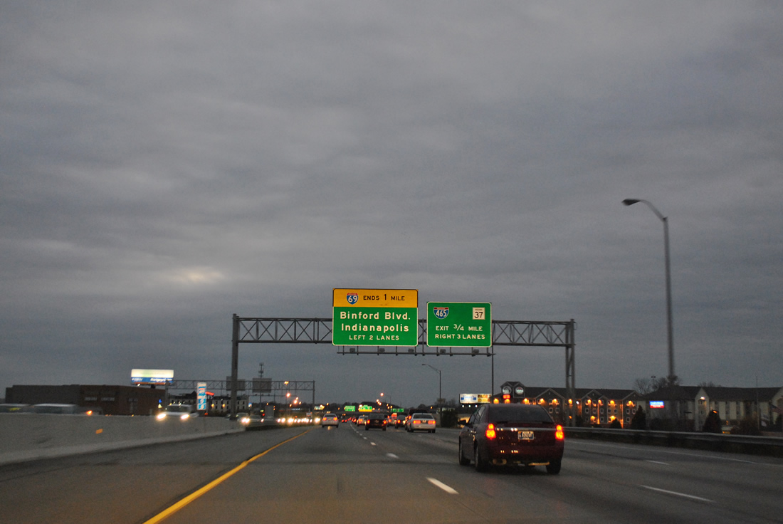
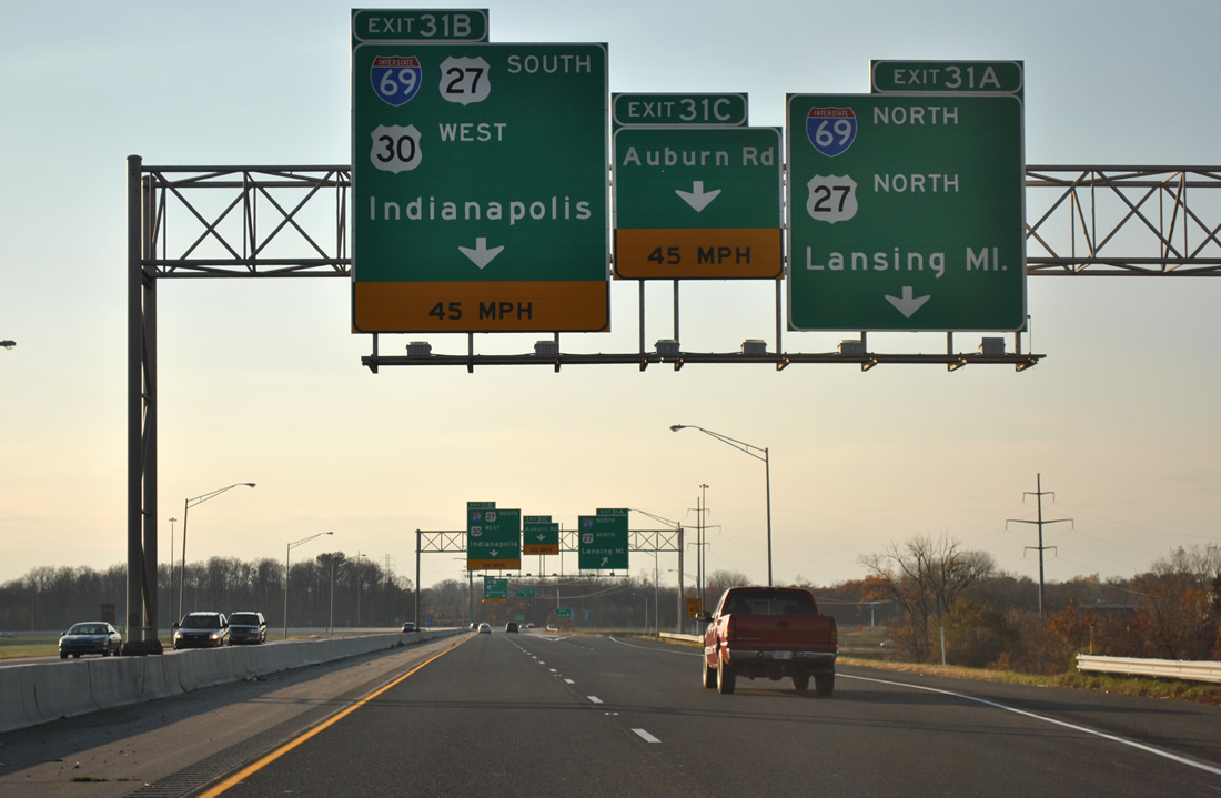
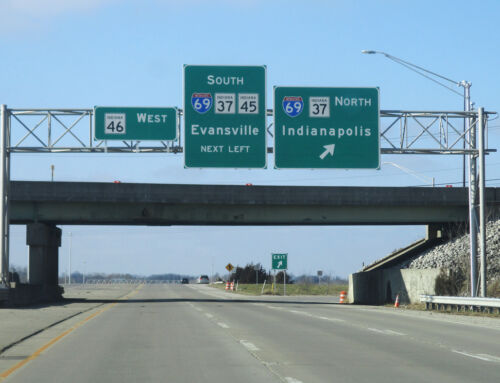
Interstate 69 currently ends at the Indianapolis Beltway (Interstate 465).
SR 37 follows the freeway from Exit 6 south to join I-465 in an implied overlap along the east side of the city. Presumptive renumbering will redesignated Exit 0 to 184 when I-69 is extended southwest from Indianapolis to Evansville in the coming years, bringing the total mileage in the state to 341.6
Sources: