
Began the trip by plotting out a circuitous route to Lake Champlain, Vermont via the New Hampshire seacoast and Hampton Beach. Started out on Interstate 93 southbound to its end and encircling Boston via Interstate 95 north. Traffic on Interstate 95 and the Boston area was relentless, even on a Sunday night at 10:30 am. The number of cars and trucks barreling down the road on the area freeways makes highway photography a chore…
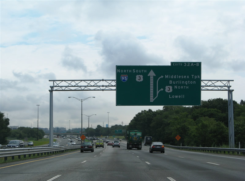
MassHighway uses large diagrammatic signs regularly along its freeways for interchange elements such as loop ramps and in this instance, a collector/distributor roadway. This particular sign resides along Interstate 95 northbound ahead of the trumpet interchange with U.S. 3 (Exits 32A/B). The c/d roadway serves not only interests to the U.S. 3 freeway north, but also to the nearby folded-diamond interchange with Middlesex Turnpike. Note that U.S. 3 south joins Interstate 95 north to make the jump from its freeway onto its original alignment on Cambridge Street (Exit 33).
Interstate 93 north carried us back to the Loop Connector (Massachusetts 213) east to Interstate 495 north. Interstate 495’s northernmost extent includes just four lanes and the lightest amount of traffic that we saw. Though that is an understatement, it was a welcome concept given the overall Massachusetts’ and Southern New England traffic woes.
I neglected to go to the east end of New Hampshire 101 and Atlantic Coast in 2005, so we decided to make that a stop this year. New Hampshire 101 appears as a freeway with an interchange with U.S. 1 on some maps. This is gravely incorrect, as the highway narrows to two lanes across tidal marshes west of Hampton Beach before partitioning into a one-way one-lane street couplet in the town itself. State maintenance ends near the couplet partition no less.
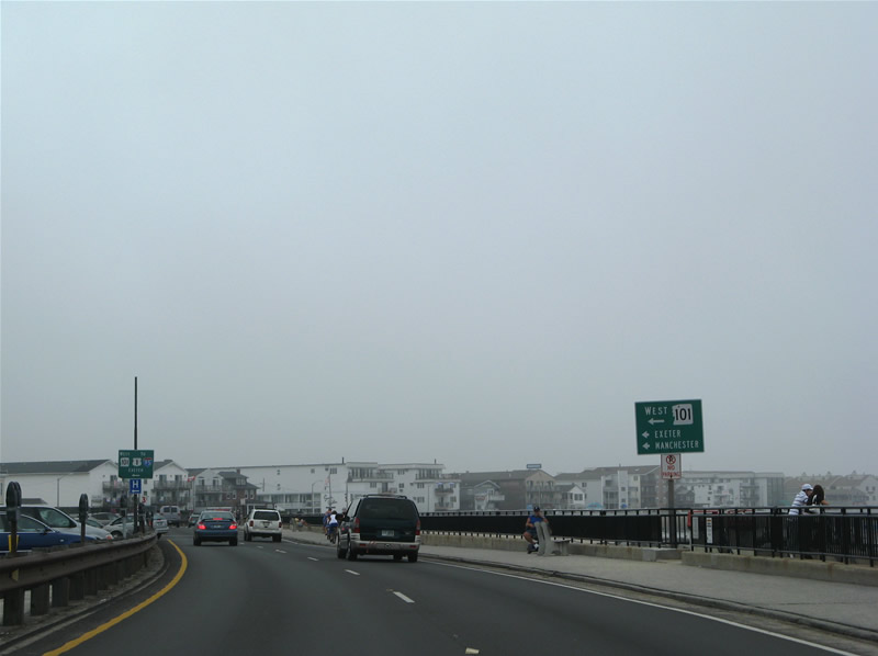
U.S. 1 (Ocean Boulevard) northbound at the westbound beginning of New Hampshire 101 (Church Street) in Hampton Beach. Church Street carries one lane of N.H. 101 west to the confluence with Highland Avenue (N.H. 101 east). From there New Hampshire 101 crosses marshland to a signalized intersection with Landing Road. After that at-grade intersection, the New Hampshire 101 freeway begins as a super-two expressway.
Hampton Beach was shrouded in some late morning low cloudiness this day, but was bustling with tourists and beach goers none the less. Densely built beach cottages line U.S. 1 southbound and the adjoining narrow street grid. U.S. 1 otherwise constitutes a divided highway with parallel parking slots in its median through here. Sand on the adjacent beach is more orange than anything else. Overall, we thought it was a quaint place, that worthy of a return visit…
New Hampshire 101 took us west to Manchester. The freeway is much less traveled then its Massachusetts counterparts and offers a direct link between the coast and mountains with Interstates 93 and 89. The corridor historically is that of Interstate 92, though the freeway itself was not fully completed until the early 2000s.
In Manchester, finding a stand-alone Interstate shield or reassurance marker of any kind can be quite a task. That is, as mentioned in yesterday’s blog post, overlapped routes are signed in a green box. This makes it next to impossible to find a single Interstate 293 shield as the Manchester loop shares pavement with the F.E. Everett Turnpike, New Hampshire 101, and New Hampshire 3A along its routing. Otherwise construction is still present at the Granite Street diamond interchange and Interstate 293 north to Amoskeag Street. Crews are essentially modernizing the highway through there.
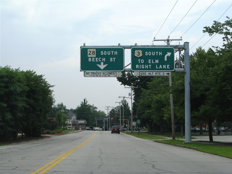
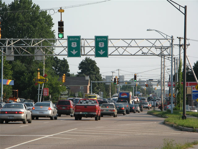
Classic button copy overheads on U.S. 3 (Hooksett Road) southbound at its split with New Hampshire 28. New Hampshire 28 follows the one-way street couplet of Beech Street (south) and Maple Street (north) between U.S. 3 and Willow Street. U.S. 3 meanwhile turns west on Webster Street to Elm Street south and the Manchester central business district.
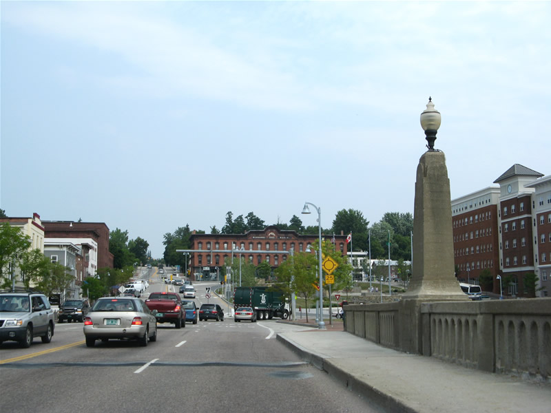
We poked around downtown Manchester from Bridge Street east and U.S. 3 north. For a small city, there appears to be many entertainment spots, including a full scale arena. Though other parts of Manchester remind me of Scranton…
Leaving Manchester, Interstate 93 briefly becomes the F.E. Everett Turnpike on the drive to Interstate 89 and Concord. Concord, the state capital, is similar to Montpelier with a dense downtown and its overall layout.
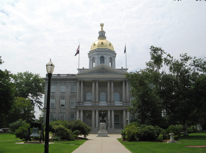
Looking west at the New Hampshire State Capital Complex from U.S. 3-202 & New Hampshire 9 (Main Street).
Construction involving the repaving of Interstate 89 hampered us and all other northbound drivers over the course of the first three miles leaving Interstate 93. I was once told that DOT’s in northern New England repave their freeways every two to three years. As we would later discover on Interstate 89 between White River Junction and Barre, repaving was underway in Vermont as well.
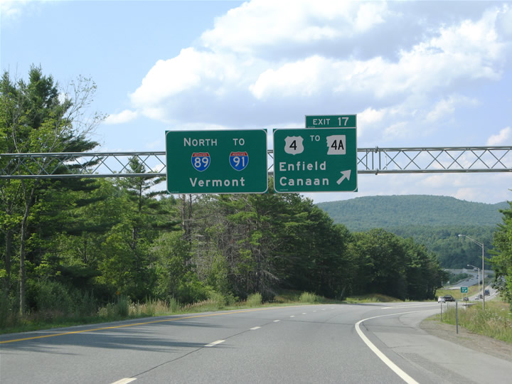
Interstate 89 parallels U.S. 202 west from Concord before veering northwest to Lebanon. A bulk of the traffic departs via U.S. 202 en route to Henniker and Keene, leaving Interstate 89 to the mountains. Pictured here is the Interstate 89 north & New Hampshire 10 west approach to eastern Lebanon.
Interstate 91 northeast of Interstate 89 is one of the more beautiful freeways in the northeast. The difference between it and Interstate 89 northwest of Montpelier is that there is less traffic, which anymore is becoming an increasing problem in Vermont with the influx of vacationers. Jay Hogan, formerly of New England Turnpikes, wrote earlier this year that VTrans was undertaking a sign replacement project along Interstate 91 leading north from White River Junction. The results of that project were clear in the form of a complete sign overhaul along the route between Interstate 89 and one exit south of Interstate 93. Crews were in the process of replacing signs at St. Johnsbury of both Interstates 91 and 93 that week no less. Further north, original signs are still in use, some of which have lost all of their green and now appear gray…
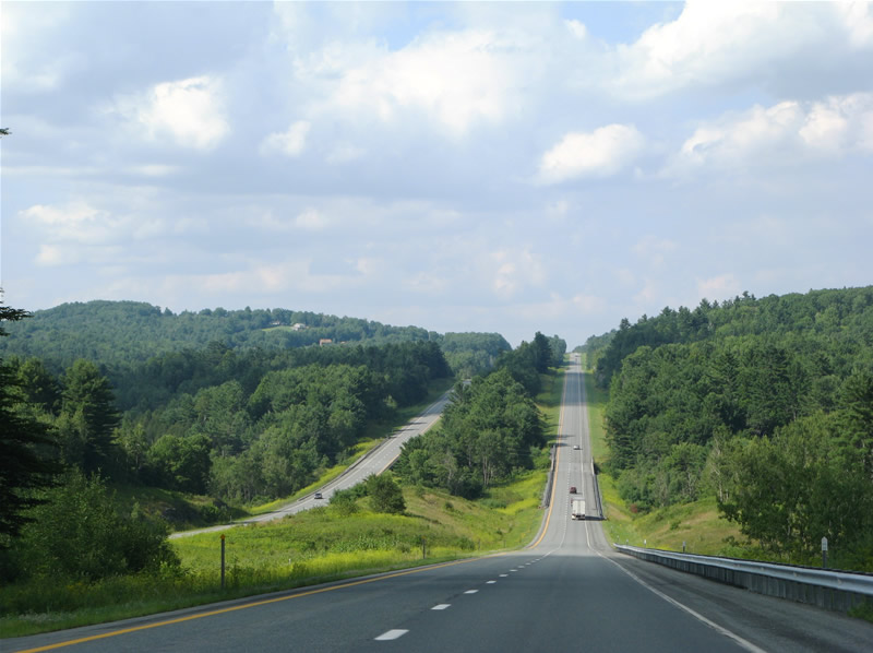
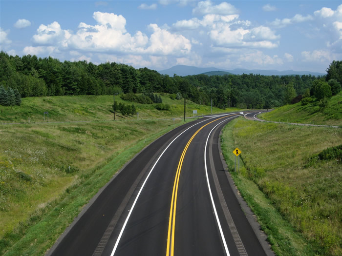
One of the many hills along Interstate 91 between White River Junction and St. Johnsbury. Breathtaking vistas into the parallel Connecticut River Valley are afforded to the east periodically. This view looks at the freeway south of Exit 17.
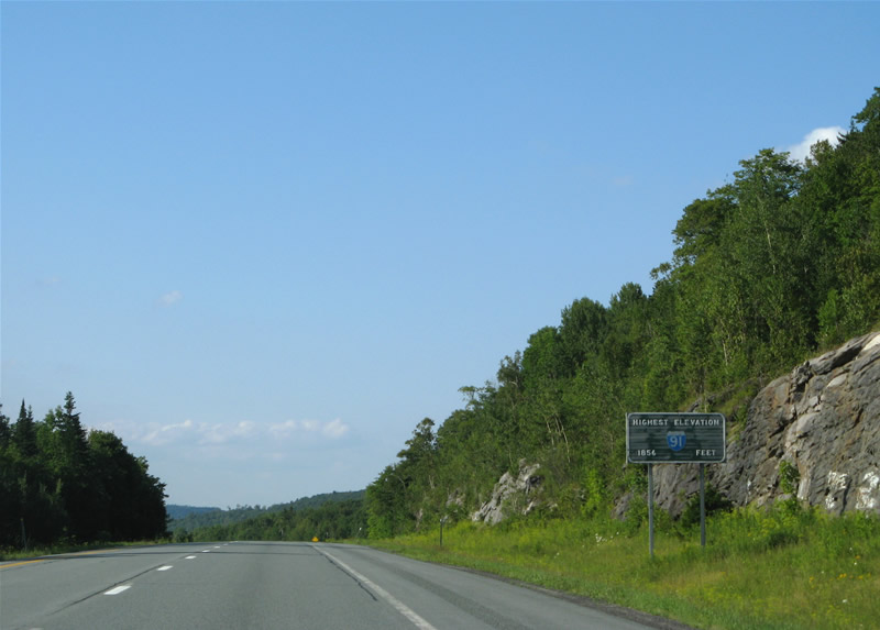
Original guide sign along Interstate 91 northbound proclaiming the highest elevation along the entire route (1,856 feet).
Our final stop before heading west across the Green Mountains to Lake Champlain took us to Newport and Derby Line, Vermont. Interstate 91 defaults into the Canadian Port of Entry, ahead of Quebec Autoroute 55. A connector street stems west along the Canadian border to U.S. 5 at its northern end, which is another Port of Entry. The next town south along U.S. 5 is Newport.
Vermont 191, which appears as a freeway on some maps, provides access to Interstate 91 from Newport. Like the “Interstate Access Road” in St. Albans, Vermont 191 is a controlled access surface road connecting the parent freeway with the nearby town. Vermont 191 ends at a stop light with junction U.S. 5 & Vermont 105 and sees a few at-grade intersections along the way. Thus it is not a freeway, nor even an expressway.
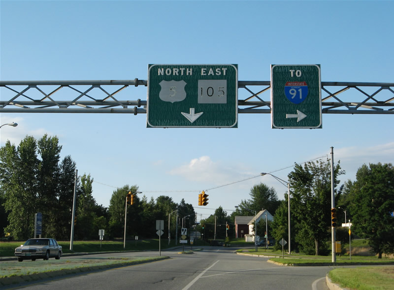
U.S. 5 north & Vermont 105 east (Causeway) at junction Vermont 191. Vermont 191 spurs east to Western Avenue, Crawford Farm Road, Citizens Road, and the Exit 27 partial-cloverleaf interchange with Interstate 91. The traffic light between the two highways is permanently set to flash caution for U.S. 5 & Vermont 105.

hi nice post, i enjoyed it
I like the White River/St. J photo. I’ve traveled that road hundreds of times and that stretch is very familiar!