U.S. 26
From U.S. 101 in Seaside, Oregon (retracted from Astoria in 2004), east to Interstate 80 in Ogallala, Nebraska.
U.S. 26 follows State Control Route 10 from Alpine Junction to Moran Junction, State Control Route 30 from Moran Junction to Riverton, State Control Route 20 from Riverton to Shoshoni, State Control Route 34 from Shoshoni to Casper, State Control Route 505 from Casper to Glenrock, Interstate 25 from Glenrock to Dwyer Junction, and State Control Route 27 from Dwyer Junction to Nebraska (including concurrent section with State Control Route 25 [U.S. 85] near Torrington).
U.S. 26 Auxiliary Routes
In Casper, Business U.S. 26 follows the original route of U.S. 26 and the Oregon Trail before Interstate 25 was built to the north of the city. It is known as Yellowstone Highway and is cosigned with Business U.S. 20 throughout its length. Business Loop Interstate 25 and Business U.S. 87 converge with Business U.S. 20-26 on the east side of Casper's downtown, and the four routes remain merged to Interstate 25 at Eastgate.
In Douglas, it follows the Business Loop Interstate 25 route through the city; it is cosigned with Business U.S. 20 and Business U.S. 87 too.
Bypass U.S. 26 in Casper is the east-west bypass to the north of the city. The western half is cosigned Bypass U.S. 20-26, while the eastern half is signed as Interstate 25 and is signed U.S. 20-26-87. The bypass moniker is not used consistently, so don't be surprised if you see regular U.S. 20 or 26 shields without a "bypass" banner above them.
There are no primary state routes with the root x26 numbering in the state of Wyoming. Wyoming 126 is not assigned, but it would be a secondary state route in Crook County. Wyoming 226 is designated but is not signed along Missile Drive. Wyoming 326 through 926 are not assigned.
History
U.S. 26 follows the path of the historic Oregon Trail in Eastern Wyoming through Goshen County and Torrington. The Oregon Trail in Wyoming ran across the middle of the state via U.S. 30, Wyo. 28, U.S. 287, Wyo. 220, Interstate 25, and U.S. 26.
Following the North Platte River in the agrarian Goshen County, the U.S. 26 portion of the Oregon Trail is on the south bank, while the historic Mormon Trail is on the north bank. Several state parks line this corridor, including Fort Laramie State Historic Site. This was established as a trading outpost in 1834 and became a significant base for protecting the travelers along the Oregon Trail. Near the Guernsey State Park are Register Cliffs and Oregon Trail Ruts. The cliffs have inscriptions of the names of the people making the journey, while the ruts are actual wagon ruts that have carved into the soft sandstone.
The Oregon Trail continues along U.S. 26 as part of Interstate 25. There are several Oregon Trail historical sites along this portion of the road, including museums in Douglas and Glenrock. Upon reaching Casper, the trail leaves U.S. 26, heading along Wyo. 220 toward South Pass. Please go to the Wyoming 220 listing for more on the Oregon Trail.
In 1926, U.S. 26 was commissioned to begin at old U.S. 185 in Dwyer, Wyoming, and end at U.S. 30 in Ogallala, Nebraska. There was a Wyoming 26 that began at U.S. 185 in Wheatland and headed southwest to U.S. 30 at Bosler. After the great recommissioning of 1936, U.S. 26 still had the same length, but it began at the newly defined U.S. 87 rather than U.S. 185. Wyo. 26 remained as well.
It was not until 1950, nearly fifteen years later, that U.S. 26 was finally extended west to the Pacific Ocean by replacing portions of U.S. 28 in Oregon and merging with routes (mainly U.S. 20) in Idaho and Wyoming.
During that same year (1950), Wyoming 26 was recommissioned as Wyoming 34 to prevent confusion between the newly extended U.S. 26 and the state route of the same number. The routing for U.S. 26 has persisted since then, and it reached its golden anniversary in 2000.
Guide
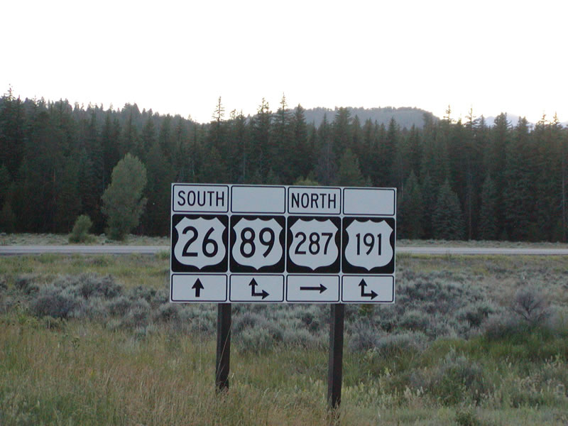
Much of U.S. 26 overlaps with other routes. Its guide is the same as that for U.S. 89 between Alpine and Moran Junction, U.S. 287 between Moran Junction and Diversion Dam Junction, U.S. 20 between Shoshoni and Casper, and Interstate 25 between Casper and Dwyer.
The solo section of U.S. 26 between Diversion Dam junction and Riverton is best bypassed by taking Wyoming 133 and 134. This route combination goes to the north of Ocean Lake (so named because of its unusual color) and reconnects to U.S. 26 just south of Shoshoni. Riverton is a nice enough town, if not boring. Riverton boomed when uranium mining in the Gas Hills exploded; however, the closure of those mines has resulted in a downturn in Riverton. In Riverton, U.S. 26 and Wyoming 789 meet up; the two routes travel northeast toward Shoshoni along the Wind River.
At Shoshoni, U.S. 26 and U.S. 20 hook up for the long trip back to Casper. U.S. 26 then merges with Interstate 25 all the way to Dwyer Junction. Please refer to the History section, above, for information on U.S. 26 between Dwyer and the Nebraska state line. This routing parallels the historic Oregon Trail.

| U.S. 26 East and U.S. 89-189-191 North | ||||||||
|---|---|---|---|---|---|---|---|---|
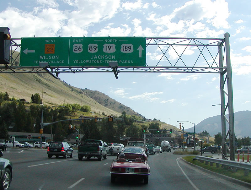
Southwest of Jackson, eastbound U.S. 26 and northbound U.S. 89-189-191 (Broadway Street) meet Wyoming 22 (Teton Pass Road) at the "Y" intersection. Wyoming 22 travels west to Wilson and Wyoming 390, which connects to Teton Village. After that, the highway travels over Teton Pass (elevation 8,429 feet) into Idaho, where it becomes Idaho 33. U.S. 26-89-189-191 continue straight ahead into Jackson. Photo taken by Casey Cooper, 07/09/05.
| 
Now entering downtown Jackson, U.S. 189 ends, having reached its northern terminus. Eastbound U.S. 26 and northbound U.S. 89-191 turn left (north) to continue toward Grand Teton National Park and Yellowstone National Park. Prior to entering Yellowstone, U.S. 26 will turn southeast at Moran Junction to cross Togwotee Pass (elevation 9,544 feet) along with U.S. 287 to serve Dubois, Crowheart, and Riverton/Lander in Fremont County. Photo taken by Casey Cooper, 07/09/05.
| 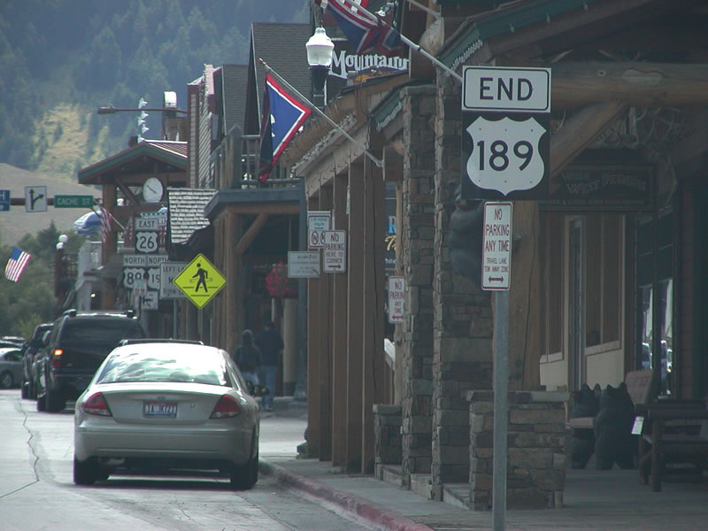
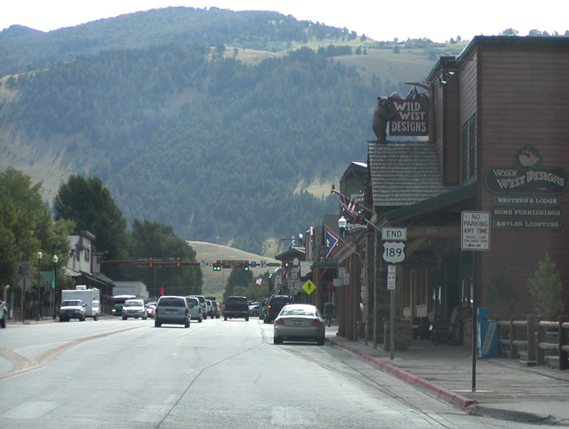
U.S. 189 ends in Jackson at the intersection of Broadway Street and Cache Street, not at Hoback Junction or at the Wyoming 22 as some maps seem to indicate. A relatively short U.S. route, it connects to its parent (U.S. 89) at either end, with a gap between Heber City, Utah, and the Wyoming-Utah State Line on Interstate 80. If the section of U.S. 189 is decommissioned in Utah, the orphaned stretch of U.S. 189 would be a single-state U.S. highway, residing solely in Wyoming. Photo taken by Casey Cooper, 07/09/05.
| U.S. 26 East and U.S. 89-191 North
| | ||||
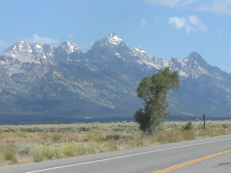
The Grand Tetons rise to the west of U.S. 26, U.S. 89, and U.S. 191 as the three routes travel north toward Moran Junction. Photos taken by Casey Cooper, 07/09/05.
| 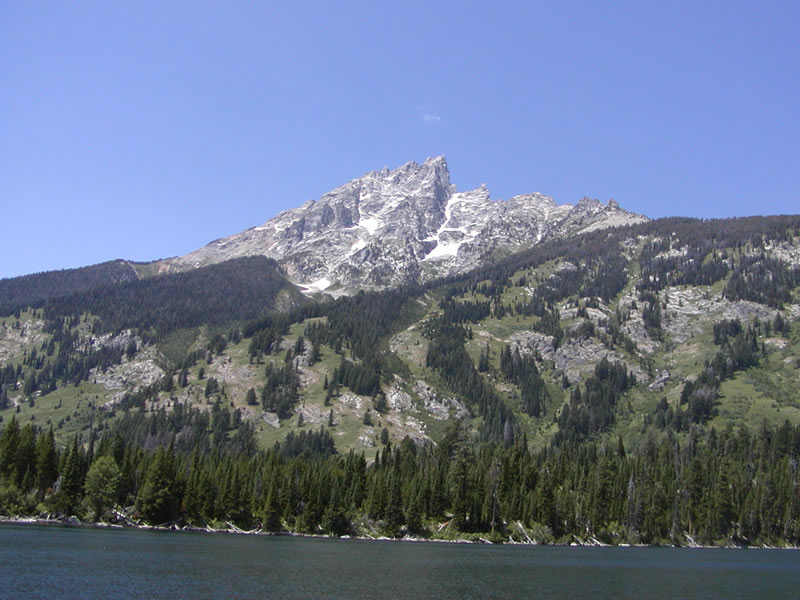
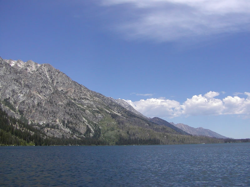
Jenny Lake, along with Jackson Lake and Leigh Lake, are among the largest lakes in Grand Teton National Park. Located west of the main U.S. 26-89-191, a fee is required to access Jenny Lake and hike around its trail system. These views are afforded from a boat on Jenny Lake. Photos taken by Casey Cooper, 07/09/05.
| 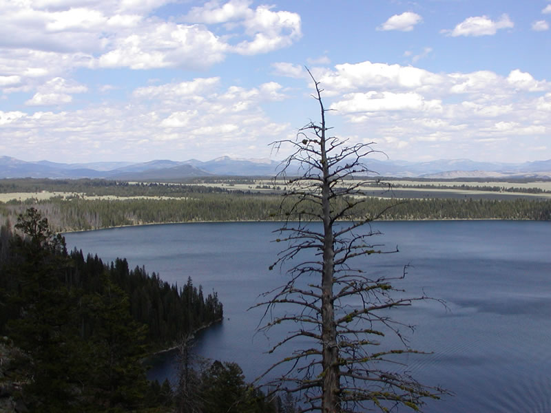
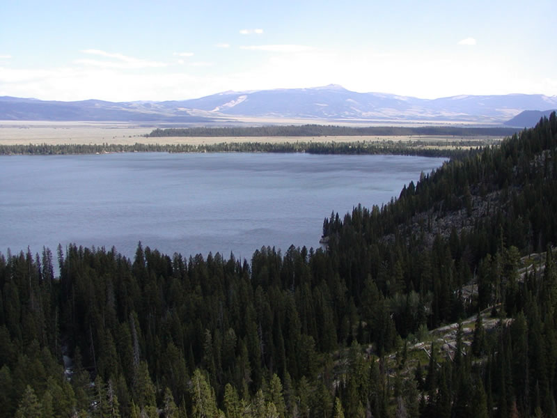
These pictures show Jackson Hole as seen from the hiking trails above Jenny Lake, Leigh Lake, and Jackson Lake. The first picture looks north toward Moran Junction; the second looks south toward Sleeping Indian (mountain), the city of Jackson, and Jackson Hole. Photos taken by Casey Cooper, 07/09/05.
| |
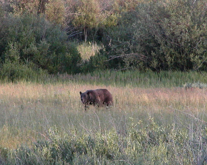
Wildlife predators may be found throughout the national park system in Northwestern Wyoming. Here, a black bear forages for food along the Snake River near Moran Junction. Photo taken by Casey Cooper, 07/09/05.
| 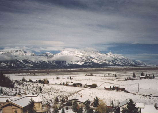
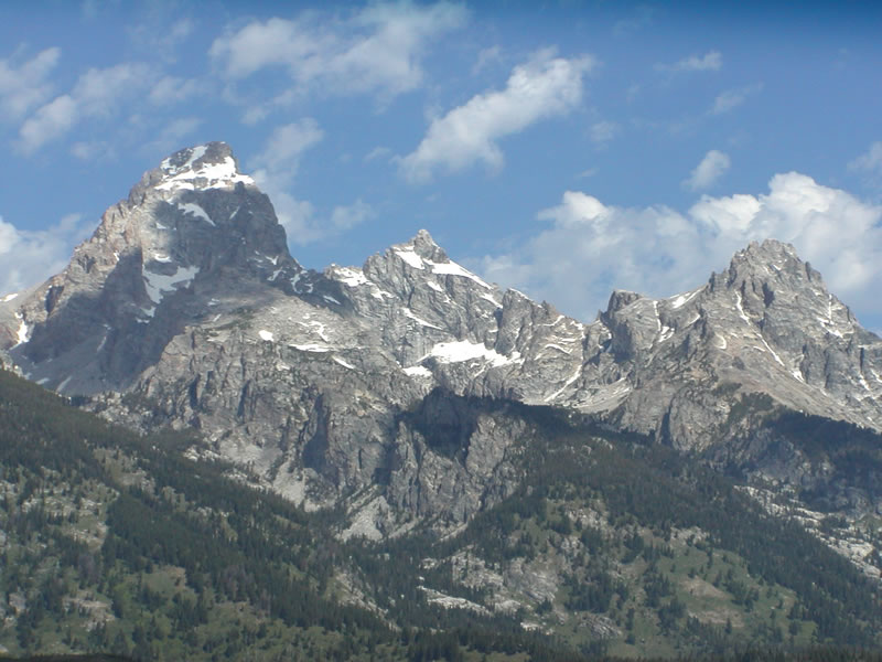
This view of the Grand Tetons is afforded along eastbound U.S. 26 and northbound U.S. 89-191 within Grand Teton National Park. Photo taken 11/94.
| U.S. 26 East and Wyoming 789 North
| 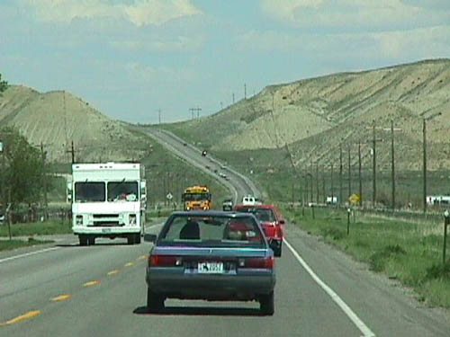
This is the scene along eastbound U.S. 26 and northbound Wyoming 789 as the highway leaves the city of Riverton in Fremont County. Photo taken by Mike Ballard, 8/98.
| 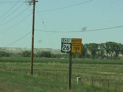
A pair of eastbound U.S. 26 and northbound Wyoming 789 shields are posted on their shared alignment between Riverton and Shoshoni. Photo taken by Mike Ballard, 8/98.
| U.S. 26 East and U.S. 85 South
| 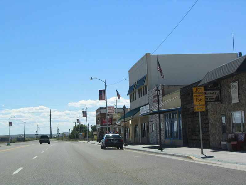
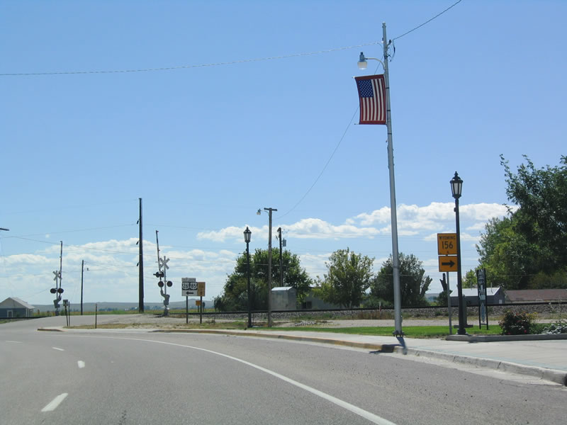
Eastbound U.S. 26 and southbound U.S. 85 approach their junction with Wyoming 156 in Lingle just prior to leaving town. Photo taken 09/04/04.
| 
As the U.S. highway approaches the Burlington Northern and Santa Fe Railroad crossing, Wyoming 156 prepares to split to the south. Wyoming 156 connects to Wyoming 157 and then crosses the North Platte River to London Flats. Both Wyoming 156 and Wyoming 157 might be old alignments of U.S. 26-85. Photo taken 09/04/04.
| 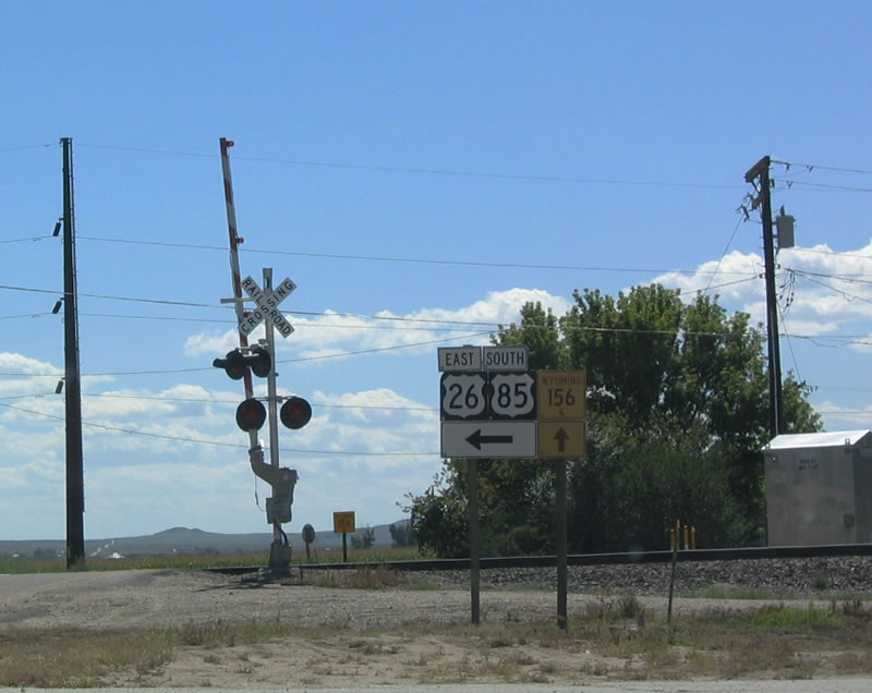
This unique shield assembly shows that U.S. 26-85 turn left (southeast), while Wyoming 156 travels south toward the North Platte River. Photo taken 09/04/04.
| 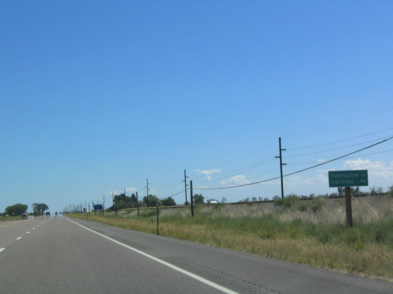
Now leaving Lingle, this mileage sign provides the distance to Torrington (10 miles) and Cheyenne (94 miles) via U.S. 85. Mileage to Scottsbluff in western Nebraska is not provided. The highway is four lanes between Lingle and Torrington. Photo taken 09/04/04.
| 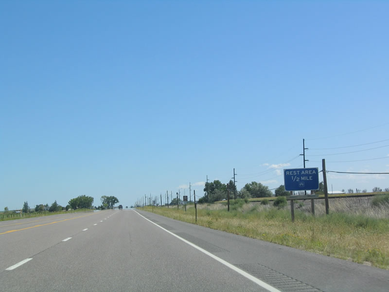
U.S. 26-85 follows the Burlington Northern and Santa Fe Railroad along the north bank of the North Platte River. A rest area is located along U.S. 26-85 just southeast of Lingle. Photo taken 09/04/04.
| 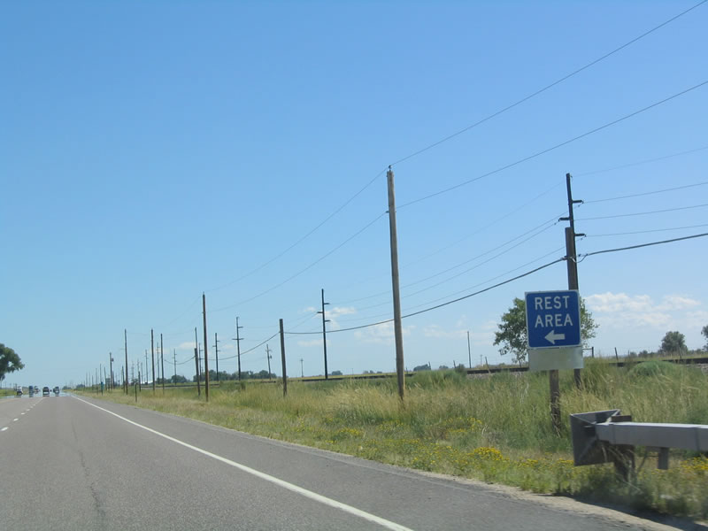
The rest area is located on the north side of U.S. 26-85. Along U.S. 85 south, the next roadside rest area is located in northeastern Laramie County. Photo taken 09/04/04.
| 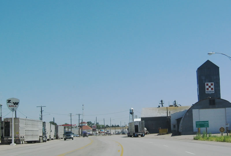
U.S. 26-85 enters the city of Torrington, the Goshen County seat. Agriculture takes priority in this town, given its proximity to the North Platte River valley and land that is much more fertile than lands to the south or north of the river. Torrington was founded in 1889 and was named after the city of the same name in Connecticut. When Goshen County split from Laramie County in 1911, Torrington became the county seat in 1913 after a brief battle with neighboring Lingle. Torrington did not become a city until 2000. Photo taken 09/04/04.
| 
Home to 5,776 people (per the 2000 Census), Torrington has hovered around this number of residents since at least 1990. Booms and busts in agriculture greatly impact the economy and population of this small city. U.S. 26-85 enter the industrial part of town, passing by several supply yards on its way into town. The Torrington water tower dominates the skyline along with storage tanks. Photo taken 09/04/04.
| 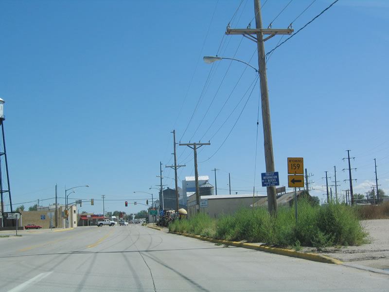
Wyoming 159 follows West C Street north to provide ranch and farm access to areas north of Torrington close to the state line. The state highway does not continue beyond a certain point, but county routes continue north from that point. Photo taken 09/04/04.
| 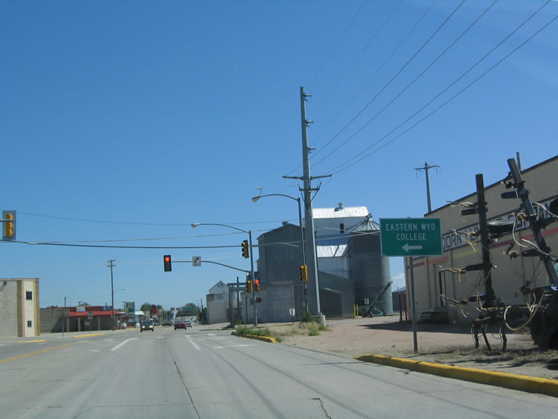
Follow Wyoming 159 (West C Street) north to Eastern Wyoming College. Continue straight ahead along U.S. 26-85/Valley Road to downtown Torrington. Photo taken 09/04/04.
| 
Eastbound U.S. 26 and southbound U.S. 85 prepare to split as Valley Road approaches Main Street after the Wyoming 159 (West C Street) intersection and traffic signal. Photo taken 09/04/04.
| 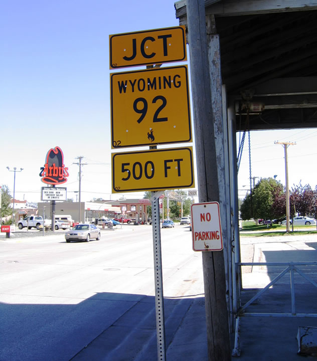
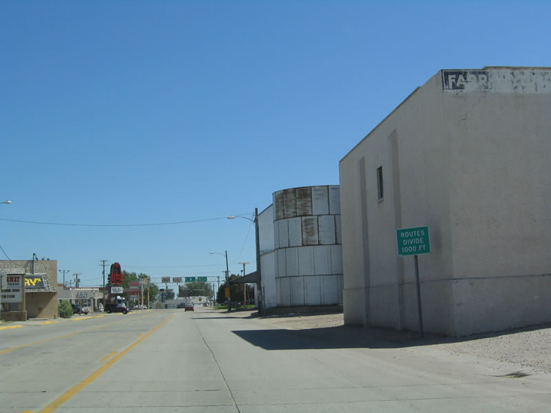
This intersection also serves as the western terminus of multi-state route 92, which connects Torrington in the west with La Moille, Illinois, in the east. the highway traverses Nebraska and Iowa, passing through rural farm and ranching areas on its journey toward the Land of Lincoln. Wyoming 92 follows U.S. 85 south, then turns east into Nebraska where it serves the community of Lyman. Photo taken 09/04/04.
| 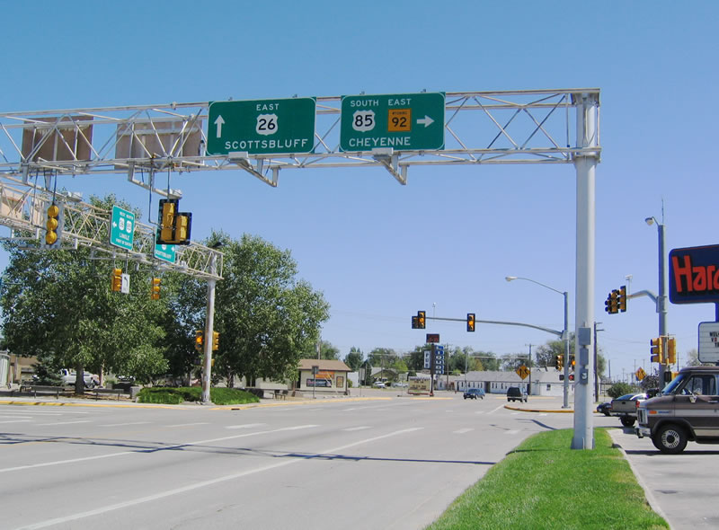
U.S. 26 continues straight ahead, following the Oregon Trail corridor east toward Scottsbluff and Ogallala. U.S. 85/CanAm Highway turns south onto Main Street, traveling toward Cheyenne, the capital city. Turn left onto Main Street northbound to enter Torrington's historic downtown area. Photo taken 09/04/04.
| U.S. 26 West
| 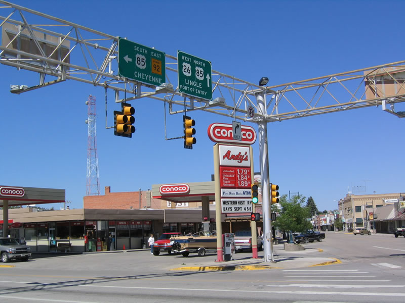
At the main Torrington intersection is this traffic signal as seen from westbound U.S. 26 as the highway reaches the junction with U.S. 85 south. Follow U.S. 85 south to Cheyenne as well as the small Goshen County towns of Veteran, Yoer, Huntley, and Morrill via ancillary routes Wyoming 92 and Wyoming 154.
| U.S. 26 West and U.S. 287 North
| 
Much farther to the west, westbound U.S. 26 and northbound U.S. 287 meet U.S. 89 and U.S. 191 at Moran Junction in the heart of Grand Teton National Park. U.S. 26-89-191 turn south toward Jackson, passing through the Antelope Flats on their way to Moose and Gross Ventre Junction. U.S. 287 turns north with U.S. 89 and U.S. 191 toward Yellowstone National Park. Photo taken by Casey Cooper, 07/09/05.
| 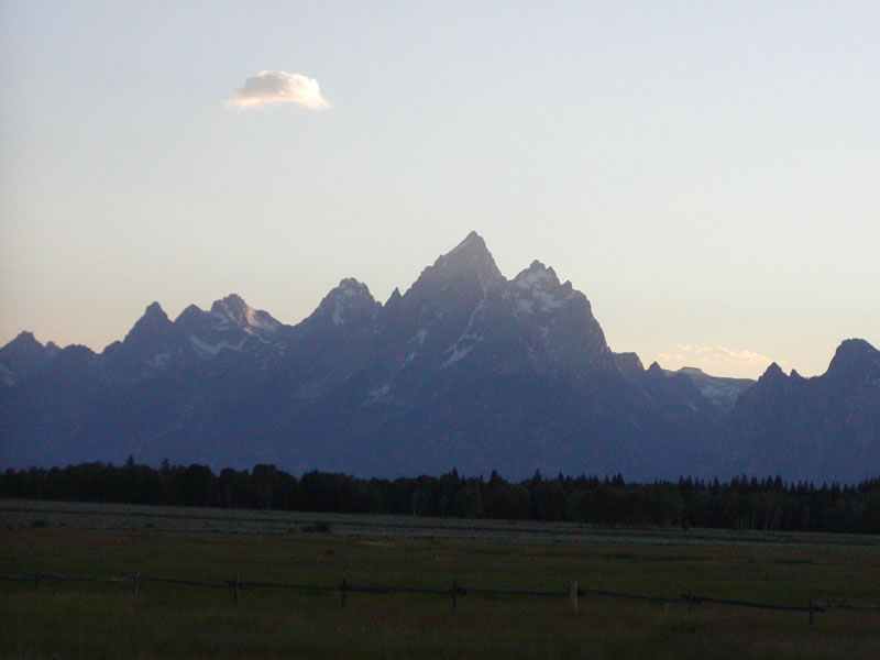
At Moran Junction, the majestic Grand Tetons dominate the skyline, with its jagged peaks backlit by a setting sun in the early evening. Photo taken by Casey Cooper, 07/09/05.
| | |||||||||||||||||||||||||||
Page Updated October 30, 2005.
|
About Contact FAQ |
Spotlights Testimonials Interstate Guide |
Social Media:
 |
|
© 2000-23 AARoads.com | All Rights Reserved | Privacy Policy / Terms of Use
|
||