|
| The first northbound U.S. 199 reassurance shield stands along the transition ramp from northbound U.S. 101. 05/26/06 |
|
| The directional ramp from U.S. 101 north to U.S. 199 north comes to an end as U.S. 199 north approaches Del Norte County D-2 (Elk Valley Road). Elk Valley Road north provides return access to U.S. 101 north. 05/26/06 |
|
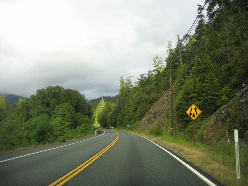
| A small end freeway sign follows along U.S. 199 (Redwood Highway) north. Most of the route is two lane highway, but a few sections have been upgraded to controlled access standards. 05/26/06 |
|
| After Del Norte County D-2, the next intersection is with Kings Valley Road / Parkway Drive. 05/26/06 |
|
| This distance sign provides the distance to Hiouchi (five miles), Gasquet (14 miles), and Grants Pass, Oregon (78 miles). U.S. 199 is one of the shortest U.S. highways in the country with a length less than 100 miles (U.S. 266 in Oklahoma and U.S. 123 in South Carolina-Georgia are shorter). 05/26/06 |
|
| The bridge over the Smith River was built in 1990 and carries two lane U.S. 199 to its first major intersection, with SR 197 (North Bank Road) northwest to U.S. 101 en route to Brookings, Oregon. SR 197 is a very short state route, connecting U.S. 101 with U.S. 199 along the north bank of the Smith River. From here, U.S. 199 will follow the Smith River Middle Fork for much of its journey northeast toward Grants Pass. 05/26/06 |
|
| Tiny Hiouchi is split by U.S. 199 as the U.S. route travels through Jedediah Smith Redwoods State Park and Redwood National Park. An antique store, gas station, and general store can be found alongside U.S. 199. 05/26/06 |
|
| Ascending out of Hiouchi, northbound U.S. 199 enters the Smith River National Recreation Area, which is managed as part of the Six Rivers National Forest. Recreational opportunities include camping, fishing, hiking, and rafting. 05/26/06 |
|
| Sections of U.S. 199 pass closely along the edge of cliffs and climb above the forest (slides are relatively common along this route), while other sections remain shrouded within the forests that dominate the Six Rivers National Forest. A very long and narrow national forest, Six Rivers National Forest is named due to fact it contains portions of six major rivers watersheds: Smith River, Klamath River, Trinity River, Mad River, Van Duzen River, and Eel River. It was formed in 1947 as part of a consolidation of sections of the Siskiyou, Klamath, and Trinity National Forests that were more coastal in nature and is managed in Eureka. 05/26/06 |
|
| Northbound U.S. 199 approaches South Fork Road to the Stout Grove and Howland Hill Scenic Drive. 05/26/06 |
|
| U.S. 199 crosses Myrtle Creek on a concrete arch bridge built in 1984. 05/26/06 |
|
| A roadside pull out for Myrtle Beach is located north of the Myrtle Creek arch bridge. Several other roadside stops can be found along U.S. 199 as it passes through the recreation area. 05/26/06 |
|
| The Smith River winds its way alongside U.S. 199 (Redwood Highway) north, offering magnificent vistas such as this one. 05/26/06 |
|
| Northbound U.S. 199 crossed Hardscrabble Creek on this 1929 bridge. The span was replaced in 2008. 05/26/06 |
|
| An oddly placed end divided highway sign, since the road is certainly not divided at this point, appears as northbound U.S. 199 (Redwood Highway) continues toward Gasquet. 05/26/06 |
|
| Northbound U.S. 199 (Redwood Highway) approaches Gasquet Flat Road. 05/26/06 |
|
| Gasquet is a small town that follows along U.S. 199 and provides some services and tourist facilities. Leaving the unincorporated community, this distance sign provides the distance to three Oregon destinations: Cave Junction (Oregon 46, 34 miles), Grants Pass (Interstate 5, 63 miles), and Portland (308 miles via Interstate 5 north). 05/26/06 |
|
| A sidehill viaduct (1976) is required to carry three-lane U.S. 199 northeast above the Smith River Middle Fork. 05/26/06 |
|
| This U.S. 199 north reassurance shield accompanies a national scenic byway trailblazer. 05/26/06 |
|
| Northbound U.S. 199 (Redwood Highway) approaches Patricks Creek Road and Patrick Creek Lodge. 05/26/06 |
|
| U.S. 199 spans the Smith River Middle Fork across this concrete arch bridge, which was built in 1965 and rehabilitated in 1976. 05/26/06 |
|
| U.S. 199 north begins to climb toward Hazel View Summit on Oregon Mountain. The Collier Tunnel is located near the summit, and it carries U.S. 199 below the actual summit of Oregon Mountain. A rest area is located prior to the tunnel on the west side of the highway. Parallel Oregon Mountain Road is an old alignment of U.S. 199 that climbs over the top of Hazel View Summit. 05/26/06 |
|
| Warning signs for the Collier Tunnel include a warning for bicyclists, with beacons activated with the press of a button, and another that advises all motorists to use headlights within the tunnel. 05/26/06 |
|
| The Collier Tunnel was built and opened to traffic in 1963 as a bypass for U.S. 199, avoiding Old Oregon Mountain Road over the summit. The tunnel bypassed a series of switchbacks. 05/26/06 |
|
| Named for Randolph Collier, the Collier Tunnel offers two lanes under Oregon Mountain. Randolph Collier was a state senator who represented multiple North Coast counties (including Del Norte and Siskiyou Counties as identified on the tunnel plaque) from 1938 through 1976. Senator Collier was known for innovation in the funding of highways (such as the Collier-Burns Act), hence the nickname "Father of the California Freeways." Ironically, most of these freeways ended up in the southern two-thirds of the state, not in his home counties. The Collier Tunnel is 574.9 feet long. 05/26/06 |
|
| Standing at the entrance to the Collier Tunnel. Rumbling trucks and cars can be heard for miles around as they enter the Collier Tunnel on U.S. 199. 05/26/06 |
|
| Overhead lights illuminate the two lane Collier Tunnel. 05/26/06 |
|
| Continuing to the other side of Oregon Mountain, U.S. 199 north begins to descend toward the Oregon state line 05/26/06 |
|
| A fruit quarantine is signed on the northbound U.S. 199 approach to the Oregon state line. 05/26/06 |
|
| U.S. 199 (Redwood Highway) north leaves the Golden State of California and enters the Beaver State of Oregon. The highway remains two lanes wide as it crosses the state line. 05/26/06 |
Page Updated 08-29-2017.