
U.S. 180 East - Valle to Flagstaff


 East
East  South
South
SR 64 leaves Grand Canyon National Park and enters the Kaibab National Forest here.
01/08/11

Distance sign to Williams (64 miles) and Flagstaff (84 miles).
01/08/11
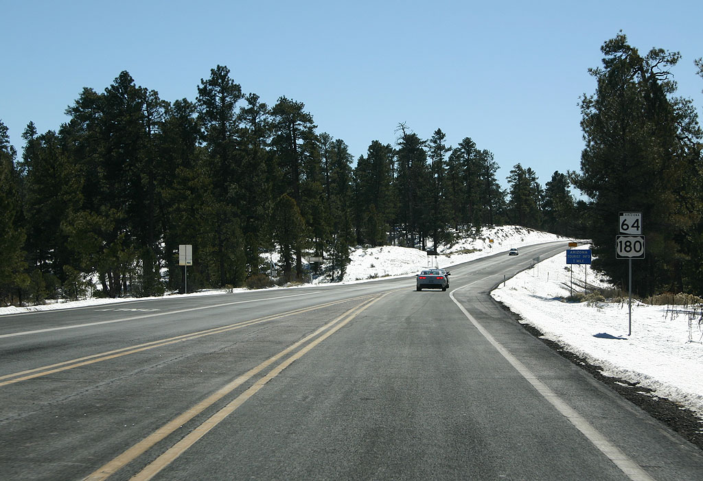
Reassurance marker for SR 64 and US 180.
01/08/11

SR 64 enters Tusayan. Tusayan is a small town surrounded by the Kaibab National Forest, named after the Spanish name for the area (which is a corruption of the Navajo word for the area). The primary function of the town is to serve vistors to Grand Canyon National Park.
01/08/11

Use caution for low flying aircraft in this area. The Grand Canyon Airport is just off the side of SR 64.
01/08/11
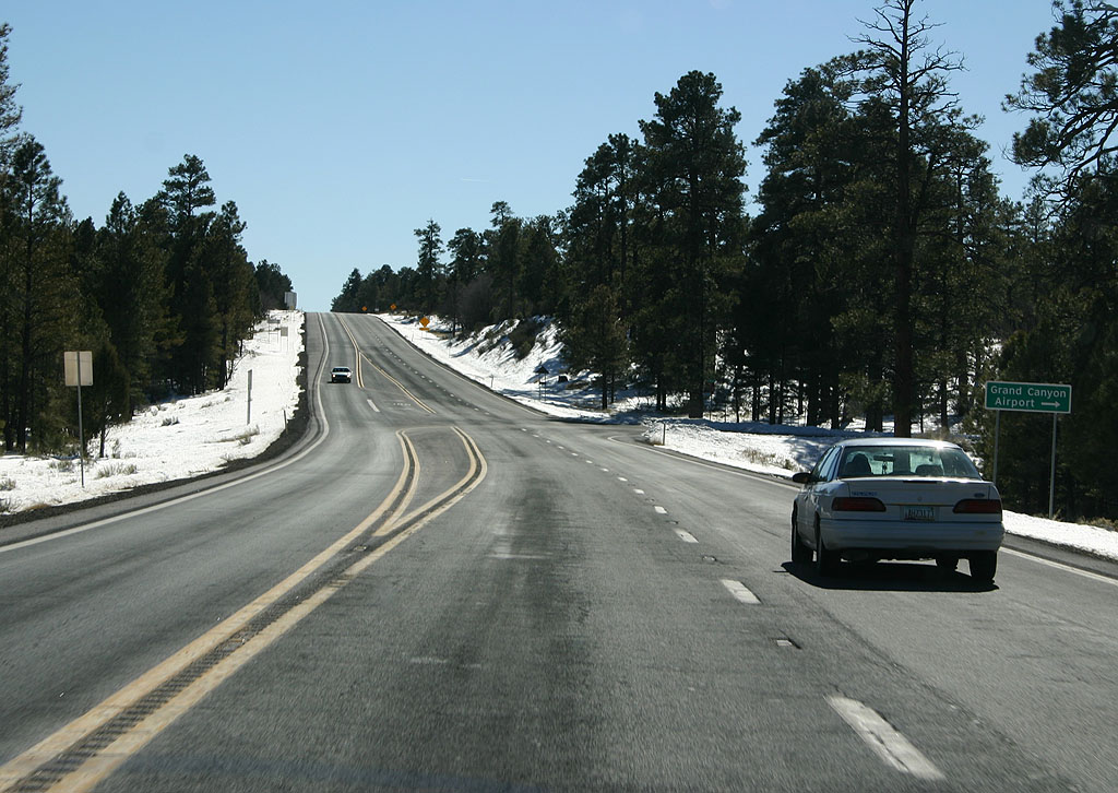
Turn right for Grand Canyon Airport. The airport used to be run by the State of Arizona, but is now maintained by an airport authority.
01/08/11
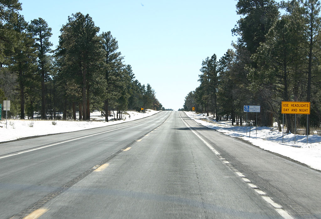
Headlights use is required on SR 64.
01/08/11

Elk occassionally presents hazards to motorists on the Kaibab Plateau.
01/08/11
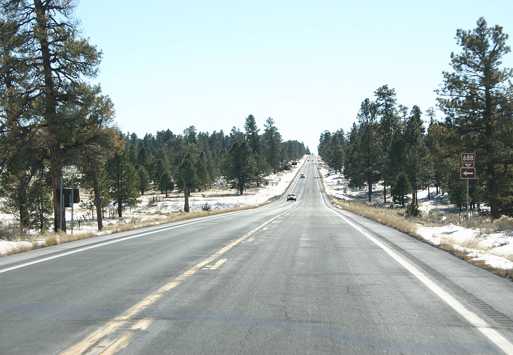
SR 64 meets Forest Road 488 here.
01/08/11

SR 64 meets Forest Road 347 here.
01/08/11

Distance sign to Williams (44 miles) and Flagstaff (64 miles).
01/08/11

SR 64 south leaving Kaibab National Forest.
01/08/11

Distance sign to Williams (34 miles) and Flagstaff (54 miles).
01/08/11

SR 64 enters Valle. Valle is a small town at the junction of US 180 and SR 64.
01/08/11
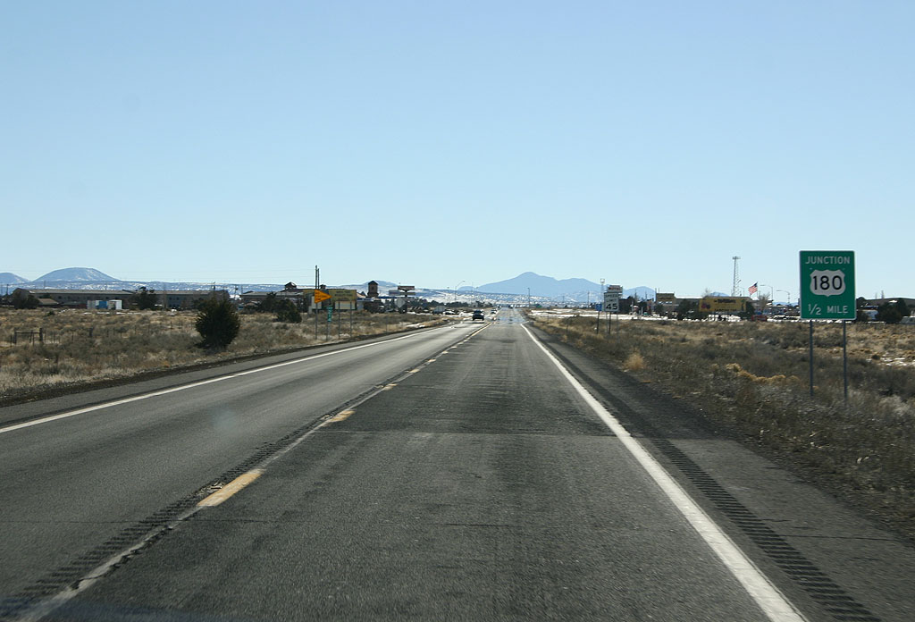
Advance signage for US 180, 1/2 mile.
01/08/11
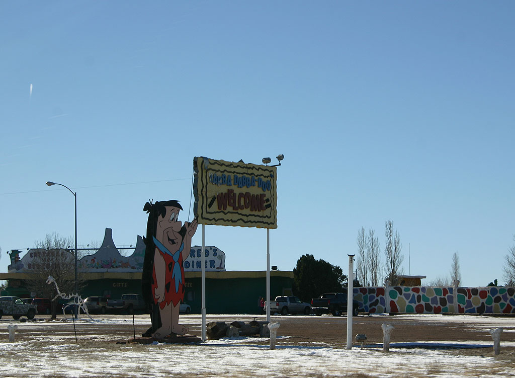
SR 64 passes Bedrock City. Bedrock City is a RV park and small theme park, modeled after the Flintstones.
01/08/11

U.S. 180 branches southeast from SR 64 to Flagstaff while SR 64 continues south to Williams.
01/08/11
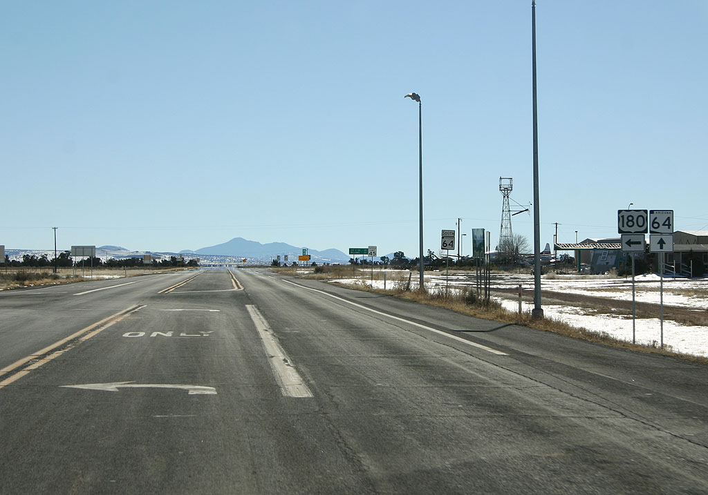
U.S. 180 connects with I-40 east to Winslow. SR 64 south ties into I-40 at Business Loop I-40/Historic U.S. 66 outside Williams.
01/08/11
East  South
South
Reassurance markers for US 180 Eastbound and US 191, in St. Johns.
09/11/11

Reassurance marker for US 180 eastbound.
01/08/11

Distance sign to Arizona Snowbowl (43 miles) and Flagstaff (50 miles).
01/08/11

Use headlights day and night along US 180 between Valle and Flagstaff.
01/08/11

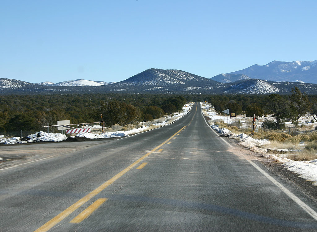
US 180 has scenic panoramas across the prairies to the distant San Francisco Peaks, which dominate the Northern Arizona skyline.
01/08/11

Watch for elk for the next 40 miles (until just past Flagstaff.)
01/08/11

US 180 is the San Francisco Peaks Scenic route. The route was designated as a scenic route in 1990.
01/08/11

US 180 enters the Kaibab National Forest here.
01/08/11

US 180 enters the Coconino National Forest.
01/08/11
This is a point where the road can be closed due to snow.
01/08/11

Turn right for the Red Mountain trailhead.
01/08/11

At this point, we are 23 miles from Arizona Snowbowl and 30 miles from Flagstaff.
01/08/11

US 180 climbs steadily from Valle up to the 7000 foot level. The road has not reached it's highest elevation yet, however.
01/08/11

US 180 is a designated scenic route between Valle and Flagstaff.
01/08/11

Mt. Humphries, the highest peak in Arizona, looms large over US 180.
01/08/11

US 180 enters the San Francisco Peaks recreation area. The forest preserves the majority of the Ponderosa Pine forest around Flagstaff.
01/08/11

US 180 now turns south to follow the base of Mt. Humphries.
01/08/11

US 180 now approaches Saddle Mountain. There is a lookout tower atop the low mountain. In the background is Mt. Humphries.
01/08/11

US 180 continues to stay in meadows between the nearby mountains.
01/08/11

Distance sign to Snowbowl (13 miles) and Flagstaff (20 miles).
01/08/11

US 180 reaches the highest point along the route, at 8,046 feet in elevation.
01/08/11

US 180 travels through dense Ponderosa Pine forests along the base of Mt. Humphries.
01/08/11

Daytime headlight restrictions end at this point.
01/08/11

Distance sign to Snowbowl (3 miles) and Flagstaff (10 miles).
01/08/11

US 180 remains as a scenic road until reaching Flagstaff.
01/08/11

Turn left for Round Tree road, or right for Bader Road.
01/08/11

US 180 meets Arizona Snowbowl here. Snowbowl is one of two ski areas in Arizona.
01/08/11

Turn left for Forest Hills Drive.
01/08/11

US 180 enters Flagstaff. Flagstaff is the largest city in northern Arizona, and a center of commerce.
01/08/11

Turn right to continue on US 180 in Flagstaff. We are approaching downtown Flagstaff and former Business 40.
01/08/11
Photo Credits:
- Kevin Trinkle: 01/08/11, 09/11/11
Connect with:

Page Updated Monday October 24, 2011.