Franktown Road comprises a rural loop west from U.S. 395 Alternate through southwestern reaches of Washoe Valley. Nevada State Route 877 leads west by the Toiyabe Golf Club by a handful of residential streets to cross Musgrove Creek and turn north. Running along the eastern foothills of the Cascade Range, SR 877 continues north by ranch areas to the site of Franktown, where it returns to U.S. 395 Alternate.
Prior to construction of the more linear route of U.S. 395 to the east, Franktown Road was a part of the first alignment of the highway through western Washoe Valley. U.S. 395 travels further east along Interstate 580 by Washoe Lake State Park.
|
| SR 877 curves east ahead of Franktown Creek to end at a T-intersection with U.S. 395 Alternate. 09/05/10 |
|
| Although officially upgraded to U.S. 395 Alternate in 2012, the formal name for the bannered route is still Old U.S. 395. U.S. 395A runs south to I-580 at the Eastlake Boulevard interchange (Exit 44) and north by the site of Ophir City to the freeway at Exit 50. 09/05/10 |
|
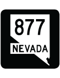
| The last milepost for SR 877 north stands at U.S. 395 Alternate (Old U.S. 395). 09/05/10 |
|
| SR 877 loops 4.30 miles south along the western edge of Washoe Valley and the foot of the Carson Range of the Sierra Nevada. 09/05/10 |
|
| A begin shield for SR 877 south appears as Franktown Road branches south from U.S. 395 Alternate (Old U.S. 395). This is the lone shield for the route southbound. 09/05/10 |
Page Updated 07-19-2017.

 North
North


