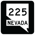
Traveling 100.25 miles wholly within Elko County, Nevada State Route 225 (Mountain City Highway) begins at Business Loop I-80 (SR 535) in the city of Elko. SR 225 proceeds northwest from Interstate 80 at Exit 301 across the Adobe Range and north past Wild Horse Reservoir. Paralleling the winding course of the Owyhee River through Wild Horse Range, SR 225 reaches Mountain City, with minimal services available there, 84 miles north of Elko. The remainder of the route in the Silver State travels northwest through Duck Valley Indian Reservation to Owyhee and the Idaho state line. Idaho State Highway 51 extends north from SR 225 to eventually meet Interstate 84 and U.S. 20-26-30 in Mountain Home.
|
| West Silver Street transitions to SR 225 (Mountain City Highway) north at Business Loop I-80 and SR 535 (Idaho Street) east of Elko Regional Airport (EKO). 09/09/05 |
|
| The first confirming marker for SR 225 north stands just between Business Loop I-80 (Idaho Street) and Sage Street in west Elko 09/09/05 |
|
| SR 225 (Mountain City Highway) constitutes a commercial arterial both south and north of the exchange with Interstate 80. Elko Junction retail plaza lines the west side of the state route ahead of Argent Avenue north to a residential subdivision. 08/05/13 |
|
| Construction of Interstate 80 across the north side of Elko included a realignment of Mountain City Highway (old SR 51) from a more linear route to a sweeping curve to the east. Sagecrest Drive represents the former state route to the west of the diamond interchange with SR 225. 08/05/13 |
|
| Interstate 80 ventures southwest from SR 225 and Elko to Carlin. 08/05/13 |
|
| Crossing over I-80, motorists on SR 225 south meet the eastbound on-ramp to Deeth, Wells and West Wendover. 08/05/13 |
|
| Mountain City Highway continues along a commercialized stretch leading southeast from I-80 to Idaho Street (Business Loop I-80 / Historic U.S. 40). Terminal Way spurs west from the ensuing intersection to Elko Regional Airport (EKO). 09/09/05 |
|
| Sage Street follows from Mountain City Highway south and angles northeast to Great Basin College. 05/16/12 |
|
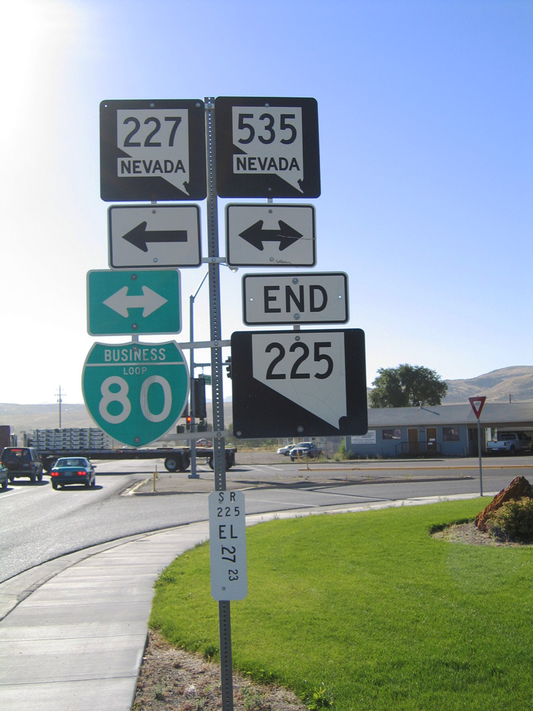
| Approaching Business Loop I-80 and SR 535 (Idaho Street) on SR 225 (Mountain City Highway) south. SR 535 overlays Idaho Street east for 0.79 miles to SR 227 (5th Street / Lamoille Highway) in Downtown Elko. 09/09/05 |
|
| Silver Street extends southeast from the end of SR 225 (Mountain City Highway) to Errecart Boulevard south across the Humbolt River and the south side of Downtown Elko. 09/09/05 |
|
| SR 225 concludes with an end shield at Idaho Street (Business Loop I-80) and Silver Street to the east of Elko Regional Airport (EKO). 09/09/05 |
|
| SR 535 formerly overlapped with all 5.5 miles of Business Loop I-80 along Idaho Street (old U.S. 40) through Elko. The state route is discontinuous west along Idaho Street to the Elko city line, where it resumes alongside the business route to I-80 at Exit 298. 05/16/12 |
Page Updated 07-26-2018.

 North
North