
Lanai and Molokai State Routes
| Route Number | Names | West or South End | East or North End | Mileage |
|---|---|---|---|---|
| 440 | Kaumalapau Hwy; Manele Rd | Hulopoe Beach Park Rd (CR 649080) | Kaumalapau Harbor Rd | 13.18 |
| 441 | Airport Rd | Lanai Airport | HI 440 (Kaumalapau Hwy) | 0.47 |
| 442 | Kaumalapau Hwy | HI 440 (Kaumalapau Hwy / Manele Rd) | Fraser Av (CR 430) | 0.03 |
| 450 | Kamehameha V Hwy | Kaunakakai HI 460 (Maunaloa Hwy) at Ala Malama Av (CR 525003) |
end of state maintenance at Halawa | 27.51 |
| 460 | Kaunakakai Pl; Maunaloa Hwy | Maunaloa end of state maintenance at Maunaloa Rd west of Mokio St |
end of state maintenance at Kaunakakai Harbor wharf | 16.56 |
| 465 | Airport Lp | HI 460 (Maunaloa Hwy) west of Molokai Airport | HI 460 (Maunaloa Hwy) east of Molokai Airport | 2.13 |
| 470 | Kalae Hwy | HI 460 (Maunaloa Hwy) | Palaau State Park | 5.79 |
| 480 | Farrington Ave; Puupeelua Ave | HI 460 (Maunaloa Hwy) south of Hoolehua | Kualapuu HI 470 (Kalae Hwy) |
3.66 |
| Source: GIS file, DOT Road Inventory (State Routes) for the main Hawaiian Islands, State of Hawaii Dept. of Transportation, August, 2011. | ||||
Historical state route information provided by the 1970 Hawaii State Official Transportation Map and Larry Epstein.
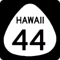 |
Former Hawaii 44 - Kaumalapau Highway / Keomuku HighwayHawaii 44 was one of two routes on Lanai, following Kaumalapau Highway east from Kaumalapa'u Harbor to Lana'i City. This stretch is the western leg of Hawaii 440. Hawaii 44 north along Lanai Avenue north to Keomuku Highway and the eastern shore line of Lanai was decommissioned. This includes the unpaved Keomuku Road paralleling the coast to Halepalaoa Landing. |
 |
Former Hawaii 45 - Kamehameha V HighwayHawaii 45 is the original designation for Kamehameha V Highway leading east from Kaunakakai to Halawa on the east end of Molokai. This route is now Hawaii 450 between Kaunakakai and Ualapue and County Route 450 east from Ualapue to Halawa. |
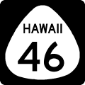 |
Former Hawaii 46 - Maunaloa HwyHawaii 46 follows what is now Hawaii 460 along the Maunaloa Highway between Maunaloa and Kaunakakai. |
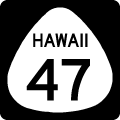 |
Former Hawaii 47 - Kalae HighwayState Route 47 was replaced by Hawaii 470 along the Kalae Highway between Maunaloa Highway and Palaau State Park. |
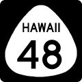 |
Former Hawaii 48 - Farrington AvenueAll of Farrington Avenue through Hoolehua was designated as Hawaii 48 originally. The portion east from Puupeelua Avenue to Kualapuu was renumbered as the east-west leg of Hawaii 480, the remainder is now unnumbered. |
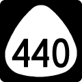 |
Hawaii 440 - Kaumalapau Highway / Manele RoadThe lone signed state highway of Lana'i, Hawaii 440 follows an "L" shaped route consisting of Kaumalapu Highway west from Lanai City and Manele Road south to Manele Bay. |
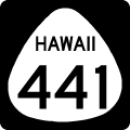 |
Former Hawaii 441 - Manele RoadFormer Hawaii 441 followed Manele Road south from Hawaii 44 and Lanai City. This route is now one half of Hawaii 440. |
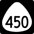 |
Hawaii 450 - Kamehameha V HighwayHawaii 450 follows Kamehameha V Highway east from Hawaii 460 at Kaunakakai to Halawa, the designation replaced Hawaii 45. |
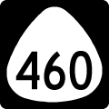 |
Hawaii 460 - Maunaloa HighwayHawaii 460 begins at Kaunakakai Ferry Terminal along Kaunakakai Place to overtake Hawaii 450 onto the Maunaloa Highway northwest to Hoolehua. The state route meanders west to Maunaloa over former Hawaii 46. |
 |
Hawaii 465 - Airport LoopHawaii 465 loops around Molokai Airport from Hawaii 460 (Maunaloa Highway) to the south. |
 |
Hawaii 470 - Kalae HwyHawaii 470 spurs northeast from Hawaii 460 (Maunaloa Highway) to Kualapuu, Kalae and Palaau State Park. The state route provides the closest road to the Kalawao County line. |
 |
Hawaii 480 - Farrington Avenue / Puupeelua AvenueComprising a loop through Hoolehue, Hawaii 480 follows Puupeelua Avenue north from Hawaii 460 to Farrington Avenue east to Kualapuu and Hawaii 470. |
 |
Former Hawaii 481 - Puupeelua AvenueHawaii 481 followed Puupeelua Avenue north from Maunaloa Highway to Puu Kapele Avenue through Hoolehua. The portion between Hawaii 460 and Farrington Avenue is the current north-south stretch of Hawaii 480. |
 |
Former Hawaii 482 - Puu Kapele Ave / Lihi Pali AveHawaii 482 angled northwest from Farrington Avenue along Lihi Pali Avenue to Puu Kapele Avenue west around Hoolehua. This roadway is now County Route 475. |
Page Updated 02-04-2012.