|
| Ramps from I-H1 combine ahead of Halawa Stream to form the eastbound beginning of Interstate H3. The initial stretch of I-H3 links I-H1 with Interstate H201 (Moanalua Freeway) east. 02/04/24 |
|
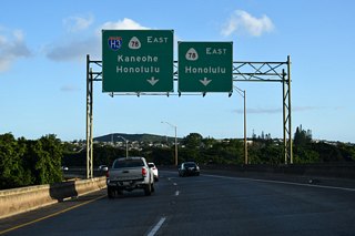
| Two lanes turn northward onto the John A. Burns Freeway toward Kaneohe while an unnumbered two lane ramp joins I-H201 east to Honolulu. 02/04/24 |
|
| Passing under the Interstate H201 (Moanalua Freeway) mainline and over North Halawa Stream. A loop ramp at Exit 1 C joins I-H201 east with I-H3 east. 01/17/11 |
|
| Interstate H3 elevates onto a viaduct by North Halawa Stream and an adjacent quarry. The speed limit increases to 60 miles per hour, the highest limit for any road in Hawaii. 02/05/24 |
|
| Distance sign with the two major control points for I-H3, Kaneohe and Kaneohe Marine Corps Base Hawaii (MCBH). 02/05/24 |
|
| Interstate H3 proceeds east from the Halawa Heights community into the North Halawa Valley. The John A. Burns Freeway designation honors the former Governor of Hawaii. 02/05/24 |
|
| Interstate H3 gains 500 feet in elevation from the Halawa Interchange northeast through North Halawa Valley. 02/05/24 |
|
| The North Halawa Viaduct along Interstate H-3 measures 1.2 miles in length. 02/05/24 |
|
| Pu'u'ua'i and Pu'ukawipo'o Mountains rise along the north side of the John A. Burns Freeway. 02/05/24 |
|
| Pu'u'ua'i and Pu'ukawipo'o Mountains rise along the north side of the John A. Burns Freeway. 01/17/11 |
|
| Several dynamic message and regulatory signs precede the Tetsuo Harano Tunnels along I-H3 east on the North Halawa Viaduct. 02/05/24 |
|
| The Tetsuo Harano Tunnels constitute a pair of two lane tubes crossing the Ko'olau Range from North Halawa Valley to Ha'iku Valley. 02/05/24 |
|
| The Tetsuo Harano Tunnels are named for a man who was both a state highways administrator who served office for 52 years and the H-3 Freeway administrator when the highway was completed in the 1990s.1,2 02/05/24 |
|
| The eastbound tube of the Tetsuo Harano (Trans-Koolau) Tunnels is 5,165 feet long. The westbound tube is 4,980 feet long.1 01/17/11 |
|
| These tunnels were briefly named for Governor John A. Burns, but renamed to honor Tetsuo Harano in 2003. The 24 inch high aluminum letters baring his name were installed in 2006.2 02/05/24 |
|
| Traveling through the eastbound tube of the Tetsuo Harano Tunnel. 02/05/24 |
|
| Interstate H3 eastbound emerges from the Tetsuo Harano Tunnels on the Windward side of the Ko'olau Range. 01/17/11 |
|
| Interstate H3 turns southward along the Ko'olau Range and gradually lowers toward Kane'ohe Bay. 02/05/24 |
|
| I-H3 (John A. Burns Freeway) arcs southward to a partial interchange (Exit 9) with Route 63 (Likelike Highway) between Pu'ukeahiakahoe mountain and Kaneohe. 02/05/24 |
|
| The Windward Viaduct straddles the hillside of Pu'ukeahiakahoe on the descent from the Tetsuo Harano Tunnels. The elevated roadway travels 80 to 130 feet above Haiku Valley. 02/05/24 |
|
| An expansive view of Kane'ohe Bay and the Pacific Ocean opens to the east from the Windward Viaduct above Ha'iku Valley. 02/05/24 |
|
| Interstate H3 eastbound continues its descent through Ha'iku Valley. 02/05/24 |
|
| The loop ramp at Exit 9 links I-H3 eastbound with Route 63 (Likelike Highway) northbound to Pu'ohala Village. 02/05/24 |
|
| Encircling Pu'ukeahiakahoe mountain, Interstate H3 passes through the Hospital Rock Tunnels within the Kane'Ohe Forest Reserve. 02/05/24 |
|
| Encircling Pu'ukeahiakahoe mountain, Interstate H3 passes through the Hospital Rock Tunnels within the Kane'Ohe Forest Reserve. 01/17/11 |
|
| Route 63 travels 8.30 miles north from Kalihi in Honolulu through the Wilson Tunnel to Route 83 (Kahekili Highway). 02/05/24 |
|
| The John A. Burns Freeway proceeds to the first of two interchanges serving the census designated place of Kaneohe. 02/05/24 |
|
| A runaway truck ramp follows Exit 9 where Interstate H3 begins the easterly turn toward Kailua. 01/17/11 |
|
| Route 63 (Likelike Highway) concludes 0.48 miles to the north at a jughandle intersection with Route 83 (Kahekili Highway). Route 83 heads north from there to Ahuimanu and the North Shore of Oahu. 02/05/24 |
|
| Route 83 continues LikeLike Highway 0.48 miles east from Route 63 to Route 65 (Kaneohe Bay Drive) and Kamehameha Highway in Kaneohe. Route 65 extends extends 1.99 miles east from Route 83 along Kaneohe Bay Drive to Kokokahi, Mahinui and Mokapu Saddle Road. 02/05/24 |
|
| The eastbound runaway truck ramp follows the elevated roadway spanning Route 63 (Likelike Highway) and Luluku Stream. 02/05/24 |
|
| Confirming marker posted east of Route 63 and the runway truck ramp. 02/05/24 |
|
| Route 83 turns southward from Likelike Highway onto Kamehameha Highway at Pu'ohala Village 0.66 miles to meet Interstate H3 at a parclo interchange (Exit 11). 02/05/24 |
|
| I-H3 arcs eastward around Ho'omaluhia Botanical Garden to Exit 11 for Route 83 (Kamehameha Highway). Route 83 travels 43.90 miles from Route 61 (Pali Highway) nearby to Kawela Bay on the North Shore and Route 99 at Haleiwa. 02/05/24 |
|
| The Halekou Interchange (Exit 11) with Kamehameha Highway marks the limit of 1987 construction for Interstate H-3. 02/05/24 |
|
| Interstate H-3 curves northeast from Exit 11. 36,800 vehicles per day (vpd) were recorded by HDOT on this stretch in 2021. 02/05/24 |
|
| The succeeding exit serves Kane'Ohe and Kailua. The subsequent exit precedes Kaneohe MCBH. 02/05/24 |
|
| Clearview sign replacements made for Exit 14 show Route 630 in place of Route 65 west along Mokapu Saddle Road to Kaneohe Bay Drive and Pu'ohala Village, and east along Mokapu Boulevard to Kailua. 02/05/24 |
|
| 4.15 miles in length, Route 65 leads west to Route 83/830 at LikeLike Highway and Kamehameha Highway. East from I-H3, Route 65 continues to Kanehoe Bay Drive (Route 6511), Kalaheo Avenue (Route 6012) and Route 6015 along Mokapu Boulevard. 02/05/24 |
|
| Route 65 is properly acknowledged at the half diamond interchange (Exit 14) with Mokapu Saddle Road and Mokapu Boulevard. 02/05/24 |
|
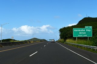
| Interstate H3 proceeds north across the Oneawa Hills to Exit 15 for Kaneohe Bay Drive (Route 6511). 02/05/24 |
|
| Scenic pull offs line both sides of Interstate H3 overlooking the shallow waters of Kane'ohe Bay by Kea'alau and Mala'e. 02/05/24 |
|
| Kaneohe Bay Drive (Route 6511) encircles Kane'ohe Bay from Kane'ohe east 2.59 miles to Kokokahi and the Mokapu Peninsula. Route 6511 represents an old alignment of Route 63 extending east to Kailua. 02/05/24 |
|
| Kaneohe Bay Drive runs north from Kea'alau to Mala'e to the parclo B2 interchange at Exit 15. Kalaheo Avenue (Route 6012) extends south from Kaneohe Bay Drive into Kalua. 02/05/24 |
|
| All traffic remaining along Interstate H3 north from Exit 15 defaults to Kanehoe Marine Corps Base Hawaii (MCBH). 01/17/11 |
|
| Interstate H-3 spans a causeway between Kane'ohe Bay and Nu'upia Pond to Kaneohe MCBH. 02/05/24 |
|
| Freeway ends sign posted ahead of the Kaneohe MCBH gate to G Street. 02/05/24 |
|
| A median cut preceding the gate into Kaneohe MCBH allows return access onto I-H3 (John A. Burns Freeway) southwest off Mokapu Peninsula. Formerly a U-turn lane, it was restriped by 2010. 02/05/24 |
Page Updated 02-16-2024.

 East
East


