|
| Interstate 275 initially travels west along its 60 mile course through the St. Petersburg-Tampa metropolitan area in northern Manatee County. 01/16/14 |
|
| Forthcoming U.S. 41 leads north from Exit 2 to Port Manatee and across the Hillsborough County line toward Ruskin. 03/06/24 |
|
| 36th Avenue E (Ellenton-Gillette Road) crosses over I-275 a half mile from Exit 2 to U.S. 41 (Tamiami Trail). 03/06/24 |
|
| The upcoming diamond interchange (Exit 2) with U.S. 41 is the final departure point before I-275 combines with U.S. 19 north across the tolled Sunshine Skyway bridge system. 03/06/24 |
|
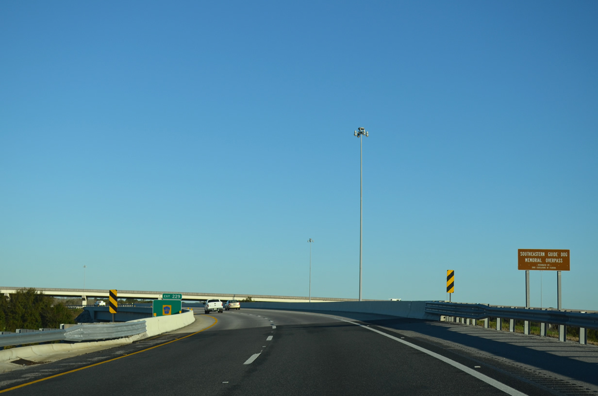
| Exit 2 departs Interstate 275 south for U.S. 41 (Tamiami Trail) near Rubonia. 03/06/24 |
|
| Palmetto (5.3 miles) and Bradenton (7.2 miles) both lie south along U.S. 41 and its business counterpart. 03/06/24 |
|
| The exchange joining I-275 with U.S. 41 in Manatee County is the lone direct connection between the two routes. 03/06/24 |
|
| Interstate 275 passes over Bayshore Road, a former alignment of U.S. 41, west of Exit 2 and 15 miles south of St. Petersburg. 10/16/16 |
|
| Interstate 275 spans the Terra Ceia River over a 0.3 mile long viaduct. 10/16/16, 01/16/14 |
|
| The forthcoming toll plaza for the Sunshine Skyway Bridge follows the wye interchange bringing U.S. 19 northbound onto I-275 from Memphis. 10/16/16 |
|
| The first of two rest area facilities along I-275 and the Skyway South Fishing Pier lies two miles ahead. 10/16/16 |
|
| U.S. 19 joins I-275 north just ahead of the Sunshine Skyway bridge main line toll plaza. The two routes overlap 12 miles northward to South St. Petersburg. 10/16/16, 03/06/24 |
|
| A weaving traffic pattern ensues along I-275/U.S. 19 north leading into the Sunshine Skyway Bridge toll plaza. A single Sunpass lane operates to the left, with cash collection and Sunpass options at the remaining toll booths. 03/06/24 |
|
| Toll schedules for 2-axle passenger vehicles crossing the Skyway increased to $1.50 in 2017 and to $1.75 on July 1, 2023. Sunpass users pay a reduced rate per crossing. 03/06/24 |
|
| The Sunshine Skyway mainline toll plaza. 03/06/24 |
|
| A modified diamond interchange joins I-275/U.S. 19 with the Skyway South Fishing Pier and rest area. Stretching 1.6 miles into Tampa Bay, the fee-based fishing pier uses the southbound lanes of the previous Skyway span. 03/06/24 |
|
| The Sunshine Skyway Bridge comes into view by the South Skyway Rest Area. 01/16/14 |
|
| Confirming markers for I-275/U.S. 19 north stand beyond the entrance ramp from the south Skyway Rest Area. 03/06/24 |
|
| A former U.S. Senator and Florida governor, Bob Graham was instrumental in choosing the cable-stay design of the Skyway as the replacement of the former cantilever spans. 04/14/20 |
|
| The exit for the North Skyway Rest Area lies 4.5 miles to the north beyond the Bob Graham Sunshine Skyway Bridge. 03/06/24 |
|
| Overall, the Sunshine Skyway travels 4.1 miles across Tampa Bay. The span rises nearly 200 feet above the main shipping channel. 03/06/24 |
|
| I-275/U.S. 19 north pass through a 3.2 mile wide wedge of Hillsborough County across the main span of the Skyway. 03/06/24 |
|
| The 42 steel cables used to support the main span over the shipping channel are anchored into two 435 foot high towers. A lighting system is in place along the cable section. 03/06/24 |
|
| 11 foot high fencing lines both sides of the Sunshine Skyway along a 1.5 mile long stretch extending from where the bridge is at least 50 feet above the waters of Tampa Bay. Aimed to prevent suicides, installation of the protective fencing was completed on June 23, 2021.1 03/06/24 |
|
| The North Skyway Fishing Pier, a remnant of the original Skyway crossing, appears along the west side of I-275. 03/06/24 |
|
| I-275/U.S. 19 north enter Pinellas County near the north end of the Skyway bridge. 03/06/24 |
|
| A diamond interchange joins I-275/U.S. 19 with the North Skyway Fishing Pier just beyond the Skyway bridge. Like its counterpart, the north pier is also fee-based. 03/06/24 |
|
| A rest area lies along the west side of I-275/U.S. 19 and north of the North Skyway Fishing Pier. The rest area is also the site of Blackthorn Memorial Park, a monument commemorating the largest peacetime loss of life in United States Coast Guard History, the January 1980 collision of the CGC Blackthorn (WLB-391) with the oil tanker S.S. Capricorn. 03/06/24 |
|
| Interstate 275 is formally St. Petersburg Parkway and William C. Cramer Memorial Highway. Signs were installed in 2006 along both directions at the freeway entrance points into St. Petersburg. 03/06/24 |
|
| I-275/U.S. 19 span a channel between man-made islands built for the Sunshine Skyway Bridge east of Tarpon Key. 03/06/24 |
|
| Interstate 275 enters the city of St. Petersburg northbound at mile marker 14. 03/06/24 |
|
| A northbound vista point overlooking Tampa Bay lies across from the southbound toll plaza along I-275/U.S. 19. 03/06/24 |
|
| This sign referencing the next 8 exits for St. Petersburg replaced a distance sign referencing Pinellas Park at 16 miles, TPA Airport at 26 miles and Tampa at 30 miles. 03/06/24 |
|
| Exit 16 links I-275/U.S. 19 with adjacent Sunshine Skyway Lane S by Maximo Point along Tampa Bay. 03/06/24 |
|
| Connecting the Sunshine Skyway causeway with the Pinellas County mainland, the Dick Misener Bridge spans the Main Channel northeast of Cow and Calf Key. 03/06/24 |
|
| Sunshine Skyway Lane leads north from Exit 16 and a number of adjacent condos to Pinellas Point Drive S. Pinellas Point Drive meanders east from I-275/U.S. 19 to 4th Street S by Pinellas Point in South St. Petersburg. 03/06/24 |
|
| A pair of interchange sequence reference the Gulf of Mexico beaches along I-275 north. SR 682 (Pinellas Bayway) leads west to St. Pete Beach and Pass-a-grille. Central Avenue connects St. Petersburg with Treasure Island, which lies south of Madeira Beach. 03/06/24 |
|
| 38th Avenue N (CR 138) west and SR 694/CR 694 (Park Boulevard) lead west from I-275 to Redington Beach and Indian Shores respectively. 03/06/24 |
|
| U.S. 19 parts ways with Interstate 275 north for 34th Street N, a six lane commercial arterial extending north through St. Petersburg to Lealman. U.S. 19 joins 34th Street N at SR 682 (54th Avenue S). 03/06/24 |
|
| The Pinellas Bayway leads SR 682 west from Eckerd College to Isla Del Sol, where it connects with SR 679 (Pinellas Bayway S) to Tierra Verde and Fort Desoto Park on Mullet Key. 03/06/24 |
|
| The roadways for Interstate 275 invert at Left Exit 17 for U.S. 19 (34th Street S) north as they cross over 54th Avenue S. The configuration was the result of a compromise made to reduce the footprint of the freeway on adjacent land occupied by Eckerd College. 03/06/24 |
|
| SR 682 runs 3.72 miles west across Boca Ciega Bay and Isla del Sol to SR 699 (Gulf Boulevard) at St. Pete Beach on Long Key. 03/06/24 |
|
| U.S. 19 passes through the 34th Street Business district northward by the Childs Park and Central Oak Park neighborhoods in St. Petersburg. Tolls are collected along SR 682 (Pinellas Bayway) west beyond Dolphin Cay Ln and east in St. Pete Beach. 03/06/24 |
Page Updated 04-29-2024.

 North
North