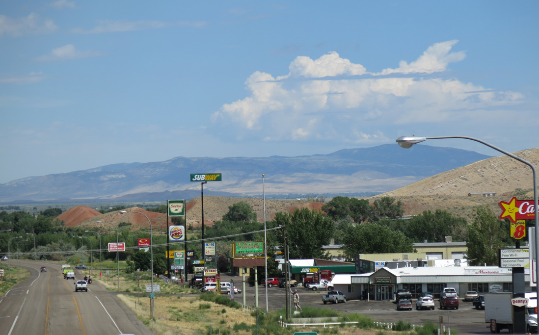
Business Loop I-70, U.S. 50 and U.S. 89 head north from I-70 into Salina. The Stone Quarry rises in the foreground while the San Pitch Mountains make up the northern horizon. 08/17/13
Business Spur I-70 provides access to services from Interstate 70 in the city of Salina. Commencing north from the diamond interchange at Exit 56, the business route overlaps with U.S. 50/89 for 1.76 miles along State Street. Business Spur I-70 concludes where U.S. 50 separates with U.S. 89 north at Main Street in Downtown Salina.
|
| U.S. 89 north separates from I-70 east at the diamond interchange with Business Spur I-70 to the southwest of Black Cap Mountain. The exchange is home to a truck stop among other traveler services. 08/09/14 |
|
| Business Loop I-70/U.S. 89 intersect the westbound ramps with I-70, where U.S. 50 north concludes a lengthy overlap that originated in Grand Junction, Colorado. 08/09/14 |
|
| U.S. 50/89 combine with Business Spur I-70 north for 1.76 miles into Salina. 08/09/14 |
|
| A small guide sign replaced the first reassurance marker for Business Loop I-70 along State Street northbound. 08/09/14 |
|
| The former first shield for Business Spur I-70 north. Additional lodging and fuel options line the three lane arterial north of I-70. 10/18/04 |
|
| Paralleling Salina Creek, State Street widens ahead of Downtown Salina near Lost Creek Road. 10/18/04 |
|
| U.S. 50/89 reassurance markers posted after the crossing of Salina Creek and ahead of 200 South. U.S. 50 west departs U.S. 89 via Main Street in two blocks. Business Spur I-70 ends at the partition. 10/18/04 |
|
| U.S. 89 continues north along State Street north toward Redmond, Axtell, Centerfield and Gunnison. U.S. 50 turns west onto Main Street and meets the west end of SR 24 (former U.S. 89) in 0.7 miles. U.S. 50 arcs northwest 28 miles to Scipio, where it combines with I-15 south. Delta lies west of I-15 along the U.S. 50 overlap with U.S. 6. 10/18/04 |
|
| Business Spur I-70, U.S. 50 and U.S. 89 at State and Main Streets in Downtown Salina. 10/18/04 |
|
| U.S. 50 east turns south from Main Street onto U.S. 89 (State Street) south in Downtown Salina. The pair overlap with Business Spur I-70 south for 1.7 miles. 10/18/04 |
|
| Business Spur I-70 appears for the only time along State Street (U.S. 50/89) southbound in Salina. The business route brings travelers back to Interstate 70. 10/18/04 |
|
| Travelers destined for I-70/U.S. 50 east of Salina are advised of the lack of services (gas, food, lodging) between Salina (Exit 56) and Green River (Exit 160). That sign is not entirely accurate, as services do lie ten miles north of Exit 89 within the town of Emery. 08/14/14 |
|
| Business Spur I-70 south ends as U.S. 50/89 enter the diamond interchange (Exit 56) with I-70. 08/14/14 |
|
| U.S. 89 south joins Interstate 70 west between Salina and Exit 23 at Sevier. 08/14/14 |
|
| Freeway entrance sign posted at the westbound on-ramp for I-70 to Cove Fort. 08/14/14 |
|
| Green River represents the main population center along Interstate 70 east to the Colorado state line. 08/14/14 |
|
| U.S. 50 combines with Interstate 70 east for its duration to Grand Junction, Colorado. 08/14/14 |
Page Updated 02-23-2022.


 North
North  West
West


