

 East
East
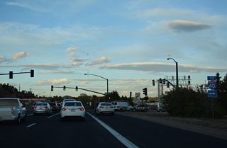
Naval Observatory Road ties into the eastbound beginning of Business Loop I-40 just ahead of the westbound entrance ramp for Interstate 40.
04/26/17

Business Loop I-40/Historic U.S. 66 proceed east to Belle Springs Way north and Saskan Ranch Circle south.
04/26/17

Woodlands Village Boulevard is a commercial arterial leading 1.14 miles south to Beulah Boulevard and north 0.08 miles to Kaibab Lane.
04/26/17

Business Loop I-40 passes The Standard at Flagstaff mixed use development ahead of Blackbird Roost and SR 89A (Milton Road).
04/26/17

Business Loop I-40 overtakes Milton Road at the north end of SR 89A. SR 89A travels 83.81 miles south, meeting the southbound beginning of I-17 nearby en route to Prescott.
04/26/17

Business Loop I-40 proceeds north along Milton Road (old U.S. 89/180) toward Downtown. Elden Mountain (el. 9,301 feet above sea level) rises along the northern horizon.
04/26/17

U.S. 180 previously overlapped with Business Loop I-40 north from SR 89A to Downtown Flagstaff. Trailblazers are posted for tourists headed to the Grand Canyon.
04/26/17

Butler Avenue comprises a four lane boulevard leading east from Business Loop I-40 at Clay Avenue 1.9 miles to Interstate 40 at Exit 198.
04/26/17

Business Loop I-40/Historic U.S. 66 curve east onto Santa Fe Avenue between the BNSF Railroad overpass and U.S. 180 (Humphreys Street). U.S. 180 provides the fastest route from Flagstaff to the south rim of the Grand Canyon.
04/26/17

U.S. 180 passes west of Humphreys Peak (el. 12, 637 feet) north of Fort Valley. The highest point in Arizona is home to the Arizona Snowbowl ski resort.
04/26/17


 East
East
A Historic U.S. 66 trailblazer appears after U.S. 180 east combines with Business Loop I-40 from Humphreys Street.
04/26/17

Switzer Canyon Drive north and Columbus Avenue west link with U.S. 180 along Fort Valley Road north in 1.28 miles.
04/26/17

Business Loop I-40/Historic U.S. 66 and U.S. 180 (Santa Fe Avenue) parallel the BNSF Railroad northeast to U.S. 89.
04/26/17

Ponderosa Parkway links Business Loop I-40/U.S. 180 with Butler Avenue east to I-40 in 0.21 miles.
04/26/17

Prior to 1992, U.S. 89 extended west from Flagstaff along I-40 to Ash Fork, and south from there to Prescott, Wickenburg, Phoenix and Nogales.
04/26/17

Historic U.S. 66 separates from Business Loop I-40/U.S. 180. Remaining alongside the BNSF Railroad, U.S. 66 passes under the access road to I-40 en route to Wildcat Hill and I-40 at Exit 204.
04/26/17

U.S. 89 commences northeast out of Flagstaff toward Wupatki National Monument, Page and Glen Canyon National Recreation Area in Utah.
04/26/17
Photo Credits:
04/26/17 by AARoads
Connect with:
Interstate 40
U.S. 89
U.S. 180
State Route 89A
Page Updated 04-04-2022.


