|
| Interstate 17 enters northern reaches of Phoenix ahead of Exit 229 for Anthem Way. 10/27/03 |
|
| Southbound Interstate 17 at Exit 229, Anthem Way. This is the main exit into the Anthem development. 10/27/03 |
|
| Funded by the developer of Anthem, the diamond interchange (Exit 227) with Daisy Mountain Drive opened to traffic in 2003. 10/27/03 |
|
| Daisy Mountain Drive runs eastward from Exit 227 into the Anthem development. 10/27/03 |
|
| 0.75 miles north of Exit 225 for Pioneer Road. As recently as the late 1990s, this area was all virgin desert. Suburban growth as part of Anthem and other nearby developments took place in the intervening decades. 10/27/03 |
|
| Pioneer Road heads south from the Pioneer RV Resort to the diamond interchange at Exit 225. 10/27/03 |
|
| East of Exit 225, Pioneer Road ties into Gavilan Peak Parkway north and North Valley Parkway south, east side service roads for Interstate 17. 10/27/03 |
|
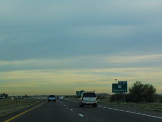
| SR 74 stems west from a six-ramp parclo interchange (Exit 223) with Interstate 17 and Carefree Highway to Wickenburg. 10/27/03 |
|
| Carefree Highway extends east from SR 74 and Exit 223 to the towns of Carefree and Cave Creek. 10/27/03 |
|
| Interstate 17 meets the north end of Loop 303 at the ensuing exit south of SR 74. 04/06/13 |
|
| Loop 303 (Bob Stump Memorial Parkway) constitutes a 36.60 mile long limited access highway west to Peoria and Surprise and south to Citrus Park and I-10 at Goodyear. 04/06/13 |
|
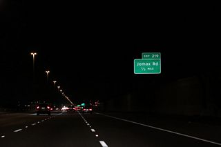
| Jomax Road stems east to N 19th Avenue from the forthcoming diamond interchange at Exit 219. 04/06/13 |
|
| Interstate 17 crosses Skunk Creek in the Little Deer Valley ahead of Exit 219 for Jomax Road. 04/06/13 |
|
| Happy Valley Road meets Interstate 17 adjacent to a heavily developed retail area anchored by Happy Valley Town Center. 04/06/13 |
|
| The exchange with Happy Valley Road was converted from a diamond to a dumbbell interchange and then a DDI. 04/06/13 |
|
| Continuing south through the Deer Valley community in Phoenix, the succeeding exit is for Pinnacle Peak Road. 04/06/13 |
|
| Pinnacle Peak Road heads east to a number of business and industrial parks. West beyond Adobe Mountain, the five lane boulevard continues to suburban development and Thunderbird Conservation Park in the Hedgpeth Hills. 04/06/13 |
|
| Entering the diamond interchange (Exit 217) with Pinnacle Peak Road on I-17 (Black Canyon Freeway) southbound. 04/06/13 |
|
| Interstate 17 converges with Loop 101 at Exit 214C in 1.5 miles. 04/06/13 |
|
| Deer Valley Road heads west from Phoenix Deer Valley Airport (DVT) to the parclo interchange at Exit 215B. There is no Exit 215A from southbound I-17. 04/06/13 |
|
| Exit 215B joins Black Canyon Highway, the west side service road for I-17, south ahead of Deer Valley Road and parallel Rose Garden Lane. 04/06/13 |
|
| Encircling the Phoenix metropolitan area, Loop 101 follows the Aqua Fria Freeway southwest from I-17 to Glendale and Peoria and southeast along the Pima Freeway through Scottsdale. 10/27/03 |
|
| Two lanes separate for Exit 214C beyond the Rose Garden Lane overpass. Loop 101 travels 61.01 miles overall between I-10 at Tolleson and Loop 202 (Santan Freeway) at Chandler. 10/27/03 |
|
| Passing through the four level, systems interchange with Loop 101 on I-17 (Black Canyon Freeway) south. 10/27/03 |
|
| Exit 214 parts ways with I-17 south within the exchange at Loop 101 for Yorkshire Drive west and Utopia Drive. The subsequent exit is for Bell Road. 04/06/13 |
|
| Black Canyon Highway links Yorkshire Drive and Union Hills Drive as part of the split diamond interchange at Exit 214. 04/06/13 |
|
| Interstate 17 meets Bell Road at a diamond interchange (Exit 212) 1.25 miles beyond the Yorkshire Drive overpass. 04/26/17 |
|
| Southbound Interstate 17 (Black Canyon Freeway) spans Union Hills Drive ahead of this confirming marker with one HOV and four general travel lanes. 04/26/17 |
|
| The forthcoming exchange at Exit 211 with Bell Road was originally a cloverleaf. All four loop ramps were eventually removed. 04/26/17 |
|
| Interstate 17 (Black Canyon Freeway) advances 1.25 miles to Exit 211 for Greenway Road at the south end of Deer Valley. 04/26/17 |
|
| Bell Road constitutes a commercial arterial west from Exit 212 into Glendale at 51st Avenue and east into Paradise Valley Village beyond 16th Street. 04/26/17 |
|
| Circumventing Moon Valley and Lookout Mountain to the north, Greenway Road heads east from I-17 to Paradise Valley in northeast Phoenix. 04/26/17 |
|
| Exit 211 leaves Interstate 17 south for Greenway Road east to Cave Creek Municipal Golf Course and west at the Northern Arizona University North Valley campus. 04/26/17 |
|
| Thunderbird Road crosses Interstate 17 at a diamond interchange (Exit 210) in one mile. 04/26/17 |
|
| Thunderbird Road heads west from Exit 210 to the West Campus of Arizona State University and into Glendale at 51st Avenue. 04/26/17 |
|
| Apartment buildings and subdivisions line both sides of the Black Canyon Freeway beyond adjacent sound walls. 04/26/17 |
Page Updated 04-24-2022.

 South
South


