

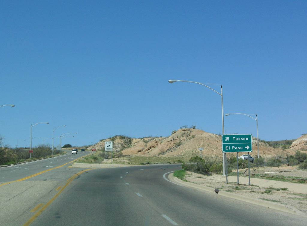
Running south from Interstate 10 between Exit 303 and 306 through the city of Benson, Business Loop I-10 follows old U.S. 80 along 4th Street. Measuring 3.51 miles in length, the route connects I-10 with SR 80 south to Tombstone, Bisbee and Douglas.
Founded in 1880, Benson was a major crossroads for the railroad until 1910. Located at an elevation of 3,585 feet above sea level in the San Pedro Valley, Benson's location at the west end of SR 80 brings traffic from the international border crossings at Douglas and Naco. Benson was home to 4,711 as of the 2000 Census and 5,355 as of the 2020 Census.
 East
East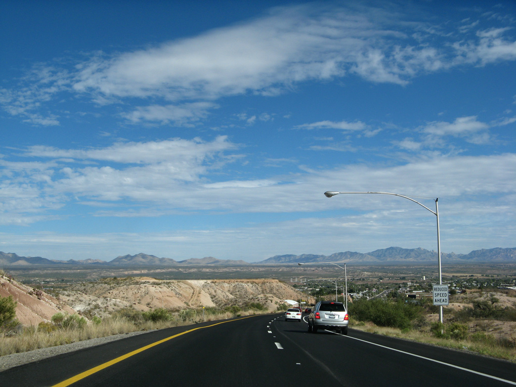
The San Pedro Valley comes into view along Business Loop I-10 (W 4th Street) just after the separation with I-10/U.S. 191 east.
11/10/07

11/10/07

Located at mile marker 304, a Historic U.S. 80 trailblazer was added below the first confirming marker for Business Loop I-10 by 2019.
03/26/04

11/10/07

A signalized intersection for Wal-Mart and the north service road follows Prickley Pear Avenue along W 4th Street eastbound.
11/10/07

Business Loop I-10 (W 4th Street) intersects Ocotillo Avenue by Butterfield Plaza shopping center.
11/10/07

11/10/07
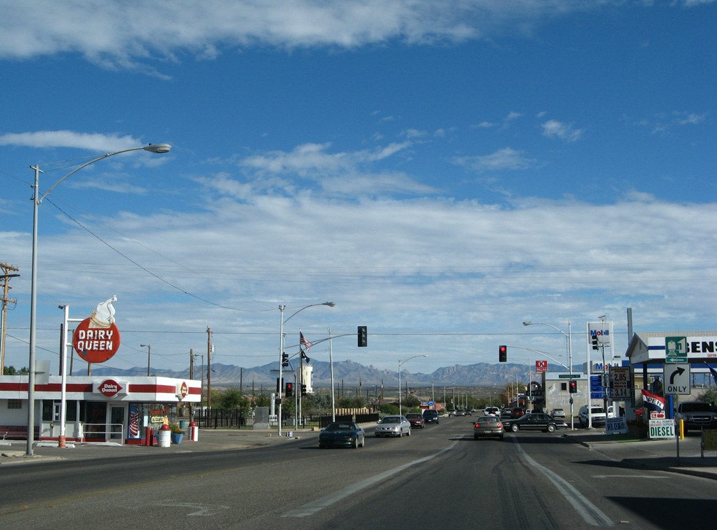
Business Loop I-10/Historic U.S. 80 (4th Street) enter Downtown Benson at Patagonia Street.
11/10/07

03/26/04

The Benson Visitors Center and Benson Station for AMTRAK line the north side of E 4th Street between Patagonia Street and San Pedro Street.
11/10/07
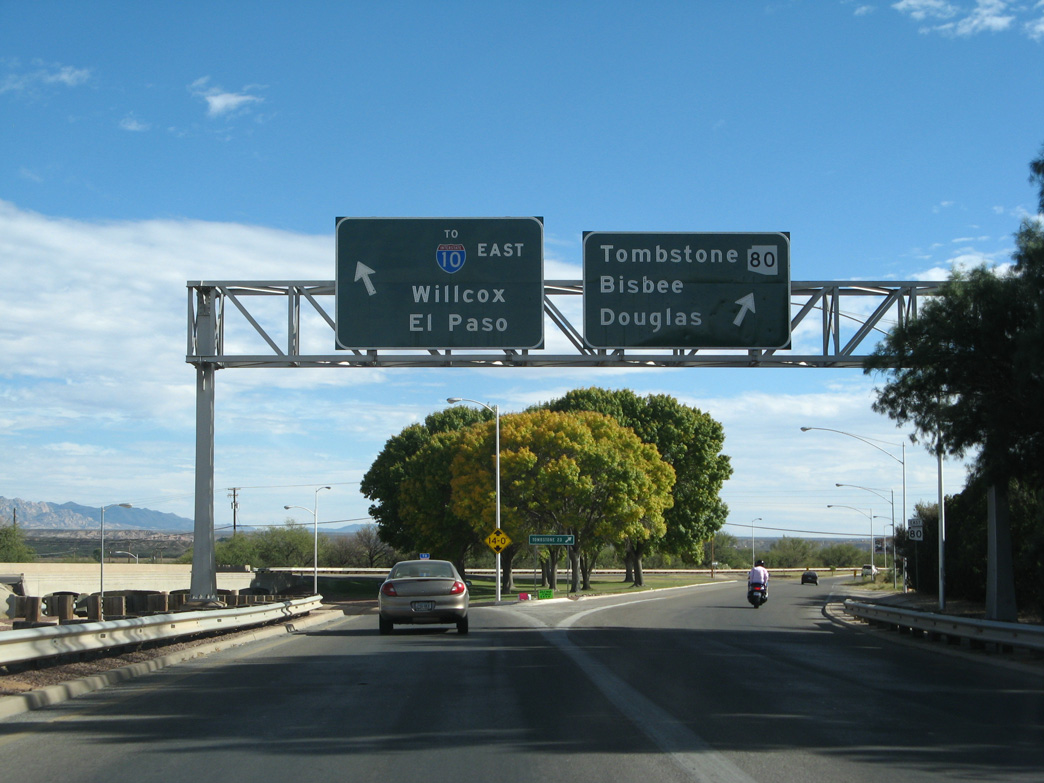
SR 80 commences south from Business Loop I-10 (E 4th Street) at a wye interchange beyond Gila Street. Historically, U.S. 80 followed SR 80, while SR 86 continued along E 4th Street. SR 86 (and NM 14) between Benson and Steins, New Mexico, were replaced with I-10.
11/10/07

SR 80 heads southeast to Tombstone, Bisbee, and Douglas and then northeast to Rodeo, New Mexico.
11/10/07

Business Loop I-10 continues from Historic U.S. 80 across the San Pedro River back to Interstate 10.
11/10/07
The grade separation at Business Loop I-10 (E 4th Street) and SR 80 dates back to 1941.
11/10/07
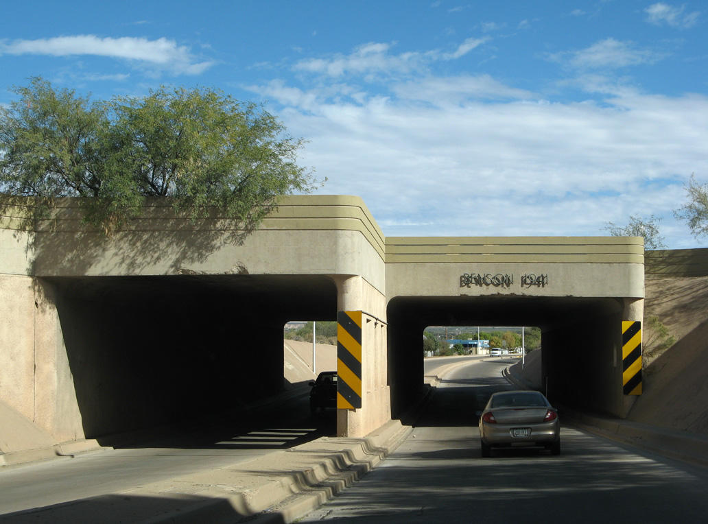
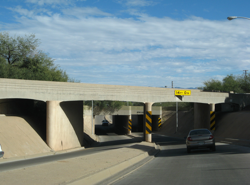
The subway below the Union Pacific Railroad along E 4th Street was also built in 1941.
11/10/07

The junction sign for Interstate 10 preceding the San Pedro River was removed by 2009.
11/10/07

The span taking Business Loop I-10 across the San Pedro River was built in 1950.
11/10/07

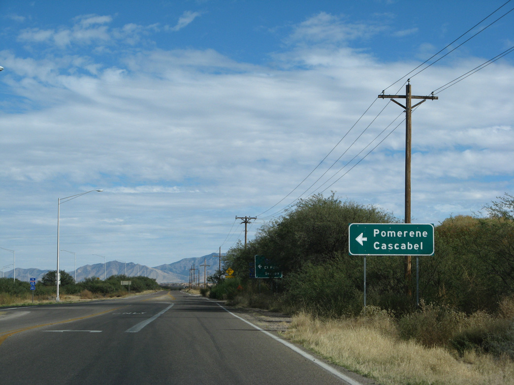
Business Loop I-10 turns north onto Pomerene Road to reconnect with Interstate 10.
11/10/07
11/10/07
11/10/07

11/10/07

11/10/07

11/10/07
West
Business Loop I-10 converges with the west end of SR 80 at a wye interchange just beyond the Union Pacific Railroad in Benson.
03/28/04

Business Loop I-10/Historic U.S. 80 proceed west along E 4th Street into Downtown Benson.
03/28/04
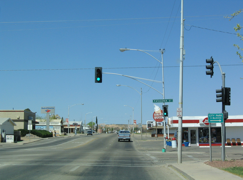
Westbound Business Loop I-10 (4th Street) at Patagonia Street.
03/28/04

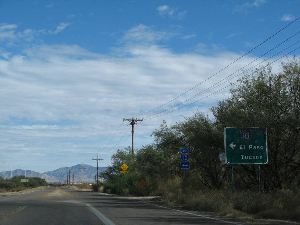
Business Loop I-10 concludes in a quarter mile at a wye interchange with access to both directions of Interstate 10.
03/28/04
Interstate 10 east leads to Willcox, Bowie and San Simon.
03/28/04

Interstate 10 continues west from Benson to Tucson, Phoenix, and ultimately Los Angeles and Santa Monica in California.
03/28/04
scenes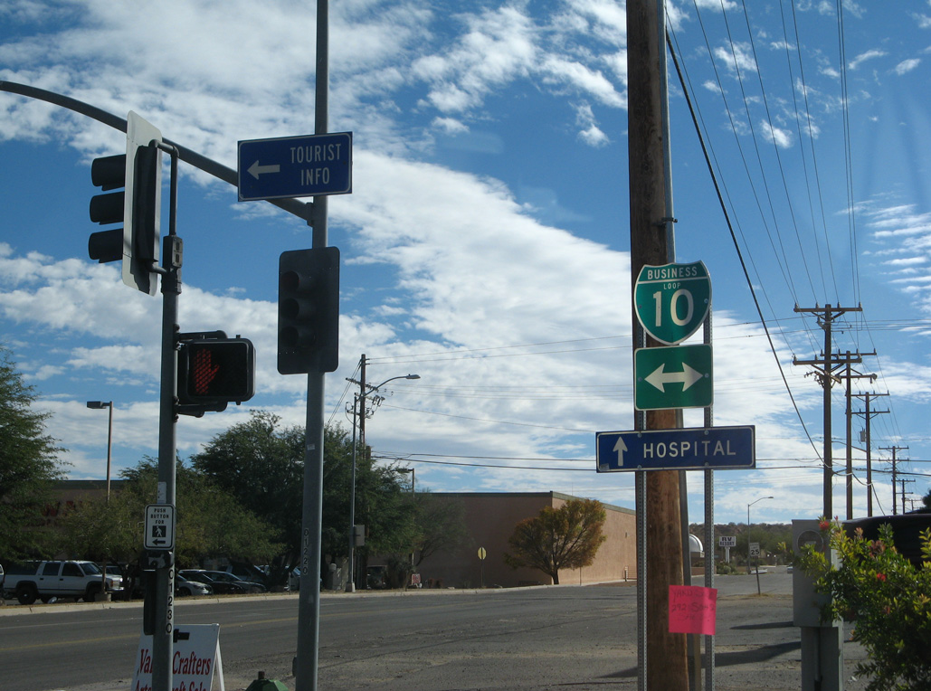
Ocotillo Avenue south at Business Loop I-10/Historic U.S. 80 (4th Street) in Benson.
11/10/07
Photo Credits:
03/26/04, 03/28/04, 11/10/07 by AARoads
Connect with:
Interstate 10
State Route 80 / Historic U.S. 80
Page Updated 04-06-2022.