Business Loop I-8 at Gila Bend constitutes a 5.96 mile long route partially along former U.S. 80. The town of Gila Bend is known as the Crossroads of the Southwest. Home to 2,319 people as of the 2020 Census, Gila Bend is named for the nearly 90 degree bend in the Gila River where the waterway changes direction from southbound to westbound en route to the Colorado River.
Branching east from Exit 115 along Pima Street, Business Loop I-8 parallels a Union Pacific Railroad line into the town center. SR 85 joins Pima Street between its south branch to Ajo and Why and north branch to Buckeye. The two routes partition just east of Gila Bend Canal. The remainder of Business Loop I-8 angles southeast along Butterfield Trail to Old Highway 84 and the diamond interchange along Interstate 8 at Exit 119.
Costing $13.5 million, the State Route 85 Safety and Enhancement Project in Gila Bend redesigned SR 85 east from the split with Business Loop I-8 at Butterfield Trail to the succeeding intersection with Maricopa Road. Underway from January 31, 2011 to 2012, work demolished the previous wye interchange at Butterfield Trail and replaced it with a signalized intersection. The intersection at SR 85 and Maricopa Road was also realigned, shifting SR 85 northbound through a left turn.1 Traffic was redirected onto newly constructed roads on October 3 and 4, 2011.2
|
| Business Loop I-8 intersects the south frontage road (old U.S. 80) just beyond the separation with Interstate 8 eastbound at Exit 115. 05/28/21 |
|
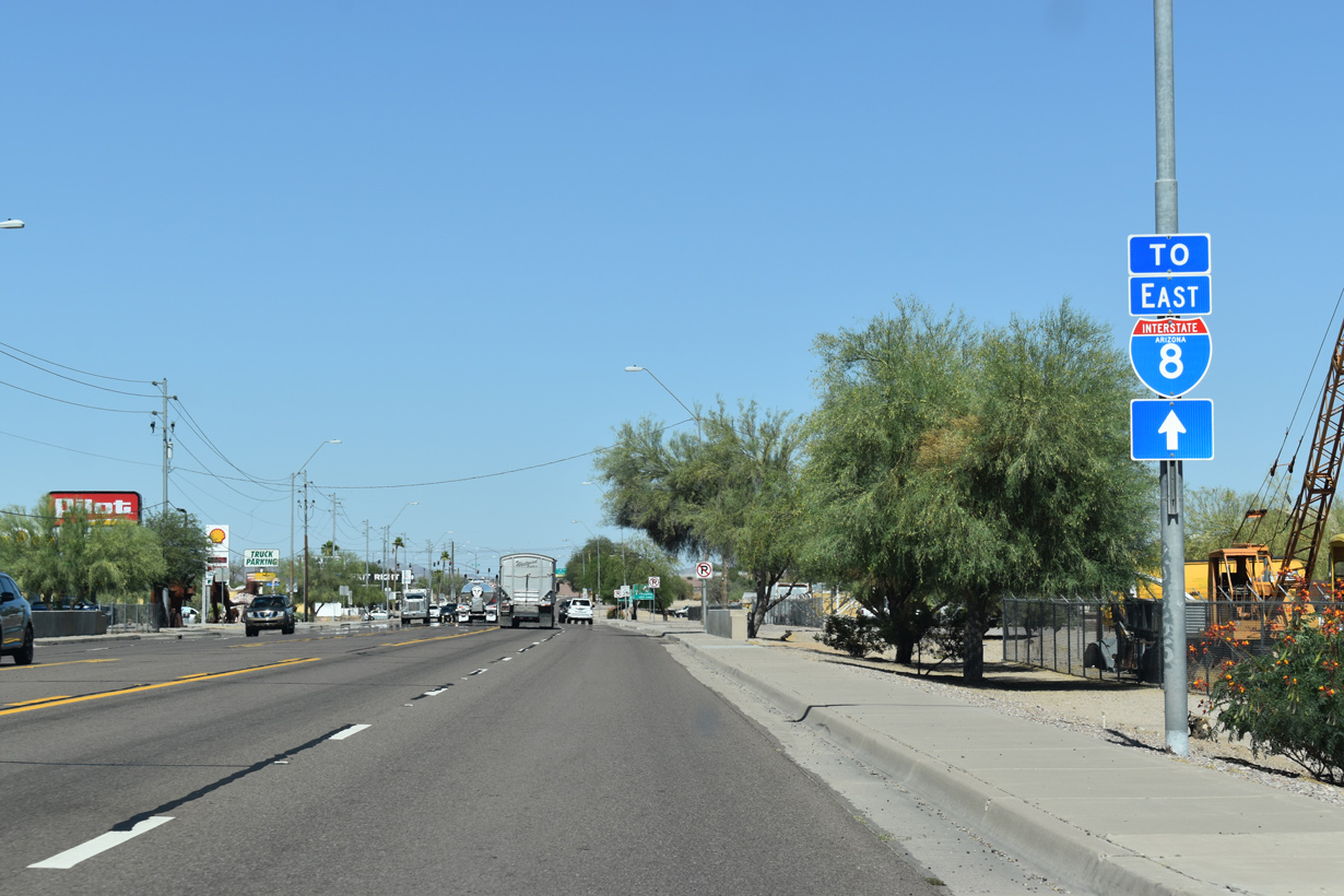
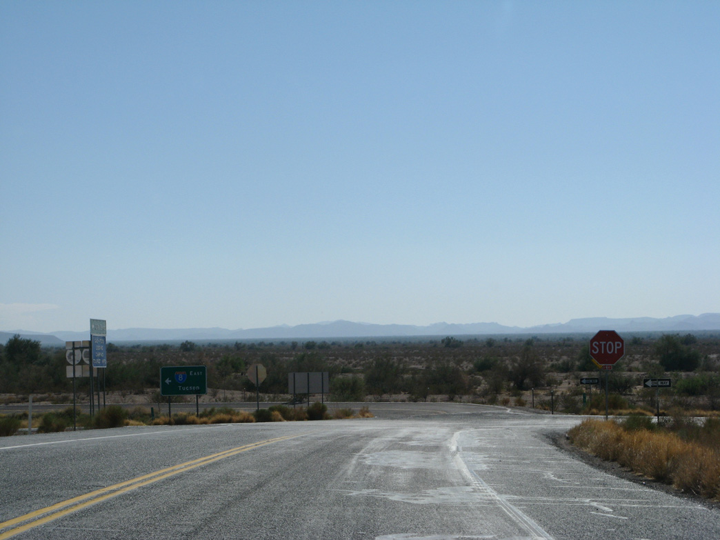
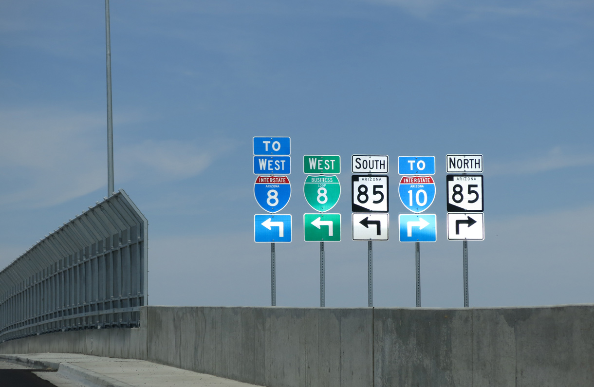
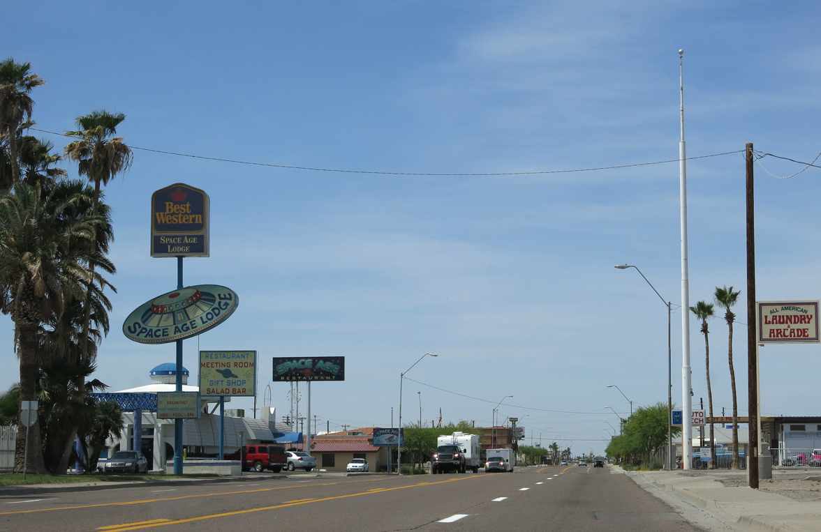
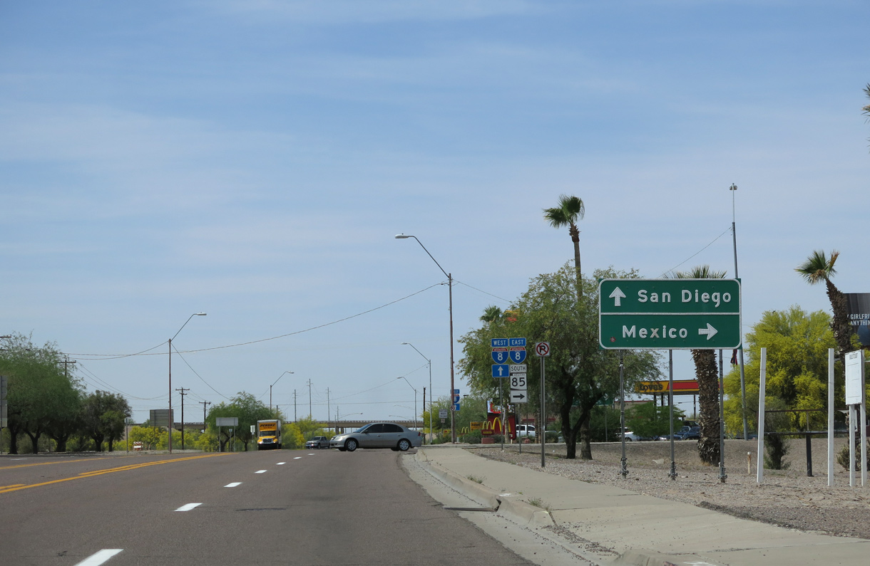
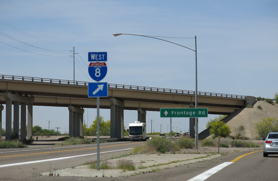
| Business Loop I-8 provides the connection from I-8 east to SR 85 south to Ajo and north beyond Gila Bend. 05/28/21 |
|
| SR 85 is mostly a four lane highway between Gila Bend and Buckeye/Palo Verde. Long range studies outlined further upgrading SR 85 to Interstate standards upon identification of funding.3 05/28/21 |
|
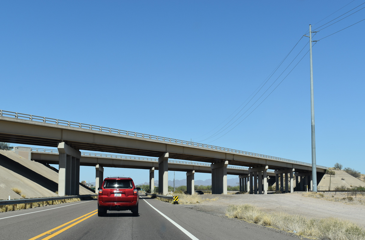
| Interstate 8 spans both Business Loop I-8 (Pima Street) and the adjacent Union Pacific Railroad line. 05/28/21 |
|
| The north Frontage Road for I-8 ties into Pima Street just ahead of the grade separation with SR 85 south. 05/28/21 |
|
| Business Loop I-8 (Pima Street) runs along the Gila Bend town line between SR 85 and Johnny Street. Situated at an elevation of 737 feet above sea level, the community was founded in 1872. 05/28/21 |
|
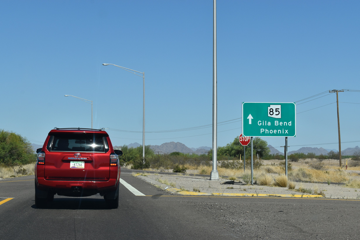
| SR 85 loops southward below Pima Street to a nearby half diamond interchange with Interstate 8 eastbound. 05/28/21 |
|
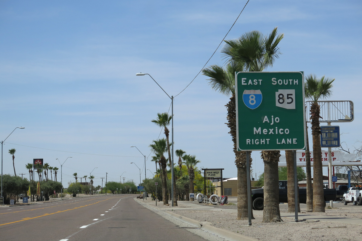
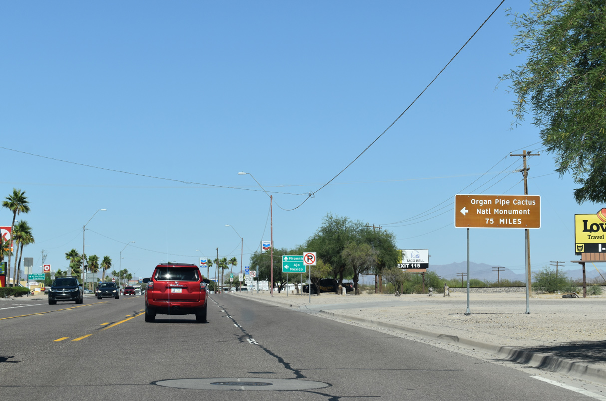
| The southern branch of SR 85 travels to Organ Pipe Cactus National Monument through the Valley of the Ajo. 05/28/21 |
|
| SR 85 runs 80.15 miles south to the International border with Mexico at Lukeville. SR 85 is the best route to Puerto Peñasco or Rocky Point in the state of Sonora. 05/28/21 |
|
| Traversing Barry M. Goldwater Air Force Range south between the Crater Range and Sauceda Mountains, SR 85 heads to the unincorporated community of Ajo. SR 86 branches east from SR 85 further south at Why. 05/28/21 |
|
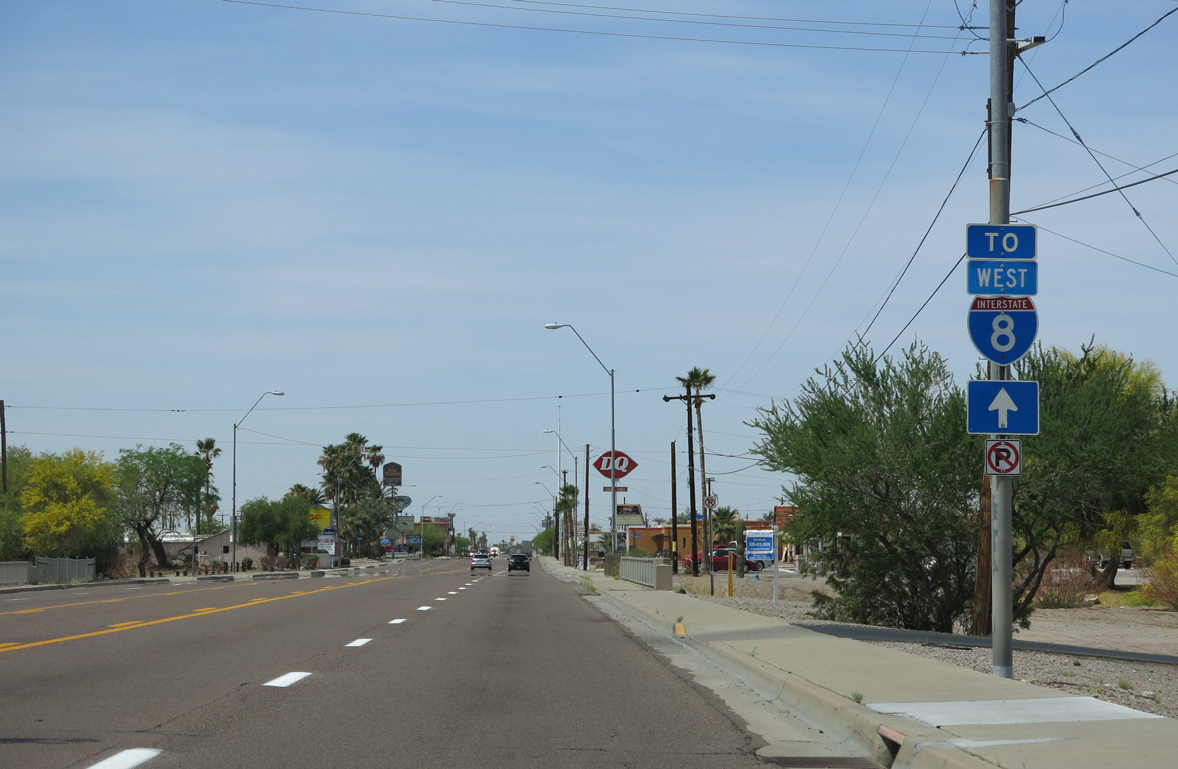
| The first confirming marker for Business Loop I-8 appears without SR 85 north acknowledged. 05/28/21 |
|
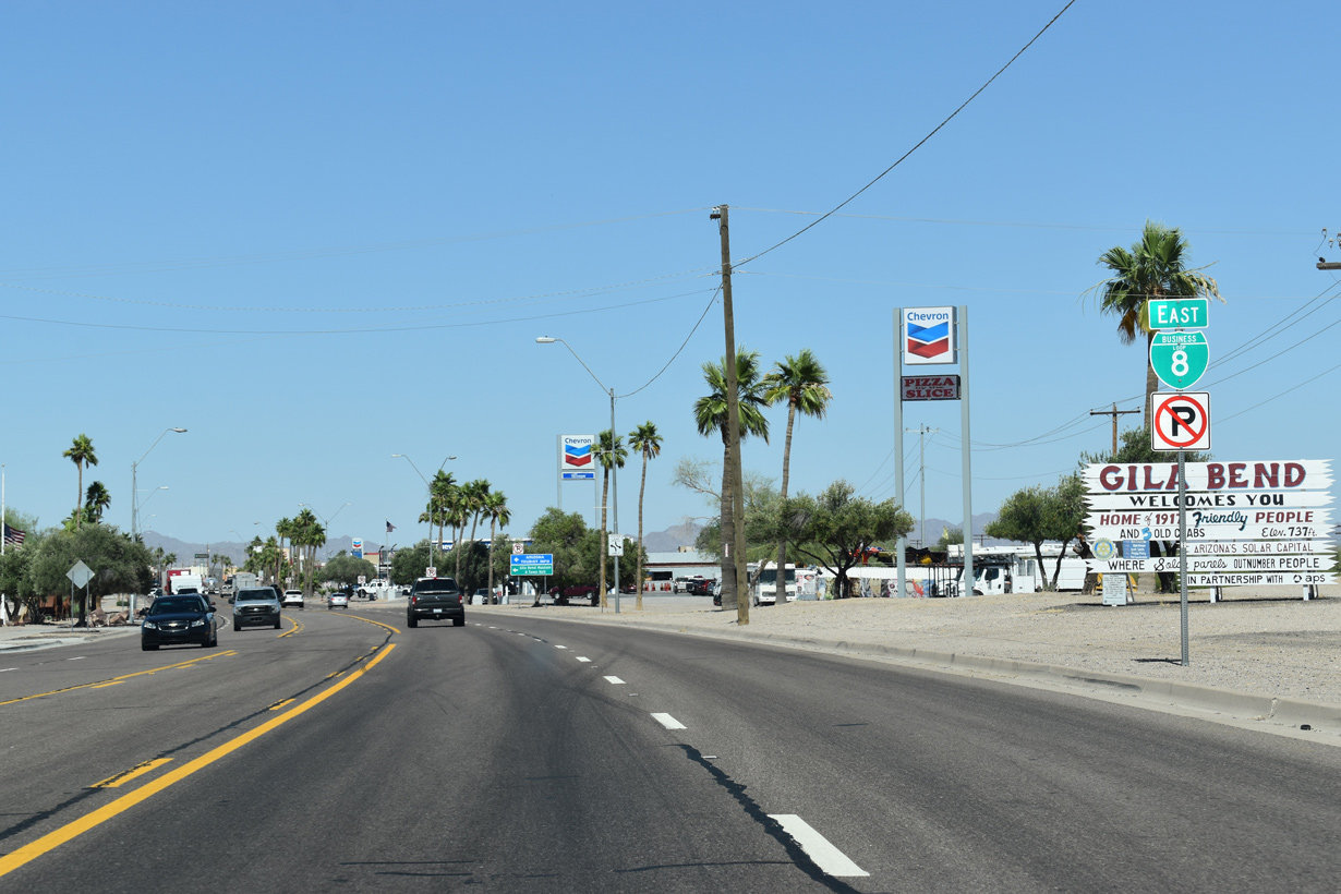
| The Gila Bend welcome sign was amended from 1,700 friendly people in 2005 to 1,917 by 2021 while still displaying 5 old crabs. 05/28/21 |
|
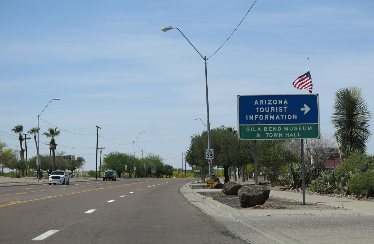
| The Gila Bend Visitor Center and Museum lines the north side of Pima Street east of Harrington Avenue. 05/28/21 |
|
| Milepost 119 for Business Loop I-8 is at the intersection with Johnny Street. Mile markers use the mileage from old U.S. 80. 05/28/21 |
|
| An SR 85 trailblazer stands along Pima Street east of Scott Avenue in lieu of a reassurance marker for the overlap with Business Loop I-8. 05/28/21 |
|
| Pima Street east at Martin Avenue in the Gila Bend business district. 05/28/21 |
|
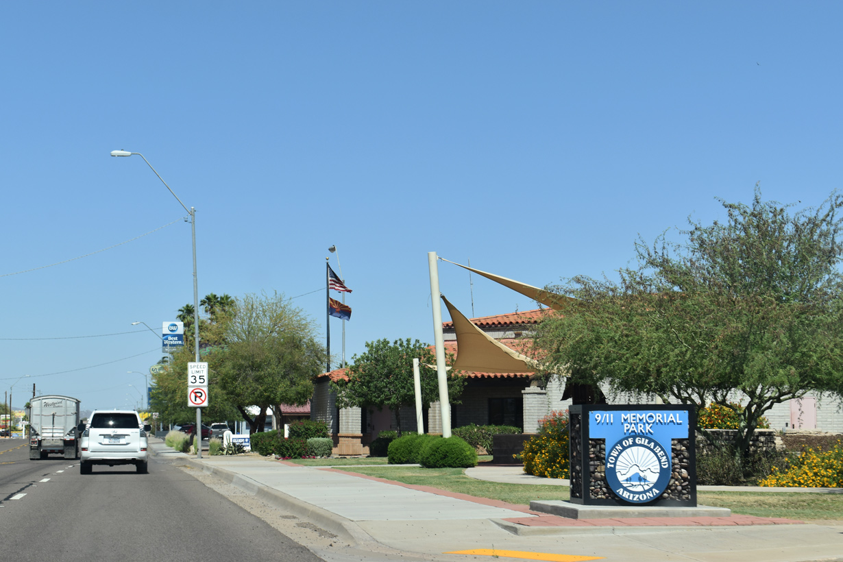
| 9/11 Memorial Park at Capitol Avenue. 05/28/21 |
|
| Business Loop I-8 (Pima Street) east at St. Louis Street. 05/28/21 |
|
| Reassurance marker posted eastbound at Barnes Avenue. 05/28/21 |
|
| Business Loop I-8/SR 85 cross Sand Tank Wash east beyond this trailblazer. 05/28/21 |
|
| A trailblazer for Interstate 8 follows Sand Tank Wash. 05/28/21 |
|
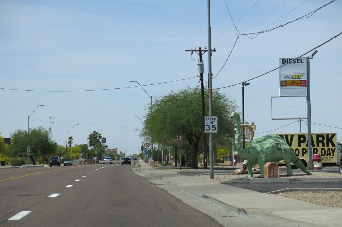
| Several dinosaur sculptures stand along the north side of Pima Street at a gas station adjacent to Palo Verde Avenue. 05/28/21 |
|
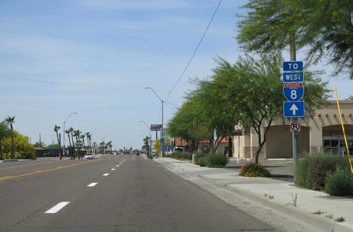
| SR 85 splits with Business Loop I-8 north to I-10 near Goodyear just beyond the forthcoming Gila Bend Canal. 05/28/21 |
|
| Business Loop I-8 returns to Interstate 8, 2.52 miles southeast from SR 85 via Butterfield Trail. 05/28/21 |
|
| Replaced by SR 85 to the east, Old US Highway 80 parallels Gila Bend Canal north from Gila Bend to Cotton Center. 05/28/21 |
|
| Business Loop I-8 separates from SR 85 and Pima Street just ahead of the signalized intersection built in place of a grade separation in 2011. 05/28/21 |
|
| Business Loop I-8 continues east along a ramp from Pima Street adjacent to the Butterfield Trail bridge spanning the Union Pacific Railroad. 05/28/21 |
|
| A new overpass was constructed for Butterfield Trail across the Union Pacific Railroad line as part of the State Route 85 Safety and Enhancement Project in Gila Bend completed in 2012. 04/07/13 |
|
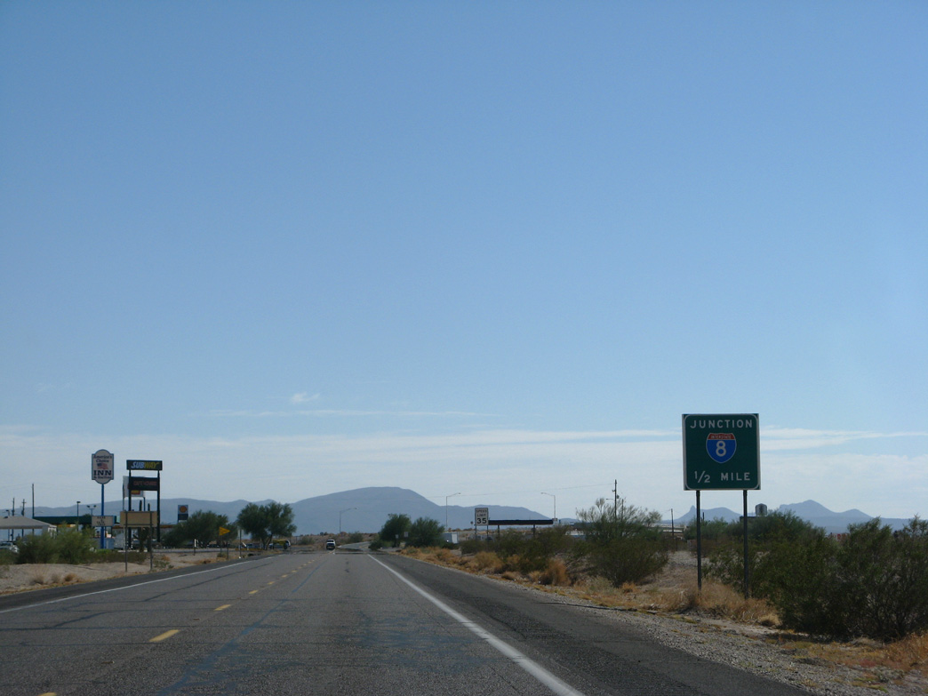
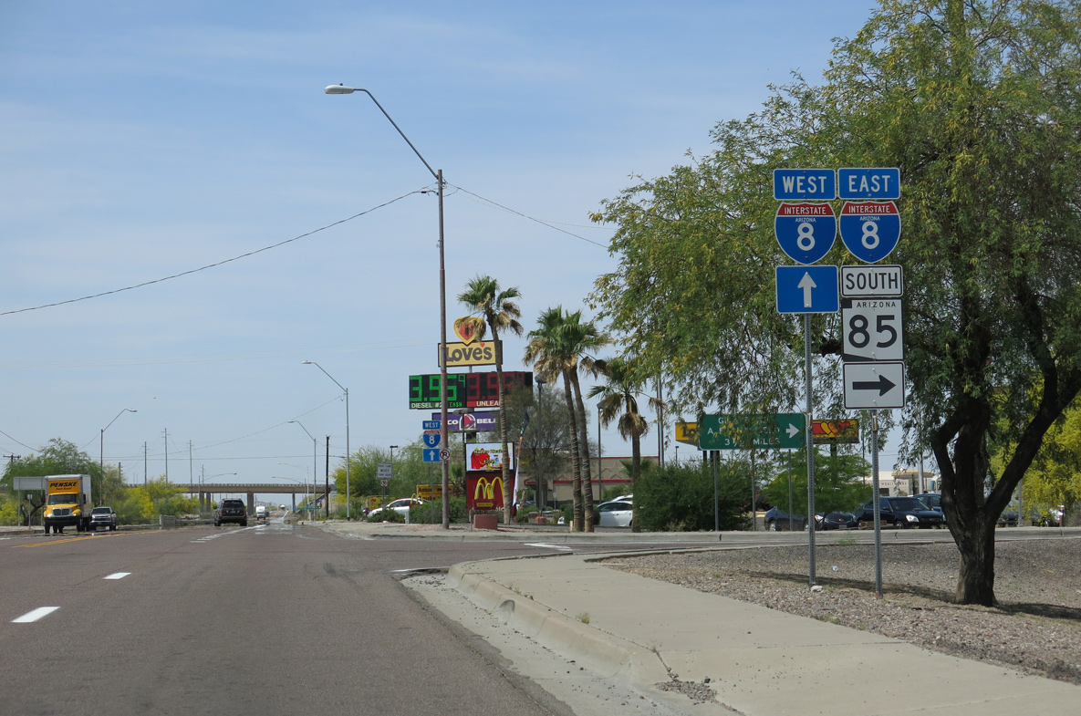
| Business Loop I-8 east to Interstate 8 west from SR 85 leads 117 miles to Yuma. 04/07/13 |
|
| The confirming marker posted southeast of SR 85 and the UP Railroad was removed by 2011. 11/12/07 |
|
| Continuing southeast from E Main Street along Butterfield Trail. 11/12/07 |
|
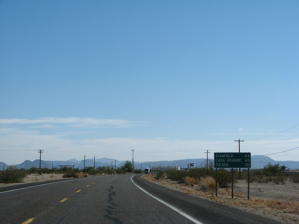
| Stanfield is 44 miles east of Gila Bend via I-8 and SR 84. Casa Grande is 56 miles via SR 84 and 59 miles via I-8 and Exit 172. This distance sign was carbon copied nonetheless. 11/12/07 |
|
| Business Loop I-8 converges with Interstate 8 southeast of Old Highway 84 at a diamond interchange (Exit 119). 11/12/07 |
|
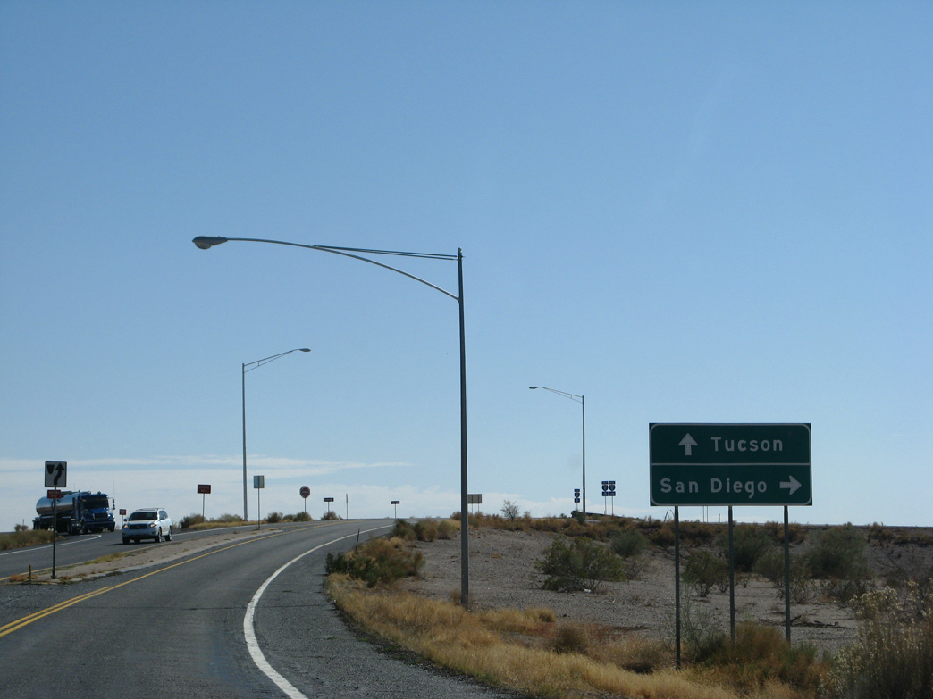
| Passing south of Gila Bend, Interstate 8 travels west to Yuma, El Centro and San Diego, California. 11/12/07 |
|
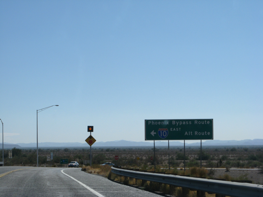
| The Phoenix Bypass route via SR 85 and Business Loop I-8 contines east to Tucson along Interstate 8 past Casa Grande. 11/12/07 |
|
| 9 Mine Well Road ties into the east end of Business Loop I-8. 11/12/07 |
|
| Business Loop I-8 (Butterfield Trail) stems north from 9 Mile Well Road and the diamond interchange along Interstate 8 at Exit 119. 11/12/07 |
|
| 59 miles of Interstate 8 east remain from Business Loop I-8 (Butterfield Trail) to I-10 southeast of Arizola. 11/12/07 |
|
| Business Loop I-8 converges with SR 85 at Pima Street 2.43 miles from Interstate 8. 11/12/07 |
|
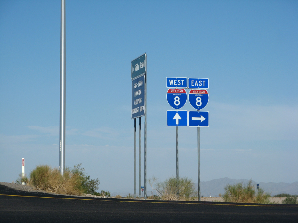
| Interstate 8 continues 3.5 miles west to Exit 115 with the southern leg of SR 85. 11/12/07 |
|
| Business Loop I-8 (Butterfield Trail) enters the town of Gila Bend to the immediate northwest of Interstate 8. 11/12/07 |
|
| Business Loop I-8 west to SR 85 north complete the Phoenix Bypass from I-8. 11/12/07 |
|
| The first trailblazer for Business Loop I-8 westbound precedes Old Highway 84. 11/12/07 |
|
| Old Highway 84 is an unimproved road spurring southeast. Business Loop I-8 (Butterfield Trail) replaced SR 84 northwest to SR 85/Old U.S. 80. 11/12/07 |
|
| Business Loop I-8 (Butterfield Trail) ascends across the Union Pacific Railroad line ahead of SR 85 and Pima Street. 04/07/13 |
|
| Road work underway in 2011/12 replaced the Union Pacific Railroad bridge and flyover joining Business Loop I-8 west and SR 85 south with a signalized intersection. 04/07/13 |
|
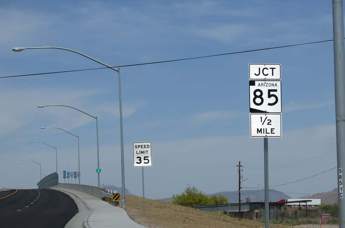
| SR 85 travels 34.67 miles north from Business Loop I-8 (Butterfield Trail) to Intestate 10 near Goodyear. 04/07/13 |
|
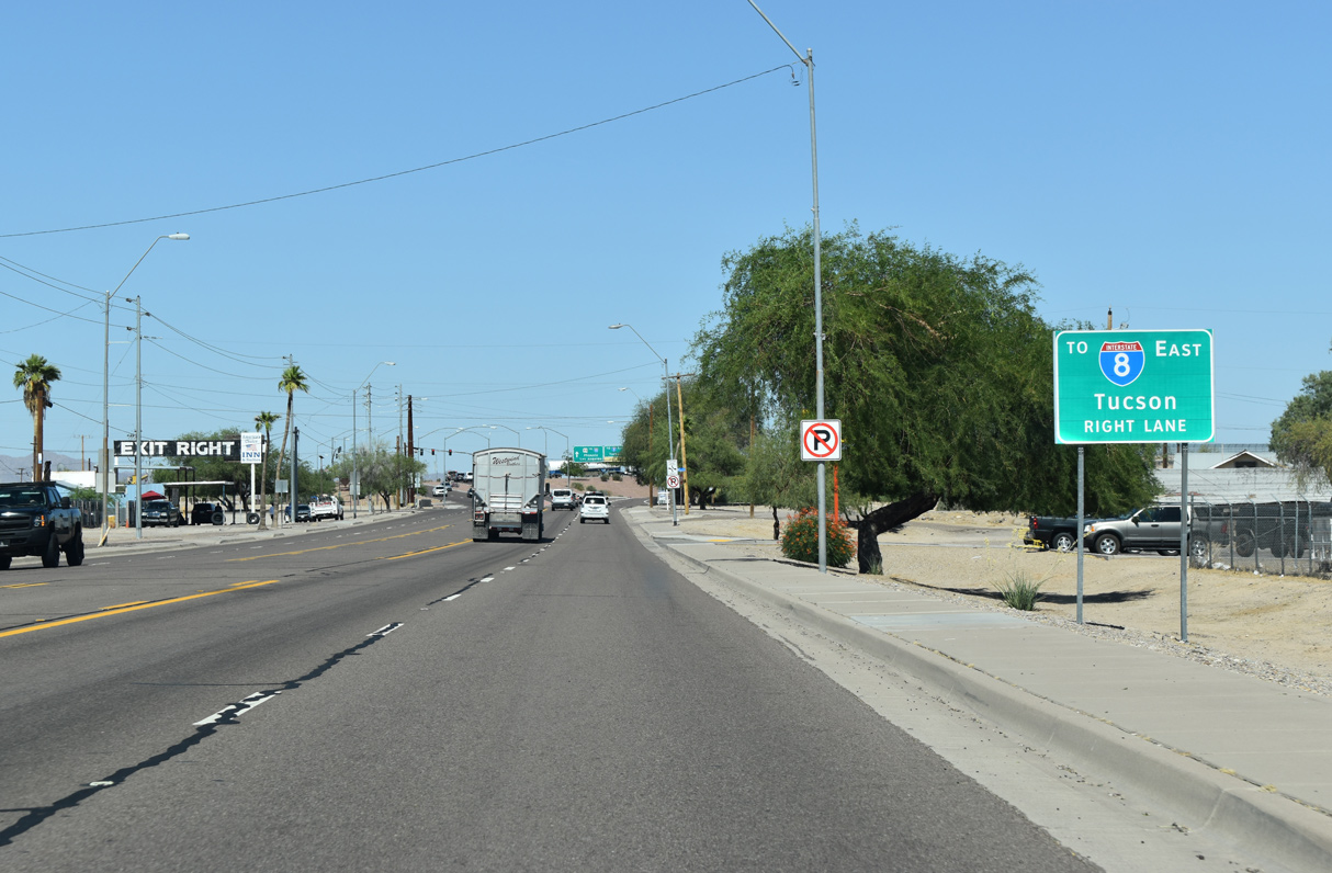
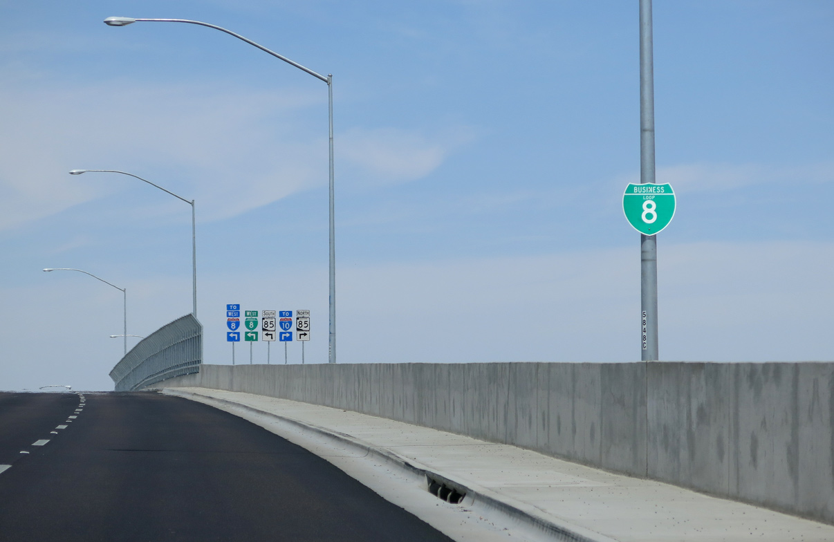
| I-8 west, Business Loop I-8 west and SR 85 provide a long distance bypass route of Phoenix for Interstate 10 west between Tucson and Los Angeles, California. 04/07/13 |
|
| SR 85 expands to a four lane, divided highway 3.2 miles north of Business Loop I-8 along the final route of what was U.S. 80. 04/07/13 |
|
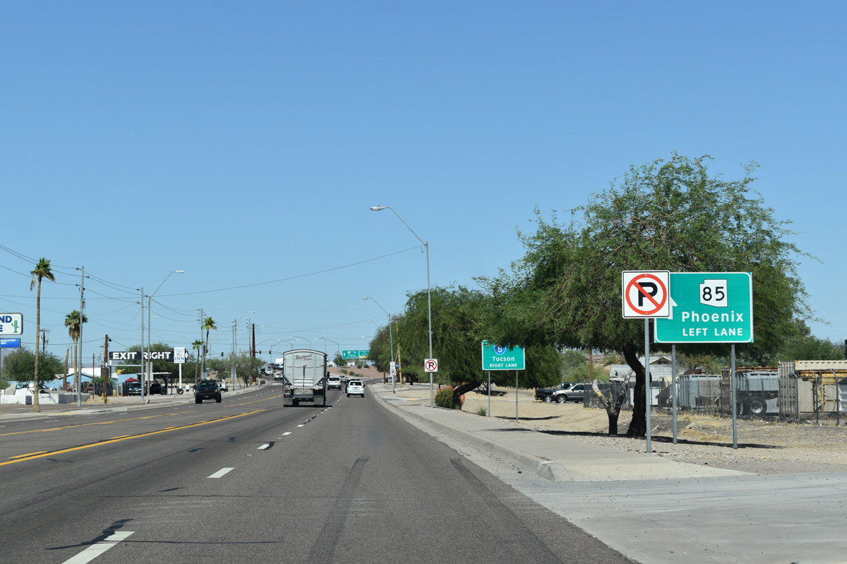
| SR 85 combines with Business Loop I-8 west for two miles along Pima Street to the south branch leading to Ajo and Why. 04/07/13 |
|
| Paralleling Gila Bend Canal, Old US Highway 80 ties into Business Loop I-8/SR 85 at the ensuing intersection along Pima Street westbound. 04/07/13 |
|
| A reassurance marker for Business Loop I-8 precedes mile marker 120 and Palo Verde Avenue. 04/07/13 |
|
| A number of dinosaur sculptures stand along the north side of Pima Street at a gas station adjacent to Palo Verde Avenue. 04/07/13 |
|
| Pima Street west crossing Sand Tank Wash. 04/07/13 |
|
| An I-8 trailblazer references the west end of Business Loop I-8 for motorists continuing from SR 85 south to Yuma and San Diego, California. 04/07/13 |
|
| Continuing west from Sand Tank Wash, Pima Street enters the Gila Bend business district. 04/07/13 |
|
| Pima Street west at Capitol Avenue in the Gila Bend town center. 04/07/13 |
|
| Martin Avenue, the former alignment of SR 85 south from Pima Street (old U.S. 80), intersects Business Loop I-8 ahead of this trailblazer for Interstate 8. 04/07/13 |
|
| The final reassurance marker for Business Loop I-8 west in Gila Bend appears along Pima Street between Euclid and Scott Avenues. 04/07/13 |
|
| SR 85 parts ways with Business Loop I-8 west a third of a mile beyond Dodson Street. The state route continues south to Gila Bend Air Force Auxiliary Field and Ajo by the Little Ajo Mountains. 04/07/13 |
|
| The Gila Bend Visitor Center and Museum lies along the north side of Pima Street west ahead of Harrington Avenue. 04/07/13 |
|
| SR 85 extends 80.14 miles south to Lukeville and the international border with Mexico. Mexico Federal Route 8 continues from there to Sonoyta and Puerto Peñasco (Rocky Point). 04/07/13 |
|
| SR 85 travels south from Ajo into the Valley of the Ajo and the unincorporated community of Why. 04/07/13 |
|
| SR 85 passes through the Barry M. Goldwater Air Force Range south to Ajo and Organ Pipe Cactus National Monument beyond Why. 04/07/13 |
|
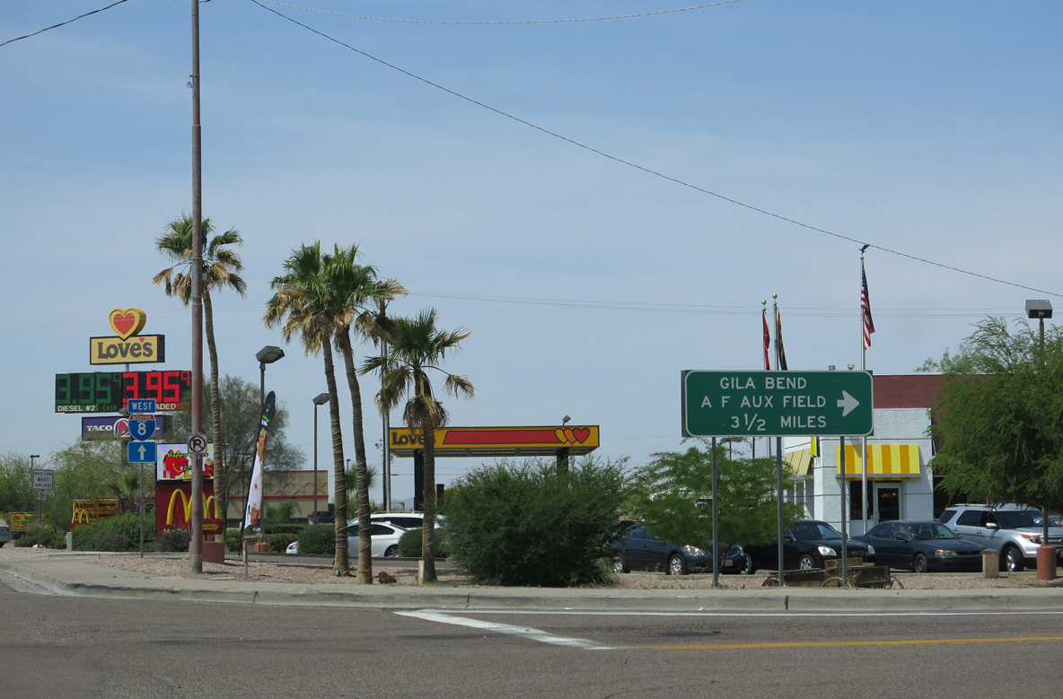
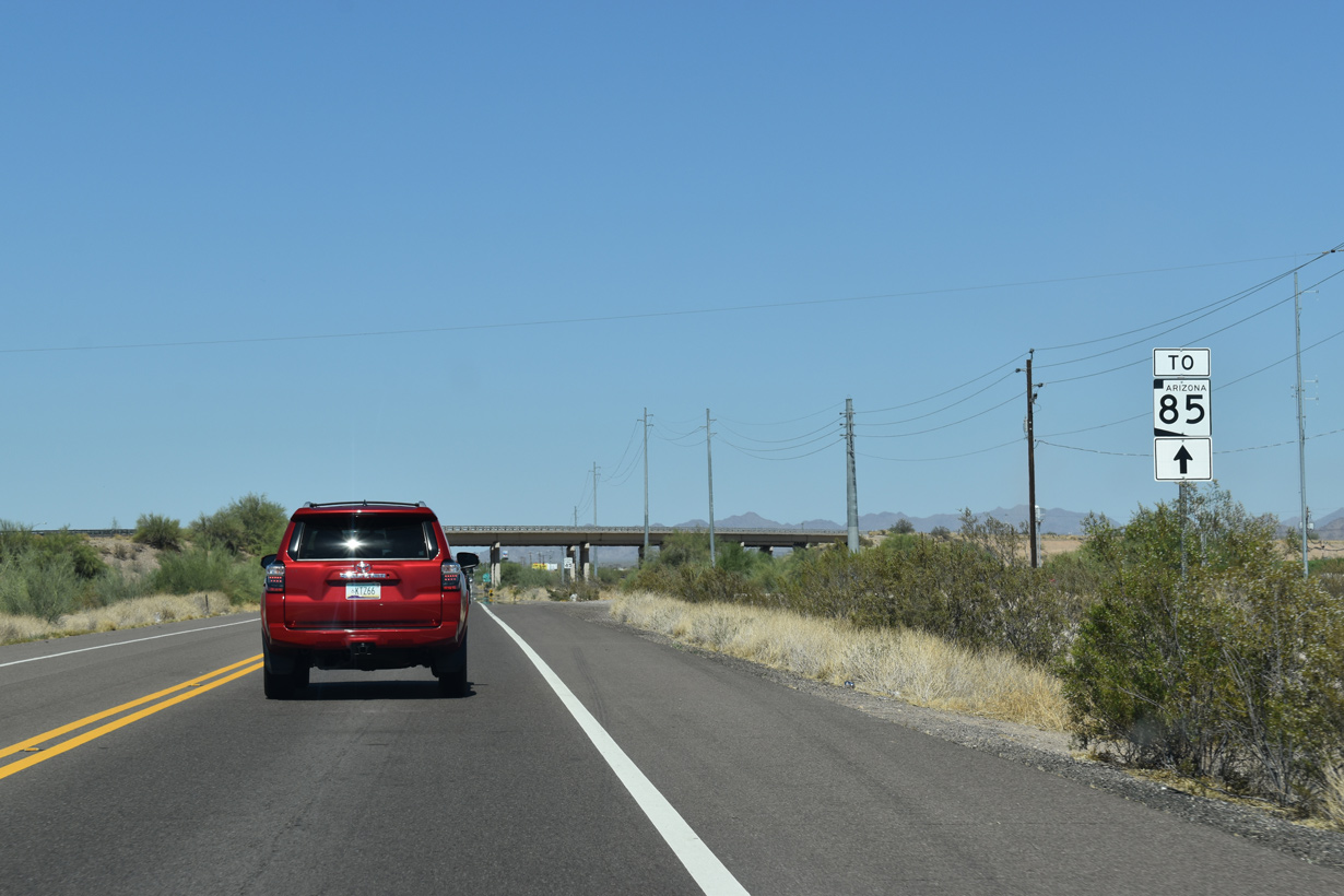
| The last traveler services for Interstate 8 from Gila Bend to Sentinel, 28 miles to the west, are located within the loop ramp taking SR 85 south below Business Loop I-8. 04/07/13 |
|
| The north Frontage Road for Interstate 8 stems west from Business Loop I-8 beyond the grade separation with SR 85. 04/07/13 |
|
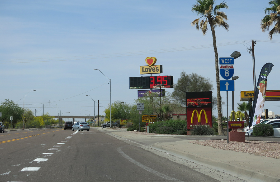
| The entrance ramp for Interstate 8 west to Yuma and San Diego, California follow. 04/07/13 |
|
| Pima Street continues below Interstate 8 to the south Frontage Road (old U.S. 80). 04/07/13 |
Sources:
- State Route 85 Safety and Enhancement Project in Gila Bend, fact sheet.
http://www.azdot.gov/ sr85atGilaBend/PDF/ SR85GilaBend_FactSheet.pdf Arizona Department of Transportation (ADOT).
- "Gila Bend traffic will be redirected to new roads beginning Monday." Arizona Department of Transportation (ADOT). News release, September 30, 2011.
http://www.dot.state.az.us/ ROADS/sr85/index.htm
Connect with:
Interstate 8
State Route 85
Page Updated 04-06-2022.


 East
East


 North
North