 East
East

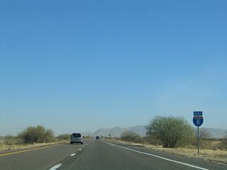
A half diamond interchange (Exit 115) connects SR 85 and the west end of Business Loop I-8 with Interstate 8 east ahead of Gila Bend Canal.
01/13/06

Business Loop I-8 (Butterfield Trail) angles southeast from SR 85 and Pima Street in Gila Bend to I-8 at Exit 119.
01/13/06

East from Exit 119, Interstate 8 replaced SR 84, which used to connect Gila Bend and Casa Grande, then turned southeast to Tucson.
01/13/06

Business Loop I-8 (Butterfield Trail) concludes at a diamond interchange (Exit 119 with I-8 across from 9 Mile Well Road. There are no services for the next 60 miles, the longest stretch without services on all of Interstate 8.
01/13/06

Leading away from Gila Bend, a 20.7 mile long exit less stretch, the longest on all of Interstate 8, ensues to Exit 140 for Freeman Road.
01/13/06

Interstate 8 traverses Sonoran Desert National Monument from just east of Gila Bend to Vekol Valley.
01/13/06

Interstate 8 gradually gains 400 feet in elevation east from Gila Bend to the Sand Tank Mountains.
01/13/06

Rest area were formerly located along both sides of Interstate 8 at mile marker 124. Beyond the Sand Tank Mountains, I-8 parallels Bender Wash to the south of the Maricopa Mountains.
01/13/06

Progressing east from Big Horn, Interstate 8 advances to a diamond interchange (Exit 140) with Freeman Road.
01/13/06

The easternmost 31.13 miles of Interstate 8 to Casa Grande and I-10 travel through Pinal County. The county seat is Florence, located at the crossroads of SR 79/287 just east of Coolidge.
05/24/03

Formerly signed as a picnic area, an eastbound parking area is located at mile marker 149 in Vekol Valley.
01/13/06

Interstate 8 continues two miles east to Exit 151 for SR 84 east to SR 347 (John Wayne Highway) north.
01/13/06

SR 84 branches east along an alignment paralleling I-8 to Casa Grande. SR 347 (John Wayne Highway) stems north to Maricopa and I-10 at the Queen Creek Road interchange. Four lanes for the most part, SR 84/347 is popular cut off to the eastern suburbs of Phoenix such as Chandler, Tempe and Mesa.
01/13/06

SR 84 branches 22.83 miles east from the diamond interchange at Exit 151 to SR 287 (Pinal Avenue) at Downtown Casa Grande.
01/13/06

There are limited services at Exit 151, and the next services along Interstate 8 east are at Casa Grande.
05/31/21

Interstate 8 straddles the northern boundary of Sonoran Desert National Monument. Saguaro cactus populate the park.
01/13/06

Stanfield Road travels north to SR 84 in Stanfield and south into the Tohono O'odham Indian Nation as Indian Route 42 to Kohatk.
01/13/06

The folded diamond interchange (Exit 161) with Stanfield Road lies just east of Santa Rosa Canal.
01/13/06

Midway Road passes over Interstate 8 one mile west of the diamond interchange (Exit 167) with Montgomery Road.
01/13/06

Exit 167 departs from I-8 a half mile east of Greene Wash. Thunderstorms during the monsoonal months of July, August and September can inundate this wash with floodwaters.
01/13/06

Montgomery Road spurs south to a dead end and continues 3.5 miles north from Interstate 8 through a rural residential street grid to SR 84 in western reaches of the Casa Grande city limits.
01/13/06

Sitting at an elevation of 1,405 feet above sea level, Casa Grande is home to 53,658 as of the 2020 Census. Suburban expansion of Phoenix and Tucson toward Casa Grande helped bring the population of the city up from 32,855 in 2000.
01/13/06

Thornton Road leads 3.5 miles north to SR 84 along the industrial west side of Casa Grande. Founded in 1879 and incorporated in 1915, Casa Grande is one of the largest communities in Pinal County.
01/13/06

Thornton Road traverses ranchland to the south and agricultural areas north to a Walmart Distribution Center.
01/13/06

Chuichu Road spans Interstate 8 one mile west of the diamond interchange (Exit 174) at Trekell Road.
01/13/06

Trekell Road extends south from an adjacent residential area to ranching and agricultural areas.
01/13/06

Trekell Road north connects Interstate 8 with Florence Boulevard (old SR 287) east of the Casa Grande city center.
01/13/06

Angling southeast, Interstate 8 concludes at a trumpet interchange (Exit 178) with I-10 just within the Casa Grande city limits.
04/26/17

Interstate 10 travels northwest from Casa Grande across the Gila River Indian Reservation to Chandler and south Phoenix.
04/26/17

Southeast from the Santa Cruz Flats, Interstate 10 passes Picacho Peak en route to Marana and the Tucson metropolitan area.
04/26/17

Two lanes default onto Interstate 10 east at Exit 178A for Tucson, Las Cruces, New Mexico and El Paso, Texas.
04/26/17
Photo Credits:
05/24/03, 01/13/06, 04/26/17, 05/31/21 by AARoads
Connect with:
Interstate 10
State Route 84
Page Updated 04-27-2022.


