
 North
North
Leaving a diamond interchange (Exit 567) with the Arbuckle business loop, I-5 advances northward to Williams in central Colusa County.
03/31/05

03/31/05

08/02/11

Grimes lies eleven miles to the east of the upcoming diamond interchange (Exit 569) with Hahn Road along SR 45 and the Sacramento River.
03/31/05

08/02/11
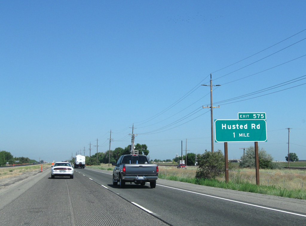
I-5 Business leaves one mile ahead at Husted Road (Exit 575) for Williams. At this point the California Northern Railroad (CNFR) and frontage road (historic U.S. 99W) still line the freeway to the east.
08/02/11

08/02/11

I-5 Business follows the former route of U.S. 99W from Exit 575 (Husted Road) through the city of Williams along a 13.7 mile course back to I-5 north of Maxwell.
03/31/05

08/02/11

08/02/11

SR 20 Business (E Street) meets I-5 east of the Williams city center at Exit 577. SR 20 Business overlays the former alignment of SR 20 along E Street and Husted Road.
08/02/11

08/02/11

SR 20 joins I-5 with the Clear Lake region and Yuba City ahead at a diamond interchange (Exit 578).
08/02/11

Overall, SR 20 winds its way eastward from SR 1 near Fort Bragg along the Pacific Coast to I-80 at Emigrant Gap midway between Sacramento and Reno, Nevada.
08/02/11

08/02/11

Interstate 5 spans Freshwater Creek 98 miles south of Redding.
08/02/11

This Pacific Gas and Electric (PG&E) transmission line crosses I-5 ahead of the Maxwell Safety Rest Area en route to Sutter Buttes in Sacramento Valley.
08/02/11

08/02/11

08/02/11

Maxville Road links I-5 with I-5 Business at the community of Maxville in one mile.
08/02/11

Maxville Road leads east to the 5,797 acre Delevan National Wildlife Refuge and SR 45.
08/02/11

The East Park Reservoir is located 22.5 miles to the west beyond the Black Mountain Range. A second reservoir at Sites, between East Park and I-5, has been long proposed but never built.
08/02/11

08/02/11

The Williams I-5 business loop returns ahead at a half diamond interchange for southbound (Exit 588) as I-5 advances north to Delevan and Willows.
08/02/11

08/02/11

08/02/11

08/02/11

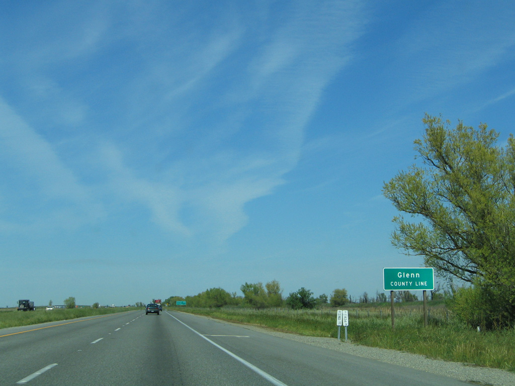
Hunters Creek flows beneath I-5 eleven miles south of Willows, seat of Glenn County.
03/31/05
Interstate 5 enters Glenn County ahead of a diamond interchange (Exit 595) with Road 68 to the Sacramento National Wildlife Refuge.
03/31/05

03/31/05

03/31/05

03/31/05

08/02/11

The longest business route for I-5 in the Golden State leaves for Willows one mile ahead at Road 57.
08/02/11

Extending 20.7 miles between Exits 601 and 621, Business Loop I-5 generally follows Historic U.S. 99W between Willows and Orland.
08/02/11

08/02/11

Road 57 ties Business Loop I-5 with Old Highway 99W directly east of Exit 588.
03/31/05

03/31/05

Bypassing Willows to the west, I-5 next meets SR 162 (W Wood Street).
08/02/11

SR 162 joins Interstate 5 with Glenn, Elks Creek, and Oroville on its stair stepped course through the Sacramento Valley region.
03/31/05

03/31/05

08/02/11

08/02/11

I-5 continues north from Willows seven miles to Artois and 73 miles to Redding.
08/02/11

03/31/05

08/02/11

A set of rest areas line both sides of Interstate 5 one half mile north of the parclo interchange (Exit 607) with Road 39.
08/02/11

08/02/11

Road 33 joins I-5 north with Business Loop I-5 and the community of Artois one mile ahead.
08/02/11

03/31/05

Interstate 5 advances nine miles north to Orland next.
03/31/05

08/02/11

08/02/11

08/02/11

Road 16 (South Street) is the first of two interchanges joining I-5 with the city of Orland in one mile.
03/31/05

03/31/05

Interstate 5 meets SR 32 at a six ramp parclo interchange (Exit 619) a half mile north of Road 16 (South Street).
03/31/05

08/02/11

Road 200 angles northwest from I-5 and SR 32 to Black Butte Lake located in southern Tehama County.
08/02/11

SR 32 travels east from I-5 and Orland to Hamilton City and Chico on its 74.387 mile long course to SR 36-89 west of Chester.
08/02/11

08/02/11

Chico lies 21 miles to the east of I-5 at the crossroads of SR 32 and 99.
08/02/11


Photo Credits:
03/31/05, 08/02/11 by AARoads
Page Updated 01-27-2023.