Hawaii Route 80 follows Kamehameha Highway for 1.189 miles north from Route 99 (Wilikina Drive) to Wahiawa back to Route 99 (Kamananui Road) west of Whitemore Village. Route 99 lines Kamehameha Highway north from Route 80 to Route 83 near Halewai and Oahu's North Shore. Kamehameha Highway south also follows Route 99 from Route 80 near Wahiawa to Waipio Acres and Waipahu.
Route 80 previously extended 2.2 miles northwest from Kamehameha Highway along Kaukonahua Road to what was Route 99 along Wilikina Drive. Kaukonahua Road was subsequently renumbered as Route 801. Wilikina Drive northwest of Kamananui was redesignated Route 803, and Route 99 was realigned over what was Route 82 along Kamananui Road and the continuation of Kamehameha Highway north from Route 80 to Weed Circle.
|
| Kamehameha Highway extends north from Route 99 (Wilikina Drive) and I-H2 as Route 80 across the Kaukonahua Stream South Fork into Wahiawa. 01/18/11 |
|
| The four lane span taking Route 80 (Kamehameha Highway) north over the Kaukonahua Stream South Fork was built in 1984. 01/18/11 |
|
| Route 80 intersects Ohai Street west and Avocado Street east just beyond the Kaukonahua Stream South Fork. Avocado Street links Kamehameha Highway with Walker Avenue to Wahiaw? Freshwater State Recreation Area. 01/18/11 |
|
| Continuing north into the Wahiawa street grid, the succeeding traffic light on Route 80 (Kamehameha Highway) is at Olive Avenue. 01/18/11 |
|
| California Avenue leads west to Wahiawa Reservoir where the North and South Forks of Kaukonahua Stream converge. East of Route 80, California Avenue continues to Wahiawa Homesteads. 01/18/11 |
|
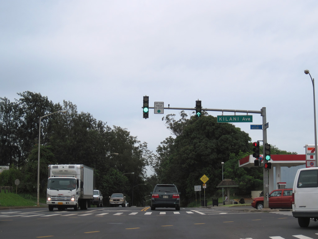
| The final signalized intersection along Route 80 (Kamehameha Highway) in Wahiawa is at Kilani Avenue. Paralleling California Avenue, Kilani Avenue becomes Glen Avenue east at Wahiawa Botanical Garden. 01/18/11 |
|
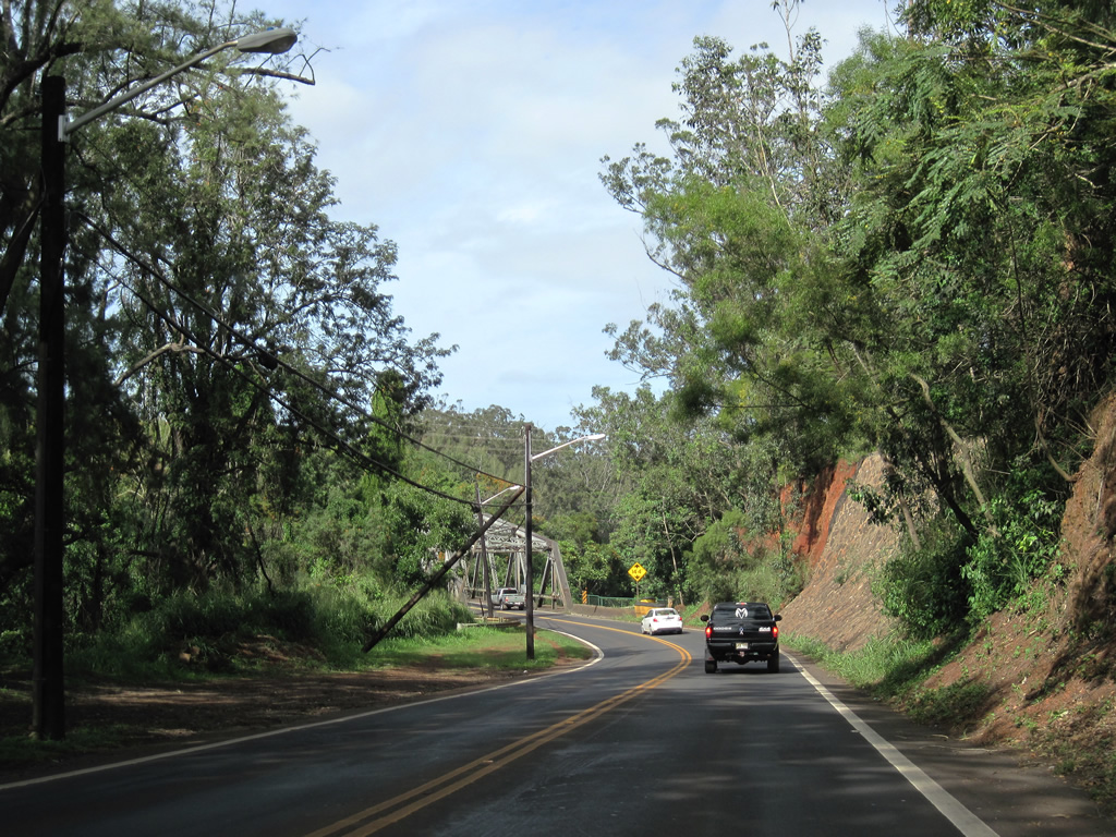
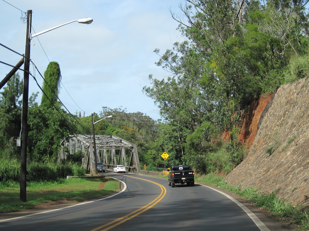
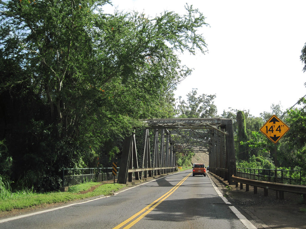
| Lowering to cross the Kaukonahua Stream North Fork, Route 80 (Kamehameha Highway) reduces to two lanes. 01/17/11 |
|
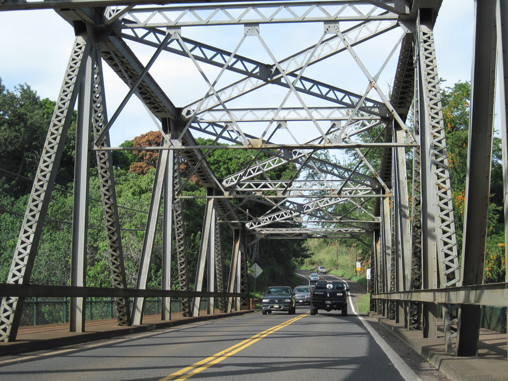
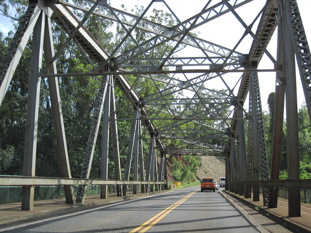
| A steel through truss bridge spans the Kaukonahua Stream North Fork on Route 80 north through western reaches of Kawailoa Forest Reserve. The bridge was built in 1932. 01/17/11 |
|
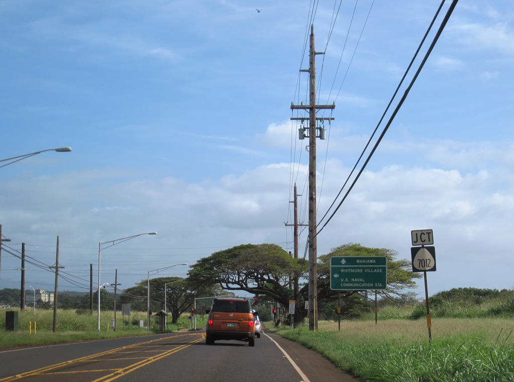
| Advancing north from Wahiawa, Route 80 (Kamehameha Highway) north next intersects Whitemore Avenu (Route 7012) east by the Kukaniloko Birth Stones monument. 01/17/11 |
|
| Whitmore Avenue (Route 7012) stems 1.86 miles east from Route 80 to Whitmore Village and Center Street into the Naval Computer and Telecommunications Area Master Station Pacific Wahiawa. 01/17/11 |
|
| Route 80 reassurance marker posted north of Whitmore Avenue (Route 7012). 01/17/11 |
|
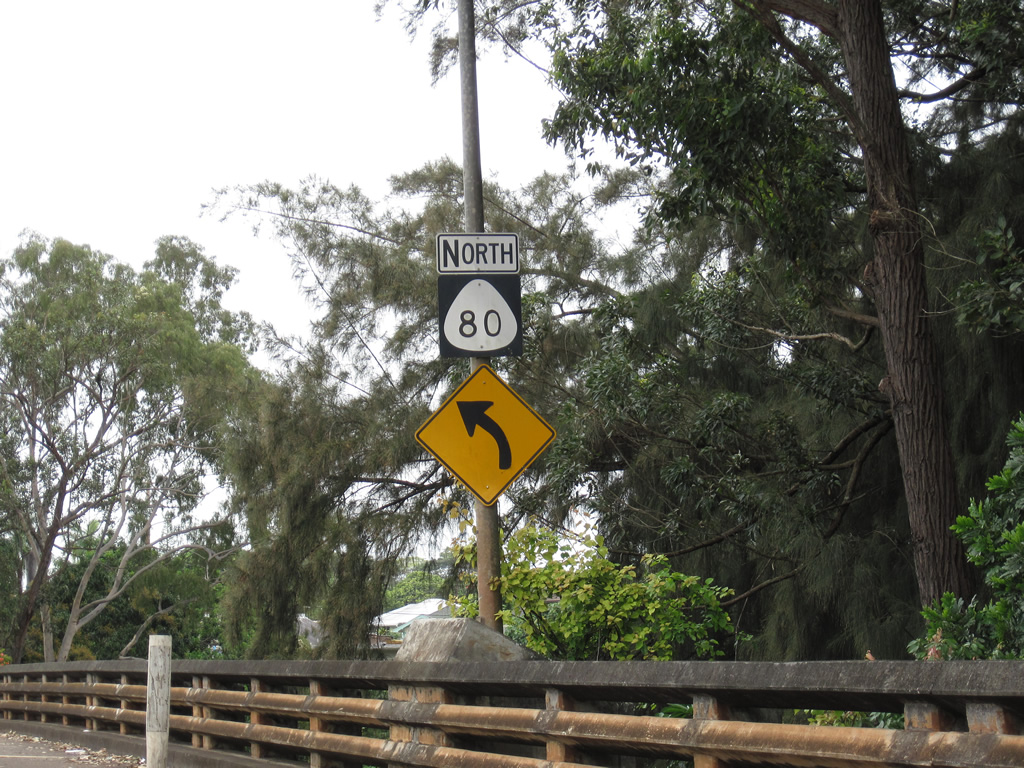
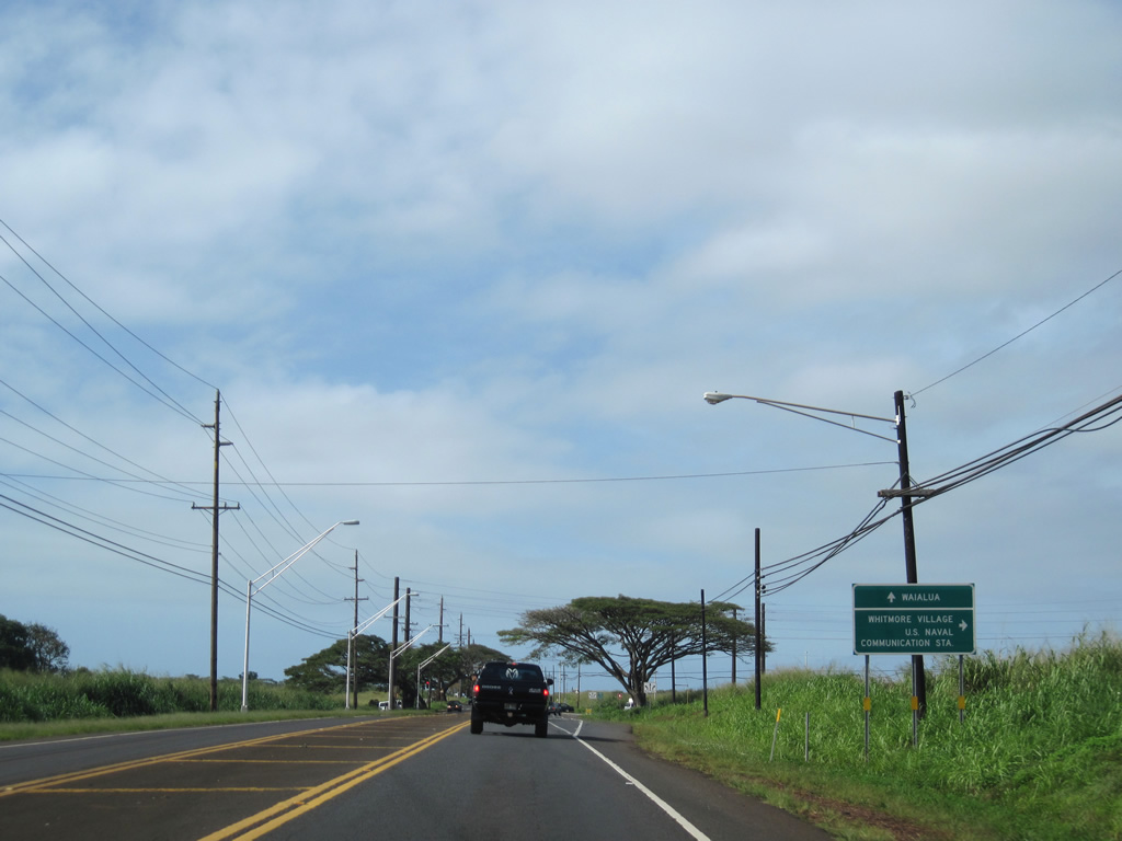
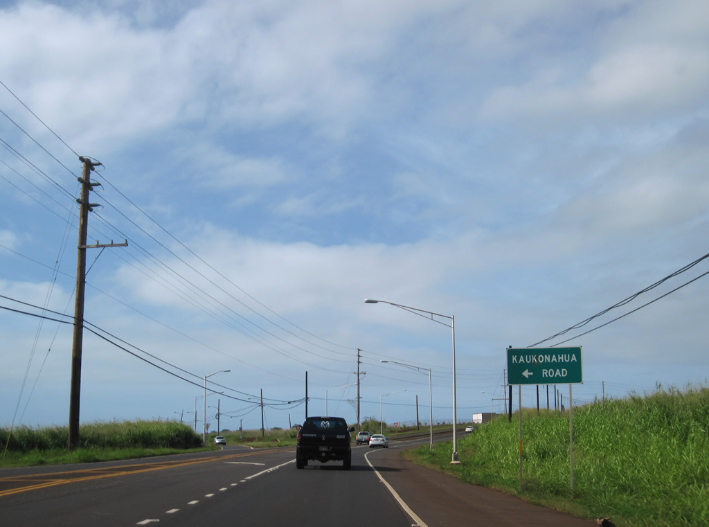
| Kaukonahua Road (County Route 801) branches west from Route 80 (Kamehameha Highway) beyond Whitmore Village for Wilikina Drive (Route 803) to Waialua. 01/17/11 |
|
| Kaukonahua Road (Route 801) angles 2.18 miles northwest to Wilikina Drive (Route 803). Route 803 follows Kaukonahua Stream 5.82 miles northwest to Route 930 (Farrington Highway) at Waialua. 01/17/11 |
|
| Route 99 (Kamananui Road) curves northeast from Wilikina Drive (CR 803) to overtake Kamehameha Highway from Route 80 in 1.18 miles. 01/17/11 |
|
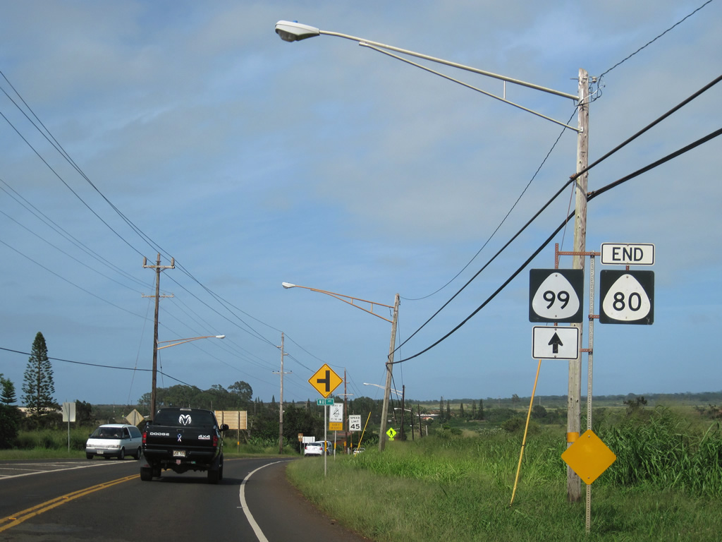
| An end shield for Route 80 appears along Route 99 (Kamehameha Highway) northbound ahead of Nui Avenue. Route 99 continues Kamehameha Highway northward to the Dole Plantation and Route 83 near Weed Circle and Kamo'oloa. 01/17/11 |
|
| Route 80 (Kamehameha Highway) angles southeast from County Route 801 (Kaukonahua Road) to Route 7012 (Whitmore Avenue) east to Whitmore Village and the Kukaniloko Birth Stones monument. 01/17/11 |
|
| Route 7012 lines Whitmore Avenue east 1.86 miles through Whitmore Village to Center Street at the Naval Computer and Telecommunications Area Master Station Pacific Wahiawa. 01/17/11 |
|
| Heading south from Whitmore Village, Route 80 crosses the Kaukonahua Stream North Fork into the community of Wahiawa. 01/17/11 |
|
| Route 80 (Kamehameha Highway) south briefly enters Kawailoa Forest Reserve at the North Fork of Kaukonahua Stream. 01/17/11 |
|
| The through truss bridge taking Kamehameha Highway across the Kaukonahua Stream North Fork was built in 1932. 01/17/11 |
|
| Kilani Avenue intersects Kamehameha Highway at the first of four traffic lights on Route 80 south through the Wahiawa street grid. 01/17/11 |
Page Updated 08-31-2011.