|
| John J. Williams initially carries four overall lanes from SR 1 (Coastal Highway) to Hudson Way and the north entrance to Rehoboth Mall. Future road work will extend the four lane section of SR 24 south to the split with SR 1D (Plantation Road). 01/16/17 |
|
| SR 1D partitions with SR 24 west for Plantation Road to run along the west side of the Midway and Five Points area. The route formerly overlapped with SR 24 Alternate, though remnant signage is still posted. 01/16/17 |
|
| Plantation Road provides an alternate route to SR 1 northward to SR 23 south at Belltown. Warrington Road ties into the traffic light with SR 24 from Old Landing Road and the Breezewood subdivision. 01/16/17 |
|
| SR 24 (Laurel Road) west enters Sandy Fork at Shiloh Church Road. The rural community may be best known as the hometown of professional wrestling's Briscoe Brothers. 01/16/17 |
|
| 4th Street takes SR 24 west from U.S. 13 (Sussex Highway) to Market Street through Laurel. No confirming marker is posted on this stretch. 01/15/17 |
|
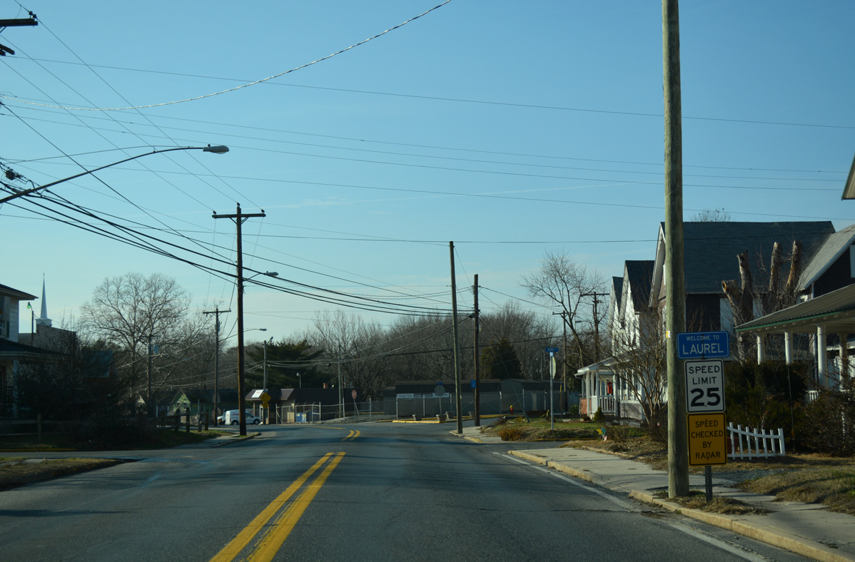
| Entering the town limits of Laurel, speed limits lower to 25 miles per hour as SR 24 makes an S-curve from King Street across Copper Branch. 01/15/17 |
|
| Fourth Street west ahead of Willow Street. Willow Street crosses Records Pond Dam to the north. 01/15/17 |
|
| An older shield assembly appears at the curve of SR 24 west from 4th Street to Market Street. 01/15/17 |
|
| The first of two traffic lights along Market Street west through Downtown Laurel operates at Delaware Avenue. Delaware Avenue arcs northeast to U.S. 13 at Sycamore Road. 01/15/17 |
|
| Central Avenue (historic U.S. 13 Alternate) bisects Downtown Laurel south to Laurel High School and north across Broad Creek to Seaford Road. 01/15/17 |
|
| SR 24 narrows on the curve leading southwest from Central Avenue to West Street. An at-grade Norfolk Southern Railroad crossing lies ahead. 01/15/17 |
|
| SR 24 (West Street) west at 6th Street. Beyond the town line, 6th Street becomes Portsville Road en route to the rural community Portsville. 01/15/17 |
|
| Hastings Drive splits from West Street as SR 24 exits Laurel along Sharptown Road west. 01/15/17 |
|
| Continuing west, SR 24 (Sharptown Road) passes by the Holly Woods Park subdivision after Little Creek. The remainder of the 6.6 mile drive to Maryland is rural. 01/15/17 |
|
| Laurel Airport (N06) resides at the corner of SR 24 (Sharptown Road) with Airport Road west and Dickerson Road south. 01/15/17 |
|
| SR 24 resembles a canopy road leading west from Horsey Church Road to a point just past Old Hickory Road. 01/15/17 |
|
| A reassurance marker for SR 24 stands west of Old Hickory Road. 01/15/17 |
|
| Mount Pleasant Road heads north from SR 24 to Portsville, where Shell Bridge Road links the road with the town of Bethel. 01/15/17 |
|
| SR 24 follows a linear alignment west past Elm Grove Road and this shield assembly. 01/15/17 |
|
| Approaching Columbia Road on Sharptown Road west. Columbia Road links SR 24 with Columbia and SR 54 south at Packing House Corner. 01/15/17 |
|
| The last shield for SR 24 west is posted after Columbia Road. 01/15/17 |
|
| Rider Road converges with a tree lined section of Sharptown Road just ahead of the Maryland state line. 01/15/17 |
|
| MD 348 (Laurel Road) takes over for the ending SR 24 west. The state route curves northwest along a 1.39 mile alignment to MD 313 at the Sharptown bypass. 01/15/17 |
Page Updated 02-03-2017.

 North
North  West
West