|
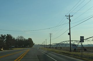
| SR 8 continues Halltown Road east from MD 454 through Marydel. Curving east from the town, a welcome sign appears at the Halltown Road crossing of Beaverdam Ditch. 01/16/17 |
|
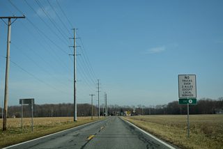
| The first shield for SR 8 was previously posted after Beaverdam Ditch. It was later relocated westward near First State Road, but was no longer posted as of 2017. 04/13/04 |
|
| Turning northeastward, SR 8 (Halltown Road) advances from Halltown Road across agricultural land to Enss Road and this SR 8 reassurance marker. 01/16/17 |
|
| Gunter Road south and Tappahanna Bridge Road north come together at a rural intersection with SR 8 ahead of the next eastbound shield. 01/16/17 |
|
| SR 8 (Halltown Road) east of Proctors Purchase Road north. 01/16/17 |
|
| Rural scenery along SR 8 east ahead of Bethesda. 01/16/17 |
|
| SR 8 continues paralleling Tappahanna Ditch east from Bethesda and Hourglass Road to Green Briar. 01/16/17 |
|
| Crystal Road ties into SR 8 (Halltown Road) from Hartley to the north at the Green Briar community. 01/16/17 |
|
| Halltown Road shifts northeast through woodlands from Brittney Lane to the settlement of Pearsons Corner. 01/16/17 |
|
| SR 44 (Hartly Road) east converges with SR 8 (Halltown Road) east from the town of Hartly at Pearsons Corner. 01/16/17 |
|
| SR 44 constitutes a rural highway 6.67 miles northwest to SR 300 at Everetts Corner. The state route also funnels traffic from the U.S. 301 corridor onto SR 8 east to Dover. 01/16/17 |
|
| Traffic lights at SR 8 and SR 44 were activated by the week of December 10, 2012.1 01/16/17 |
|
| A rural wye intersection previously joined SR 44 (Hartly Road) with SR 8 (Halltown Road). A Royal Farms gas station now occupies land on the south side of redesigned intersection. 04/13/04 |
|
| Halltown Road leads SR 8 east to adjacent Pearsons Corner Road. A $975,784 Highway Safety Improvement Program (HSIP) project in 2012 expanded the forthcoming intersection, added right turn lanes and replaced span wires with mast arm supported signals.2 12/29/20 |
|
| Pearsons Corner Road (Rd 101) forms a 7.80 mile arc north from Hazlettville Road (Rd 73) to SR 42 near the town of Cheswold. 12/29/20 |
|
| Site clearing at Pearsons Corner Road underway by January 2011 claimed a house on the southeast corner with SR 8 (Forrest Avenue). 04/13/04 |
|
| Continuing on Forrest Avenue, SR 8 gradually becomes more suburban as it progresses east from Pearsons Corner to Dover. Traffic counts increase over the next four miles by 3,000 plus vehicles per day (vpd). 01/16/17 |
|
| Victory Chapel Road leads south from Denneys Road to meet SR 8 (Forrest Avenue) across from the Hidden Acres subdivision by this reassurance marker. 01/16/17 |
|
| Winding Creek Road loops north to the Winding Creek Estates development and east to Sharon Hill Road as SR 8 passes to the south. 01/16/17 |
|
| Artis Drive merges with Forrest Avenue east as SR 8 reaches the Dover city limits. Dover High School appears to the east. 01/16/17 |
|
| Traffic lights became operational at the west entrance to Dover High School on July 10, 2014.3 Construction on the new campus broke ground in May 2011. The 290,000 square foot school was dedicated on August 16, 2014.4 01/16/17 |
|
| Dover High Drive circles east to intersect SR 8 (Forrest Avenue) opposite Heatherfield Way at a HAWK pedestrian signal. 01/16/17 |
|
| Forrest Avenue expands into a three lane boulevard east to Mifflin Road. Mifflin Road heads southeast to SR 15 (Hazlettville Road) at Schutte Park. 01/16/17 |
|
| Kenton Avenue runs south from SR 42 as SR 15 to Denneys Road and the Dover city line. The road continues southeast by the Maple Dale Country Club golf course to SR 8 (Forrest Avenue). 01/16/17 |
|
| SR 8 widens into a five lane commercial arterial from Kenton Road east to SR 15 (Saulsbury Road). 01/16/17 |
|
| Independence Boulevard winds south from Walker Road to a commercialized intersection with SR 8 (Forrest Avenue). 01/16/17 |
|
| 2015 traffic counts peak at 21,549 vpd on the stretch of SR 8 between Independence Boulevard and upcoming SR 15. 01/16/17 |
|
| SR 15 turns south from Denneys Road along a combination of McKee Road and Saulsbury Road to cross paths with SR 8 (Forest Street) ahead of its western turn on North Street. 01/16/17 |
|
| SR 15 takes a variety of roads south from Dover to Wyoming and Woodside. SR 15 also provides a back route to Kenton and Clayton to the north.
Changes made in August 2014 replaced span wire signals at SR 15 (Saulsbury Road) with mast-arm assemblies. Protected turns were implemented during the month long work.5 01/16/17 |
|
| Forest Street leads SR 8 east 0.24 miles to the split with Division Street. 12/28/16 |
|
| Traffic signals at Gibbs Drive serve crosswalks for the adjacent Booker T. Washington Elementary as SR 8 separates with Forest Street. 12/28/16 |
|
| Roughly half of the traffic shifts onto Forest Street south to Downtown as 2015 traffic counts drop from 19,777 to 9,511 vpd along SR 8 east. 12/28/16 |
|
| Forest Street angles southeast across the Norfolk Southern Railroad to combine with Loockerman Street east ahead of the Dover business district and the Capitol Complex. 12/28/16 |
|
| Continuing east, SR 8 (Division Street) passes through industrial areas ahead of the NS Railroad at West Street. 12/28/16 |
|
| A traffic light was activated on SR 8 at Forest Street westbound and Weston Avenue north on April 22, 2014.6 12/28/16 |
|
| SR 8 bypasses Downtown Dover to the north along Division Street to Wesley College. 12/28/16 |
|
| SR 8 enters a residential area at Queen Street. Division Street represents the dividing line between north and south street addresses across Dover. 12/28/16 |
|
| The subsequent traffic light on SR 8 east is located at New Street. 12/28/16 |
|
| Forthcoming Governors Avenue doubles as U.S. 13 Alternate north from Rodney Village and Bayhealth Medical Center to SR 8 (Division Street). 12/28/16 |
|
| North from SR 8, U.S. 13 Alternate overtakes N State Street across Silver Lake to conclude its 3.86 mile route at U.S. 13 (Dupont Highway) near Dover Motor Speedway. 12/28/16 |
|
| Open farm land spreads north and south from SR 8 as N Little Creek Road advances to SR 9 (Bayside Drive). Truck traffic is restricted along the coastal route. 01/15/17 |
|
| SR 9 follows Main Street south through the rural town of Little Creek. The state route ends at SR 1 in five miles. 01/15/17 |
|
| Port Mahon Road spurs east from Little Creek to Port Mahon along Delaware Bay. SR 9 north leads 6.18 miles to the small town of Leipsic. 01/15/17 |
|
| SR 8 (N Little Creek Road) ends at a two-wye intersection with SR 9. 01/15/17 |
Page Updated 02-27-2021.

 East
East


