| U.S. 95 south |
|
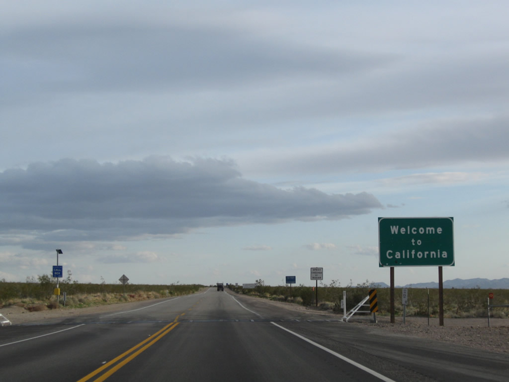
U.S. 95 leaves the Silver State of Nevada and enters the Golden State of California. U.S. 95 follows a two-lane alignment from the state line south along the Piute Wash into the Piute Valley, then meets Historic U.S. 66 at Arrowhead Junction (between Bannock and Ibis). Unlike the segment of U.S. 95 in Nevada to the north, this section of U.S. 95 has more dips and curves, thus warranting a slower speed. Photo taken 02/21/10. |
|
A regulatory sign advises motorists about operating oversize vehicles in California; a phone number is provided for those seeking more information. Photo taken 02/21/10. |
|
As noted earlier, this section of U.S. 95 has several dips, which limits sight distance and makes passing of slower vehicles difficult if not impossible. Photo taken 02/21/10. |
|
Coming out of a dip is an example of limited sight distance. Photo taken 02/21/10. |
|
The first U.S. 95 south reassurance shield is posted soon thereafter. Unlike Nevada and Arizona, California uses cut-out U.S. route markers such as this one on its limited segments of designated U.S. highway. Photo taken 02/21/10. |
|
Some brief sections of U.S. 95 are flat and straight, but these are not very common. Photo taken 04/02/06. |
|
|
In Nevada, U.S. 95 passed under several major power transmission lines. Once again, U.S. 95 passes under another line; this one is a 500kV Southern California Edison power line that leads from the Mohave substation near Laughlin southwest to the Devers substation in Hesperia. Photos taken 04/02/06 and 02/21/10. |
|
|
|
|
|
This series of photos continues to follow U.S. 95 south into the Piute Valley. Prior to meeting U.S. 66, U.S. 95 crosses a railroad crossing that has a fairly rough crossing and warrants a suggested 20 miles per hour. Photos taken 04/02/06 and 02/21/10. |
|
|
|
|
|
Southbound U.S. 95 approaches Historic U.S. 66 west. Through traffic are advised to follow U.S. 95 south to Interstate 40 for through traffic to Barstow and points southwest, but old U.S. 66 offers a much less traveled route west through Goffs. Photos taken 04/02/06 and 02/21/10. |
|
|
At the intersection with U.S. 66 in Arrowhead Junction, a mileage sign provides the distance to Goffs (14 miles west via U.S. 66), Needles (17 miles via U.S. 66 east and U.S. 95 south), and Barstow (150 miles via U.S. 66-95 south to Interstate 40 west). Photos taken 02/21/10. |
| U.S. 95 south and U.S. 66 east |
|
U.S. 66 east and U.S. 95 merge together from Arrowhead Junction southeast to Interstate 40. The routes will remain connected through Needles, then part ways south of the city. Photo taken 04/02/06. |
|
Unlike the segment of U.S. 95 between the Nevada state line and Arrowhead Junction, U.S. 66-95 sees a much flatter and straighter alignment leading to Interstate 40. Photo taken 04/02/06. |
|
|
|
This series of photos follows U.S. 66-95 between Arrowhead Junction and Interstate 40. A market found on the right side of the highway is located along the way. For this section, U.S. 66-95 parallel the railroad that we crossed at Arrowhead Junction. Photo taken 04/02/06. |
|
|
|
|
If traffic or weather conditions warrant, this sign advises motorists to tune to AM 1610 for highway news and information. Photo taken 04/02/06. |
|
Southbound U.S. 95 and eastbound U.S. 66 approaches the interchange with Interstate 40. The first right connects to Interstate 40 west to Barstow; the next left links to Interstate 40 east to Needles. U.S. 95 merges onto Interstate 40 east at this interchange. Photo taken 04/02/06. |
|
Immediately thereafter, southbound U.S. 95 and eastbound U.S. 66 meet Interstate 40 west to Barstow. Continue straight across the bridge to the ramp connecting to Interstate 40 east. Photo taken 04/02/06. |
|
At the junction with Interstate 40, all U.S. 95 south traffic must turn left onto the Interstate 40 east on-ramp. Old U.S. 66 also turns onto the freeway at this point. Photo taken 02/20/05. |
|
Two trailblazers (for U.S. 95 south and Interstate 40 east) are posted below a mileage sign for Needles, which is nine miles east of here. All motorist services (food, gas, lodging) are available in Needles. Photo taken 02/20/05. |
| Interstate 40 (Needles Freeway) east and U.S. 95 south |
|
|
Another set of reassurance shields for Interstate 40 east and U.S. 95 south are posted after the on-ramp from Exit 133. Photos taken 03/30/07 and 02/20/05. |
|
This mileage sign provides the distance to Needles (eight miles), Kingman (72 miles), and Flagstaff (221 miles). Photo taken 03/30/07. |
|
For motorist information, tune radio to AM 1610 when the lights are flashing. Photo taken 03/30/07. |
|
To Lake Havasu City, Arizona, follow Interstate 40 east to Exit 9, Arizona 95 south (27 miles from here). This was placed by the Arizona Department of Transportation by permit with Caltrans. Photo taken 02/20/05. |
|
Another Interstate 40 and U.S. 95 reassurance shield assembly is posted along eastbound. Photo taken 03/30/07. |
|
|
The next exit along Interstate 40 east and U.S. 95 south is Exit 139, U.S. 66 east and River Road Cutoff (Park Road) northeast (one mile). Use Park Road northeast to Needles Highway, which travels north to Laughlin along the east bank of the Colorado River north of Needles. An exit number sign was installed around 2007. Photos taken 03/30/07 and 02/20/05. |
|
|
Interstate 40, U.S. 66, and U.S. 95 enter the city of Needles, located in the Mojave Valley through which the Colorado River runs. Founded in 1883 with the coming of the railroad, and incorporated October 30, 1913, Needles had a population of 4,830 people as of the 2000 Census. A welcome oasis in the desert, all motorist services are available in Needles. For travelers coming south on U.S. 95, Needles is the first city since leaving Henderson, Nevada, near Las Vegas. For Interstate 40 and U.S. 66 travelers, this is the first city since leaving Barstow on the Interstate 15 corridor. Needles is known for its extreme summer temperatures, which can climb in excess of 120 degrees. Be mindful of this when traveling through the desert. Photos taken 03/30/07 and 02/20/05. |
|
|
Eastbound Interstate 40 and southbound U.S. 95 reach Exit 139, U.S. 66/River Road Cutoff east. Immediately upon exiting, turn right to follow Old Historic U.S. 66 (National Trails Highway) east; continue straight to follow Park Road northeast to River Road. To Laughlin, use either Exit 139 (Park Road east) to Needles Highway north or Exit 141, Arizona 95 north via Bullhead City. Photos taken 03/30/07 and 02/20/05. |
|
The next exit along Interstate 40 (Needles Freeway) east and U.S. 95 south is Exit 141, Business Loop I-40 and U.S. 66/Broadway east to Needles, with a link to Arizona 95 north to Bullhead City and Laughlin via a Colorado River bridge along K Street and Harbor Avenue. This interchange also serves River Road and Needles Highway north. Photo taken 03/30/07. |
|
U.S. 66 follows a winding path through the city of Needles. It departed Interstate 40 at Exit 139, crosses the freeway at Exit 141 to become West Broadway (Arch Street), makes a series of turns as it passes through town, and reconnects with Interstate 40 and U.S. 95 at Exit 144. Photo taken 03/30/07. |
|
Various Colorado River access points, with boat launches, camping, and other recreational opportunities, line River Road north of this interchange. Photo taken 03/30/07. |
|
Eastbound Interstate 40 (Needles Freeway) and southbound U.S. 95 approach Exit 141, Business Loop I-40 and U.S. 66/Broadway east to Needles, Needles Highway and River Road north, and Arizona 95 to Laughlin (one mile). Photo taken 03/30/07. |
|
The next three exits along Interstate 40 (Needles Freeway) east and U.S. 95 south serve the city of Needles: Exit 141, Business Loop I-40 and U.S. 66/Broadway; Exit 142, J Street; and Exit 144, U.S. 95 south, Business Loop I-40 west, and U.S. 66/East Broadway. Photo taken 03/30/07. |
|
An interchange sequence sign provides the distance to the next three exits, all of which serve Needles. Photo taken 03/30/07. |
|
Business Loop I-40 follows Historic U.S. 66/Broadway east through Needles. It is generally well-signed, with some reassurance shields dating back to when business route was first commissioned. Photo taken 02/20/05. |
|
Eastbound Interstate 40 (Needles Freeway) and southbound U.S. 95 meet Exit 141, Business Loop I-40 and U.S. 66/Broadway east to Needles, with a link to Arizona 95 north to Bullhead City and Laughlin via a Colorado River bridge along K Street and Harbor Avenue. Photo taken 03/30/07. |
|
The ramp to Exit 141 is a loop ramp, meaning that a right turn goes north and a left turn goes southeast. At the end of the off-ramp to Exit 141 is this sign, advising a right turn to Laughlin (via River Road and Needles Highway) and a left turn to Needles and Bullhead City (via Arizona 95). A brown Historic U.S. 66 trailblazer is posted, but unposted is a Business Loop I-40 trailblazer. Turn left to follow the business loop into Needles. Photo taken 02/20/05. |
|
A reassurance shield for Interstate 40 east and U.S. 95 south is posted after the on-ramp from West Broadway and River Road. Photo taken 03/30/07. |
|
The next exit along Interstate 40 east and U.S. 95 south is Exit 142, J Street (one mile). J Street travels north into downtown Needles, where it meets Business Loop I-40 and U.S. 66/Broadway. Around this point, Interstate 40 turns southeast to follow the Colorado River toward Park Moabi and Topock. Photo taken 02/20/05. |
|
The next three exits along Interstate 40 (Needles Freeway) east and U.S. 95 south are: Exit 142, J Street; Exit 144, U.S. 95 south, Business Loop I-40 west, and U.S. 66/East Broadway; and Exit 148, Historic U.S. 66 (Five Mile Road). Photo taken 02/20/05. |
|
Use J Street north to downtown, then follow the trailblazer signs to the Arizona 95/Harbor Boulevard bridge to Mohave Valley and Bullhead City. Photo taken 03/30/07. |
|
A hospital and the California Highway Patrol are located off the freeway via Exit 142, J Street in Needles. Photo taken 02/20/05. |
|
Eastbound Interstate 40 (Needles Freeway) and southbound U.S. 95 meet Exit 142, J Street. Photo taken 02/20/05. |
|
The next exit along Interstate 40 (Needles Freeway) east and U.S. 95 south is Exit 144, U.S. 95 south, Business Loop I-40 west, and U.S. 66/East Broadway. This is the final Needles interchange. Photo taken 02/20/05. |
|
This reassurance shield assembly only shows Interstate 40 east and omits U.S. 95 south. Photo taken 03/30/07. |
|
Another sign indicates that traffic to Lake Havasu City, Arizona, should continue east along Interstate 40 to Exit 9, Arizona 95 south. This signage is to allay confusion between U.S. 95 and Arizona 95, since there is no access to Lake Havasu City from U.S. 95. Photo taken 02/20/05. |
|
The final three California exits along Interstate 40 east are: Exit 144, U.S. 95 south, Business Loop I-40 west, and U.S. 66/East Broadway; Exit 148, Historic U.S. 66 (Five Mile Road); and Exit 153, Park Moabi Road. Photo taken 02/20/05. |
|
The Mojave Desert Information Center is located off the freeway at Exit 144; visit here for maps and attractions in the Mojave Desert. Photo taken 02/20/05. |
|
Another Desert Information sign is posted prior to the gore point for Exit 144. Photo taken 02/20/05. |
|
Interstate 40 east and U.S. 95 south split at Exit 144, U.S. 95 south. At this interchange, Business Loop I-40 and U.S. 66/East Broadway travel west back toward downtown Needles. U.S. 66 east, meanwhile, follows U.S. 95 south, then cuts east again via Five Mile Road to Interstate 40. At this interchange, the continuation of Arizona 95 joins the freeway. The state route will appear on an upcoming mileage sign and is cosigned with Interstate 40 upon crossing the Colorado River. Caltrans declined to cosign the route in California citing confusion with U.S. 95. Photo taken 02/20/05. |
| U.S. 95 south and U.S. 66 east |
|
As U.S. 95 joins Broadway and U.S. 66 in east Needles, the on-ramp for Interstate 40 east is signed for Kingman and Lake Havasu City. Continue south for U.S. 95 to Vidal Junction and Blythe. Make a U-Turn back to Business Loop I-40 and U.S. 66 west to Needles. (The business route is the original U.S. 95 alignment through Needles; the route was moved onto the freeway.) Photo taken 03/14/09. |
Page Updated August 2, 2009.