This page showcases extant segments of Historic U.S. 80 through El Cajon, Bostonia, Lakeside, Crest, Alpine, and Viejas.
| Business Loop I-8 & Historic U.S. 80 east |
|
Historic U.S. 80 essentially lies beneath Interstate 8 between the California 125-Grossmont Boulevard-La Mesa Boulevard interchange in La Mesa and the Exit 15 El Cajon Boulevard interchange in El Cajon. Here, Historic U.S. 80 departs from Interstate 8 east at Exit 15. The right lane will depart to Chase Avenue, while the left two lanes continue east on Business Loop I-8 (El Cajon Boulevard) toward El Cajon Boulevard. Through traffic may use the left two lanes for El Cajon Boulevard east or take the exit right onto Chase Avenue, then proceed through the traffic signal to rejoin El Cajon Boulevard east. Photo taken 02/11/12. |
|
The left two lanes continue east on Business Loop I-8 (El Cajon Boulevard). The right lane departs to Chase Avenue. The business loop route marker seen in the next picture can also be seen in this picture. Photo taken 02/11/12. |
|
A shield for Business Loop I-8 east posted along the off-ramp from eastbound El Cajon Boulevard to Chase Avenue presumably reminded motorists to continue straight ahead to merge back onto the route east to Downtown El Cajon. Photo taken 02/07/05. |
|
|
|
|
| The mainline Business Loop I-8 (El Cajon Boulevard) passes over Chase Avenue, and the bridge separates traffic to allow through traffic passage over Chase Avenue. At the end of the bridge, El Cajon Boulevard will merge with traffic from Chase Avenue, then meet Boulevard Place at a traffic signal. Photos taken 02/11/12. |
|
|
Nearing the signalized intersection with Boulevard Place, motorists can turn right here, follow Boulevard Place south, Grossmont Avenue west, Chase Avenue north, and El Cajon Boulevard west to Interstate 8 west to La Mesa and San Diego. The sign for Interstate 8 west was replaced between 2006 and 2012 due to fading. Photos taken 02/11/12 and 10/21/06. |
|
Eastbound Business Loop I-8 (El Cajon Boulevard) meets Boulevard Place at this traffic signal. A landscape median separates the two directions of El Cajon Boulevard. Photo taken 02/11/12. |
|
A Historic U.S. 80 route marker is posted along eastbound El Cajon Boulevard after the Boulevard Place signalized intersection. Photo taken 10/21/06. |
|
A median sign welcomes motorists along Business Loop I-8 and Historic U.S. 80 east into the city of El Cajon. Incorporated on November 12, 1912, El Cajon had a population of 99,478 as of the 2010 Census. Photo taken 10/21/06. |
|
At this traffic signal, eastbound Business Loop I-8 and Historic U.S. 80 meet Washington Avenue east and Marshall Avenue north. Photo taken 10/21/06. |
|
|
This is the first shield found along eastbound Business Loop I-8 in the city of El Cajon, immediately after exiting the Interstate 8 freeway. The shield was installed in 2002. Photos taken 10/21/06 and 02/11/12. |
|
Billboards and businesses line the aptly named Business Loop I-8 as it travels northeast along El Cajon Boulevard toward downtown El Cajon. Photo taken 02/11/12. |
|
Eastbound Business Loop I-8 (El Cajon Boulevard) meets Johnson Avenue at this traffic signal. Photo taken 02/11/12. |
|
Business Loop I-8 will shift from El Cajon Boulevard onto Main Street at the Douglas Avenue intersection. Through traffic is encouraged to bypass downtown via Douglas Avenue and Claydelle Avenue. Business traffic should stay left to follow Main Street into downtown El Cajon. Photo taken 06/25/09. |
|
Theatre goers are also encouraged to use Douglas Avenue rather than Business Loop I-8/Main Street. Photo taken 06/25/09. |
|
The right lane of Business Loop I-8 shifts from El Cajon Boulevard onto Douglas Avenue. Turn left here for Main Street west. Photo taken 06/25/09. |
|
Business Loop I-8 (El Cajon Boulevard) meets Douglas Avenue at this traffic signal. This marks the eastern extent of El Cajon Boulevard, which originated in University Heights. Photo taken 06/25/09. |
|
Streetscape narrowed Main Street through downtown Main Street, keeping only one lane in each direction with ample parking. Businesses line both sides of Main Street (Historic U.S. 80). Photo taken 06/25/09. |
|
|
Passing through downtown El Cajon, Business Loop I-8 (Main Street) used to have white painted traffic signals such as this one located at Sunshine Avenue, but this changed along with a streetscaping project by 2012. Photos taken 02/11/12 and 06/25/09. |
|
|
Eastbound Business Loop I-8 and Historic U.S. 80 approaches Magnolia Street (former California 67). On June 10, 2009, the city of El Cajon dedicated a new arch that spans Main Street just west of the Magnolia Street intersection. Photo taken 06/25/09. |
|
Eastbound Business Loop I-8 (Main Street) meets Magnolia Avenue (old California 67/) at this signalized intersection. This is considered to be the centerpiece of downtown El Cajon. Turn left here to follow Magnolia Avenue north to California 67 north to Santee, Lakeside, and Ramona. Photo taken 02/07/05. |
|
A Historic U.S. 80 route marker is posted on eastbound Business Loop I-8/Main Street at its intersection with Sulzfeld. Photo taken 06/25/09. |
|
Eastbound Business Loop I-8 (Main Street) meets Claydelle Avenue at this traffic signal. Turn left here for El Cajon city hall and the civic theatre. Photo taken 06/25/09. |
|
Leaving downtown El Cajon, eastbound Business Loop I-8 (Main Street) meets Mollison Avenue at this traffic signal. Turn left here to return to Interstate 8. Photo taken 06/25/09. |
|
A Historic U.S. 80 route marker is posted along eastbound Business Loop I-8/Main Street prior to the Anza Street traffic signal. Photo taken 02/11/12. |
|
Eastbound Business Loop I-8 and Historic U.S. 80 (Main Street) meet First Street at this traffic signal. Photo taken 02/11/12. |
|
Soon thereafter, eastbound Business Loop I-8 and Historic U.S. 80 (Main Street) meet Ballard Street. Photo taken 02/11/12. |
|
Another Historic U.S. 80 route marker is posted after Ballard Street. Photo taken 02/11/12. |
|
Eastbound Business Loop I-8 and Historic U.S. 80 (Main Street) meet Second Street (north) and Jamacha Road (south) at this traffic signal. This used to be California 54 but became California 54 Business in 1999. The business route designation replaced California 54 within El Cajon. It officially begins at the southern city limits of El Cajon and proceeds north to Interstate 8. There are no California 54 Business signs along eastbound Business Loop I-8. Photo taken 02/11/12. |
|
We find this Historic U.S. 80 route marker on eastbound Business Loop I-8/Main Street after the California 54 Business (Jamacha Road) intersection. The next traffic signal is with Melody Lane. Photo taken 10/21/06. |
|
Main Street passes by the East County Auto Center. Photo taken 02/11/12. |
|
Eastbound Business Loop I-8 and Historic U.S. 80 (Main Street) meet Madison Avenue at this traffic signal. Photo taken 02/11/12. |
|
After the intersection with Oakdale Avenue, eastbound Business Loop I-8 and Historic U.S. 80 (Main Street) connect with an on-ramp to Interstate 8 to El Centro. The business loop continues ahead to Greenfield Drive, although one could argue that this on-ramp is a logical eastern end of the business loop due to the easy access back to Interstate 8 east. Photo taken 02/11/12. |
|
At the freeway entrance to Interstate 8 east, Business Loop I-8 and Historic U.S. 80 (Main Street) pass under the busy freeway. Photo taken 02/11/12. |
|
Shortly thereafter, eastbound Business Loop I-8 and Historic U.S. 80 (Main Street) meet Third Street. Photo taken 02/11/12. |
|
Business Loop I-8 and Historic U.S. 80 (Main Street) retain five lanes between Interstate 8 and Greenfield Drive in eastern El Cajon. Photo taken 02/11/12. |
|
The next traffic signal along eastbound Business Loop I-8 and Historic U.S. 80 (Main Street) is with Broadway. Photo taken 02/11/12. |
|
This shield assembly for both Interstate 8 and Historic U.S. 80 is posted between Broadway and Greenfield Drive, which is the next intersection. Turn right ahead for the connection to Interstate 8 east to El Centro and west to San Diego. Continue ahead on Main Street for Historic U.S. 80 and Highway 8 Business. Photo taken 10/21/06. |
|
Eastbound Historic U.S. 80 and Business Loop I-8/Main Street meet Greenfield Drive at this intersection. Turn right here for a connection back to Interstate 8 and Greenfield Drive south toward Granite Hills, San Diego Christian College, and Shadow Mountain Community Church. Photo taken 10/21/06. |
|
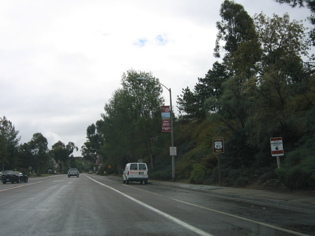
Eastbound Historic U.S. 80 (Main Street) meets Pepper Drive at this traffic signal. Use Pepper Drive northwest to the unincorporated community of Bostonia, which sits between El Cajon and Lakeside. Photo taken 02/11/12. |
|
|
Upon leaving the city of El Cajon, Main Street becomes known as Highway 8 Business, a road maintained by San Diego County. Unofficially, this road is also Business Loop I-8, although no signs attest to this designation. (Officially, Business Loop I-8 departs from Main Street at Greenfield Drive, but many maps show the official business loop extending east on "Highway 8 Business" to Lake Jennings Park Road.) This Historic U.S. 80 sign is posted just after the intesection with Lavala Lane. Historic U.S. 80 will follow Highway 8 Business from Lavala Lane east past Los Coches Road to Lake Jennings Park Road. Photos taken 10/14/06 and 02/11/12. |
|
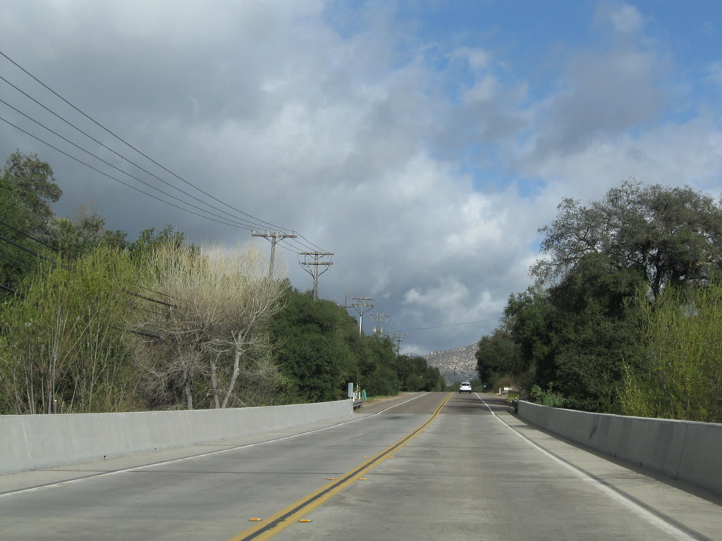
Clouds amass in the mountains as Historic U.S. 80 and Highway 8 Business proceed east between Pepper Drive and Los Coches Road. Photo taken 02/11/12. |
|
Eastbound Historic U.S. 80 and Highway 8 Business approaches the signalized intersection with Los Coches Road. Turn left at this intersection to Lakeside. Photo taken 02/11/12. |
|
To Interstate 8, use Los Coches Road south. A neutered shield placed by San Diego County is posted here. Photo taken 02/11/12. |
|
Eastbound Historic U.S. 80 and Highway 8 Business meet Los Coches Road at this signalized intersection. Turn left here for Los Coches Road north to Lakeside and south to Interstate 8. Photo taken 02/11/12. |
|
Another Historic U.S. 80 route marker is posted along eastbound Highway 8 Business after the intersection with Los Coches Road. Photo taken 02/11/12. |
|
Highway 8 Business passes by this rock cut as it proceeds east/northeast, parallel to Interstate 8. Photo taken 02/11/12. |
|
Near this storage facility, look for some older remnant concrete that winds behind the storage garages on the right side of the old highway. Photo taken 02/11/12. |
|
Businesses and industrial yards line this stretch of Highway 8 Business. Photo taken 02/11/12. |
|
A middle turn lane briefly forms, but the road remains one lane in each direction. Photo taken 02/11/12. |
|
Continuing east, Historic U.S. 80 and Highway 8 Business pass under a set of San Diego Gas and Electric powerlines. These lines originate at the Miguel substation near the California 125 (South Bay Expressway)-San Miguel Ranch Road interchange. They travel north through the Los Coches substation near Lake Jennings en route to the Mission substation visible above Mission Valley just east of Interstate 805 in Serra Mesa. Photo taken 02/11/12. |
|
At Lake Jennings Park Road, Historic U.S. 80 turns south to meet Interstate 8, then connects with Olde Highway 80 south of the freeway. Photo taken 02/11/12. |
| Historic U.S. 80 east |
|
Eastbound Historic U.S. 80 and southbound Lake Jennings Park Road meet the on-ramp to Interstate 8 west to El Cajon and San Diego. Stay right for a loop ramp onto Interstate 8 east to El Centro. Photo taken 02/11/12. |
|
After passing under Interstate 8, eastbound Historic U.S. 80 and southbound Lake Jennings Park Road meet Interstate 8 east to El Centro. To continue east on Historic U.S. 80, turn left onto Olde Highway 80. Photo taken 02/11/12. |
|
Eastbound Historic U.S. 80 resumes along old alignment. Locally signed as "Olde Highway 80," Historic U.S. 80 will again follow Interstate 8 from here east past Flinn Springs to Alpine. Photo taken 02/11/12. |
|
|
|
|
|
| This series of pictures follows eastbound Historic U.S. 80 (Olde Highway 80) as the old road passes through the unincorporated community of Flinn Springs. A right turn connects to Flinn Springs County Park, which offers day use recreational activities. After passing by the small commercial area, Olde Highway 80 proceeds under Interstate 8 to return to the north side of the freeway. Photos taken 02/11/12. |
|
|
|
|
|
| Eastbound Historic U.S. 80 (Olde Highway 80) stays on the north side of the freeway until reaching an intersection with Dunbar Lane. At that intersection, travelers must turn south under the freeway again and then proceed east again along Alpine Boulevard. The Dunbar Lane intersection occurs right after Olde Highway 80's seventh milepost. Photos taken 02/11/12. |
|
Turning south again, eastbound Historic U.S. 80 and southbound Dunbar Lane pass under Interstate 8. The next right connects to Interstate 8 west to El Cajon and San Diego. Photo taken 02/11/12. |
|
An auxiliary sign advises motorists that the next left turn will lead toward Sycuan Indian Reservation. Additionally, eastbound Historic U.S. 80 will also turn left onto Alpine Boulevard. Photo taken 02/11/12. |
|
Dunbar Lane comes to an end. Turn left at Alpine Boulevard for the continuation of Historic U.S. 80 east to Alpine and Harbison Canyon. The next left also connects to Interstate 8 east to El Centro. Photo taken 02/11/12. |
|
Now on Alpine Boulevard, a mileage sign advises that Sycuan Indian Reservation is seven miles ahead via Historic U.S. 80. Photo taken 02/11/12. |
|
Shortly thereafter, eastbound Historic U.S. 80 (Alpine Boulevard) meets the on-ramp to Interstate 8. Continue ahead for Alpine Boulevard east to Alpine. Photo taken 02/11/12. |
|
Historic U.S. 80 enters the unincorporated community of Alpine. Located in the foothills of the Laguna Mountains east of San Diego and El Cajon, Alpine had a population of 14,236 as of the 2010 Census and continues to see growth as more suburban-style development encroaches on the more rural development that used to be common here. Sitting at an elevation of 1,841 feet, Alpine marks the approximate halfway point between the ocean (sea level) and the heights of Laguna Summit (el. 4,050 feet) on Interstate 8. Photo taken 02/11/12. |
|
This Historic U.S. 80 route marker sign is posted along eastbound Alpine Boulevard east of Dunbar Lane and the Interstate 8 interchange. From here, the historic route will proceed along Alpine Boulevard toward dowtown Alpine. Look for an upcoming right turn to Arnold Way, which is the original U.S. 80 alignment before the more modern Alpine Boulevard alignment was constructed. Photo taken 02/11/12. |
|
To Sycuan Indian Reservation, follow Arnold Way southeast, Harbison Canyon Road south, and Dehesa Road southwest. Arnold Way is a notable old alignment of U.S. 80, but the signed Historic U.S. 80 Route proceed east along Alpine Boulevard. Photo taken 02/11/12. |
|
Eastbound Historic U.S. 80 (Alpine Boulevard) meets Peutz Valley Road, which travels northeast into Peutz Valley. Photo taken 02/11/12. |
|
Continuing into Alpine, eastbound Historic U.S. 80 (Alpine Boulevard) meets Tavern Road at this signalized intersection. Turn left for Business Loop I-8 and Tavern Road south to Interstate 8 at Exit 30, or turn right for Tavern Road south to Dehesa Road and Japatul Road. Photo taken 02/11/12. |
| Business Loop I-8 & Historic U.S. 80 east |
|
Leaving the intersection with Tavern Road, Business Loop I-8 and Historic U.S. 80 proceed east along Alpine Boulevard. Another U.S. 80 historic route marker sign is posted along eastbound Alpine Boulevard east of Tavern Road, but the business loop is unsigned. Photo taken 10/14/06. |
|
Banners such as this one advertising Historic U.S. 80 were posted along Alpine Boulevard in the week prior to the official dedication of U.S. 80 as a historic route recognized by the state of California. Photo taken 10/14/06. |
|
Now east of downtown Alpine, eastbound Historic U.S. 80 (Alpine Boulevard) proceeds along the south side of Interstate 8 and will cross the freeway again at Exit 33, Willows Road. Photo taken 02/11/12. |
|
|
Remains from an old Cleveland National Forest sign are still identifiable on the south side of Alpine Boulevard in 2012, but the sign was still there in 2005. This marker established the western boundary of the national forest. Photos taken 02/11/12 and 01/16/05. |
|
Eastbound Historic U.S. 80 (Alpine Boulevard) approaches Willows Road. Photo taken 02/11/12. |
|
At this intersection, turn left onto Willows Road to cross over Interstate 8 and connect to Viejas Indian Reservation. Photo taken 02/11/12. |
| Historic U.S. 80 east |
|
Turning north briefly, Willows Road crosses over Interstate 8 at this diamond interchange. Turn right for Interstate 8 east to El Centro. The next left connects to Interstate 8 west to San Diego. Photo taken 02/11/12. |
|
A two-lane bridge carries Willows Road over Interstate 8. Photo taken 02/11/12. |
|
Eastbound Historic U.S. 80 (Alpine Boulevard) meets Interstate 8 (Kumeyaay Highway) west to San Diego. Photo taken 02/11/12. |
|
Leaving the Interstate 8 and West Willows Road interchange (Exit 33), this Historic U.S. 80 route marker is posted along eastbound Willows Road. Ahead, the historic route will enter the reservation of the Viejas Band of Kumeyaay Indians. Photo taken 10/14/06. |
|
Interstate 8 briefly comes into view behind the chain-link fence along eastbound Historic U.S. 80 (Willows Road). While passing through the Viejas Indian Reservation, Historic U.S. 80 follows Willows Road just north of and parallel to Interstate 8. Photo taken 10/14/06. |
|
Willows Road curves away from Interstate 8. Photo taken 02/11/12. |
|
Eastbound Historic U.S. 80 (Willows Road) approaches Viejas Grade Road. Photo taken 02/11/12. |
|
After the Viejas Grade Road intersection, eastbound Historic U.S. 80 (Willows Road) crosses Viejas Creek. This bridge was replaced in 1997; the original 1933 bridge (picture shown on Casey Cooper's U.S. 80 page) featured some old highway features such as divoted curbing and white wooden bridge railing. Photo taken 02/11/12. |
|
U.S. 80 enters the Viejas Indian Reservation. Photo taken 02/11/12. |
|
Eastbound U.S. 80 widens as it approaches the Viejas Casino and outlet mall. Photo taken 02/11/12. |
|
Lush landscaping lines both sides of Historic U.S. 80 (Willows Road) the highway travels through the center of the Viejas Band of Kumeyaay Indian reservation. Casino, hotel, and outlet mall parking is available on both sides of the old highway. Photo taken 10/14/06. |
|
Approaching the casino, a traffic signal allows pedestrians to cross Willows Road between the outlet stores on the sout) side of the road and the Viejas Casino on the north side. Photo taken 10/21/06. |
|
The palms that line Historic U.S. 80 (Willows Road) near Viejas Casino were not an original installation, but were added when the casino and outlet shops were constructed. According to Viejas Band of Kumeyaay Indians's Tribal Gaming History page, the Viejas Casino started Las Vegas-style gambling on June 14, 2000; this was the first tribal gaming facility to feature such games in California. Authorization for such gambling came from Traffic increased in the ensuing years, resulting in the growth seen along Willows Road (including the modern casino, outlet shops, and hotel).1 Photo taken 10/21/06. |
|
Historic U.S. 80 (Willows Road) passes between Viejas Casino and the outlet shops. Photo taken 10/21/06. |
|
Eastbound Historic U.S. 80 (Willows Road) passes alongside the Viejas Casino parking lot, with the speed limit increasing as it leads away from the most congested areas around the casino. Photo taken 10/21/06. |
|
Towering rock formations and large boulders along the south slope of Poser Mountain and the Viejas Grade come into view along eastbound Historic U.S. 80 (Willows Road). Photo taken 10/21/06. |
|
Eastbound Historic U.S. 80 (Willows Road) curves south to rejoin with Interstate 8 east of the Viejas Indian Reservation. To continue east on U.S. 80, turn east on Interstate 8 for about four miles to the California 79 interchange (Exit 40). Photo taken 10/21/06. |
|
Historic U.S. 80 (Willows Road) meets Interstate 8. To continue east on Historic U.S. 80, take Interstate 8 east. Photo taken 02/11/12. |
|
This view looks east along Interstate 8 from the East Willows Road interchange (Exit 33). This section of Interstate 8 directly overlays U.S. 80 (as far east as the Vista Point). Photo taken 01/16/05. |
Page Updated February 12, 2013.