This page showcases extant segments of Historic U.S. 80 and Historic U.S. 395 from the corner of Harbor Drive and Market Street in downtown San Diego east to Market Street and Park Boulevard (Twelfth Avenue). The two routes then turned north along Park Boulevard past Balboa Park into Hillcrest, then turned east again at El Cajon Boulevard into University Heights and North Park.
| Historic U.S. 80 & Historic U.S. 395 north |
|---|
|
|
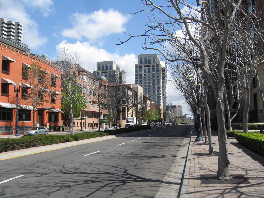
In the shadow of the Hyatt towers near San Diego Bay and Seaport Village in downtown San Diego, Market Street (U.S. 80-395) begins at its intersection with Harbor Drive (U.S. 101). While this intersection has not always served as the western terminus of U.S. 80, it is the last serving endpoint before the route was relocated to the current Interstate 8 freeway (and ending at the current Interstate 5 and Interstate 8 interchange near the Presidio). After U.S. 80 and U.S. 395 were fully decommissioned from San Diego, Market Street was briefly signed as California 163 before that route was retracted to cover only the freeway segment north of Ash Street. Photos taken 02/27/11. |
|
|
Historic U.S. 80-395 proceed east along Market Street toward the Gaslamp Quarter in downtown San Diego. Photos taken 02/27/11. |
|
|
|
|
|
| This series of pictures follows U.S. 80 east and U.S. 395 north along eastbound Market Street past Union Street, Front Street, First Avenue, Second Avenue, Third Avenue, and Fourth Avenue. Photos taken 02/27/11. |
|
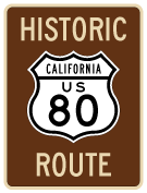
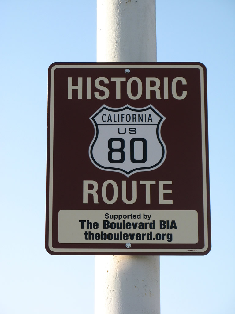
A Historic U.S. 80 Route marker is posted along eastbound Market Street between Fourth Avenue and Fifth Avenue. This sign was posted in 2010. Photo taken 02/27/11. |
|
Eastbound Market Street meets Fifth Avenue in the Historic Gaslamp Quarter in downtown San Diego. Fifth Avenue travels one-way northbound toward the Financial District, Bankers Hill, and Hillcrest. Photo taken 02/27/11. |
|
|
This Historic U.S. Route 80 sign is posted on a street light on eastbound Market Street after the intersection with Fifth Avenue in downtown San Diego. Historic U.S. 395 is not signed in downtown as of 2011. Photos taken 02/27/11. |
|
U.S. 80 east and U.S. 395 north turn from Market Street east to Park Boulevard (former 12th Avenue) north. This segment is now known in its entirety as Park Boulevard. Before that, U.S. 80 and U.S. 395 followed former 12th Avenue from Market Street to near San Diego High School, where it changed into Park Boulevard. Photo taken 12/27/10. |
|
The San Diego Trolley now uses Park Boulevard; most motor traffic now uses the one-way couplet of 10th Avenue (southbound) and 11th Avenue (northbound). Photo taken 12/27/10. |
|
Eastbound U.S. 80 and northbound U.S. 395/Park Boulevard approaches G Street. Turn right here for G Street east to California 94 (Martin Luther King, Jr. Freeway). Photo taken 12/27/10. |
|
Northbound Park Boulevard meets F Street, which travels west to Horton Plaza (at Fourth Avenue). Photo taken 12/27/10. |
|
U.S. 80 east and U.S. 395/Park Boulevard north next approaches E Street. Photo taken 12/27/10. |
|
Northbound Park Boulevard meets Broadway. The San Diego Trolley curves off Park Boulevard here, which is known as the Smart Corner. The San Diego Trolley uses this block to curve from Park Boulevard north to C Street west. Photo taken 12/27/10. |
|
The wide walkway along Park Boulevard serves as part of the Bay to Park link, connecting San Diego Bay near Petco Park with Balboa Park. Photo taken 12/27/10. |
|
Northbound Park Boulevard meets C Street. Park Boulevard now carries both directions of vehicular traffic. Photo taken 12/27/10. |
|
One block further north, Park Boulevard approaches B Street. Use B Street west to the Financial District and Civic Center in downtown San Diego. Photo taken 12/27/10. |
|
At B Street, this sign advises motorists to California 163 (Cabrillo Freeway) north to follow Park Boulevard north to a dedicated on-ramp located about an eighth of a mile from here. Another option would be to turn left on B Street, then turn right on 11th Avenue to California 163 north. Photo taken 12/27/10. |
|
Northbound Park Boulevard meets A Street. No turns are permitted. On the east side of Park Boulevard is San Diego City College and San Diego High School. Photo taken 12/27/10. |
|
Another California 163 trailblazer is located in the median of Park Boulevard after the A Street intersection. This sign used to look like the one seen at B Street, but it was replaced once the original sign was damaged in an accident. Photo taken 12/27/10. |
|
Northbound Park Boulevard passes by San Diego High School and San Diego City College. Photo taken 01/21/11. |
|
A bus stop is located in the median of Park Boulevard near San Diego High School. Photo taken 01/21/11. |
|
Northbound Park Boulevard (U.S. 80 east and U.S. 395 north) next approaches the freeway on-ramp to Interstate 5 south to National City, Chula Vista, and San Ysidro. Photo taken 01/21/11. |
|
Turn left here for the loop ramp on to Interstate 5 south. Continue straight for the connection to California 163 (Cabrillo Freeway) north and Balboa Park via Park Boulevard north. Photo taken 01/21/11. |
|
A freeway entrance shield assembly is posted on the west side of Park Boulevard for the on-ramp to Interstate 5 (Montgomery Freeway) south. Photo taken 04/21/11. |
|
A trailblazer for California 163 north is posted in the median of Park Boulevard. Turn left for the ramp to California 163 north. This ramp also used to connect to Interstate 5 north until the ramp was removed. Photo taken 01/21/11. |
|
|
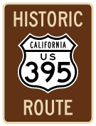
A brown Historic U.S. 395 marker was posted along northbound Park Boulevard in September 2011. Now we'll wait for a Historic U.S. 80 marker to accompany it. Photos taken 09/29/11. |
|
Northbound Park Boulevard (U.S. 80 east and U.S. 395 north) meets the on-ramp to California 163 (Cabrillo Freeway) north to Escondido. The freeway served as U.S. 395 from its construction in 1947 until it was replaced by California 163 in the early 1970s. Photo taken 04/21/11. |
|
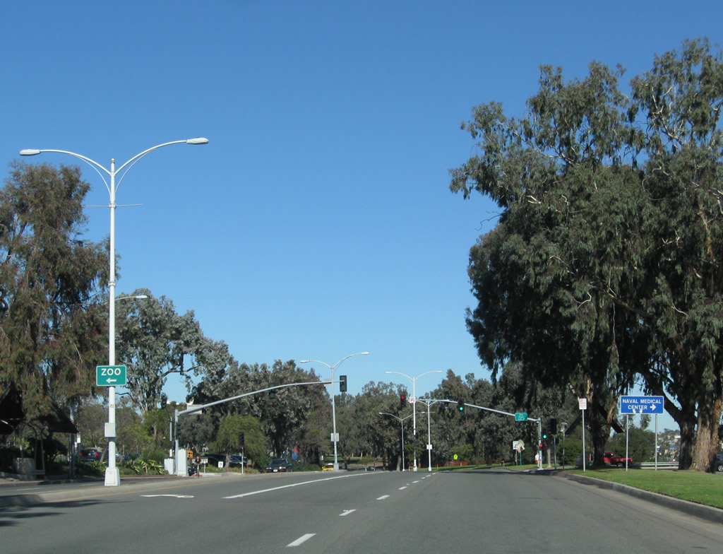
Entering Balboa Park, northbound Park Boulevard approaches Presidents Way. Turn left here for most park attractions such as museums, international cottages, El Prado, and Plaza de Panama. However, for access to the World Famous San Diego Zoo, continue north on Park Boulevard. Photo taken 01/21/11. |
|
Between Presidents Way and Inspiration Point Way, Park Boulevard continues with two lanes in each direction with a landscaped median (mostly turf with eucalyptus trees). Photo taken 01/21/11. |
|
Northbound Park Boulevard meets Inspiration Point Way at this traffic signal. Turn right here for the Veterans Memorial and Balboa Park Administration Building. Photo taken 01/21/11. |
|
|
|
|
|
| This series of pictures follows Park Boulevard north through Balboa Park between Inspiration Way and Zoo Place. Most of the developed park areas are to the west of Park Boulevard. In addition to parking located on Presidents Way, plenty of parking is also available at Zoo Place next to the World Famous San Diego Zoo. A pedestrian bridge connects the east end of El Prado with the rose garden and xeriscape garden on the east side of Park Boulevard. Photos taken 01/21/11. |
|
|
|
|
|
|
Northbound Park Boulevard meets Zoo Place at this traffic signal. Turn left here for the San Diego Zoo or right for the Naval Hospital and Florida Canyon. Photo taken 01/21/11. |
|
Continuing north, Park Boulevard passes by the zoo parking area and the War Memorial Building. Photo taken 01/21/11. |
|
Park Boulevard curves as it prepares to leave Balboa Park. Photo taken 01/21/11. |
|
Northbound Park Boulevard meets Zoo Drive and Morley Field Drive . Photo taken 01/21/11. |
|
Park Boulevard leaves Balboa Park and enters the neighborhood of Hillcrest. Photo taken 01/21/11. |
|
|
|
Park Boulevard proceeds north through eastern Hillcrest, passing through a residential and commercial area prior to reaching University Avenue. To the east lies the community of North Park. Photos taken 01/21/11. |
|
|
|
Continuing north, Park Boulevard swerves a bit near Robinson Avenue and Indiana Street before approaching University Avenue. Photos taken 01/21/11. |
|
Northbound Park Boulevard meets University Avenue, which travels east to North Park and City Heights and west to downtown Hillcrest and Mission Hills. Photo taken 01/21/11. |
|
A four-way stop is posted at Park Boulevard and Lincoln Avenue one block north of University Avenue. Photo taken 01/21/11. |
|
The center median along this stretch of Park Boulevard is planned to become a transit station once bus rapid transit is installed between downtown and El Cajon Boulevard. Photo taken 01/21/11. |
|
Northbound Park Boulevard approaches Polk Avenue. Photo taken 01/21/11. |
|
One block north, Park Boulevard approaches Howard Avenue. Photo taken 01/21/11. |
|
|
By 2012, a trailblazer marker for Historic U.S. 395 was added on northbound Park Boulevard on a centerline light pole between Howard Avenue and El Cajon Boulevard. The 395 signs were placed in addition to an already-existing U.S. 80 historic route sign situated on the next light post. Photos taken 05/07/12. |
|
And shortly thereafter, Park Boulevard approaches El Cajon Boulevard. Both U.S. 80 and U.S. 395 turned right onto El Cajon Boulevard, and the two routes stayed merged on the boulevard as far east as Fairmount Avenue. Business Loop I-8 is sporadically signed along El Cajon Boulevard, but signs are generally disappearing. Photo taken 01/21/11. |
|
Northbound U.S. 80-395/Park Boulevard shifts onto El Cajon Boulevard in the University Heights community of the city of San Diego. At this point, U.S. 80 turns east from Park Boulevard onto El Cajon Boulevard. This was the alignment of U.S. 80 from 1930 until 1947, when the route was relocated to the Cabrillo Freeway (modern California 163). The Cabrillo Freeway served as U.S. 80 from 1947 to 1953, until U.S. 80 was relocated onto the Mission Valley (Alvarado) Freeway (from 1953 to 1972). Signs for Old U.S. 80 were placed in March 2008. Photo taken 05/15/08. |
|
The first trailblazers for the El Cajon Boulevard segment of Historic U.S. 80 were placed by the El Cajon Boulevard Business Improvement Association. U.S. 395 is not acknowledged on these historical markers, although it would be accurate to show U.S. 395 since El Cajon Boulevard served as part of its alignment prior to the completion of today's California 163 (Cabrillo Freeway). Photo taken 05/15/08. |
|
Northbound Park Boulevard meets El Cajon Boulevard at this traffic signal. El Cajon Boulevard east and Normal Street southwest are part of Business Loop I-8, although many of the business route shields were removed in 2002. Some shields remain closer to 54th Street, but it is likely that the business loop designation will see its signs removed and the designation fully decommissioned soon. Photo taken 05/15/08. |
Page Updated February 12, 2013.