| Interstate 215 north |
|
|
Interstate 215 begins its northerly journey at Murrieta Hot Springs. Upon splitting from Interstate 15, the freeway passes through some largely agricultural areas between Temecula and Moreno Valley, following Old U.S. 395 the whole way. This first mileage sign provides the distance to the first three exits on northbound: Exit 1, Murrieta Hot Springs; Exit 2, Los Alamos Road; and Exit 4, Clinton Keith Road. Photos taken 09/28/08 and 02/20/05. |
|
This section of Interstate 215 is known as the Riverside County Deputy Sheriff Eric Andrew Thach Memorial Freeway. Use Exit 1 to the city of Murrieta, a "great place to grow." Murrieta is the southern terminus of Interstate 215 and is another rapidly growing community in the Temecula Valley. Like Temecula, Murrieta incorporated relatively recently (July 1, 1991). Murrieta is named for Esequial Murrieta, who purchased 52,000 acres and transferred the property to his brother, Juan Murrieta, in 1873. The region was mostly agricultural at that time, but development increased with the coming of Interstate 15 in the 1970s and 1980s (just as in neighboring Temecula). The city's population was 44,282 as of the 2000 Census, and California Department of Finance estimates place the 2007 population of Murrieta at 97,257. Photo taken 06/24/07. |
|
|
Northbound Interstate 215 at Exit 1, Murrieta Hot Springs. Development at this interchange exploded between 2004 and 2008, and this is evidenced by the new buildings that appear in 2008 photos. Photos taken 09/28/08 and 02/20/05. |
|
The next exit along Interstate 215 north is Exit 2, Los Alamos Road. This sign is posted within the Murrieta Hot Springs interchange. After leaving the city of Murrieta, the next destination along Interstate 215 is Sun City, ten miles north of here. Photo taken 09/28/08. |
|
After the on-ramp from Murrieta Hot Springs Road (Exit 1) is the first reassurance marker for Interstate 215 north. Most of the Interstate 215 shields between the southern terminus with Interstate 15/Temecula Valley Freeway and California 60 (Moreno Valley Freeway) tend to be of a smaller size than what is typically found on a mainline freeway in California. Photo taken 11/10/08. |
|
|
This mileage sign provides the distance to the next three exits along northbound Interstate 215: Exit 2, Los Alamos Road; Exit 4, Clinton Keith Road; and Exit 7, Scott Road. In the distance is a mileage sign providing the distance to Sun City, Photos taken 11/10/08 and 09/28/08. |
|
|
Northbound Interstate 215 (Escondido Freeway) reaches Exit 2, Los Alamos Road. Like the Murrieta Hot Springs Road interchange to the south, this interchange has seen significant development since 2000. Photos taken 09/28/08 and 11/10/08. |
|
Between 2006 and 2008, the Los Alamos Road overpass was widened. Photo taken 09/28/08. |
|
A neutered Interstate 215 shield is posted after the on-ramp from Los Alamos Road. This shield was replaced after the Los Alamos Road overpass was reconstructed. Photo taken 09/28/08. |
|
The next exit along Interstate 215 north is Exit 4, Clinton Keith Road (one-half mile). The next exits are for Scott Road (four miles) and Newport Road (six miles). Photo taken 09/28/08. |
|
Mileage sign for the next three exits along northbound: Exit 4, Clinton Keith Road; Exit 7, Scott Road; and Exit 10, Newport Road. Photo taken 11/10/08. |
|
Northbound Interstate 215 reaches Exit 4, Clinton Keith Road. Photo taken 11/10/08. |
|
After passing under Clinton Keith Road overpass along northbound, an Interstate 215 is posted after the on-ramp. Photo taken 02/20/05. |
|
This mileage sign provides the distance to Sun City (six miles), Perris (13 miles), and Moreno Valley (25 miles, via California 60 (Moreno Valley Freeway) east). Photo taken 02/20/05. |
|
|
The next exit along northbound is Exit 7, Scott Road (one mile). An exit number sign was added in 2008, replacing the earlier reflective sign shown in the 2004 photo. Photos taken 09/28/08 and 02/20/05. |
|
|
This interchange sequence sign provides the distance to the next three exits along northbound Interstate 215 (Escondido Freeway): Exit 7, Scott Road; Exit 10, Newport Road; and Exit 12, McCall Boulevard/Sun City. Photos taken 09/28/08 and 02/20/05. |
|
Northbound Interstate 215 (Escondido Freeway) reaches Exit 7, Scott Road. Photo taken 02/20/05. |
|
|
This mileage sign provides the distance to Sun City and Perris, but it omits Moreno Valley and Riverside. The control city for Interstate 215 north is San Bernardino. Note the change by one mile in the distance to Sun City. Photos taken 11/10/08 and 03/20/04. |
|
The next exit along northbound is Exit 10, Newport Road, 1.50 miles. Photo taken 11/10/08. |
|
This mileage sign provides the distance to the next three exits along northbound Interstate 125: Exit 10, Newport Road; Exit 12, McCall Boulevard/Sun City; and Exit 14, Ethanac Road. Photo taken 11/10/08. |
|
Use Newport Road (Exit 10) to Menifee, Quail Valley, and Canyon Lake. Photo taken 11/10/08. |
|
Use Newport Road (Exit 10) to Mount San Jacinto College. Photo taken 11/10/08. |
|
Northbound Interstate 215 (Escondido Freeway) reaches Exit 10, Newport Road. Photo taken 11/10/08. |
|
This reassurance shield is posted for Interstate 215 north after the on-ramp from Newport Road. Photo taken 11/10/08. |
|
The next exit along northbound is Exit 12, Sun City. Interstate 215 will begin to lose its rural characteristics as it passes through Sun City and enters Perris. Photo taken 11/10/08. |
|
This mileage sign provides the distance to the next three exits along northbound: Exit 12, McCall Boulevard/Sun City; Exit 14, Ethanac Road; and Exit 15, California 74 east. Photo taken 09/28/08. |
|
The next exit along Interstate 215 north is Exit 12, McCall Boulevard, one mile. Sun City is the first city north of Murrieta and Temecula, and it is a small, agricultural community on the eastern fringes of the Inland Empire. Photo taken 03/20/04. |
|
Interstate 215 enters the community of Sun City, which is part of the newly incorporated city of Menifee. Sun City was incorporated as part of the city of Menifee on October 1, 2008. (Other communities within the city of Menifee include Sun City, Quail Valley, most of Paloma Valley and Paloma Hills, the community of Menifee, and part of Romoland). Prior to that, Sun City was a master planned community for senior citizens (over age 55). The community of Sun City had 17,773 people as of the 2000 Census. Photo taken 09/28/08. |
|
Northbound Interstate 215 (Escondido Freeway) reaches Exit 12, McCall Boulevard. Use McCall Boulevard east to enter the southern edge of Sun City. A good business route for Interstate 215 could serve Sun City via McCall Boulevard east and Matthews Road northwest. Matthews Road northwest of downtown Sun City is part of California 74. Photo taken 02/20/05. |
|
The next exit along northbound Interstate 215 (Escondido Freeway) is Exit 14, Ethanac Road, the first exit to serve the city of Perris. Photo taken 11/10/08. |
|
This mileage sign provides the distance to the next three exits along Interstate 215 north: Exit 14, Ethanac Road; Exit 15, California 74 east to Hemet; and Exit 17, California 74 (Fourth Street) west to Perris and Lake Elsinore. Photo taken 09/28/08. |
|
|
A 500kV power line crosses over Interstate 215 near the Ethanac Road interchange. This line, maintained by Southern California Edison, travels east toward the Devers substation near Palm Springs to connect with the Devers-Palo Verde line of Path 46. This 500kV line connects the Devers substation with power generating facilities in Arizona, including the Palo Verde Nuclear Generating Station in Arizona. The Path 46 line between Devers and Palo Verde is proposed (as of 2008) to be expanded to include a second 500kV line. Photos taken 09/28/08 and 11/10/08. |
|
Interstate 215 enters the city of Perris upon crossing under the 500kV powerline. Home to 46,600 people as of the 2000 Census, Perris sits at an elevation of 1,453 feet and consists of 31.5 square miles. Photo taken 09/28/08. |
|
Northbound Interstate 215 reaches Exit 14, Ethanac Road. Photo taken 11/10/08. |
|
The next exit is Exit 15, California 74 east to Palm Springs and Indio. Photo taken 02/20/05. |
|
|
A temporary detour sign was installed to recommend usage of Exit 15 to reach Diamond Lake; this sign was gone by 2005. Photos taken 03/20/04 and 02/20/05. |
|
|
Use Exit 15 to reach Romoland (part of the city of Menifee) and Homeland, both of which are only a few miles east of Interstate 215 via California 74. An exit number sign replacement was in use at this location by 2008. Photos taken 09/28/08 and 02/20/05. |
|
Northbound Interstate 215 (Escondido Freeway) reaches Exit 15, California 74 east. Use California 74 east to the burgeoning city of Hemet and California 79 north to Beaumont. East of Hemet and Valle Vista, California 74 again ascends, this time into the San Jacinto Mountains and into the San Bernardino National Forest. The state route eventually descends into the Coachella Valley, ending at California 111 in Palm Desert. Photo taken 02/20/05. |
|
|
Immediately after Exit 15 (the gore point is visible in this picture), this sign reminds motorists that the westbound exit to California 74 is located two miles north of here, at Exit 17. The sign was replaced between 2004 and 2008; oddly, no exit number was added to the 2008 sign. Photos taken 09/28/08 and 02/20/05. |
|
This shield assembly includes both Interstate 215 north and California 74 west. Photo taken 02/20/05. |
|
This mileage sign provides the distance to Perris, Riverside, and San Bernardino. Photo taken 09/28/08. |
|
The next exit along northbound Interstate 215 is Exit 17, California 74 (Fourth Street) west to Perris and Lake Elsinore. The two highways remain merged for only a few miles. Photo taken 06/24/07. |
|
From this point, California 74 travels west through Perris to Lake Elsinore along an old alignment of U.S. 395, then continues west over the Santa Ana Mountains into Orange County. Leading past Ladera Ranch, California 74 ends in San Juan Capistrano at its junction with Interstate 5. Photo taken 06/24/07. |
|
Exit 17 departs from Interstate 215 north for SR 74. Heading west beyond I-15, SR 74 climbs the Santa Ana Mountains, passes through Cleveland National Forest, and descends into Orange County near unincorporated Ladera Ranch. The state route ends at Interstate 5 in San Juan Capistrano near the coast. Photo taken 06/24/07. |
|
Interstate 215 narrowly fits under these bridges as it passes north of downtown Perris. This bridge carries Fourth Street over the freeway. If the freeway were to be expanded to three or more lanes in each direction, this bridge and the next one would need to be replaced. Photo taken 03/20/04. |
|
The second bridge carries the on-ramp from Old U.S. 395 (D Street) onto Interstate 215 north. Photo taken 03/20/04. |
|
The next exit along northbound is Exit 19, Nuevo Road, 1.50 miles. Photo taken 11/10/08. |
|
Northbound Interstate 215 reaches Exit 19, Nuevo Road. Use Nuevo Road to Harvill Road. An Interstate 215 north reassurance shield is posted prior to the exit for traffic merging onto Interstate 215 from D Street (Old U.S. 395). Photo taken 09/28/08. |
|
An Interstate 215 north reassurance shield is posted after the on-ramp from Nuevo Road. Photo taken 09/28/08. |
|
The next exit along Interstate 215 north is Exit 22, Ramona Expressway and Cajalco Expressway. These highways connect to Lakeview, the Lake Perris Recreational Area, and San Jacinto. Despite their designation as expressways, they are not freeways. Photo taken 02/20/05. |
|
The next exit along northbound Interstate 215 (Escondido Freeway) is Exit 22, Ramona Expressway/Cajalco Expressway, one mile. Photo taken 11/10/08. |
|
The Ramona Expressway heads due east from this interchange, passing through the northern reaches of the city of Perris and skirting the south shore of Lake Perris. The Cajalco Expressway changes into Cajalco Road as it heads west past Lake Mathews and reach Interstate 15 at Exit 91 near the community of El Cerrito. Photo taken 11/10/08. |
|
Northbound Interstate 215 (Escondido Freeway) reaches Exit 22, Ramona Expressway and Cajalco Expressway. Photo taken 11/10/08. |
|
This mileage sign provides the distance to the next three exits along northbound: Exit 23, Oleander Avenue; Exit 25, Van Buren Boulevard; and Exit 27A, Cactus Avenue. Photo taken 02/20/05. |
|
Oleander Avenue traces the southern boundary of March Air Reserve Base until reaching Hancock Street in southwestern corner of the city of Moreno Valley. Photo taken 11/10/08. |
|
Northbound Interstate 215 (Escondido Freeway) reaches Exit 23, Oleander Avenue. Photo taken 11/10/08. |
|
The next exit along northbound is Exit 25, Van Buren Boulevard. Photo taken 11/10/08. |
|
Northbound Interstate 215 (Escondido Freeway) approaches Exit 25, Van Buren Boulevard (next right). Photo taken 11/10/08. |
|
Use Van Buren Boulevard west to Riverside National Cemetery. Photo taken 11/10/08. |
|
Northbound Interstate 215 reaches Exit 25, Van Buren Boulevard. Photo taken 11/10/08. |
|
The next exit along Interstate 215 north is Exit 27A, Cactus Avenue, one-half mile. A significant extant section of vintage U.S. 395 expressway parallels the freeway from this exit northward for a mile or so. Cactus Avenue leads to March Base, which is now a reserve base. Several older aircraft are parked on the tarmac and are visible from the freeway. Photo taken 11/10/08. |
|
This mileage sign along northbound provides the distance to the next two of the next four exits: Exit 27A, Cactus Avenue; Exit 27B, Alessandro Boulevard; Exit 28, Eucalyptus Avenue and Eastridge Avenue; and Exit 29, California 60 east to Indio. Only Exits 27A and 29 are listed. Photo taken 11/10/08. |
|
Northbound Interstate 215 (Escondido Freeway) reaches Exit 27A, Cactus Avenue and March Air Reserve Base. Photo taken 11/10/08. |
|
Upon departing at Exit 27A, the off-ramp splits between Cactus Avenue west to Arnold Heights and east to March Air Reserve Base. Photo taken 02/20/05. |
|
This mileage sign along northbound provides the distance to the next two exits: Exit 27B, Alessandro Boulevard and Exit 28, Eucalyptus Avenue and Eastridge Avenue. Photo taken 11/10/08. |
|
This reassurance shield for Interstate 215 north is located after the on-ramp from Cactus Avenue and prior to the offrmap to Alessandro Boulevard. Photo taken 02/20/05. |
|
Northbound Interstate 215 (Escondido Freeway) reaches Exit 27B, Alessandro Boulevard. Photo taken 02/20/05. |
|
Interstate 215 enters the city of Riverside upon crossing Alessandro Boulevard. Photo taken 03/20/04. |
|
Mileage sign along northbound for the next two exits: Exit 28, Eucalyptus Avenue and Eastridge Avenue and Exit 29, California 60 east. Photo taken 02/20/05. |
|
|
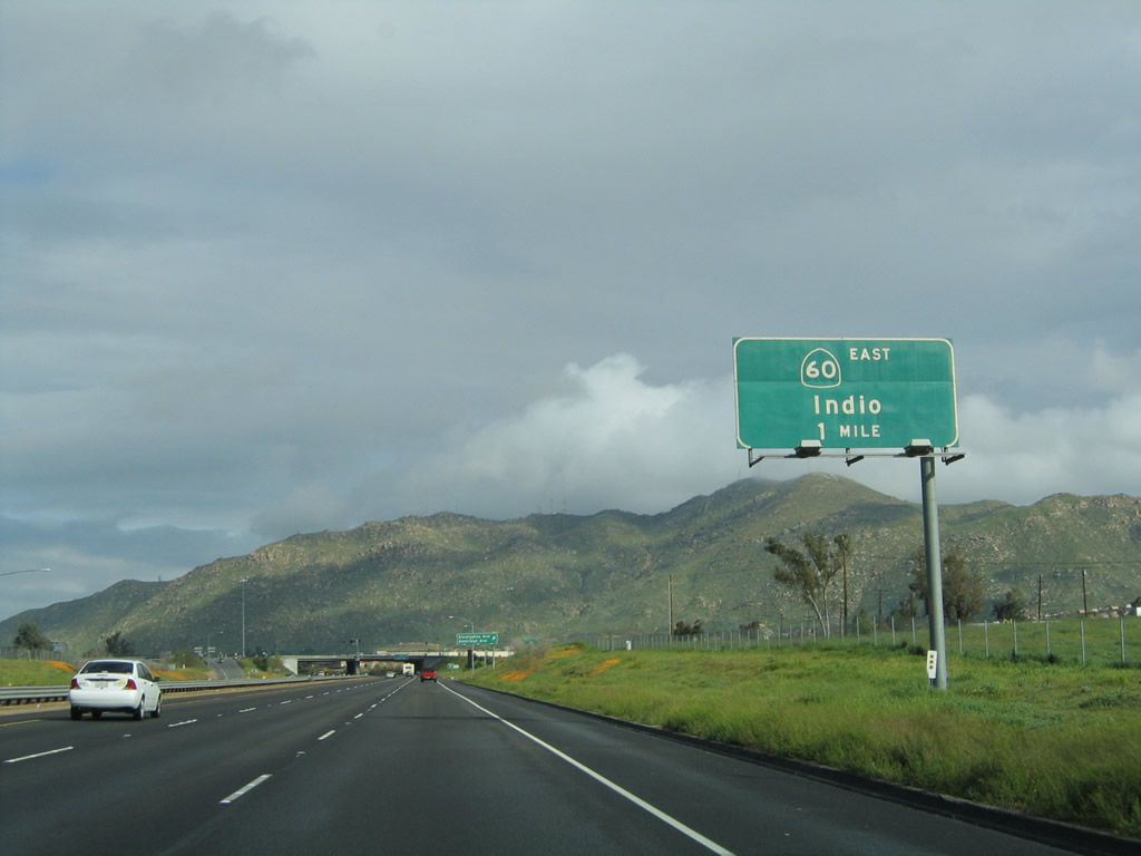
In a mile, Interstate 215 will merge onto westbound California 60 (Moreno Valley Freeway); a ramp provides access via Exit 29 to eastbound California 60 into Moreno Valley, Redlands, and Interstate 10 east to Palm Springs and Indio. Photos taken 11/10/08 and 02/20/05. |
|
|
Northbound Interstate 215 at Exit 28, Eucalyptus Avenue and Eastridge Avenue. Use Eucalyptus Avenue east into the community of Edgemont, which is part of the city of Moreno Valley. Photos taken 11/10/08 and 02/20/05. |
|
This advance guide sign for eastbound California 60/Exit 29 is affixed to the single point urban interchange of Eucalyptus Avenue and Eastridge Avenue. Photo taken 09/28/08. |
|
The right lane becomes exit only for Exit 29, California 60 (Moreno Valley Freeway) east to Moreno Valley, Beaumont, Palm Springs (via California 111), and Phoenix (via Interstate 10). The left two lanes continue north on Interstate 215, which merges onto California 60 west. Photo taken 09/28/08. |
|
Northbound Interstate 215 meets California 60 (Moreno Valley Freeway) at Exit 29. While much of the freeway between Interstate 15 and California 60 was completed by the late 1980s and early 1990s, the California 60 freeway and the remainder of Interstate 215 north of here is of a much older vintage. The freeway also gains higher traffic counts due to incoming traffic from California 60 and California 91, which brings traffic from Orange County. California 60 travels east from this point to meet Interstate 10 near Beaumont, and then Interstate 10 connects to Palm Springs and Indio in the desert (hence the signed control cities listed on this sign). Heading west, California 60 merges with Interstate 215 north from here to Riverside, where they will meet California 91 (Riverside Freeway). Photo taken 09/28/08. |
|
This view shows the transition from northbound Interstate 215 onto westbound California 60. The sign for Box Springs Road was removed when access was eliminated as part of the Interstate 215 and California 60 expansion project. Photo taken 06/24/07. |
|
|
|
Prior to merging onto California 60 west, this sign advises that Interstate 215 becomes part of the Moreno Valley Freeway. At this point, the Escondido Freeway designation turns onto the westbound Moreno Valley Freeway. Photos taken 09/28/08, 02/20/05, and 03/20/04. |
Page Updated June 13, 2009.