

California 263

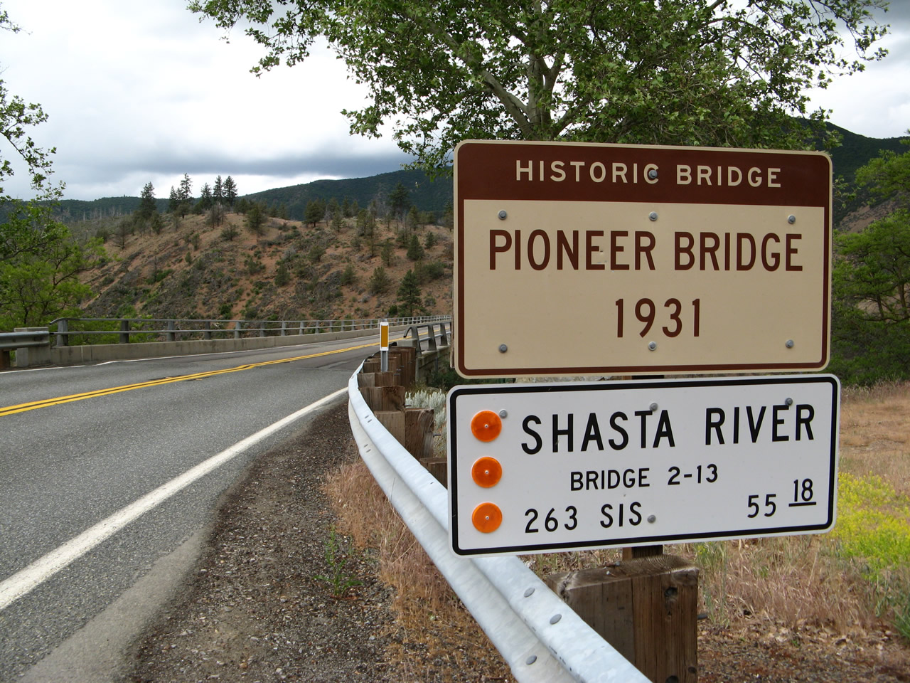
Following the original alignment of U.S. 99 through the Shasta River Canyon, California 263 follows several historic bridges built in the late 1920s and early 1930s that remain in use today. Among these is the historic Pioneer Bridge, which carries California 263 over the Shasta River high above the canyon below. Photo taken 05/25/08.
California 263 is a north-south state route that follows Historic U.S. 99 between Yreka and its junction with California 96 near the Oregon state line. The route passes through the Shasta River Canyon and provides a scenic alternative to Interstate 5. The route begins at the intersection of North Main Street and Montague Road, which is the junction with Business Loop I-5 and California 3 in Yreka. A series of old bridges carry California 263 over the Shasta River.
| California 263 north | |
|---|---|
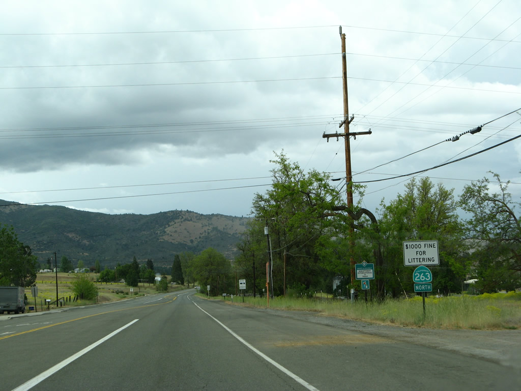 |
Main Street northbound in northern Yreka. California 263 leaves the intersection with Business Loop I-5 and California 3 (Montague Road) and proceeds north along Historic U.S. 99 toward the Shasta River Canyon. The business loop does not continue north of Montague Road along Main Street. Photo taken 05/25/08. |
 |
California 263 is mostly a two-lane rural highway north of Yreka; here the highway parallels Yreka Creek, a tributary to the Shasta River. Photo taken 05/25/08. |
 |
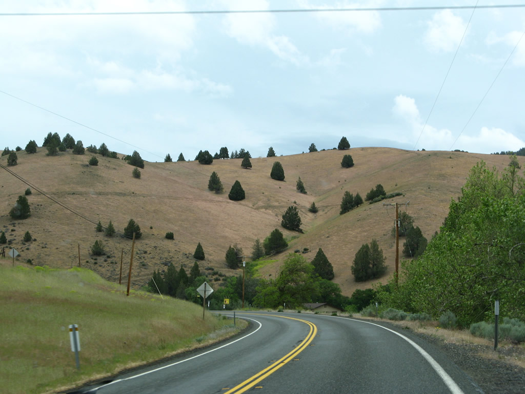
Continuing north, California 263 sees only some limited development; this view is just south of the intersection with Hawkinsville Humbug Road. This road travels northeast to provide local and ranch access. Photo taken 05/25/08. |
 |
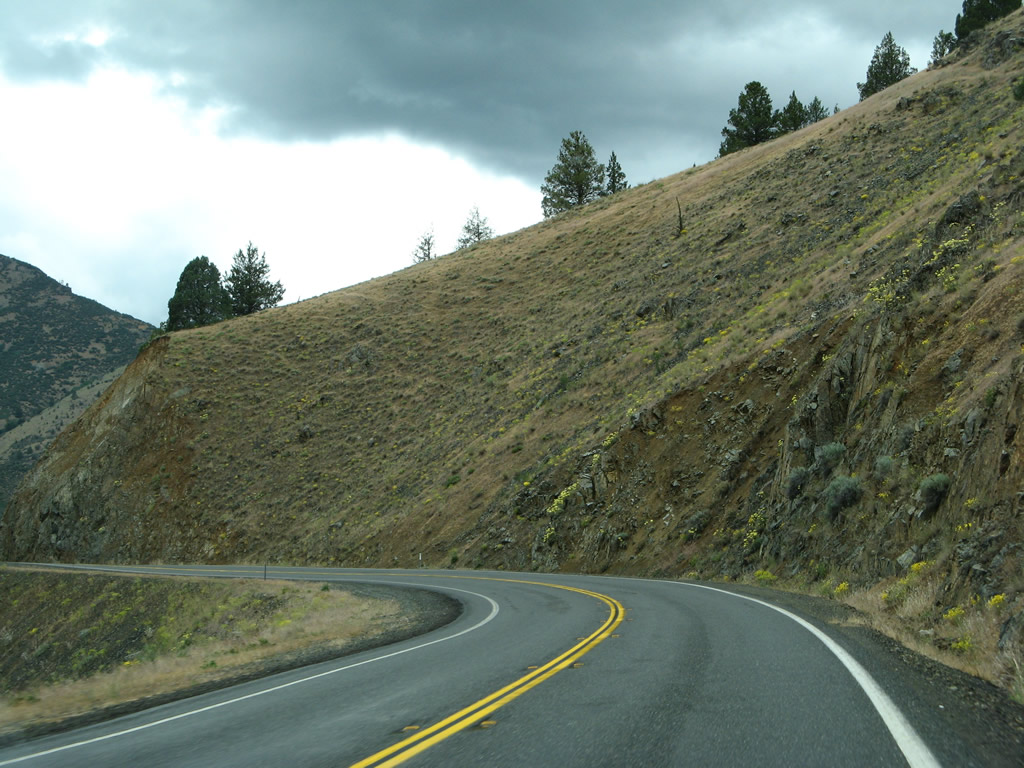
California 263 descends toward the Shasta River. Photo taken 05/25/08. |
 |
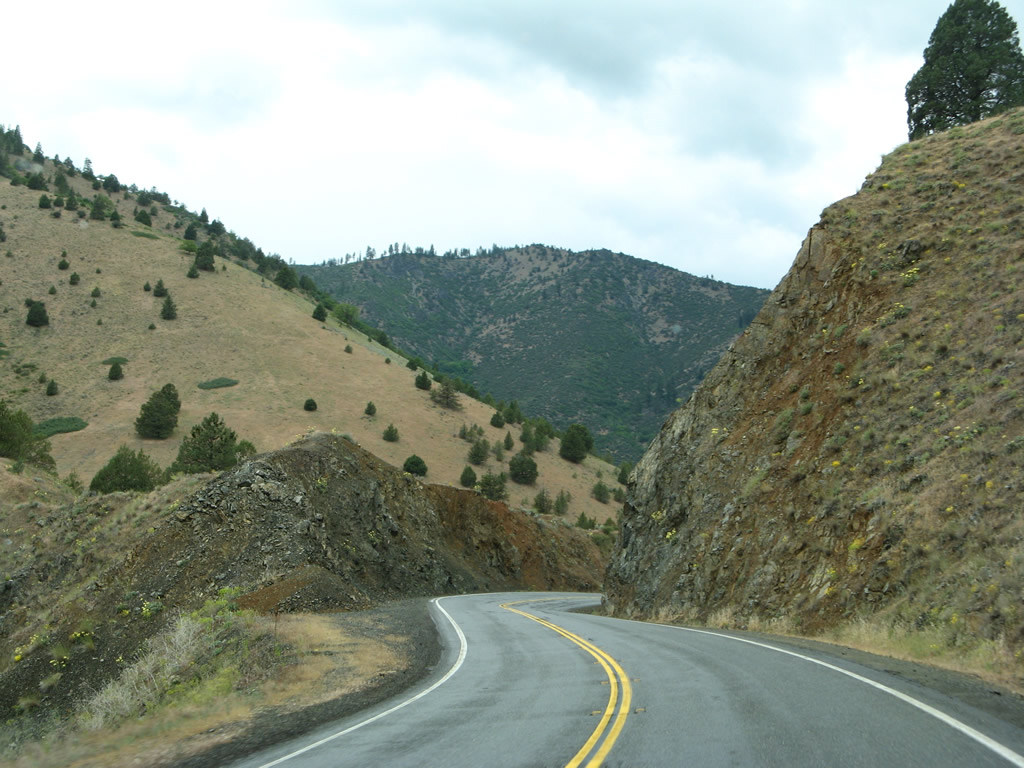
Soon thereafter, California 263 makes the first of several crossings over the Shasta River. Five bridges serve California 263; this first bridge over the Shasta River was built as part of U.S. 99 in 1928. This is a concrete tee beam structure. Photo taken 05/25/08. |
 |
 |
 |
 |
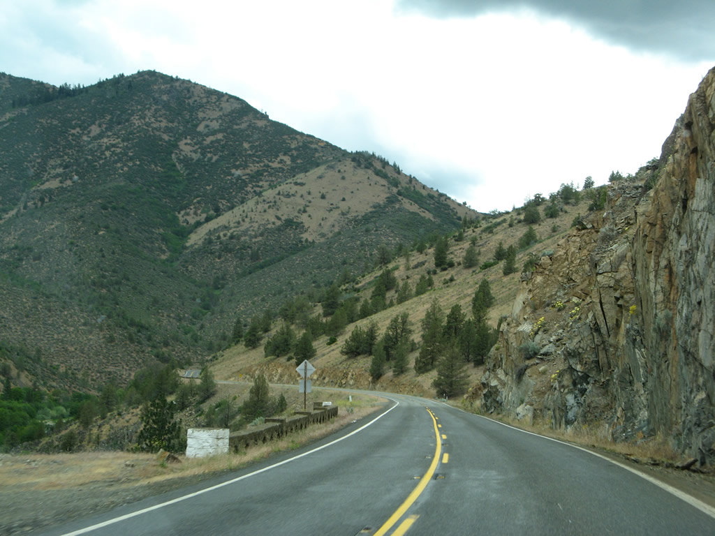 |
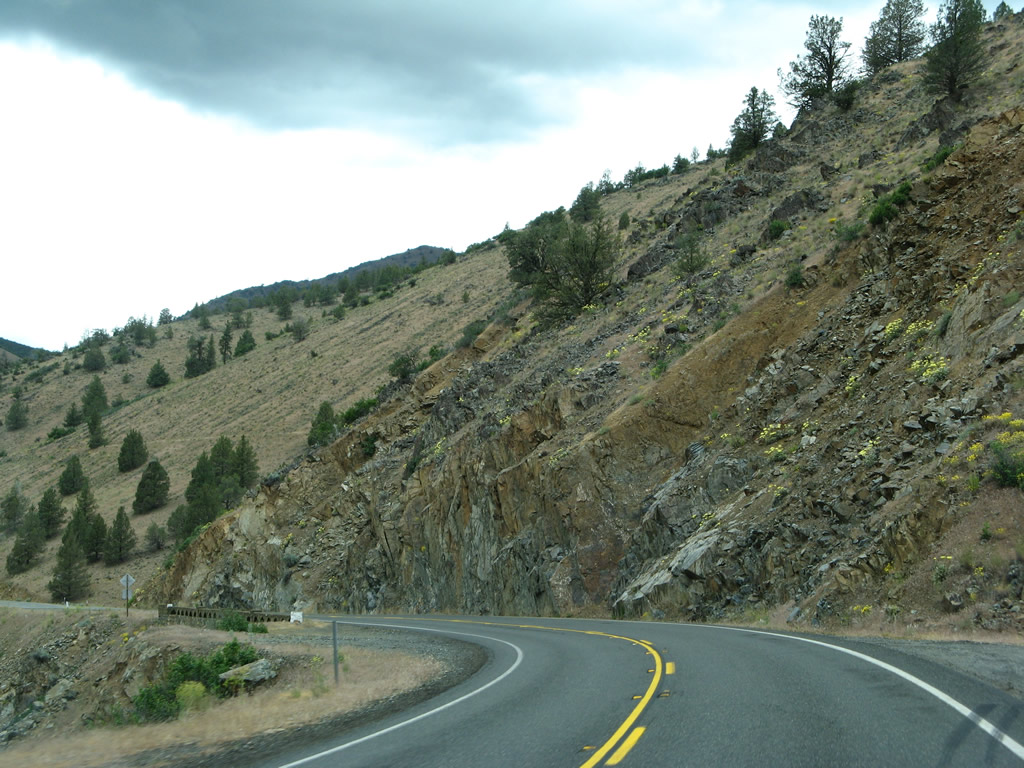
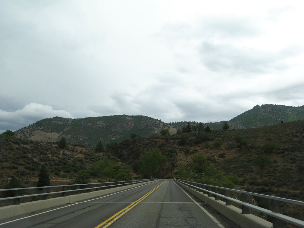
| California 263 (Old U.S. 99) follows the Shasta River on a ledge above the canyon. The historic route takes several twists and turns along the way between the first Shasta River bridge and the Dry Gulch Bridge. The state route was especially treacherous on this day due to recent rains. Gravel turnouts for slower traffic are available, but watch for historic stone guardrails along the way. Photos taken 05/25/08. | ||||
 |
 |
 |
 |
 |
 |
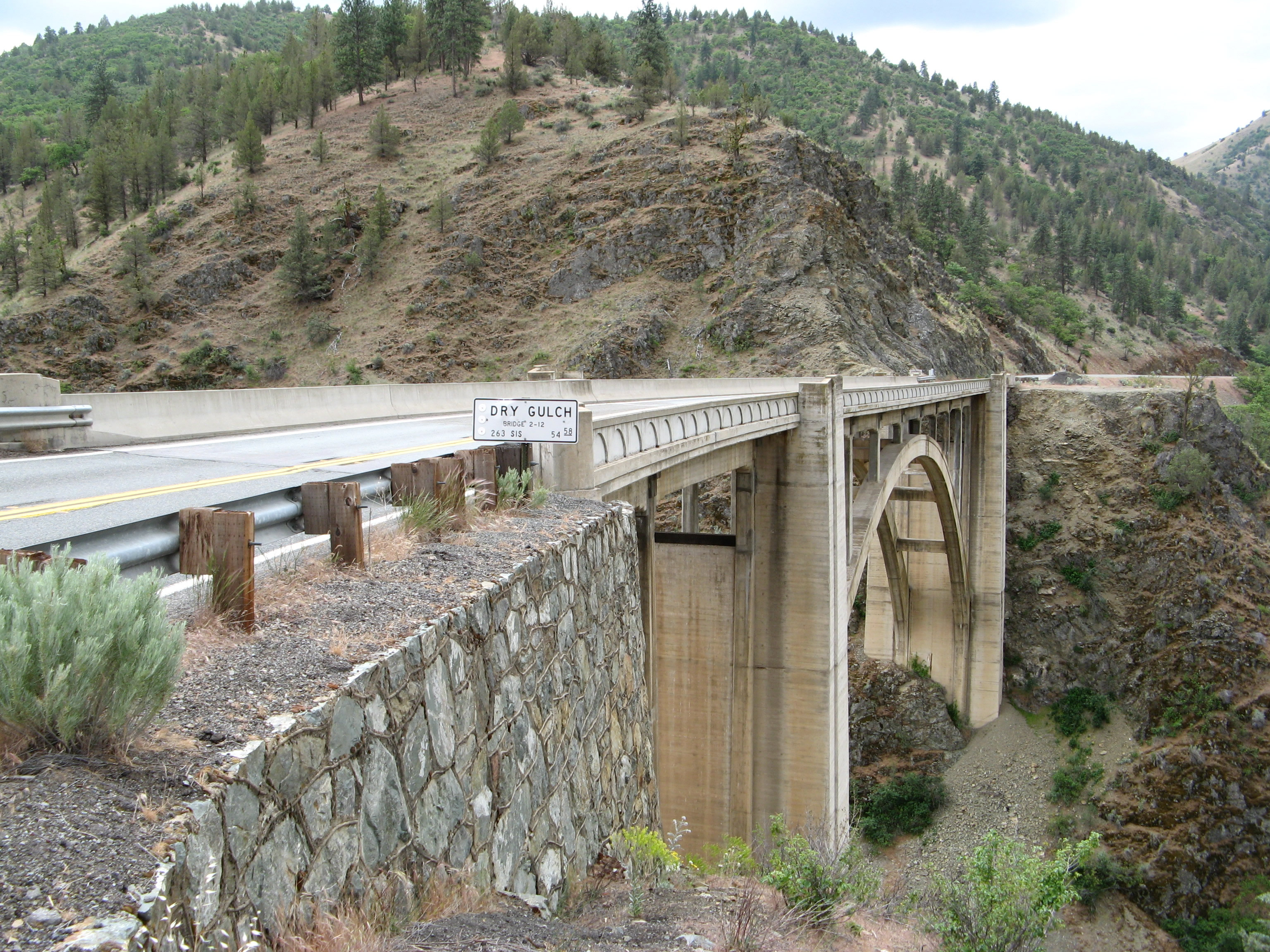
California 263 next crosses Dry Gulch on a 1929 concrete arch bridge. Photo taken 05/25/08. |
 |
The Dry Gulch Bridge is narrow, so there are no shoulders on this section of California 263 (Historic U.S. 99). Photo taken 05/25/08. |
 |
This view looks north along California 263 just after the Dry Gulch Bridge. Photo taken 05/25/08. |
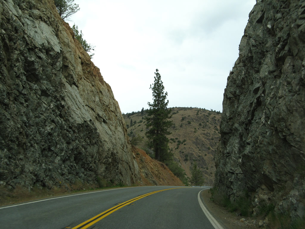 |
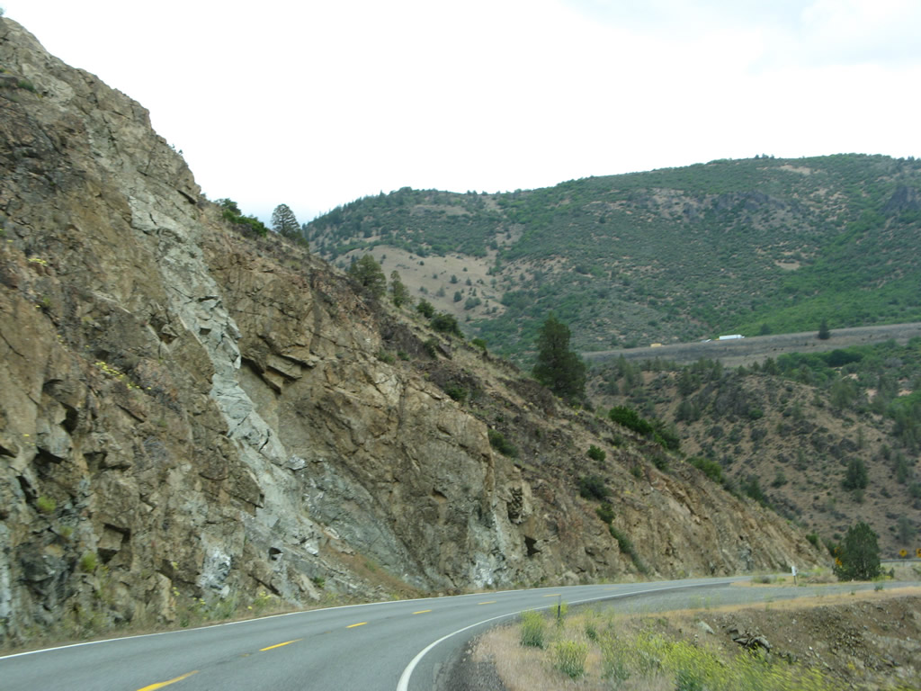
California 263 passes through a tight rock cut north of the Dry Gulch Bridge. Photo taken 05/25/08. |
 |
Just before the Pioneer Bridge over the Shasta River, California 263 passes through another tight rock cut. Photo taken 05/25/08. |
 |
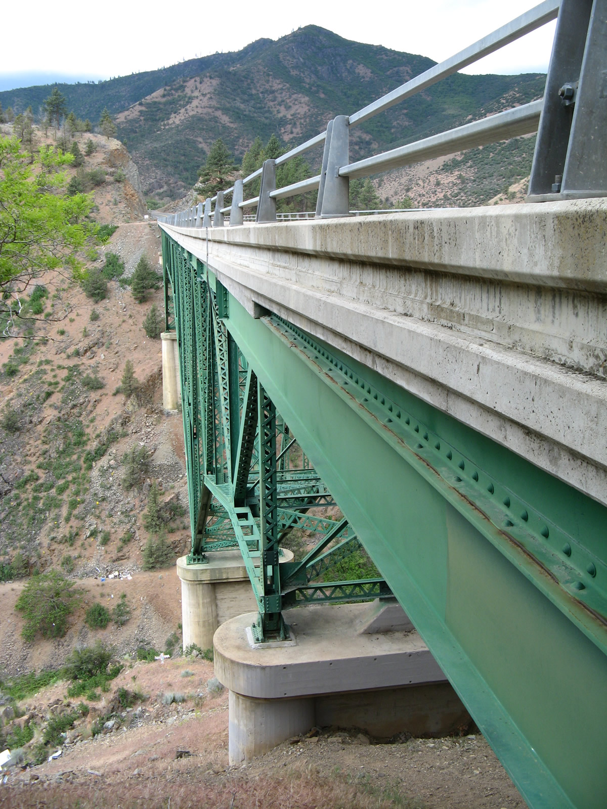
Northbound California 263 prepares to cross the Pioneer Bridge, which carries California 263 and Old U.S. 99 over the Shasta River a second time. This historic deck truss (steel) bridge was built in 1931. Photo taken 05/25/08. |
 |
Just like the Dry Gulch Bridge, the Pioneer Bridge over the Shasta River is narrow. Photo taken 05/25/08. |
 |
While the Shasta River rides deep in the canyon below the state highway, Interstate 5 remains on a ridge well above the old highway and the river. Photo taken 05/25/08. |
 |
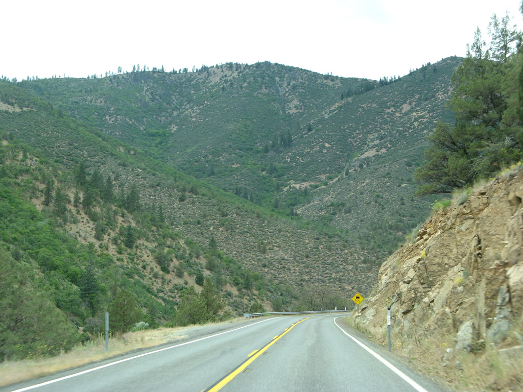
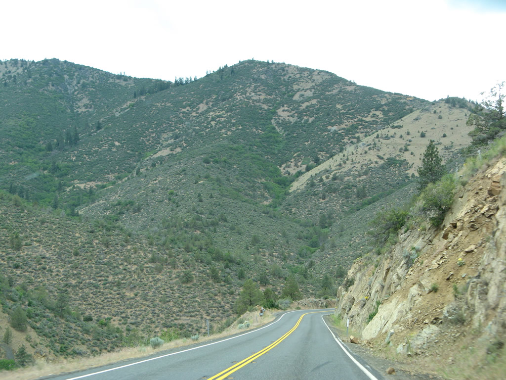
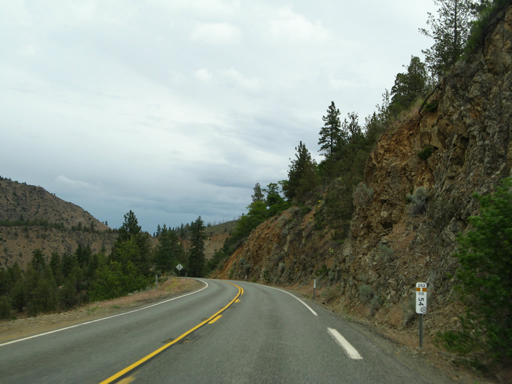
Unlike the freeway, California 263 has some sharp twists and curves as it follows a ridge above the river. Photo taken 05/25/08. |
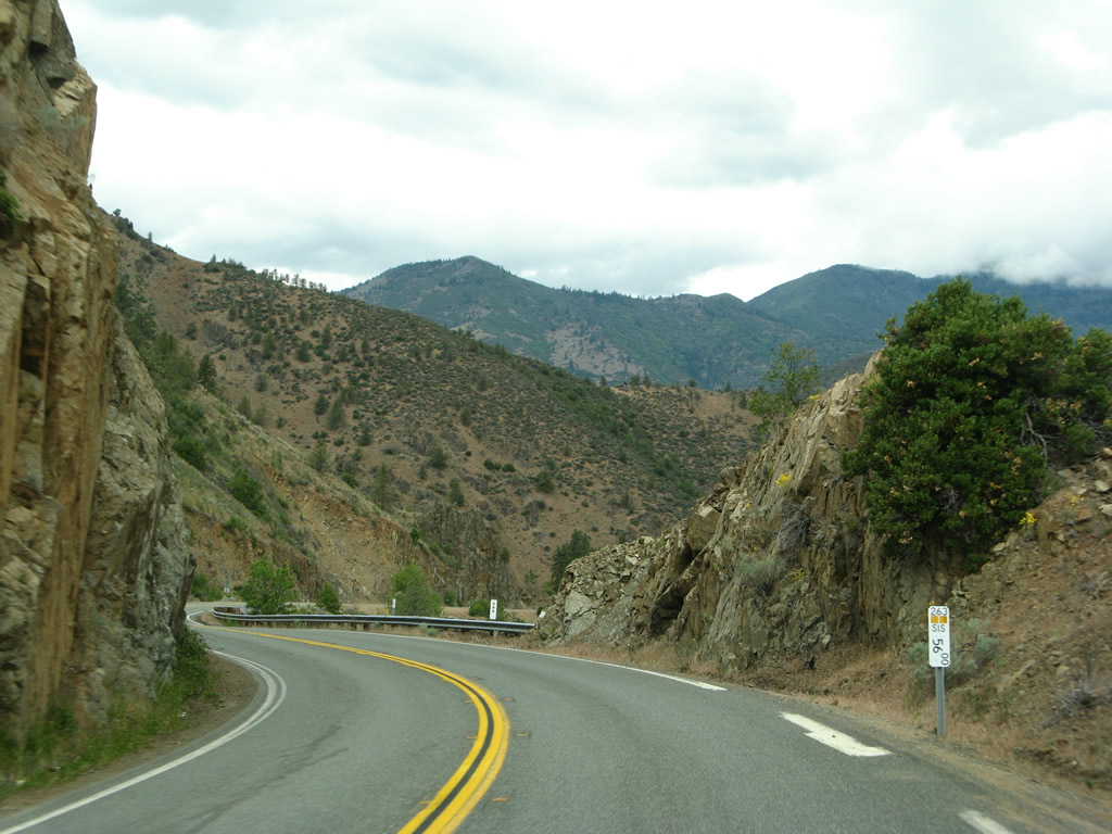 |
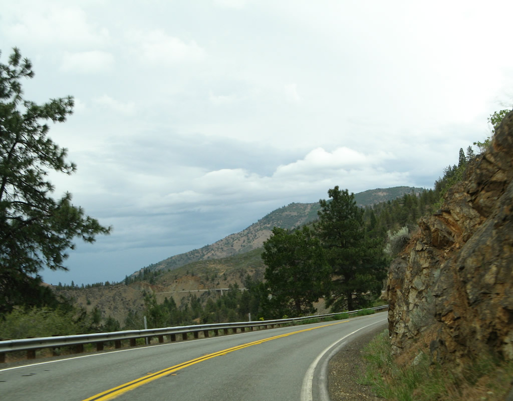
Postmiles along California 263 roughly approximate the Siskiyou County postmile markers for Interstate 5. Photo taken 05/25/08. |
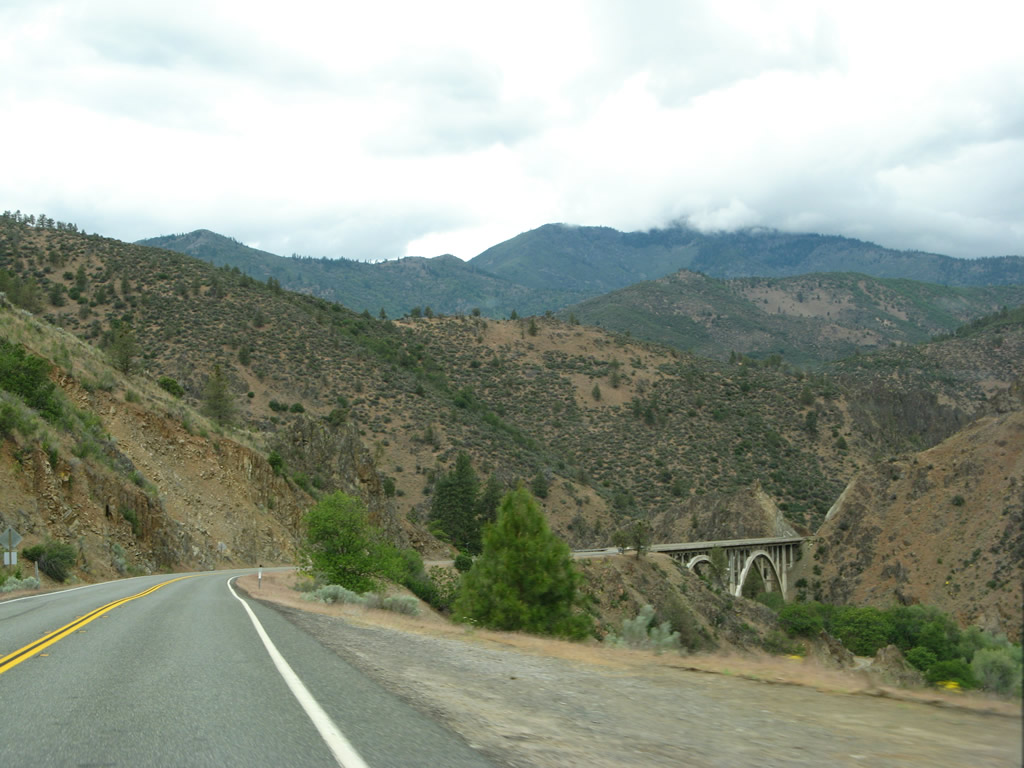 |
A double concrete arch bridge carries California 263 over the third Shasta River bridge (built 1931). Photo taken 05/25/08. |
 |
This bridge identification sign advises of the 1931 Shasta River bridge. Photo taken 05/25/08. |
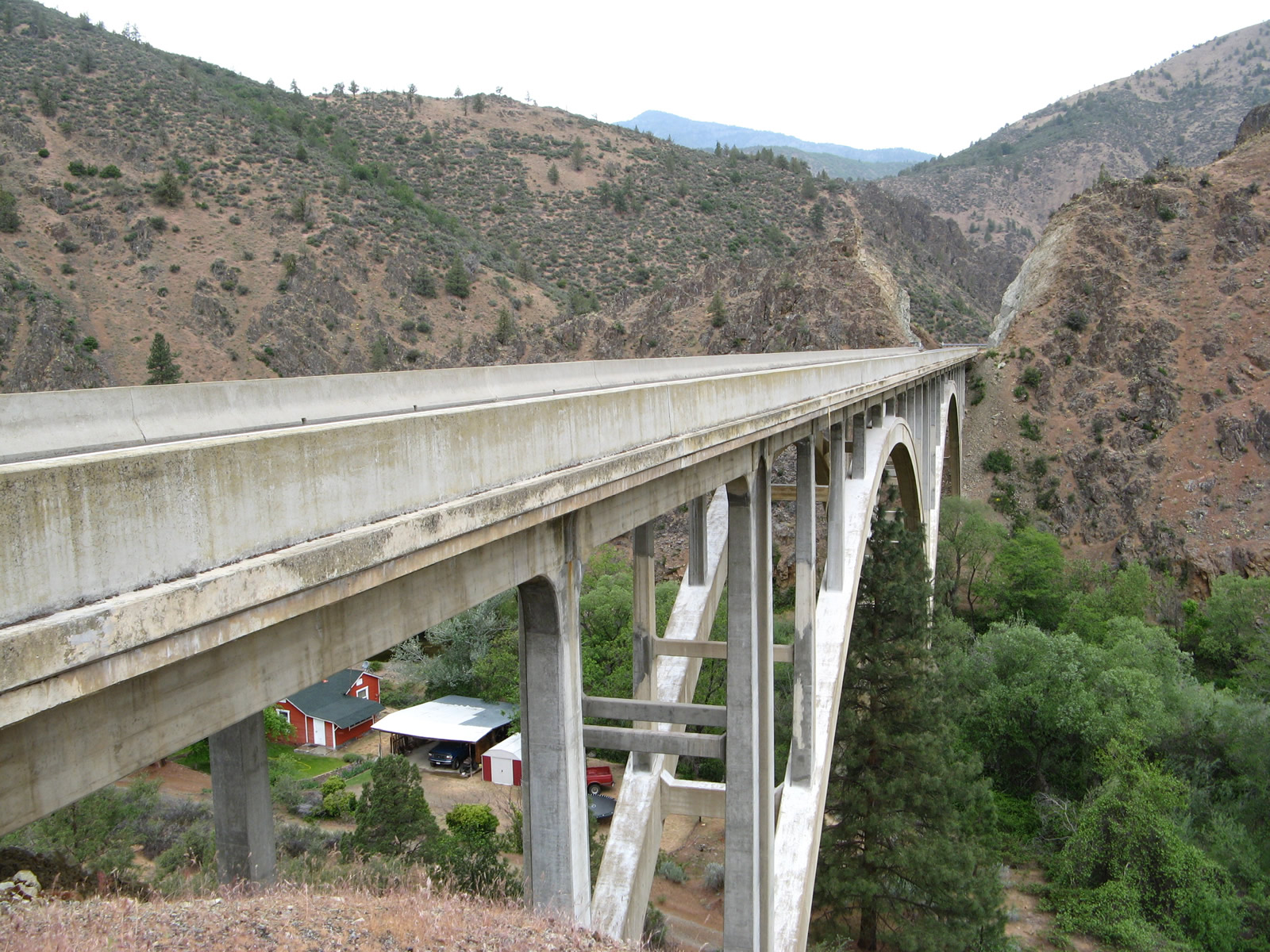 |
A ranch is located in the canyon below the double arch bridge. Photo taken 05/25/08. |
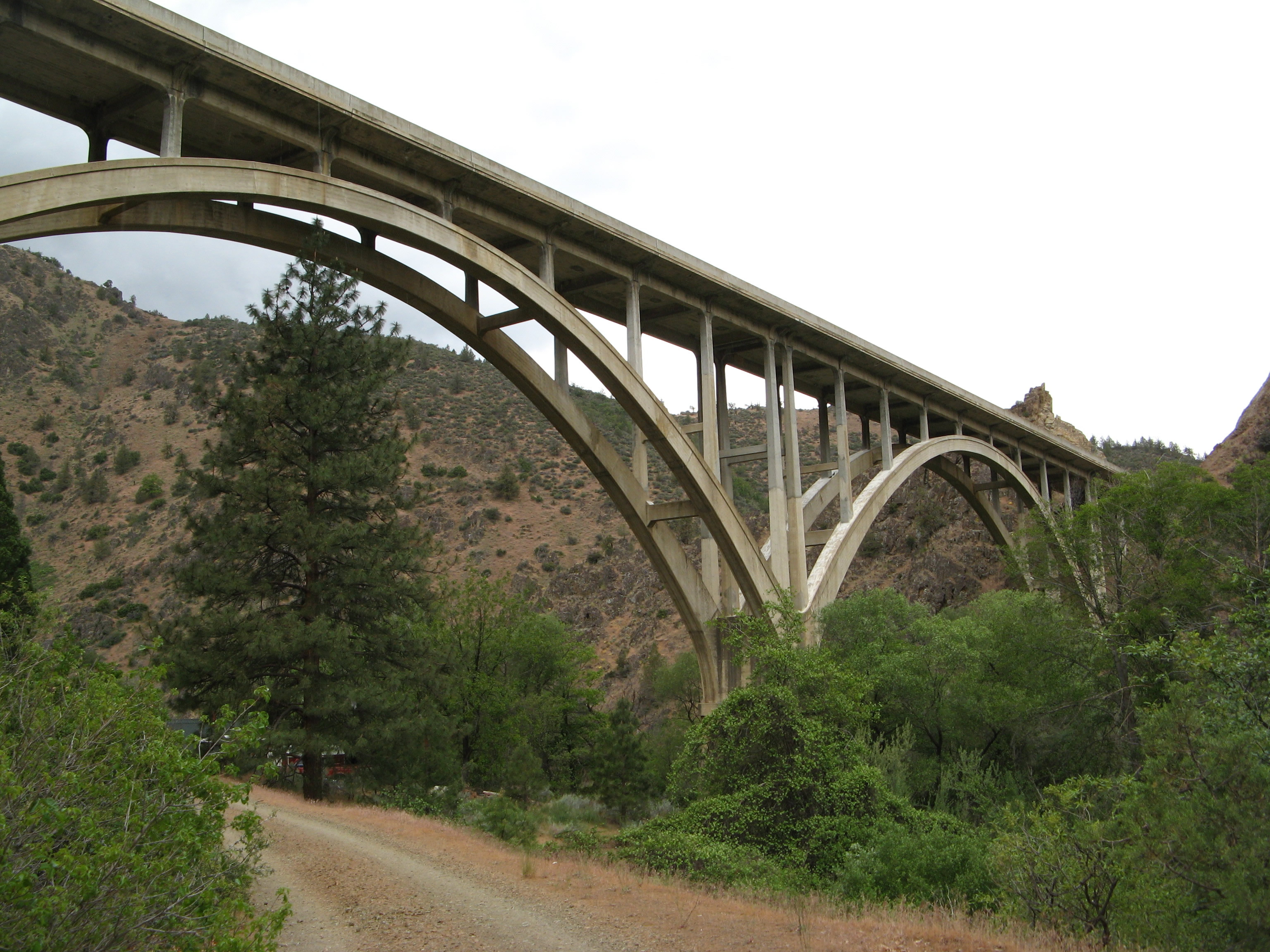 |
This view looks at the Shasta River bridge as seen from the canyon floor looking up (west). Photo taken 05/25/08. |
 |
Like the other Shasta River bridges of this vintage along California 263, the roadway has no shoulders. Photo taken 05/25/08. |
 |
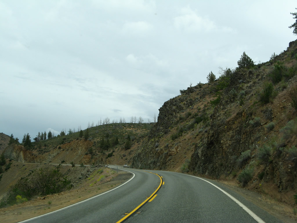
After the third Shasta River bridge, California 263 next approaches its final bridge and its ending junction with California 96. Photo taken 05/25/08. |
 |
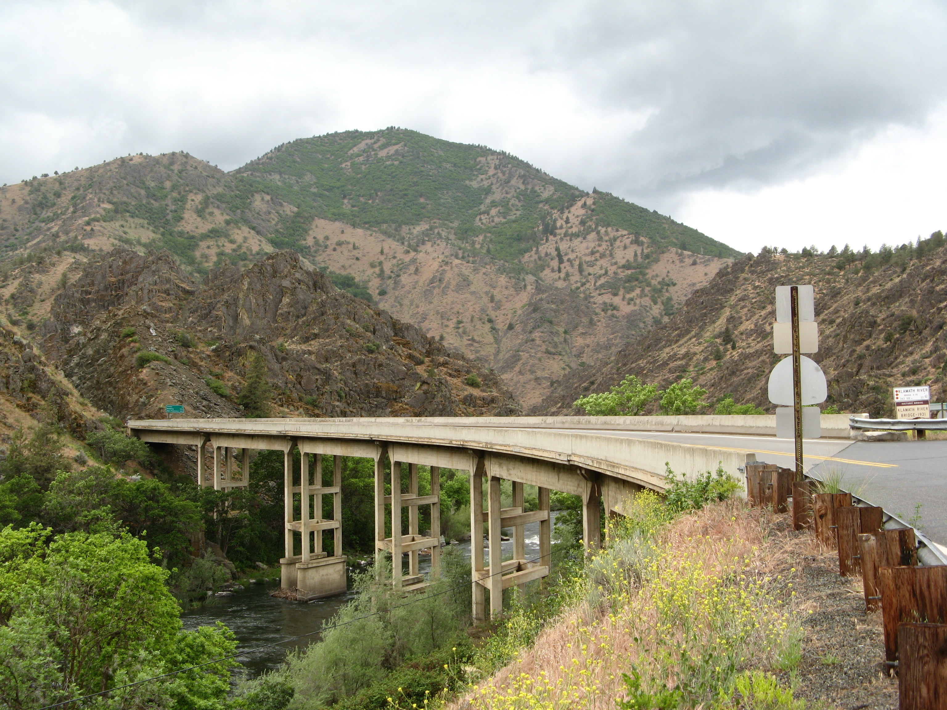
Soon thereafter, California 263 prepares to cross the Klamath River on its last bridge. This 1931 bridge is also a designated historic bridge. Photo taken 05/25/08. |
 |
Northbound California 263 crosses the Klamath River just before reaching its intersection with California 96. Photo taken 05/25/08. |
 |
California 263 ends at its junction with California 96. A long route that closely follows the Klamath River, California 96 travels west into the Siskiyou Mountains, then curves south along with the Klamath and Trinity Rivers until the state highway reaches its terminus at California 299 in Willow Creek. Photo taken 05/25/08. |
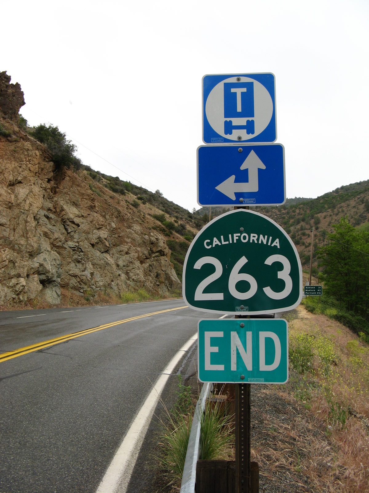 |
An end California 263 route marker is posted at the intersection with California 96. Notably, the transition between California 263 north to California 96 east is without a stop sign. Photo taken 05/25/08. |
 |
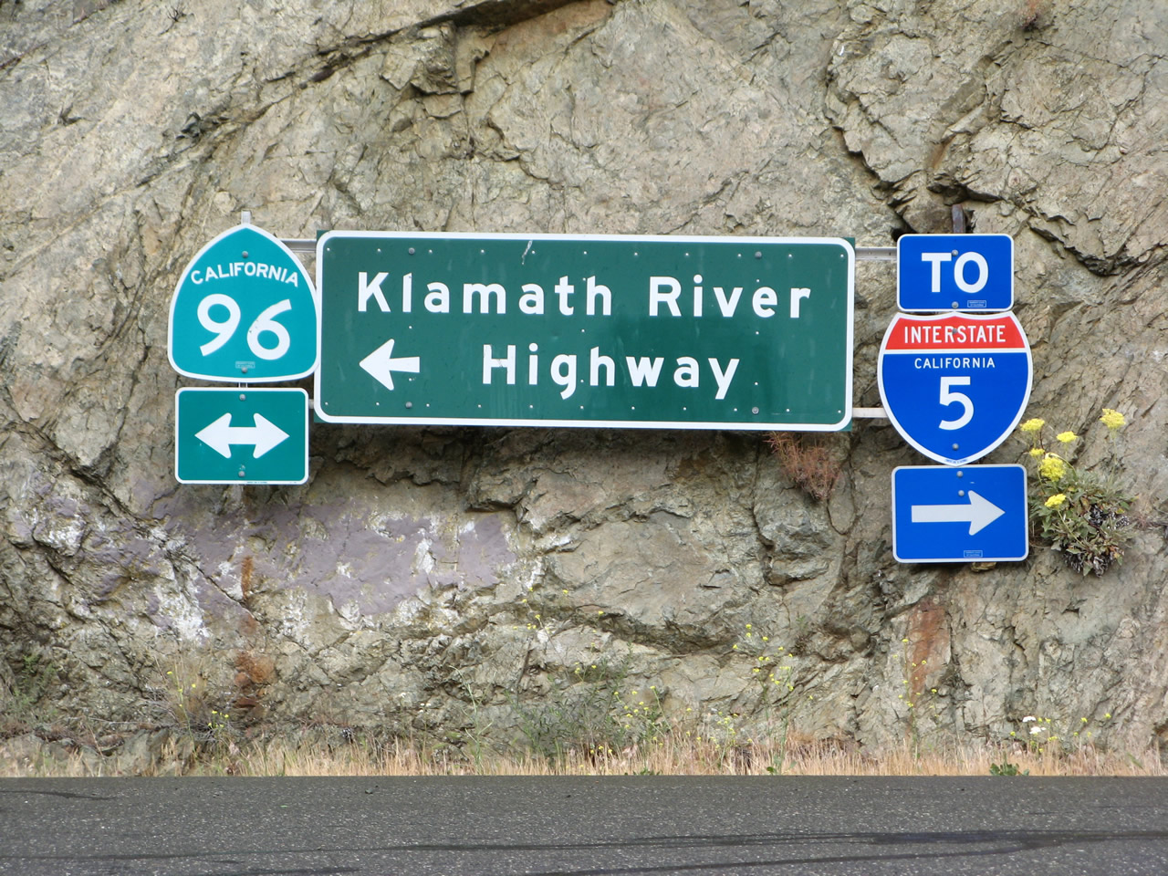 |
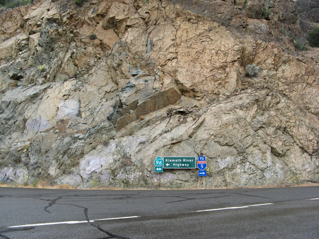
Mounted into the cliff face at the north end of California 263 is a pair of route markers for California 96 east/west and Interstate 5. California 96 is signed as the Klamath River Highway, but even California 96 does not follow the Klamath River all the way to the coast. California 96 curves south to follow the Trinity River, while the remaining section of the Klamath River heading toward the Pacific Ocean is paralleled by California 169. However, conditions have made road passage impossible for a segment of the highway, and California 169 currently exists in two discontinuous segments as a result. Photos taken 05/25/08. |
| California 263 south | |
|---|---|
 |
The 1931 Klamath River Bridge as seen from the south edge of California 96. Photo taken 05/25/08. |
 |
Southbound California 263 crosses over the Klamath River on this 1931 bridge just south of the intersection with California 96. Photo taken 05/25/08. |
 |
Here is another view of the 1931 Klamath River bridge looking south. Photo taken 05/25/08. |
 |
California 263 (Old U.S. 99) south prepares to cross the Shasta River on the deck-truss Pioneer Bridge. Photo taken 05/25/08. |
 |
Two lanes of California 263 (Old U.S. 99) cross over the Shasta River via the Pioneer Bridge. Photo taken 05/25/08. |
 |
A plaque commemorates the naming of the Pioneer Bridge, which was named in honor of pioneer stage drivers. The plaque was placed here (north end of bridge on east side of road) on August 29, 1931. Photo taken 05/25/08. |
 |
This view looks south at the 1931 Pioneer Bridge on the east side of the bridge. Photo taken 05/25/08. |
|
A second view also looks south along California 263 (Old U.S. 99) but this time from the west side of the bridge as it crosses the Shasta River on the 1931 Pioneer Bridge north of Yreka. Photo taken 05/25/08. |
 |
Southbound California 263 (Old U.S. 99) prepares to cross the 1929 Dry Gulch Bridge. This concrete arch bridge remains in use 85 years after installation. Photo taken 05/25/08. |
 |
This is a side view of the 1929 Dry Gulch Bridge looking south. The bridge railing has been replaced since its original installation. Photo taken 05/25/08. |
 |
 |
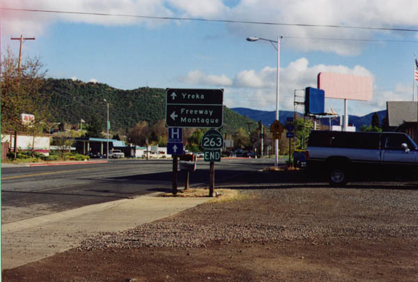
Skipping ahead toward Yreka, southbound California 263 ends at its junction with Business Loop I-5 and California 3. From here, the business route continues south into Yreka, while through traffic turns left onto Interstate 5 or to meet California 3 east to Montague. California 3 also travels south from here via Main Street through Yreka via the original U.S. 99 route and business loop. Photos taken by Jerry Mullady (03/99). |

Page Updated April 2, 2015.
|
About Contact Glossary |
In The News Testimonials Interstate Guide |
Social Media:
 |
|
© 2000-23 AARoads.com | All Rights Reserved | Privacy Policy / Terms of Use
|
||