
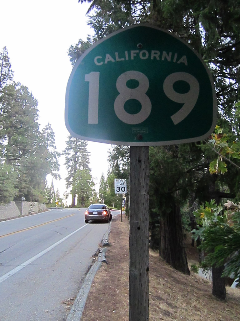
California 189

This California 189 trailblazer sign is posted on southbound Lake Gregory Drive just prior to the intersections with Squirrel Inn Road and California 18 (Rim of the World Highway). California 189 follows Squirrel Inn Road east toward Twin Peaks. Ahead, California 189 briefly merges onto Lake Gregory Drive south, then terminates at the signalized intersection with California 18 east of Crestline and Arrowhead Highlands and west of Rimforest, Skyforest, Heaps Peak, and Running Springs. Photo taken 10/13/12.
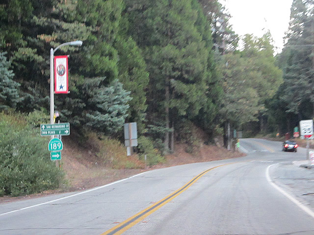
California 189 is a 5.57-mile long state highway that connects California 18 with California 173 via the unincorporated communities of Twin Peaks, Agua Fria, Blue Jay, and Lake Arrowhead in the San Bernardino Mountains. Twin Peaks is located near Strawberry Peak, which is mentioned in the legislative definition of California 189). A winding and twisting route, California 189 follows portions of Lake Gregory Drive, Squirrel Inn Road, and Lakes Edge Road. At Agua Fria, which is the approximate midpoint of the state route, a connecting road (Daley Canyon Road) links California 189 with California 18 (Rim of the World Highway). Daley Canyon Road provides a more direct and slightly faster route for through traffic heading from the California 189 corridor downhill on California 18 south to San Bernardino. Trailblazers on Daley Canyon Road mark it as a link to California 18.
History
This route appears to have been unchanged since its inception. According to Daniel Faigin's California Highways site, the California 189 designation was created in 1933 and was allowed to keep its numerical designation during the many changes made to the the California state route system in 1964. So this short state route corridor in the San Bernardino Mountains has been known as 189 for about 80 years as of this writing, and no realignments have occurred along its route to date (reference the Caltrans District 8 Route Log - no "R" mileage is found along this route, unlike routes that have been realigned through the years). Only one bridge structure is on the route: Little Bear Creek culvert at postmile 4.08, which was built in 1967.
| California 189 east | ||
|---|---|---|
 |
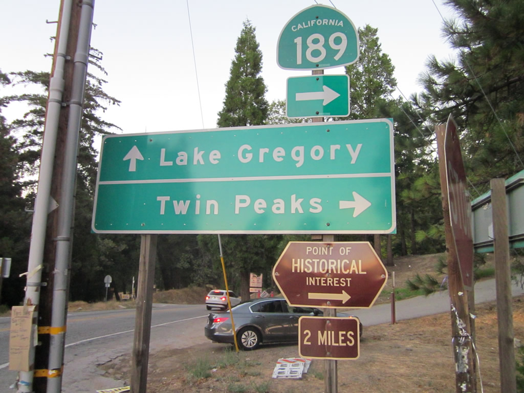 |
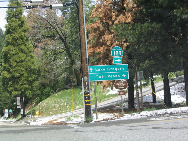
Upon making a left from eastbound California 18, this sign advises motorists to turn right from Lake Gregory Drive onto California 189 eastbound. Ahead, Lake Gregory Drive will lead to Lake Gregory itself. Photos taken 04/18/04 and 10/13/12. |
 |
This view looks east along California 189 after leaving the Lake Gregory Drive intersection. The state route begins an uphill climb and will see multiple twists and turns on its way to Twin Peaks, Agua Fria, Blue Jay, and Lake Arrowhead Village. Drive carefully on this very narrow state highway! Photo taken 10/13/12. | |
 |
California 189 briefly parallels California 18 before pulling away toward Twin Peaks. Photo taken 04/18/04. | |
 |
This mileage sign along eastbound provides the distance to Twin Peaks, Blue Jay, and Lake Arrowhead. Photo taken 04/18/04. | |
 |
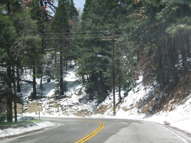 |
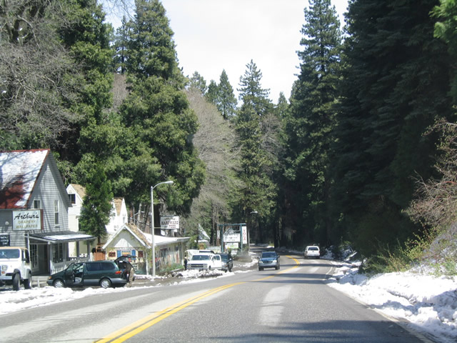
Snow from a late spring storm graces the rights of way for California 189. Snow is common in the winter due to the high elevation despite being fairly far to the south in the state. Photos taken 04/18/04. |
 |
Now leaving Twin Peaks, California 189 continues east through some twists and turns toward Blue Jay and Lake Arrowhead. Photo taken 04/18/04. |
 |
California 189 enters Blue Jay before culminating its short journey at its junction with California 173 in Lake Arrowhead. Photo taken 04/18/04. |
 |
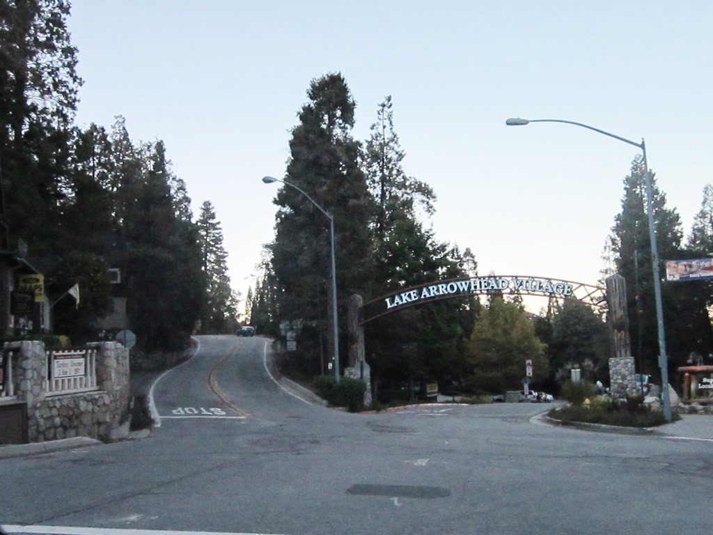
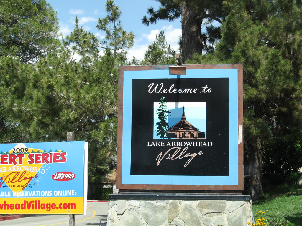
California 189 enters Lake Arrowhead Village ("Old World Charm, New World Excitement"). After the right turn depicted in this picture, California 189 will descend to its junction with California 173 and its eastern terminus. Photo taken 06/27/09. |
 |
More shops and residences line California 189 as we travel the final distance to the California 173 intersection in Lake Arrowhead Village. Photo taken 06/27/09. |
 |
This stop ahead sign is the first indication that we are approaching California 173. (A California 173 route marker assembly would be appropriate here but is missing.) Photo taken 06/27/09. |
 |
We see a fairly steep descent as we approach the California 173 intersection. Photo taken 06/27/09. |
 |
 |
 |
On the left side of the state highway we find an end California 189 route marker accompanied by a California 173 trailblazer marker. Turn left for California 173 northwest to the east shore of Lake Arrowhead, or continue ahead for California 173 southeast to reconnect with California 18 east toward Running Springs and Big Bear Lake. Photos taken 06/27/09 and 10/13/12. |
 |
At the bottom of the hill is a four-way stop between California 173, California 189, and another entrance to Lake Arrowhead Village. Watch carefully for cars and pedestrians at this intersection. A sharp left turn connects to Lake Arrowhead Village, while an easier left connects to California 173 northwest. Continue ahead for California 173 southeast to California 18 (Rim of the World Highway). Photo taken 06/27/09. |
| California 189 west | |
|---|---|
 |
California 189 splits with California 173 at this intersection. The left fork follows California 189/Lakes Edge Road west toward Blue Jay, while the middle fork enters Lake Arrowhead village, which features lake access, attractions, shops, and restaurants. Mainline California 173 bears right to continue north, eventually coming alongside the eastern shore of Lake Arrowhead. This is a rather complicated intersection both in terms of odd angles of approach roads as well as limited sight distance. Watch carefully here before proceeding. Photo taken 10/13/12. |
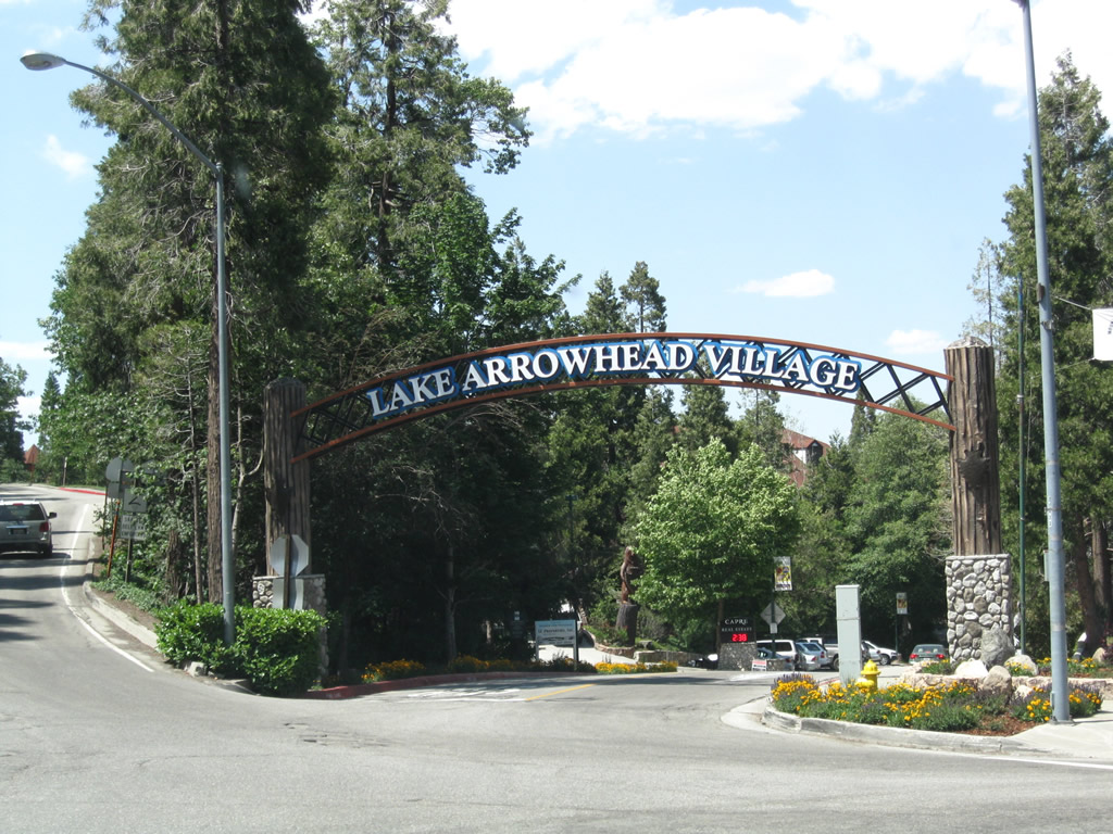 |
An arch spans the entrance to the privately owned Lake Arrowhead Village ("Old World Charm, New World Excitement"). The village is part of the larger unincorporated community of Lake Arrowhead, which had a population of 12,424 as of the 2010 Census. Bear left here to connect to California 189 west, or pass through the arch to enter the village. Photo taken 06/27/09. |
 |
 |
This view typifies California 189: narrow, hilly, and winding with limited sight distances. The state route shields on the right side are for eastbound travelers (the signs depict both an end California 189 and California 173 trailblazer). Photos taken 10/13/12 and 06/27/09. |
 |
 |
The first California 189 east reassurance shield is posted shortly thereafter. California 189 will climb a bit uphill to avoid Lake Arrowhead Village, which is situated to the north of the state route. Photos taken 10/13/12 and 06/27/09. |
 |
Almost immediately, California 189 sees the first of several tight turns, with this first one calling for a speed reduction to 10 miles per hour. Several more hard turns are needed ahead to complete the route. Photo taken 06/27/09. | |
 |
 |
Soon after the sharp turn, eastbound California 189 meets the driveway entrance into the Lake Arrowhead Resort and Spa. A Lake Arrowhead Village welcome sign is posted next to the resort entrance. Photos taken 06/27/09. |
 |
Another sharp, 10-mile-per-hour curve carries California 189 as we leave the central Lake Arrowhead Village and proceed west toward Blue Jay. Photo taken 10/13/12. |
 |
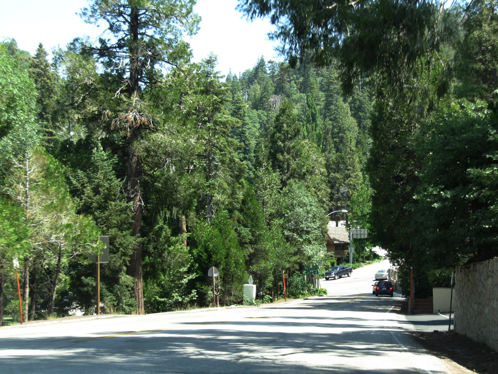
Scenes like this dominate most of California 189: deeply forested lands on both sides of the highway with occasional driveways into private properties/residences. The state route will continue to have curves and limited sight distance for the entire route. Photo taken 10/13/12. |
 |
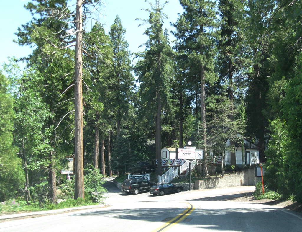
California 189 enters the unincorporated community of Blue Jay. Photo taken 10/13/12. |
 |
Westbound California 189 reaches North Bay Road at this stop sign in Blue Jay. Turn right here for access to the western and northern shores of Lake Arrowhead as well as access back to California 173. Food and shopping are available in Blue Jay; a short commercial strip lies ahead on California 189 east. Photo taken 10/13/12. |
 |
Upon leaving Blue Jay, California 189 turns southwest and then south into Agua Fria, where California 189 meets Daley Canyon Road. Continue straight ahead on Daley Canyon Road for a faster route back to California 18 and onward to San Bernardino via California 18 south or Running Springs and Big Bear Lake via California 18 east. Daylight was running away from us at this point, so our pictures through here were blurry. Photo taken 10/13/12. |
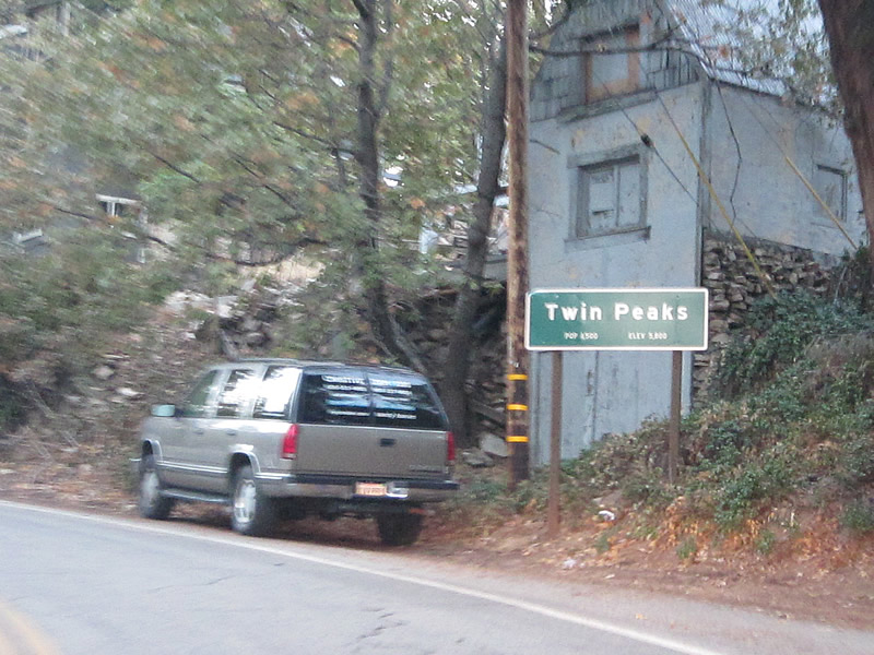 |
About two miles further west, California 189 enters the unincorporated community of Twin Peaks. Photo taken 10/13/12. |
 |
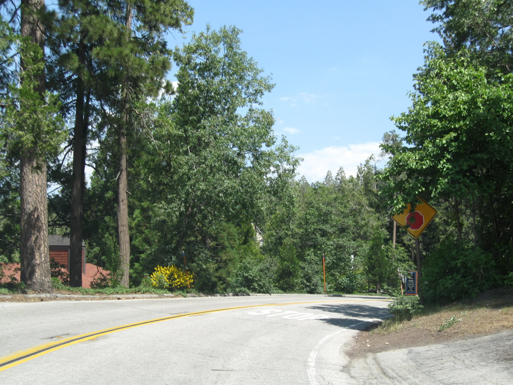
California 189 passes west through Twin Peaks. A left turn on Bear Springs Road will lead to the Strawberry Peak lookout tower (el. 6,135 feet). Photo taken 10/13/12. |
 |
Late-day sun illuminated the treetops along California 189 west of Twin Peaks. Photo taken 10/13/12. |
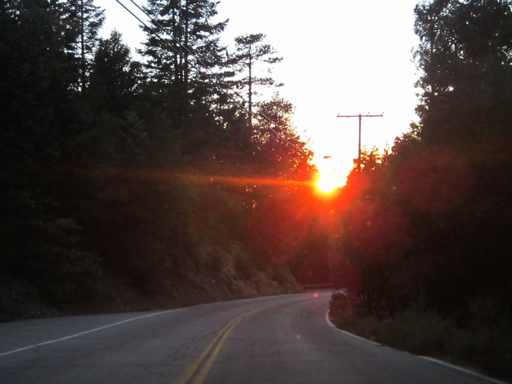 |
The sun came out briefly as it was poised to set on this autumn day. California 189 proceeds west from Twin Peaks toward its rendezvous back with California 18. Photo taken 10/13/12. |
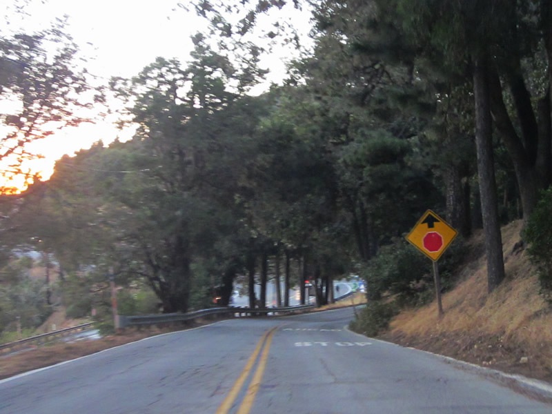 |
California 189 descends to its junction with Lake Gregory Drive and California 18 (Rim of the World Highway). Photo taken 10/13/12. |
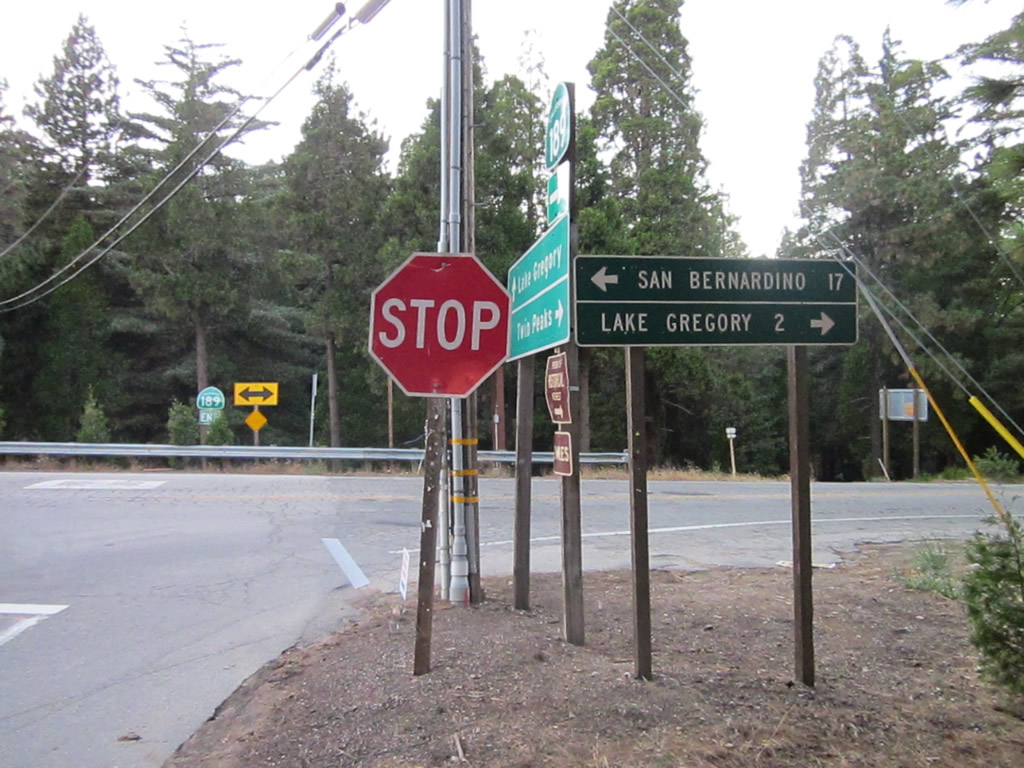 |
Westbound California 189 meets Lake Gregory Drive at this stop sign. Turn left to connect to California 18 south en route to San Bernardino (and points west via California 138 at Crestline) or right to Lake Gregory. Photo taken 10/13/12. |
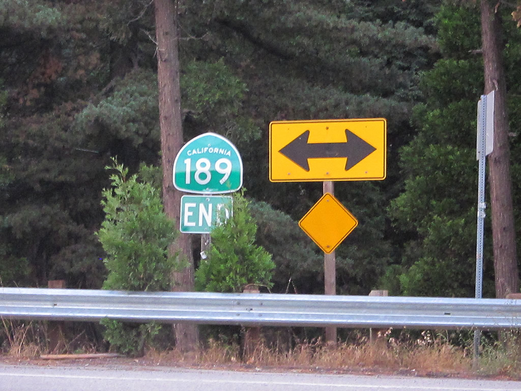 |
An end California 189 route marker is posted at the intersection with Lake Gregory Drive, although technically California 189 has a couple hundred feet left in the route for the link to California 18 at a traffic signal. Photo taken 10/13/12. |
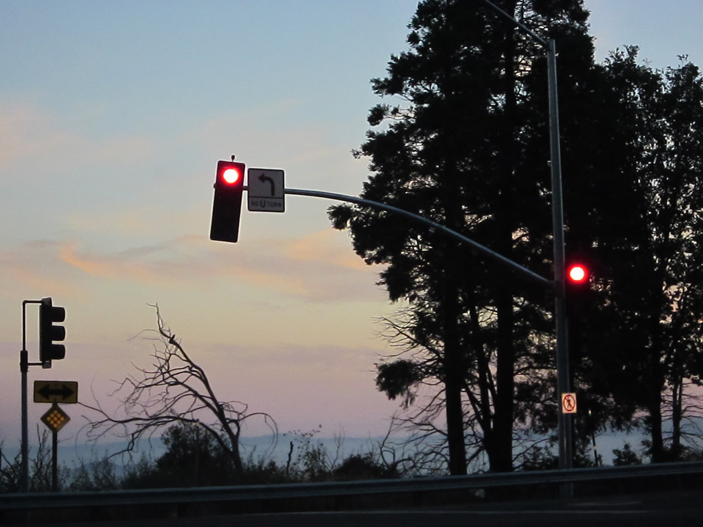 |
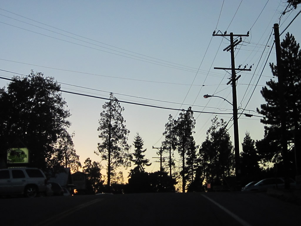
Sunset has come as southbound Lake Gregory Drive and westbound California 189 terminate at California 18 (Rim of the World Highway). Turn left for California 18 east to Running Springs and Big Bear Lake. Turn right for California 18 south to California 138 west and downhill to San Bernardino (California 210). The majority of California 18 downhill is four lanes and offers a good quality route back to the city. Photo taken 10/13/12. |

Page Updated October 14, 2012.
|
About Contact Glossary |
In The News Testimonials Interstate Guide |
Social Media:
 |
|
© 2000-23 AARoads.com | All Rights Reserved | Privacy Policy / Terms of Use
|
||