| California 178 west |
|
Leaving California 14 (Sierra Highway) at Freeman Junction, California 178 resumes its trip west toward Walker Pass, Lake Isabella, and Bakersfield. Photo taken 10/08/06. |
|
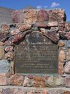
A historical marker for Freeman Junction is posted on the north side of California 178 at the pull-out area under the power lines visible ahead. Photo taken 10/08/06. |
|
|
This mileage sign along California 178 west provides the distance to Weldon (31 miles), Lake Isabella (42 miles), and Bakersfield (87 miles). Photos taken 10/08/06. |
|
|
Under the Los Angeles Department of Water and Power (LADWP) power lines is a monument to Freeman Junction, which is the original name of the intersection between California 14 and California 178. Photos taken 10/08/06. |
|
|
|
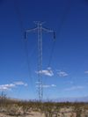
Ascending to Walker Pass in the Sierra Nevada, westbound California 178 passes under the Pacific Intertie, a major north-south +/-500kV direct current power transmission line (Path 65) that leads from near The Dalles, Oregon, south to Sylmar in Los Angeles, California. The other power line, owned by the Los Angeles Department of Water and Power, carries power generated in the Owens Valley south to Los Angeles along a path parallel to the Owens River Valley aqueduct. Photos taken 10/08/06. |
|
Watch for possible loose range and cattle stock on the road ahead, from here west to Weldon via Walker Pass. Photo taken 10/08/06. |
|
|
|
This series of photos follows California 178 west as it ascends and reaches Walker Pass in the Sierra Nevada. Joshua trees, which are very commonly found in the Mojave Desert, line the highway as it gains elevation. Photos taken 10/08/06. |
|
|
|
|
|
|
|
|
|
Westbound California 178 reaches Walker Pass. A marker for the pass is posted on the south side of the highway (placed in 1937). Walkers Pass sits at an elevation of 5,280 feet, or exactly one mile above sea level. Photos taken 10/08/06. |
|
|
|
|
|
|
Descending from Walker Pass, westbound California 178 sees a seven percent decline in elevation, eventually joining the Canebrake Creek downhill. At the bottom is a double-sided California 178 reassurance shield. Photos taken 10/08/06. |
|
|
|
Westbound California 178 follows the Kern River west toward Canebrake. Photos taken 10/08/06. |
|
|
|
The Cane Brake Cafe, which is located on the north side of California 178/Isabella-Walker Pass Road, serves highway travelers east of Onyx in the unincorporated community of Canebrake. There is not much else here. A map on the restaurant building shows nearby attractions. Photos taken 10/08/06. |
|
This mileage sign along California 178 west (just after the Cane Brake Cafe) provides the distance to Onyx (seven miles), Lake Isabella (24 miles), and Bakersfield (68 miles). Photo taken 10/08/06. |
Page Updated October 23, 2009.


