| California 94 east |
|
After Cailfornia 94 crosses over the Sweetwater River, the two-lane highway takes on a predominantly rural characteristic. (The new Sweetwater River bridge opened to traffic in 1987 and replaced the original 1929 steel truss bridge.) Photo taken 08/22/04. |
|
Eastbound Cailfornia 94 meets Jefferson Road and Proctor Valley Road at this signalized intersection. On the southeastern corner of this intersection is Simpson's Nursery, which has grounds dotted by old highway signs. From here, California 94 generally travels southeast toward Dulzura, Engineer Springs, and Tecate. Photo taken 08/22/04. |
|
This mileage sign provides the distance to Dulzura (eight miles), California 188 south to Tecate (19 miles), and Campo (31 miles). Photo taken 08/22/04. |
|
|
These are some views of eastbound California 94 near Jamul, after the split from California 54 and the Sweetwater River bridge. Scenic rolling hills and open spaces are now the rural rather than the exception. Photos taken 08/22/04. |
|
Cailfornia 94 continues east through some beautiful, undeveloped terrain. Photo taken 08/22/04. |
|
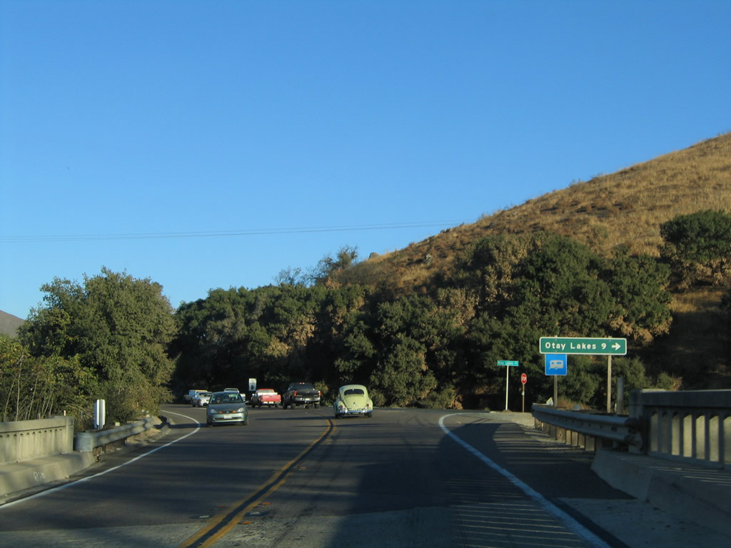
The truck route ends as Cailfornia 94 approaches its intersection with Otay Lakes Road. An improved road, Otay Lakes Road travels west to the city of Chula Vista, emerging in the city between Upper Otay Lake and Lower Otay Lake. Photo taken 08/22/04. |
|
Eastbound California 94 meets Otay Lakes Road at this intersection. The lakes and Chula Vista are nine miles west of here. Photo taken 08/22/04. |
|
|
|
California 94 continues east through the foothills on a path following Dulzura Creek. The state route eventually passes through the small, unincorporated communities of Dulzura and Engineer Springs. Photos taken 08/22/04. |
|
|
|
|
This scenic view is afforded on the drive between Dulzura and Barrett Junction. Photo taken 08/22/04. |
|
Eastbound California 94 meets Barrett Lake Road in the unincorporated community of Barrett Junction. Use Barrett Lake Road north to the Barrett Lake reservoir. Photo taken 08/22/04. |
|
A California 94 east shield is posted upon leaving Barrett Junction. Photo taken 08/22/04. |
|
California 94 crosses Cottonwood Creek on this 1954 bridge. Barely noticeable in the distance are the towers for the Southwest Powerlink, a 500kV power transmission line that carries power between the Imperial Valley and the San Diego metropolitan area. Photo taken 08/22/04. |
|
|
California 94 gains elevation as the two-lane highway continues toward Tecate Junction (intersection with California 188). The Southwest Powerlink (500kV power transmision line) generally parallels the state route. Photos taken 08/22/04. |
|
|
|
Eastbound California 94 approaches California 188 (Tecate Road) south to Tecate and the international border crossing into Tecate, Mexico. Photo taken 08/22/04. |
|
A mileage sign is posted for California 188 (Tecate Road) south. The state route extends south to the international border crossing and the unincorporated community of Tecate on the U.S. side of the border. South of the border, Tecate is a major city with urban amenities. Upon entering Mexico, roads connect to east-west Mexico Federal Route 2 to Tijuana (west) and Mexicali (east) as well as Mexico Federal Route 3 south to Ensenada (76 miles). Photo taken 08/22/04. |
Page Updated May 13, 2009.