
California 89 South - Truckee to Tahoe City
| California 89 south | |
|---|---|
 |
California 89 south approaches California 70 northwest of Quincy. Turn left to continue south on California 89 and east on California 70 to Quincy, or turn right for California 70 west through the Feather River Canyon to Oroville and the Sacramento Valley. Photo taken 09/04/10. |
 |
 |
 |
These signs are posted at the T-intersection where California 89 south meets California 70, which is known as the Feather River Highway. Photo taken 09/04/10. |
 |
Leaving California 70 (Feather River Highway), southbound California 89 approaches a turnoff to a tourist information center (Eastern Plumas Chamber of Commerce) prior to passing under the Union Pacific Railroad and meeting the turnoff to Blairsden. Photo taken 09/04/10. |
 |
A reassurance shield for California 89 south is posted shortly thereafter, before the underpass and Blairsden turnoff (Bonta Street, next left). Photo taken 09/04/10. |
 |
Turn left here for Bonta Street east to Blairsden or right for Little Bear Road west. Photo taken 09/04/10. |
 |
Another California 89 south reassurance shield is posted thereafter. Photo taken 09/04/10. |
 |
California 89 crosses over the Middle Fork of the Feather River between Blairsden and Graeagle. Photo taken 09/04/10. |
 |
Tall pine trees line both sides of the state highway en route to Graeagle. Photo taken 09/04/10. |
 |
Southbound California 89 enters the unincorporated community of Graeagle, "The Gift of a Lifetime." Graeagle had a population of 737 people as of the 2010 Census. Photo taken 09/04/10. |
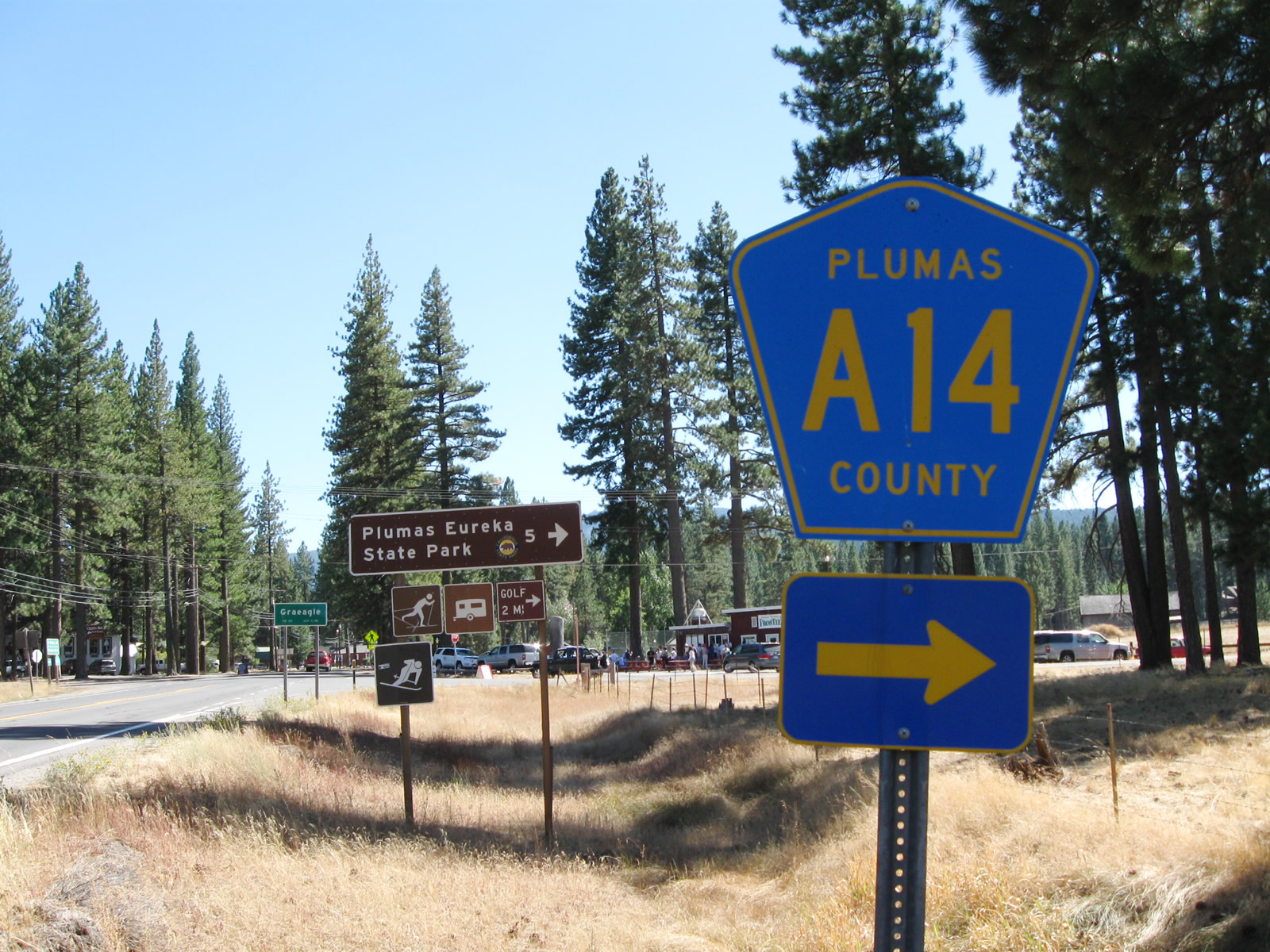 |
The next intersection along California 89 south is with Plumas County A-14, which travels west along Graeagle-Johnsville Road to the unincorporated community of Johnsville. Plumas County A-14 is not a through route; it ends in Johnsville (about five miles west of Graeagle). Johnsville is an unincorporated community that had a population of 20 people as of the 2010 Census. Photo taken 09/04/10. |
 |
CR A-14 (Johnsville Road) heads west to Plumas-Eureka State Park, which was established in 1959. In addition to its scenic setting in the Sierra Nevada, the park offers a glimpse into the mining history of the area, including stamp mills and a historic miner residence. Photo taken 09/04/10. |
 |
Just before the turnoff to CR A-14 (Graeagle-Johnsville Road) west, a Caltrans-standard sign welcomes motorists into Graeagle. Photo taken 09/04/10. |
 |
After the intersection with Plumas County A-14 (Graeagle-Johnsville Road), we find another California 89 south reassurance shield. Ahead is downtown Graeagle, followed by Clio and the Plumas-Sierra County line. Photo taken 09/04/10. |
| California 49 north & 89 south | |
|---|---|
 |
Some distance south and now in Sierra County, California 49 and California 89 merge together for about five miles between Sattley and Sierraville. Signed as California 49 north and California 89 south, the two routes actually travel east between these two communities. This view is taken upon entering Sierraville. Photo taken 01/19/03. |
 |
The routes divide in Sierraville. California 49 proceeds northeast through the eastern edge of the Sierra Valley en route to Loyalton and Vinton, while California 89 turns south from Sierraville toward Truckee via Hobart Mills. Photo taken 01/19/03. |
| California 89 south | |
 |
Now in the vicinity of Truckee and fter the roundabout intersection with Donner Pass Road (former Business Loop I-80 / old U.S. 40 and former California 267), southbound California 89 approaches Interstate 80. This interchange serves as the eastern terminus of the former Truckee business route. Photo taken 07/21/09. |
 |
The right lane of southbound California 89 becomes exit only for Interstate 80 west to Sacramento and San Francisco. California 89 itself turns right onto Interstate 80 west to bypass downtown Truckee. Continue straight ahead for California 267 south to Northstar at Tahoe and Kings Beach. Photo taken 07/21/09. |
 |
A California 89 trailblazer points to the Interstate 80 west on-ramp. The two routes will share alignment until Exit 185, where California 89 resumes its trek south toward the west shore of Lake Tahoe: Tahoe City, Emerald Bay, and South Lake Tahoe. Photo taken 07/21/09. |
 |
Continue south on California 267 to the next traffic signal for the link to Interstate 80 east to Reno and Elko. California 267 travels southeast from this interchange to Kings Beach on the north shore of Lake Tahoe. Photo taken 07/21/09. |


Page Updated April 15, 2012.
|
About Contact Glossary |
In The News Testimonials Interstate Guide |
Social Media:
 |
|
© 2000-23 AARoads.com | All Rights Reserved | Privacy Policy / Terms of Use
|
||