| California 47 south |
|
California 47 begins its southerly journey at the interchange between California 91 and Alameda Street within the city of Compton (incorporated May 11, 1888 and population 93,493 as of the 2000 Census). Here, southbound Alameda Street meets the on-ramp to California 91 west to Redondo Beach. The second right links Alameda Street south with California 91 east to Anaheim and Riverside. Photo taken 09/28/08. |
|
Passing under Artesia Boulevard, an overhead sign points the way from California 47 south to California 91 east to Anaheim and Riverside. California 47 will pass under California 91 at the next overpass. Photo taken 09/28/08. |
|
Old style bridge railing lines the east side of California 47 as we approach the turnoff to California 91 east (next right). Photo taken 09/28/08. |
|
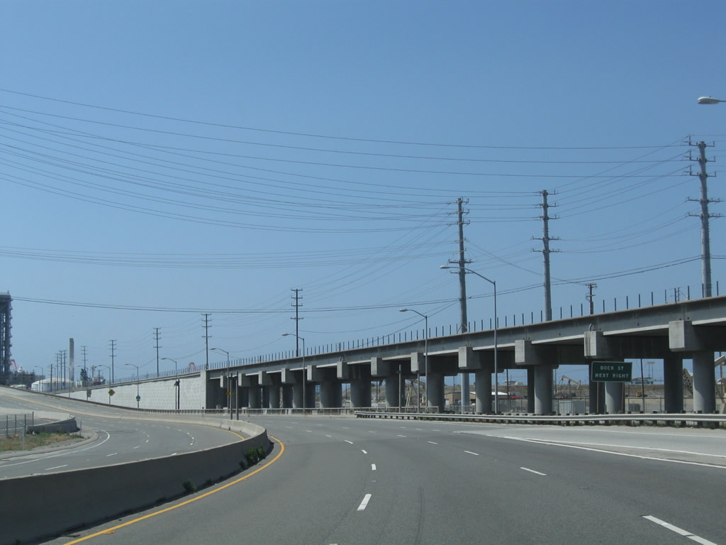
Turn right here to connect to California 91 east. California 47 proceeds south from this interchange toward Terminal Island and the Ports of Los Angeles and Long Beach. Photo taken 09/28/08. |
|
The first California 47 south reassurance shield is posted at the Manville Street traffic signal. Photo taken 09/28/08. |
|
Now looking south from the Homestead Place intersection, California 47 has left Compton and proceeds into unincorporated Rancho Dominguez. A train enters the Mid-Corridor Trench on the east side of Alameda Street. Photo taken 09/28/08. |
|
|
|
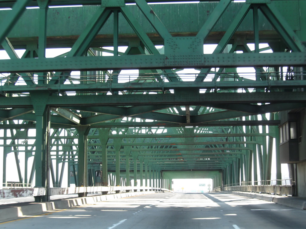
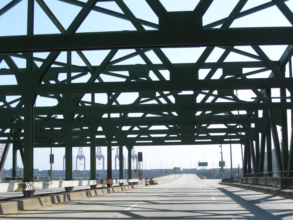
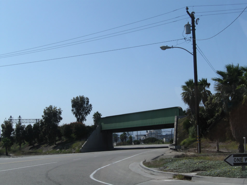
California 47 next passes under the Metro Blue Line, which provides a light rail connection between downtown Los Angeles (Union Station) with Long Beach (at Long Beach Boulevard and First Street just north of the convention center). After passing under the Blue Line, California 47 drops below grade to pass under the Alameda Corridor railway, which carries three mainline tracks overhead. Photos taken 09/28/08. |
|
|
|
|
Southbound California 47 (Alameda Street) meets Santa Fe Avenue at this traffic signal. No turns are permitted from southbound Alameda Street. Photo taken 09/28/08. |
|
Soon thereafter, southbound California 47 (Alameda Street) approaches Del Amo Boulevard. California 47 leaves Rancho Dominguez and enters Carson ("Future Unlimited," population 89,730 as of the 2000 Census, and incorporated on February 20, 1968). Photo taken 09/28/08. |
|
Southbound California 47 (Alameda Street) meets Dominguez Street at this traffic signal. Photo taken 09/28/08. |
|
|
|
Southbound California 47 next meets Carson Street. The overpass carries Carson Street over both Alameda Street and the railroad, while the traffic signal governs the flow of traffic between California 47 and Carson Street. Photos taken 09/28/08. |
|
|
|
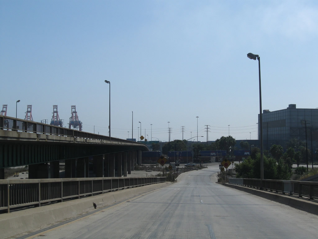
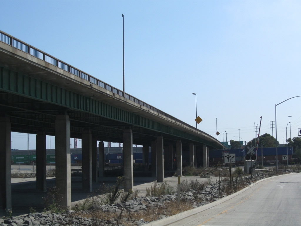
Continuing south, California 47 (Alameda Street) connects next with Interstate 405 north to Los Angeles International Airport and Santa Monica. Continue south on Alameda Street to 223rd Street. To Interstate 405 south, turn left to 223rd Street. A railroad, Interstate 405, and 223rd Street all pass overhead. Photos taken 09/28/08. |
|
Southbound California 47 (Alameda Street) meets 223rd Street at this traffic signal. Photo taken 09/28/08. |
|
The next major intersection along California 47 (Alameda Street) south is with Sepulveda Boulevard (overpass visible in the distance ahead, followed by a traffic signal to offer a connection to this important route). At this junction, exiting traffic may turn left at the traffic signal to join Sepulveda Boulevard east to Willow Street and the northern terminus of California 103 (Terminal Island Freeway) or west to Torrance. Photo taken 09/28/08. |
|
California 47 leaves Carson and enters the city of Los Angeles right around the point where the street light standards change and the LADWP power lines cross over the highway. Photo taken 09/28/08. |
|
|
|
California 47 passes under another railroad overcrossing. The next major intersection along southbound will be with California 1 (Pacific Coast Highway). Photos taken 09/28/08. |
|
|
|
Southbound California 47 (Alameda Street) meets O Street to California 1 (Pacific Coast Highway). Photos taken 09/28/08. |
|
After the California 1 grade separation, California 47 prepares to split from Alameda Street and turn southeast onto Henry Ford Avenue toward the Terminal Island Freeway (California 103). Stay left for California 47 or merge right for the continuation of Alameda Street southwest to Interstate 110 (via Harry Bridges Boulevard) and San Pedro. Note the DETOUR signage; this indicates that Henry Ford Avenue is a temporary alignment for California 47 until the Port Access Expressway segment is built. Photo taken 09/28/08. |
|
Now on Henry Ford Avenue, southbound California 47 meets Denni Street at this traffic signal. Photo taken 09/28/08. |
|
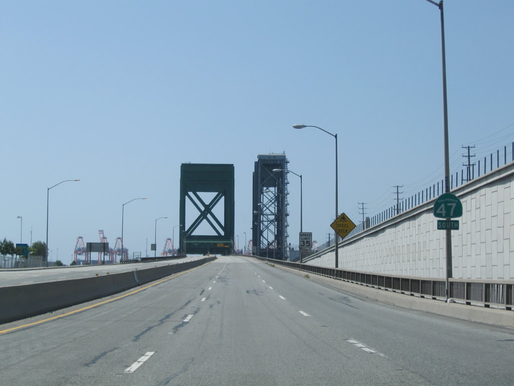
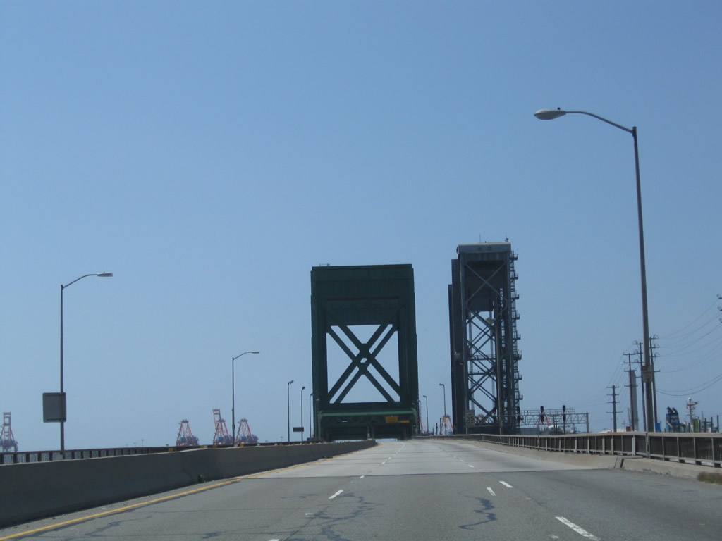
The Commodore Schuyler F. Heim Bridge and railroad bridge lift towers come into view looking south on California 47/Henry Ford Avenue. Photo taken 09/28/08. |
|
Southbound California 47/Henry Ford Avenue meets Anaheim Street at this traffic signal. Photo taken 09/28/08. |
|
|
|
Soon thereafter, California 47/Henry Ford Avenue south approaches its intersection with Pier A Way. At this traffic signal, California 47 will depart from Henry Ford Avenue and prepare to join the Terminal Island Freeway southbound. Photo taken 09/28/08. |
|
|
After the Pier A Way intersection, southbound California 47 passes by a freeway entrance shield assembly and joins California 103 (Terminal Island Freeway) to cross onto Terminal Island via the Commodore Schuyler F. Heim Bridge. Photo taken 09/28/08. |
| California 47-103 - Terminal Island Freeway south |
|
|
Looking from the through lanes of California 103 south, traffic from California 47/Henry Ford Avenue (and the Alameda Corridor) merges onto the Terminal Island Freeway. The next exit along southbound California 47 is Exit 4, New Dock Street. Photos taken 05/02/10 and 09/28/08. |
|
|
Legislatively, California 103 ends at the interchange with California 47; arguably, California 47 and California 103 merge for the remaining southbound distance of the Terminal Island Freeway. California 47-103 is maintained by Caltrans. Photos taken 05/02/10 and 09/28/08. |
|
|
|
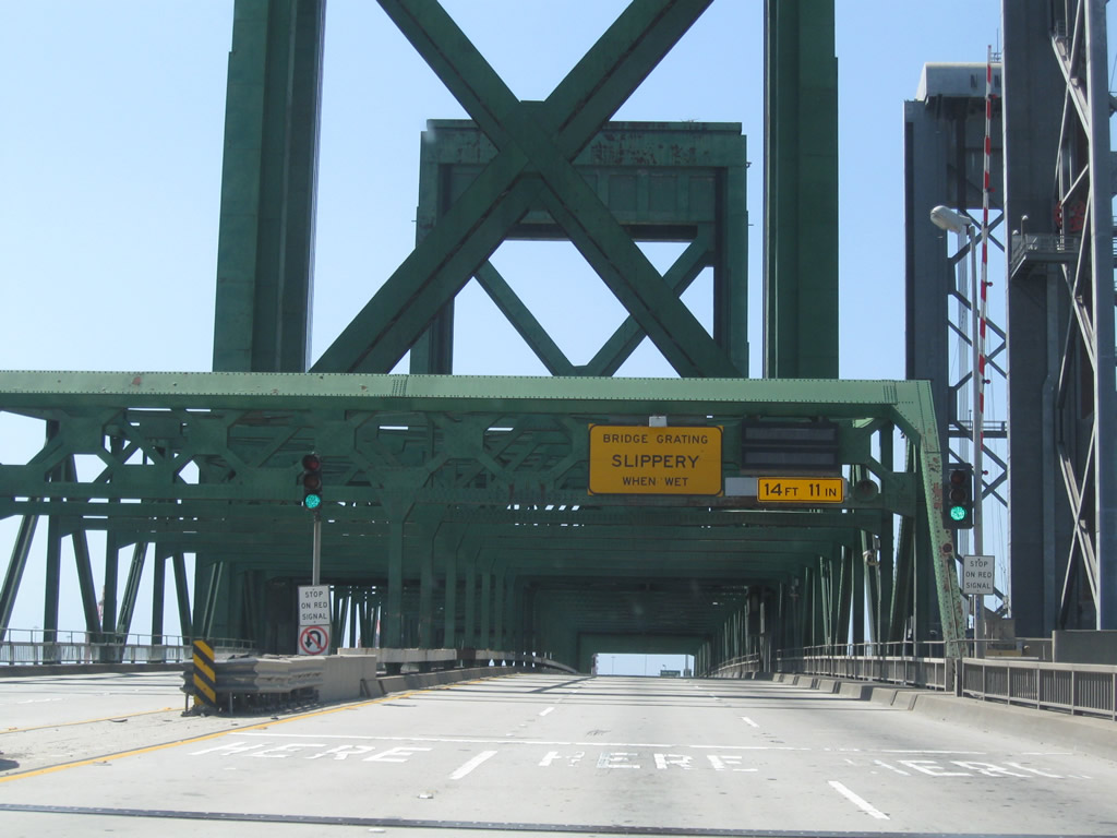
California 47-103 proceeds south across the Commodore Schuyler F. Heim Bridge and enters the city of Long Beach. This lift bridge must be raised to allow larger ships to pass underneath it; as a result, the lift bridge can sometimes stop freeway traffic. Opened to traffic on January 10, 1948, the Heim Bridge carries vehicular traffic over the Cerritos Channel but is seen as functionally deficient due to heavy truck wear and tear and closures due to lift operations. The steel grate deck of the bridge allows for a lighter deck for lifting purposes.2 Plans call for the Heim Bridge to be replaced by a new span as part of the Port Access Expressway project to be coordinated by Alameda Corridor Transportation Authority. Photos taken 09/28/08 and 05/02/10. |
|
|
|
|
|
|
|
After leaving the Heim Bridge, southbound California 47-103 (Terminal Island Freeway) meets Exit 4, New Dock Street. Moviegoers may recognize some of this industrial area around the lift bridge; in fact, the lift bridge can be clearly seen on the section of the "New Jersey Turnpike" portrayed in the movie Being John Malkovich. All of the scenes showing the characters landing alongside the "turnpike" after their trip in John Malkovich's head were in reality landing in a ditch alongside California 47 with some seemingly authentic Interstate shields with the state name. (Note that these New Jersey shields would be authentic if the scenes were filmed on a road maintained by the New Jersey Department of Transportation, but the design of that shield is not used on the turnpike.) Photo taken 05/02/10. |
|
|
|
|
This series of photos follows the off-ramp from California 47-103 south to New Dock Street. Photos taken 09/28/08. |
|
A viaduct carries California 47-103 south between the Schuyler Heim Bridge and the Ocean Boulevard interchange. Once the Port Access Expressway is constructed, a direct transition ramp carrying California 47 through this interchange will enable a freeway to freeway connection here. Photo taken 05/02/10. |
|
Prior to the completion of the diamond interchange between the Terminal Island Freeway and Ocean Boulevard, this trailblazer for California 47 south pointed the way from soutbound Terminal Island Freeway to westbound Ocean Boulevard (which becomes Seaside Avenue upon crossing into Los Angeles). At this intersection (which is now Exit 3 since it was upgraded to an interchange in 2007), California 47 turns right onto the Seaside Freeway, heading southwest toward the Vincent Thomas Bridge, Interstate 110 (Harbor Freeway), and Gaffey Street to San Pedro. Note all of the shipping containers to the left of this roadway. Photo taken 03/30/03. |
|
With the new interchange in place, the traffic signal now links the Terminal Island Freeway with a frontage road for Ocean Boulevard. Photo taken 05/02/10. |
|
|
Southbound California 47-103 (Terminal Island Freeway) approaches Ocean Boulevard. The next right carries California 47 south to the Vincent Thomas Bridge and San Pedro. To Interstate 710 (Long Beach Freeway) to downtown Long Beach and points north, pass under the freeway and turn left at the second traffic signal. This interchange marks the southern terminus of California 103 (although no shields for it are currently posted along southbound after the Heim Bridge). Photos taken 05/02/10. |
|
This sign is posted after the turnoff for California 47 (Ocean Boulevard) west. Turn left for Interstate 710 (Ocean Boulevard) east or continue straight ahead into Berth T136 Gate 2. Photo taken 09/28/08. |
| California 47 (Ocean Boulevard) south (west) |
|
After the turnoff to Interstate 710 north, California 47 briefly turns west on Ocean Boulevard. The next right connects to Pier S Avenue. The frontage road is one-way as it passes along the shadow of the Ocean Boulevard overpass, which carries high-speed traffic from Interstate 710 south to California 47 south (west). Photo taken 05/02/10. |
|
In addition to serving Pier S Avenue, this traffic signal also serves New Dock Street. Photo taken 05/02/10. |
|
Southbound California 47 (Ocean Boulevard) frontage road meets Pier S Avenue and New Dock Street at this traffic signal. Continue straight ahead for the continuation of California 47 west (south). California 47 will merge onto Ocean Boulevard, which changes into Seaside Avenue when California 47 leaves Long Beach and reenters Los Angeles. Photo taken 05/02/10. |
|
The freeway entrance shield for California 47 south is signed as west, which is geographically more accurate. California 47 proceeds nearly due west from here to its southern terminus with Interstate 110 in San Pedro. Photo taken 05/02/10. |
|
Traffic from Interstate 710 (Ocean Boulevard) west merges from the left with California 47 west. Photo taken 05/02/10. |
|
California 47 (Ocean Boulevard) immediately assumes an expressway-freeway configuration. The state route has one traffic signal ahead; otherwise, it is entirely freeway with interchanges. Photo taken 05/02/10. |
|
The next exit along California 47 (Seaside Freeway) south (west) is Exit 2, Navy Way to Berths 301-305 and Berths 401-406. Although this is marked as an interchange, there is a traffic signal to allow for turns and no grade separation. California 47 does not regain full access control until the approach to the Vincent Thomas Bridge. Photo taken 02/02/08. |
|
This reassurance shield along southbound California 47 (Ocean Boulevard) is posted after Exit 3, Interstate 710 (Ocean Boulevard) north (east) to the Gerald Desmond Bridge and downtown Long Beach. Upon leaving Long Beach, California 47 reenters Los Angeles. The next two exits along southbound California 47 is Exit 2, Navy Way. This off-ramp links to cargo berths in the Port of Los Angeles. The Port of Long Beach cedes responsibility for California 47 to the city of Los Angeles as Ocean Boulevard ends and Seaside Avenue begins. Los Angeles takes over signage and maintenance of this section of state highway near the Navy Way intersection. Photo taken 05/02/10. |
| California 47/Seaside Avenue south (west) |
|
At the point where California 47 leaves Long Beach and enters Los Angeles, southbound California 47/Seaside Avenue meets Exit 2, Navy Way to Berths 301-305 and Berths 401-406. Atraffic signal is visible in the distance across this viaduct; it controls access from Navy Way to California 47 and connects California 47 north with Navy Way. Once the Seaside Freeway is upgraded to full freeway standards, the interchange will likely be reconfigured to feature the elimination of the traffic light. Photo taken 05/02/10. |
|
This view looks on the off-ramp from southbound California 47 (Seaside Freeway) to Exit 2, Navy Way Berths 301-305 and Berths 401-406. Since this ramp is a directional ramp, there is no access to Reeves Avenue or Terminal Way by usingn this off-ramp. Use the next traffic signal instead. Photo taken 05/02/10. |
|
Shortly thereafter is the traffic signal with Navy Way. The left two lanes connect to Navy Way with connections to Reeves Avenue and Terminal Way. Terminal Way travels southwest across the island, linking the berths numbering in the 200s. Photo taken 05/02/10. |
|
An erroneous California 47 route marker has a "NORTH" banner when there should be a "WEST" or "SOUTH" banner. Photo taken 05/02/10. |
|
Southbound California 47/Seaside Avenue meets Navy Way at this traffic signal. Ahead, California 47 becomes the Seaside Freeway and prepares to cross the Los Angeles Main Channel via the Vincent Thomas Bridge. Photo taken 05/02/10. |
| California 47 (Seaside Freeway) south (west) |
|
After Navy Way, Seaside Avenue upgrades to the Seaside Freeway. Southbound California 47 (Seaside Freeway) reaches Exit 1D, Ferry Street. This is the last exit along southbound before crossing the Vincent Thomas Bridge. Photo taken 05/02/10. |
|
Ferry Street travels south to the U.S. Customs House, then meets up with Terminal Way. This exit connects to Berths numbering in the 200s. This is the final Terminal Island exit on California 47 west (south). Photo taken 05/02/10. |
|
Signs such as this one along southbound California 47 (Seaside Freeway) herald the approach to Vincent Thomas Bridge. This bridge used to be tolled, and the toll booth was located on the east end of the bridge. Photo taken 02/02/08. |
|
The freeway narrows to two westbound lanes in preparation for the approach to the Vincent Thomas Bridge. Photo taken 05/02/10. |
|
|
|
The Vincent Thomas Bridge opened to traffic on November 15, 1963, replacing passenger and car ferries. This suspension bridge crosses the Los Angeles Channel and serves the Port of Los Angeles and connects Terminal Island with San Pedro, all within the city of Los Angeles. According to the San Pedro community webpage, "San Pedro's Golden Gate" was the first suspension bridge to be built on pilings. Tolls were collected from the time of opening in 1963 until 2000, when it was one of two remaining Southern California toll bridges (the other was the San Diego-Coronado Bridge, which ceased toll collection in June 2002). The blue and white building seen at the eastern end of the bridge is the location of the former toll plaza. The toll booths themselves have since been removed. Photos taken 05/02/10. |
|
|
|
|
|
|
|
|
|
The next exit along California 47/Vincent Thomas Bridge south is Exit 1C, Harbor Boulevard (one mile). Two of the next three exits (Exit 1C, Harbor Boulevard and Exit 1A, Gaffey Street) serve the community of San Pedro ("A Whale of a Town"), which is part of the city of Los Angeles. Photos taken 05/02/10. |
|
|
|
Statistically speaking, the Vincent Thomas bridge "required 92,000 tons of Portland cement; 13,000 tons of lightweight concrete; 14,100 tons of steel; and 1,270 tons of suspension cable. (The bridge) is designed to withstand winds of 90 miles per hour, double that required by code. The overall length of the bridge is 6,050 feet, with a main suspension span of 1,500 feet and 500-foot spans on either side. The towers are 365 feet high."1 The bridge is named for former State Assemblyman Vincent Thomas, a legislator who championed the bridge's construction and was present to open the bridge to traffic in 1963. The bridge was constructed at a time when the Port of Los Angeles and Port of Long Beach were still growing and gaining traffic volume, so its importance grew as it served more trucks and commercial traffic associated with the port. Photos taken 05/02/10 and 02/02/08. |
|
|
|
|
|
|
|
|
|
|
Use Exit 1C (Harbor Boulevard) to Santa Catalina Island and Ports O Call Village. San Pedro is a popular origination point for ferries leading to Santa Catalina Island and the city of Avalon (incorporated on June 26, 1913, Avalon is the only incorporated city located on the Channel Islands and was home to 3,127 people as of the 2000 Census). Due to its location on Santa Catalina Island, Avalon is not connected by road to mainland California; a ferry ride from several coastal California cities (including San Pedro, Long Beach, Newport Beach, and Dana Point) is required to reach the resort city. Photo taken 05/02/10. |
|
As California 47 traffic descends back to the mainland from the Vincent Thomas Bridge, the dominant feature in the distance is Rancho Palos Verdes. Less noticeable from the scenic view but significant in the history of labor and unions is Liberty Hill. The link goes to the Marine Transport Workers Industrial Union 510 webpage with a facsimile of the historical marker noting the significance of a labor strike from 1923 that helped to bring better working conditions for port workers during the Roaring Twenties. The historical marker can be found at the intersection of 5th Street and Harbor Boulevard. Photo taken 05/02/10. |
|
For a brief time around 2008, this advance sign for Harbor Boulevard was the only guide sign for Exit 1C. Now a complete overhead guide sign assembly (see next picture) is posted for Exit 1C. Photo taken 05/02/10. |
|
Southbound California 47 (Seaside Freeway) reaches Exit 1C, Harbor Boulevard to San Pedro. The next exits are Exit 1B, Interstate 110 (Harbor Freeway) north and Exit 1A, Gaffey Street south. (Gaffey Street was briefly part of California 110 between California 47 and Ninth Street, but signs for that route were removed during the early 2000s.) Photo taken 05/02/10. |
|
|
The final two exits along California 47 south (west) are Exit 1B, Interstate 110 (Harbor Freeway) and Exit 1A, Gaffey Street south. This guide sign was placed during the period when the overhead guide sign (see previous picture) was missing. It was left in place after the new overhead guide signs were posted. Photos taken 05/02/10 and 02/02/08. |
|
The right lane of California 47 west becomes exit only for Exit 1B, Interstate 110 (Harbor Freeway) north to downtown Los Angeles. The left two lanes will link to Exit 1A, Gaffey Street south to San Pedro. Most motorist services can be found along Gaffey Street in San Pedro. Photo taken 05/02/10. |
|
|
Southbound California 47 splits, with the left two lanes connecting to Exit 1A, Gaffey Street south and the right lane linking to Exit 1B, Interstate 110 (Harbor Freeway) north. This marks the southern terminus of California 47. No end shield is present. Photos taken 05/02/10 and 02/02/08. |
|
Now on the transition ramp from California 47 west to Interstate 110 north, it does not take long before traffic merges onto Interstate 110 (Harbor Freeway) north toward downtown Los Angeles. Photo taken 02/02/08. |
|
|
|
California 47 continues with two westbound/southbound lanes. Stay left for the connection to Gaffey Street south to San Pedro. At the traffic signal, motorists may turn left for Gaffey Street south, right for Gaffey Street north, or straight ahead for Summerland Avenue. Photos taken 05/02/10. |
|
|
|
Page Updated October 21, 2010.


 >
>
