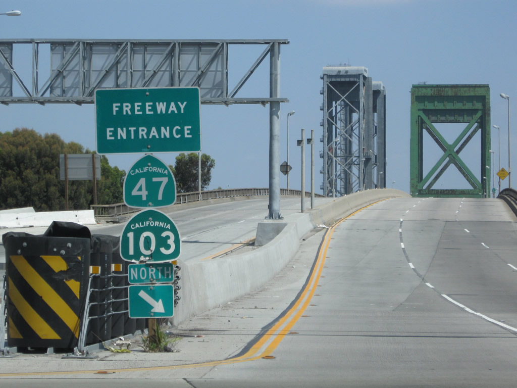
| California 47 north |
|
Leaving San Pedro "A Whale of a Town", northbound Interstate 110 (Harbor Freeway) and California 47 (Seaside Freeway) separate. Stay left for Interstate 110 north to downtown Los Angeles or merge right for California 47 north to Terminal Island and the Ports of Los Angeles and Long Beach. Photo taken 09/28/08. |
|
California 47 crosses the Vincent Thomas Bridge between San Pedro and the Port of Los Angeles on Terminal Island. This sign used to indicate the cost of the toll to cross the bridge; now it just advises that the bridge is ahead. The toll was eliminated in 2000. Photo taken 05/30/04. |
|
Significant in the history of labor and unions is Liberty Hill. A historical marker noting the significance of a labor strike from 1923 that helped to bring better working conditions for port workers during the Roaring Twenties can be found at the intersection of 5th Street and Harbor Boulevard. Photo taken 09/28/08. |
|
|
|
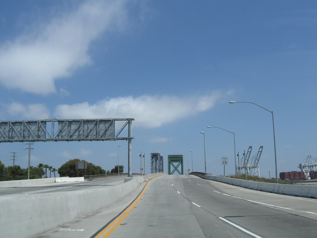
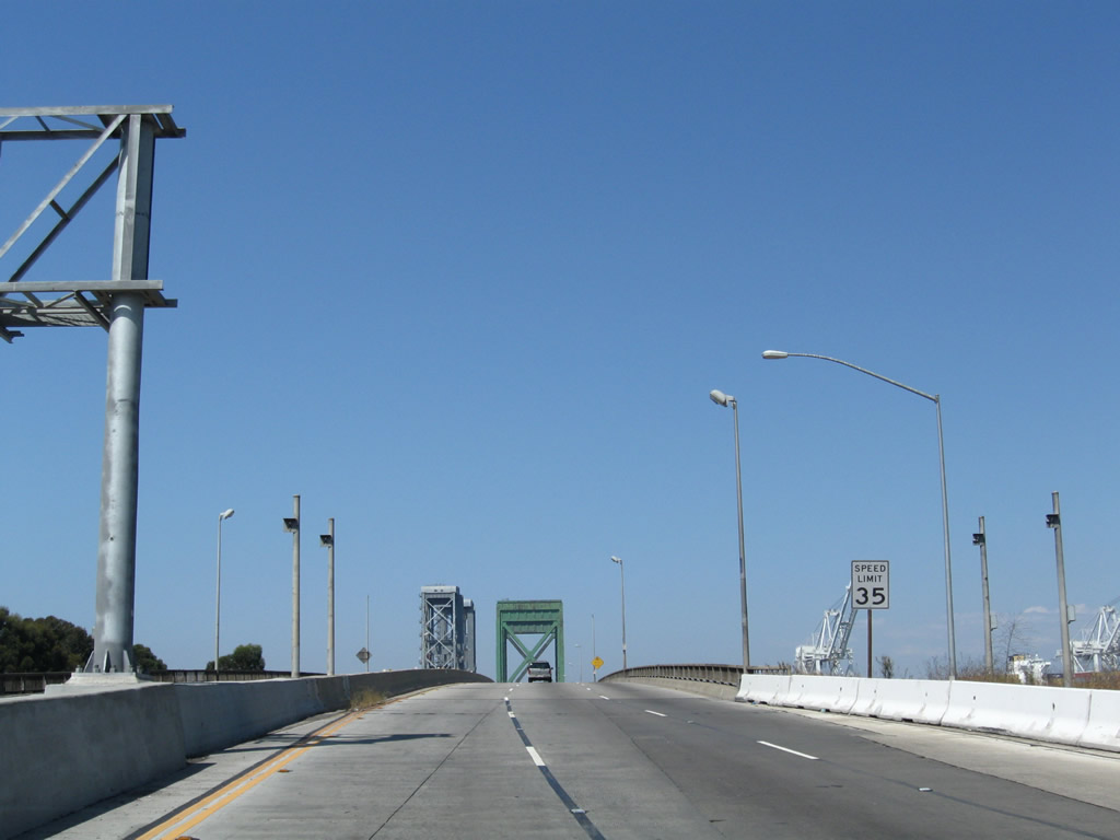
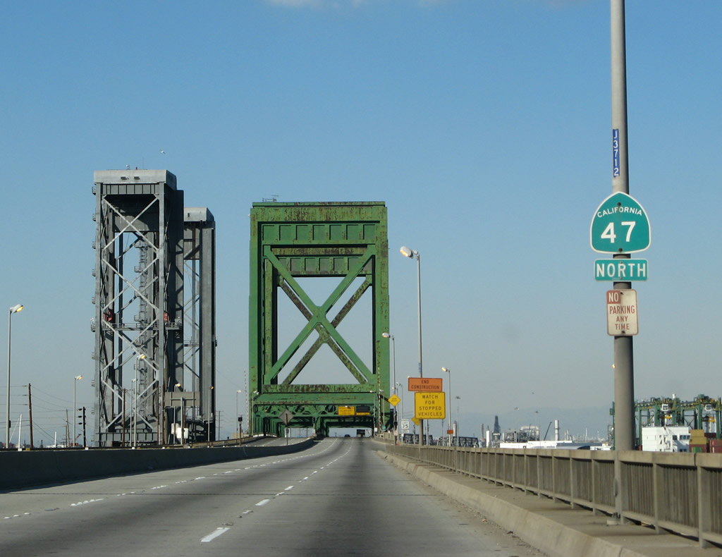
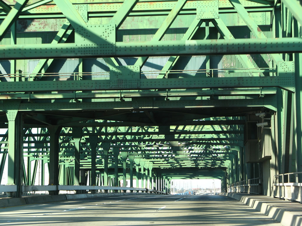
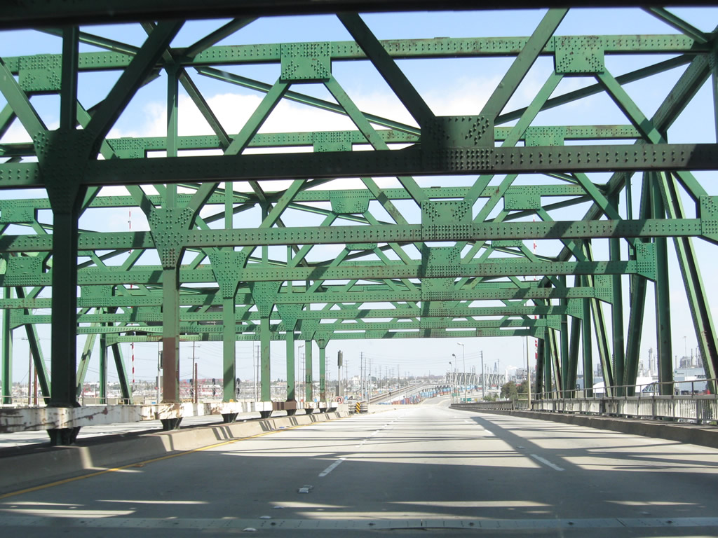
The right lane of California 47 (Seaside Freeway) north becomes exit only for Exit 1A, Harbor Boulevard. This is the final exit before California 47 leaves the mainland to connect to Terminal Island. In the final picture, note the colorful blue lights that were added to the bridge as part of an enhancement project in 2005. Tower painting was underway in 2008; hence why the western tower at that time was shrouded in white. Photos taken 09/28/08, 09/29/07, and 08/26/07. |
|
|
|
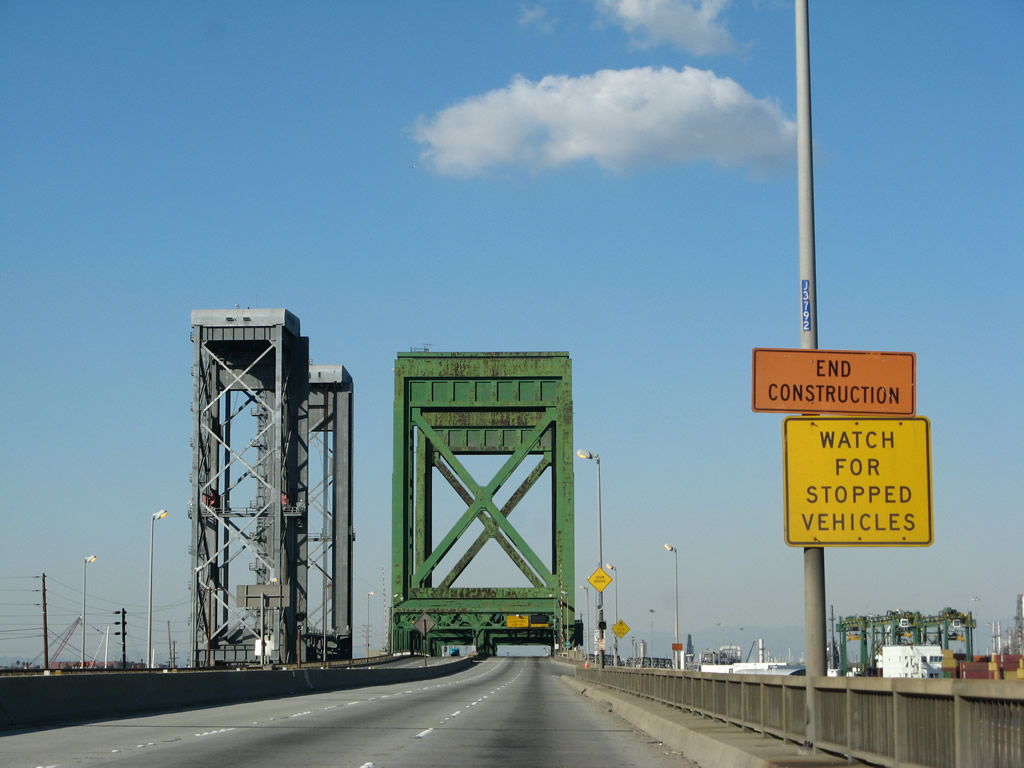
Eastbound (southbound) California 47 (Seaside Freeway) meets Exit 1A, Harbor Boulevard. Ahead, the freeway narrows to two eastbound lanes to cross the Los Angeles Channel and approach Terminal Island. The Vincent Thomas Bridge dominates the skyline in the background, its brilliant green contrasting with the blue waters and gray industry. Photos taken 09/28/08, 09/29/07, and 08/26/07. |
|
|
|
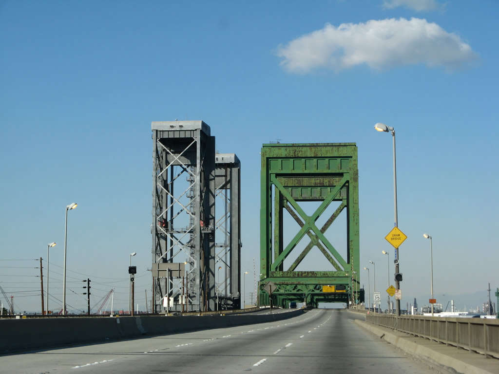
A ramp from Harbor Boulevard merges onto California 47 (Seaside Freeway) east. The freeway ascends to the Vincent Thomas Bridge, which travels high above the channel and port docks below. Photos taken 09/28/08, 09/29/07, and 08/26/07. |
|
The next exit along California 47 north is Exit 1B, Ferry Street on Terminal Island in the Port of Los Angeles. Photo taken 05/02/10. |
|
|
|
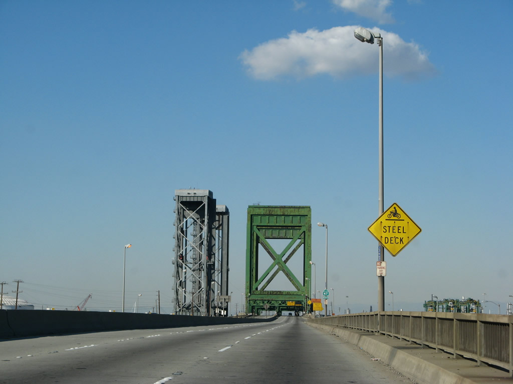
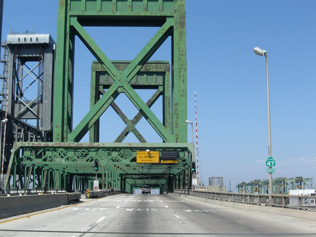
California 47 crosses the Los Angeles Channel via the Vincent Thomas Bridge, which connects San Pedro and Terminal Island within the city of Los Angeles. The Vincent Thomas Bridge opened to traffic on November 15, 1963, replacing passenger and car ferries. This suspension bridge crosses the Los Angeles Channel and serves the Port of Los Angeles and connects Terminal Island with San Pedro, all within the city of Los Angeles. According to the San Pedro community webpage, "San Pedro's Golden Gate" was the first suspension bridge to be built on pilings. Tolls were collected from the time of opening in 1963 until 2000, when it was one of two remaining Southern California toll bridges (the other was the San Diego-Coronado Bridge, which ceased toll collection in June 2002). Statistically speaking, the Vincent Thomas bridge "required 92,000 tons of Portland cement; 13,000 tons of lightweight concrete; 14,100 tons of steel; and 1,270 tons of suspension cable. (The bridge) is designed to withstand winds of 90 miles per hour, double that required by code. The overall length of the bridge is 6,050 feet, with a main suspension span of 1,500 feet and 500-foot spans on either side. The towers are 365 feet high."1 The bridge is named for former State Assemblyman Vincent Thomas, a legislator who championed the bridge's construction and was present to open the bridge to traffic in 1963. The bridge was constructed at a time when the Port of Los Angeles and Port of Long Beach were still growing and gaining traffic volume, so its importance grew as it served more trucks and commercial traffic associated with the port. The Vincent Thomas Bridge has starred in many movies, since it is the closest suspension bridge to Hollywood. The Nicholas Cage and Angelina Jolie movie, "Gone in Sixty Seconds," has a chase scene that shows Cage flying over a traffic jam on the bridge. Despite its freeway status, the Vincent Thomas Bridge is too narrow to be Interstate-standard, so routing an Interstate highway over this bridge would require a reduction in the number of lanes to allow for a shoulder or the request for a waiver of those standards. Photos taken 09/28/08, 09/29/07, 08/26/07, 05/30/04, and 05/02/10. |
|
|
|
|
|
|
|
|
|
|
|
|
|
Use Exit 1B (Ferry Street) to a federal correctional institution on Terminal Island. Photo taken 09/29/07. |
|
Northbound California 47 (Seaside Freeway) reaches Exit 1B, Ferry Street, the first exit on Terminal Island. This is the approximate location of the toll booths back from the days when California 47/Vincent Thomas Bridge was a toll bridge. Photo taken 09/28/08. |
|
The eastern approach to the Vincent Thomas Bridge has ample width due to the toll plaza that used to be located on this side of the bridge. As a result, the eastbound lanes appear to widen substantially after the gore point at Exit 1B (Ferry Street). The freeway promptly narrows back down as we approach the intersection with Exit 2 to Navy Way. Photo taken 09/28/08. |
|
Traffic from Ferry Street merges onto eastbound (northbound) California 47. The next exit is Exit 2, which is a traffic signal connecting California 47 north (east) with Navy Way en route to Berths 301-305 and Berths 401-406. For access to Terminal Way, turn right on Navy Way. Photo taken 09/28/08. |
| California 47/Seaside Avenue north (east) |
|
California 47 downgrades to an expressway briefly with its lone intersection (between Seaside Avenue and Navy Way). The Navy Way intersection serves as Exit 2, which connects to Port of Los Angeles Berths 301-305 and Berths 401-406. Photo taken 09/28/08. |
|
A traffic signal governs flow between California 47 (Seaside Freeway) and Exit 2. Photo taken 09/28/08. |
|
Northbound (eastbound) California 47 (Seaside Freeway) meets Navy Way at this intersection. If this intersection is upgraded to freeway standards, this would be Exit 2. At the traffic signal at "Exit 2" to Navy Way and Berths 301-305 and Berths 401-406, it is clear that Seaside Avenue is not built to freeway standards, and the next "exit" is actually a traffic signal. Photo taken 09/28/08. |
|
Leaving the Navy Way intersection, California 47 next approaches the interchange with the Terminal Island Freeway and Interstate 710 (Ocean Boulevard). The Gerald Desmond Bridge comes into view in the distance. In 2004, the intersection of California 47 and Interstate 710 was governed by a traffic signal. By 2007, an interchange was built in its place. Photo taken 05/30/04. |
| California 47 (Ocean Boulevard) north (east) |
|
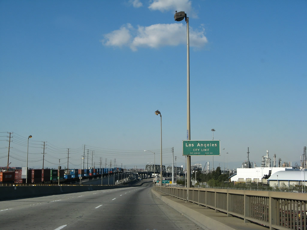
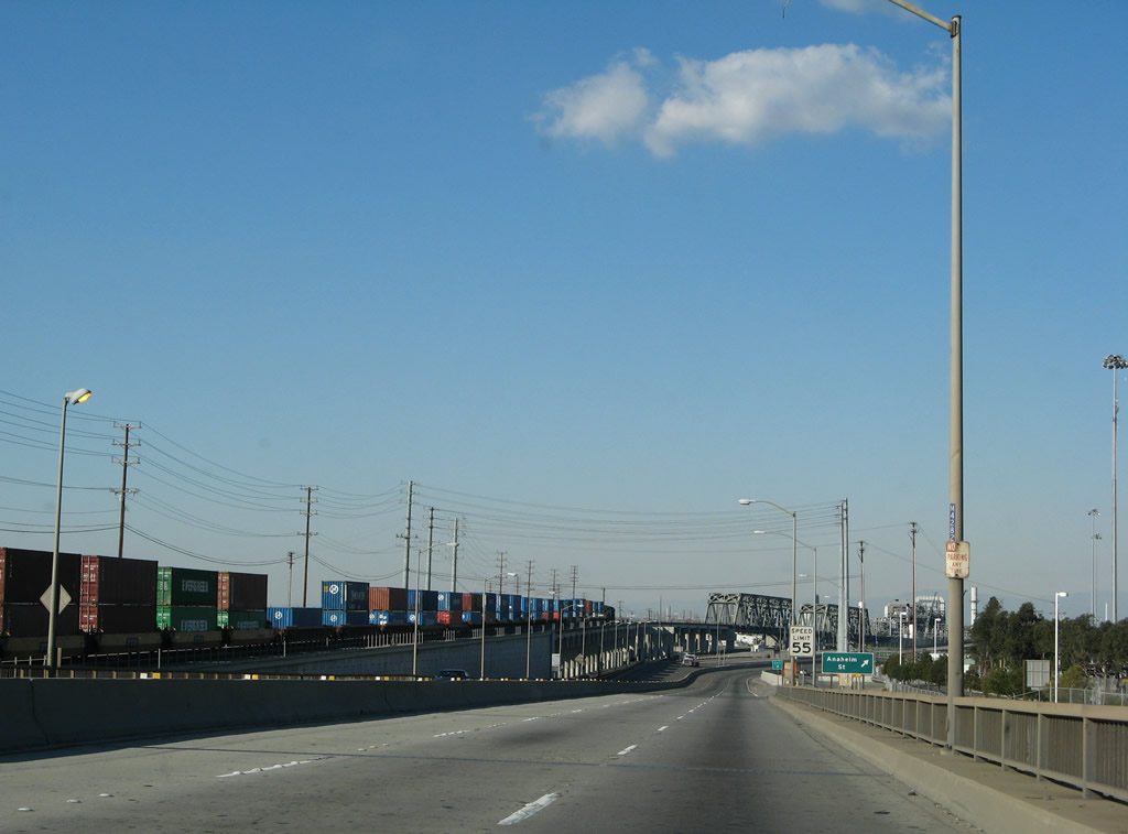
California 47 leaves the city of Los Angeles and enters the city of Long Beach (and the state route changes names from Seaside Avenue to Ocean Boulevard). Northbound (eastbound) California 47 next approaches Exit 3, Interstate 710 (Long Beach Freeway) and Ocean Boulevard north to downtown Long Beach and Pasadena. Stay left for Interstate 710 or merge right to follow California 47 north. From this interchange, California 103 begins and proceeds north along with California 47 on the Terminal Island Freeway. The two routes will divide after crossing the Heim Bridge. Photo taken 09/28/08. |
|
Stay right to follow California 47-103 (Terminal Island Freeway) north and to Pier S Avenue. Photo taken 09/28/08. |
|
Northbound California 47 reaches Exit 3, Interstate 710 north (east) to downtown Long Beach (left exit). Stay right to follow California 47 and 103 north. Photo taken 09/28/08. |
|
As much of the traffic using this interchange is commercial and truck traffic, some auxiliary signs reference truck services. Photo taken 09/28/08. |
|
The interchange between Interstate 710 and California 47-103 was built in 2007. Even though California 47 is the through route, it is forced to exit from its freeway alignment and follow a frontage road before connecting to the northbound Terminal Island Freeway. Photo taken 09/28/08. |
|
|
Northbound California 47 (Seaside Freeway) approaches the intersection with Pier S Avenue and New Dock Street. Turn left here for various container terminals within the Port of Los Angeles and Port of Long Beach. The 2008 picture shows the current configuration with the freeway overpass, while the 2004 picture shows the original traffic signal that stopped all through traffic at this intersection. Photos taken 09/28/08 and 05/30/04. |
|
|
Shortly thereafter, northbound California 47 (Seaside Freeway) briefly enters the city of Long Beach at Pier S Avenue and New Dock Street. Photos taken 09/28/08 and 05/30/04. |
|
Northbound California 47 (Seaside Freeway) next approaches the intersection with the Terminal Island Freeway, which travels north through the Port of Los Angeles and past industrial areas to end at Willow Street in Long Beach. Motorists may also continue straight through this traffic signal to join Interstate 710 north (east) to downtown Long Beach. This intersection also marks the southern terminus of California 103. Photo taken 09/28/08. |
|
To Piers B through J and Pier T, follow Interstate 710 north (east). Use Interstate 710 also to the Queen Mary, Aquarium of the Pacific, and Long Beach Cruise Ship Terminal. Turn right at the signal ahead to Berth T136 and Gate 2, both part of the Port of Long Beach. Photo taken 09/28/08. |
|
|
Right after that, northbound California 47 (Seaside Freeway) turns left at this traffic signal to join California 103 (Terminal Island Freeway) north to the Heim Bridge. Continue straight ahead to join Interstate 710 north and to Exit 1A, Pier T. Photos taken 09/28/08 and 05/30/04. |
|
|
|
|
Looking at the connecting ramp from California 47 north to Interstate 710 north, these photos show the new overpass built in 2007 that carries traffic across Terminal Island between the Vincent Thomas Bridge and Gerald Desmond Bridge. Follow Interstate 710 north to Ocean Boulevard east into downtown Long Beach. Interstate 710 turns north at that point and proceeds to follow the Los Angeles River north toward downtown Los Angeles and ultimately Pasadena (if a proposed tunnel is built to connect the route). Photos taken 08/26/07. |
|
|
| California 47-103 (Terminal Island Freeway) north |
|
After passing under the Interstate 710 freeway bridge, northbound California 47-103 meet a third traffic signal at the north frontage road for Ocean Boulevard. The Terminal Island Freeway begins after passing through this signalized intersection. Photo taken 05/02/10. |
|
A freeway entrance shield assembly is posted for California 47-103 north as we transition onto the Terminal Island Freeway north. Photo taken 05/02/10. |
|
|
|
California 47-103 starts as a substandard freeway, with a reduced speed limit and limited shoulders. To leave Terminal Island and return to the mainland, California 47-103 (Terminal Island Freeway) will use the Commodore Schuyler F. Heim Bridge. This lift bridge must be raised to allow larger ships to pass underneath it; as a result, the lift bridge can sometimes stop freeway traffic. Opened to traffic on January 10, 1948, the Heim Bridge carries vehicular traffic over the Cerritos Channel but is seen as functionally deficient due to heavy truck wear and tear and closures due to lift operations. The steel grate deck of the bridge allows for a lighter deck for lifting purposes.2 Plans call for the Heim Bridge to be replaced by a new span as part of the Port Access Expressway project to be coordinated by Alameda Corridor Transportation Authority. Photos taken 05/02/10, 07/13/09, 01/14/07, and 05/30/04. |
|
|
|
|
|
|
|
|
|
|
|
|
|
California 47-103 (Terminal Island Freeway) leave Long Beach and enter the city of Los Angeles after departing from Terminal Island. Photo taken 01/14/07. |
|
The Alameda Corridor is a north-south rail corridor that carries freight from the Ports of Los Angeles and Long Beach north to large railyards near downtown Los Angeles, where trains can carry freight north, northeast, and east to distant markets. The railroad, which also crossed Cerritos Channel using a lift bridge, comes into view on an elevated track along the west side of California 47-103. Photo taken 01/14/07. |
|
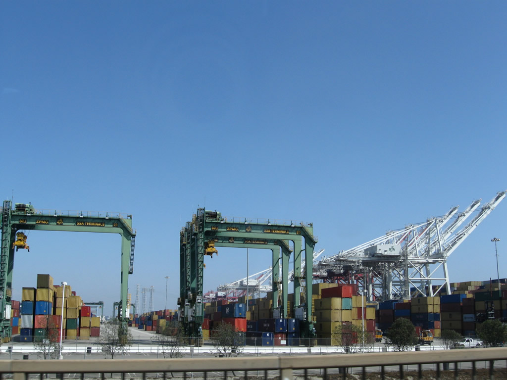
The Ports of Los Angeles and Long Beach feature massive container yards with towering cranes designed to lift cargo from ships and transfer them to holding areas until trucks or rail can take the freight to the appropriate market. Photo taken 07/13/09. |
|
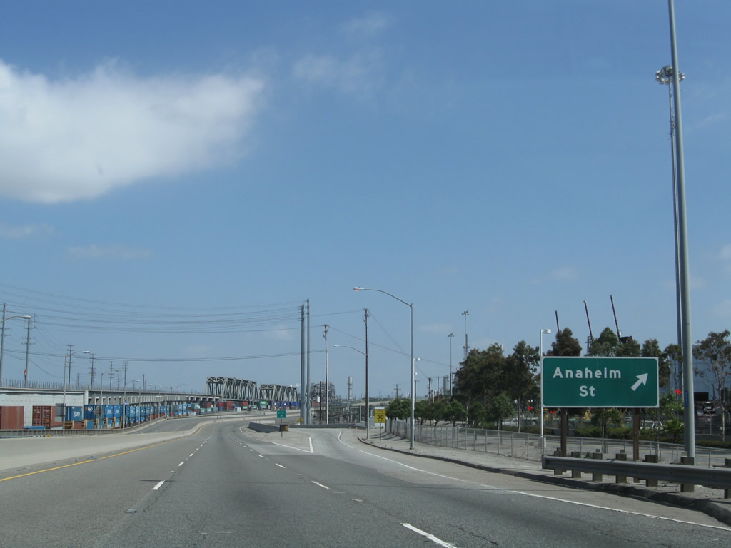
California 47 and California 103 split at Exit 4, Anaheim Street and Henry Ford Avenue. Although not signed here, California 47 departs the Terminal Island Freeway at the Anaheim Street exit to connect to Henry Ford Avenue and Alameda Street. California 47 continues north along the Alameda Corridor (expressway) all the way to California 91. The left three lanes continue as the Terminal Island Freeway north as California 103 north. Photo taken 05/02/10. |
|
|
A below grade railroad comes into view below the above grade railroad at the gore point for Exit 4, Anaheim Street. Continue north on the freeway by going to the California 103 page. Ahead, we'll follow Henry Ford Avenue north to Alameda Street. Photos taken 05/02/10 and 09/28/08. |
| California 47/Henry Ford Avenue north |
|
Now on the transition ramp from the Terminal Island Freeway, two lanes carry California 47 north onto Henry Ford Avenue. A substation is located alongside the transition ramp. Photo taken 09/28/08. |
|
The northbound lanes of California 47 curve to the northwest in order to pass under the Terminal Island Freeway next to the Union Pacific Railroad. Visible ahead is an oil refinery. Photo taken 09/28/08. |
|
California 47 shifts to an expressway configuration (with a temporary segment along Henry Ford Avenue). The next intersection along California 47 north is with Pier A Way. Photo taken 05/30/04. |
|
The next intersection along California 47 north is with Pier A Way and Anchorage Road . To the Alameda Corridor, continue north on Henry Ford Avenue. This alignment for California 47 is temporary, pending completion of the Port Access Expressway. Photo taken 09/28/08. |
|
The right lane turns onto Pier A Way, while a traffic signal governs the flow to turn left onto Anchorage Road. Photo taken 09/28/08. |
|
Northbound California 47 meets Anchorage Road and Pier A Way at this traffic signal. An at-grade railroad and above grade railroad pass through this intersection. Note the back of the California 47 freeway entrance shield assembly for the southbound direction. Photo taken 09/28/08. |
|
This California 47 north reassurance shield is posted on Henry Ford Avenue after the Anchorage Road and Pier A Way intersection. Photo taken 09/28/08. |
|
California 47/Henry Ford Avenue crosses over the Dominguez Channel, which flows south into the Consolidated Ship Channel and eventually leads through the ports toward the ocean. Photo taken 09/28/08. |
|
Another railroad meets California 47 at this at-grade crossing. One of the needs of the replacement Port Access Expressway would be to eliminate at-grade crossings along this stretch of Henry Ford Avenue, as well as create a reliable alternate route for trucks on roads other than Interstate 710 and Interstate 110. Photo taken 09/28/08. |
|
California 47 carries six lanes along the Henry Ford Avenue segment. Photo taken 09/28/08. |
|
Northbound California 47/Henry Ford Avenue meets Anaheim Street at this traffic signal. Photo taken 09/28/08. |
|
North of Anaheim Street, California 47 sees more industrial development with large storage areas and cargo businesses. Photo taken 09/28/08. |
|
Northbound California 47/Henry Ford Avenue meets Denni Street at this traffic signal. Photo taken 09/28/08. |
|
California 47 curves off Henry Ford Avenue and will now merge onto Alameda Street north. Alameda Street was widened and improved to facilitate cargo movement between the ports and Interstate 405. Photo taken 09/28/08. |
| California 47 (Alameda Street) north |
|
Leaving Henry Ford Avenue, California 47 joins Alameda Street northbound. Although signed as a state highway, Alameda Street is not currently maintained by Caltrans. Photo taken 09/28/08. |
|
This view looks north along Alameda Street. The state route is a conventional city street with some limited access with intersecting arterial roadways. Ahead are two at-grade rail crossings. Photo taken 09/28/08. |
|
|
|
The second at-grade crossing seen in the prior picture along Alameda Street northbound was active at the time we passed through the area. The train came at an angle, then curved to cross Alameda Street. The locomotive is labeled as being part of the Pacific Harbor Line with low emissions. Several containers were hauled by the locomotive; these container were traveling south, likely to a storage yard or to a container ship waiting at the ports. Photos taken 09/28/08. |
|
|
|
|
A California 47 north reassurance shield is posted between the railroad crossing and the California 1 (Pacific Coast Highway) overpass (visible in the background behind the shield). Photo taken 09/28/08. |
|
California 1 (Pacific Coast Highway) crosses over California 47 (Alameda Street). This bridge was built in 2004 as part of the Alameda Corridor project. Since Caltrans does not maintain this stretch of California 47, the bridge opening dates are not listed under Route 47 in the District VII bridge log; instead, we looked at the bridge log entry for Route 1. Photo taken 09/28/08. |
|
Since California 1 (Pacific Coast Highway) flies over California 47 (Alameda Street), the connection between the two roadways is made via a right turn at this traffic signal. California 1 travels north (west) to Torrance and Lomita and south (east) to Long Beach. This advance sign was apparently gone by 2008. Photo taken 05/30/04. |
|
|
Northbound California 47 (Alameda Street) meets California 1 (Pacific Coast Highway) at this traffic signal. Turn right on O Street to make the transition to California 1. Photos taken 09/28/08. |
|
|
|
Grade separations such as this one helped make the Alameda Corridor less congested and better able to handle increased truck traffic diverted from using Interstate 110 or Interstate 710. Another railroad crosses over Alameda Street while the highway continues with six lanes (three in each direction). Although not visible, the parallel rail corridor continues north on a separate alignment from California 47. Photos taken 05/30/04 and 09/28/08. |
|
|
|
|
|
|
Northbound California 47 (Alameda Street) approaches the Sepulveda Boulevard interchange next. At this junction, exiting traffic may turn right at the traffic signal to join Sepulveda Boulevard east to Willow Street and the northern terminus of California 103 (Terminal Island Freeway) or west to Torrance. Photos taken 05/30/04 and 09/28/08. |
|
|
|
For a time, the rail corridor is visible at-grade to the west of California 47. While the Alameda Corridor has limited major intersections, there are driveways. California 47 leaves Los Angeles and enters the city of Carson ("Future Unlimited," population 89,730 as of the 2000 Census, and incorporated on February 20, 1968). Photos taken 05/30/04 and 09/28/08. |
|
Northbound California 47 (Alameda Street) meets 223rd Street at this traffic signal. While 223rd Street passes over Alameda Street in the background (first bridge), this right turn provides the link to both directions of 223rd Street. Photo taken 09/28/08. |
|
|
|
California 47 passes under three overpasses: 223rd Street, Interstate 405 (San Diego Freeway), and a railroad. Merge into the right lane for the connection to Interstate 405 (San Diego Freeway) north to Los Angeles International Airport, Santa Monica, and Sacramento. Photos taken 05/30/04 and 09/28/08. |
|
|
Northbound California 47 (Alameda Street) meets the turnoff to Interstate 405 (San Diego Freeway) north to Los Angeles International Airport, Santa Monica, and Sacramento. Photos taken 05/30/04 and 09/28/08. |
|
|
The next intersection along California 47 (Alameda Street) north connects California 47 with Carson Street. Photos taken 09/28/08. |
|
|
|
Leaving the vicinity of the Interstate 405 interchange, California 47 next approaches Monroe Street and a traffic signal at Dominguez Street. Photos taken 05/30/04 and 09/28/08. |
|
Northbound California 47 meets Dominguez Street. The rail corridor continues to follow California 47 on the west side of Alameda Street at grade (for now). Photo taken 05/30/04. |
|
|
|
Following the signalized intersection with the connecting ramp to Dominguez Street, northbound California next approaches Del Amo Boulevard, which flies over California 47 and the rail corridor via an overpass. At Del Amo Boulevard, California 47 departs Carson and enters unincorporated Rancho Dominguez. Photos taken 05/30/04 and 09/28/08. |
|
Northbound California 47 (Alameda Street) approaches Vista Industria. Photo taken 09/28/08. |
|
This view looks north along California 47 (Alameda Street) between Vista Industria and Santa Fe Avenue. Photo taken 09/28/08. |
|
|
|
North California 47 continues along Alameda Street (left two lanes), while the right lane exits onto Santa Fe Avenue. A traffic signal allows traffic from southbound Santa Fe Avenue to connect to southbound Alameda Street. Photos taken 09/28/08. |
|
Some of the California 47 shields and signs, including this one at Santa Fe Avenue, have been tagged by graffiti artists. After this intersection with Santa Fe Avenue, California 47 will descend below grade to pass under the railroad. Photo taken 09/28/08. |
|
|
|
Alameda Street passes under the railroad via this massive viaduct that was built in 2004. After this viaduct, California 47 will parallel the Union Pacific Railroad to the left. The railroad is squeezed between California 47 (Alameda Street) on its west side and Compton Creek on its east side. Photos taken 09/28/08. |
|
California 47 next passes under the Metro Blue Line, which provides a light rail connection between downtown Los Angeles (Union Station) with Long Beach (at Long Beach Boulevard and First Street just north of the convention center). Photo taken 09/28/08. |
|
|
|
California 47 (Alameda Street) proceeds north parallel to the Union Pacific Railroad. Photos taken 09/28/08. |
|
Northbound Alameda Street approaches Homestead Place. After this turnoff, California 47 leaves Rancho Dominguez and enters the city of Compton (incorporated May 11, 1888 and population 93,493 as of the 2000 Census). Photo taken 09/28/08. |
|
|
|
Next, California 47 (Alameda Street) approaches California 91/Gardena (Redondo Beach) Freeway. California 91 travels west to the beach cities such as Manhattan Beach and Redondo Beach or east to Anaheim and Riverside. The first left connects to California 91 east, while the second left (after the bridge) links to California 91 west. Photos taken 05/30/04 and 09/28/08. |
|
|
|
|
|
Turn left here to connect from California 47 (Alameda Street) north to California 91 west to Redondo Beach. The California 47 designation ends here at the California 91 interchange; north of here, Alameda Street continues en route toward downtown Los Angeles, but trucks are assumed to use the California 91 freeway from here to deliver their cargo. No end shield is present here. Photos taken 05/30/04 and 09/28/08. |
| Alameda Street north |
|
A welcome to Compton sign is posted on northbound Alameda Street after the California 91 interchange. Photo taken 09/28/08. |
|
Northbound Alameda Street approaches Greenleaf Boulevard. In an effort to reduce noise and traffic congestion due to the major Union Pacific Railroad alignment through Compton, the Alameda Corridor project lowered the tracks into a trench that begins just north of California 91 and extends north. This allows for minimal impacts for traffic. A view of the railroad trench can be achieved by looking down from Greenleaf Boulevard. Photo taken 09/28/08. |
|
A set of Southern California Edison power lines cross over the Alameda Corridor trench (Union Pacific Railroad) and Alameda Street. This view looks east toward the towers. The chain link fence prevents accidental entry into the railroad trench. Photo taken 09/28/08. |
|
Northbound Alameda Street meets Greenleaf Boulevard. Photo taken 09/28/08. |
Page Updated October 21, 2010.