| Business Loop I-40 and U.S. 66/Broadway east |
|
A small trailblazer sign for the continuation of Business Loop I-40 east is posted along eastbound Broadway (Arch Street) in Needles. At the upcoming intersection, Business Loop I-40 and U.S. 66 turn right along with Broadway, while Arch Street continues straight toward K Street and Arizona 95 north. Photo taken 02/20/05. |
|
A Business Loop I-40 trailblazer is posted on eastbound Broadway at the Arizona 95/Arch Street intersection. To Bullhead City, continue straight to K Street, then turn left to cross the Colorado River into Arizona. To Arizona 95 south, follow Business Loop I-40 east to Interstate 40 east to Exit 9 in Arizona. Photo taken 02/20/05. |
|
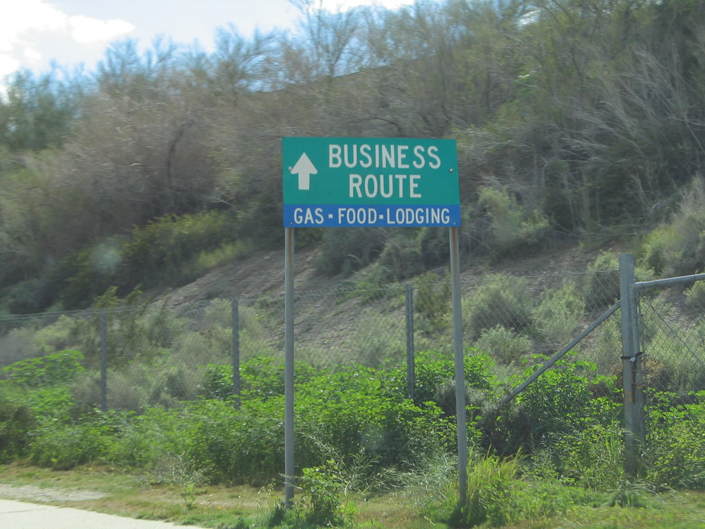
Another business route trailblazer sign with motorist services is posted along Broadway as Historic U.S. 66 proceeds east through Needles. Photo taken 02/20/05. |
|
|
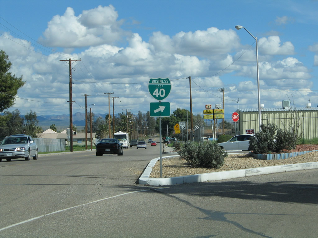
A pair of trailblazers for the continuation of Business Loop I-40 east to Interstate 40 east is posted at the L Street intersection. Photos taken 02/20/05 and 03/14/09. |
|
|
Eastbound Business Loop I-40 and U.S. 66 approach J Street at a four-way stop. Turn right to follow J Street to Interstate 40. Continue straight to follow U.S. 66 and Business Loop I-40 east along Broadway. Photos taken 02/20/05 and 03/14/09. |
|
|
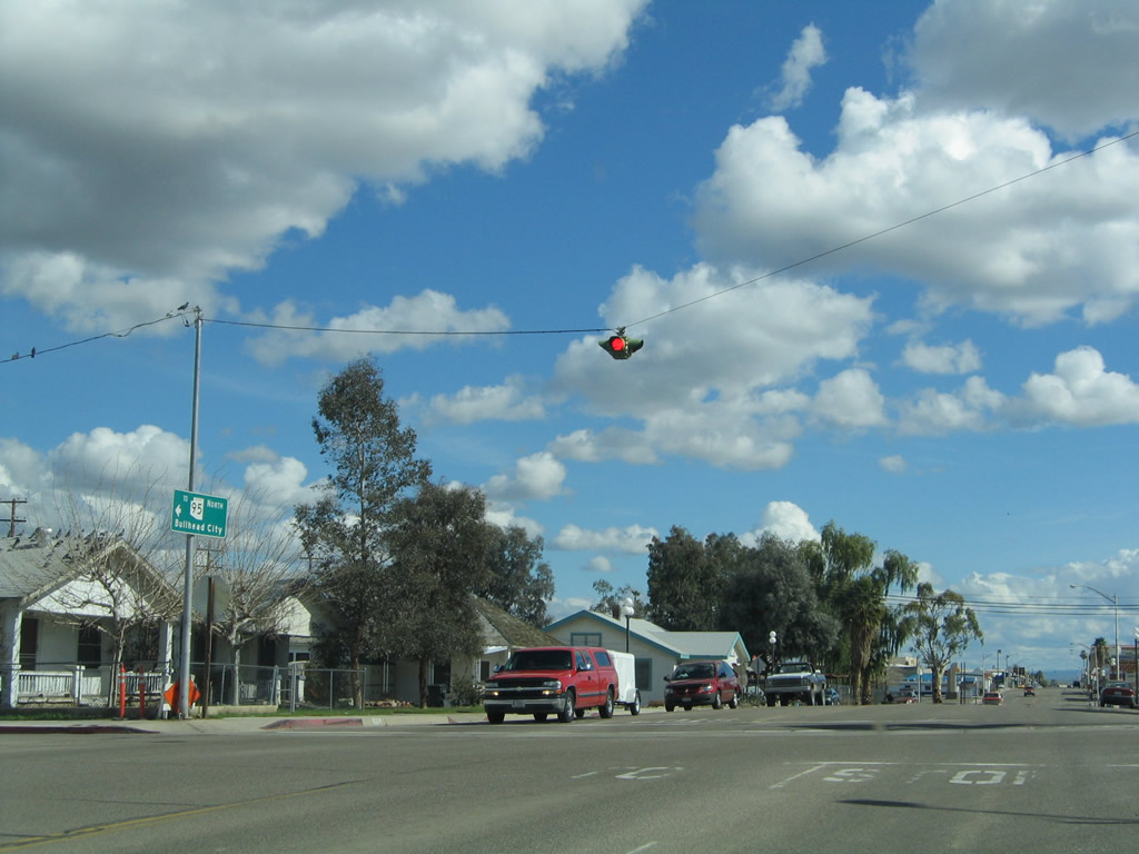
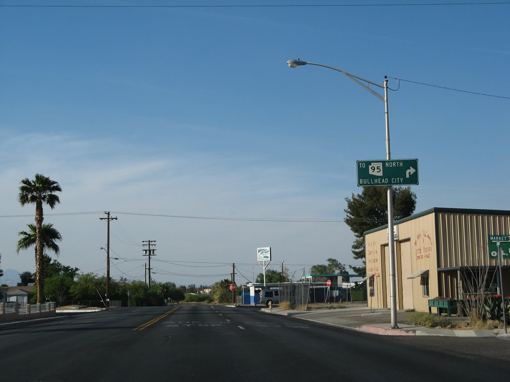
A trailblazer sign for Arizona 95 north to Mohave Valley and Bullhead City is posted at the Broadway and J Street. From here, the route to Arizona 95 is somewhat convulted but basically follows Broadway northwest to Arch Street east to K Street north into Arizona. Photos taken 02/20/05. |
|
Another four-way stop is posted along eastbound Business Loop I-40 and U.S. 66 at G Street. Photo taken 02/20/05. |
|
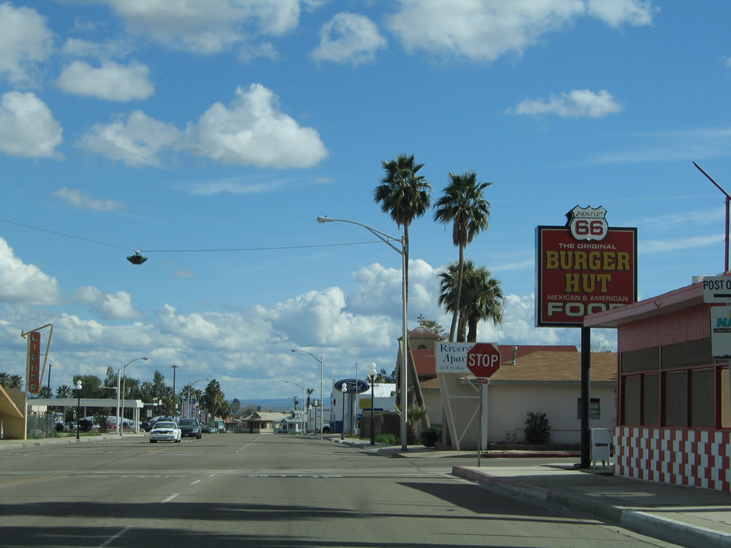
Eastbound Business Loop I-40 and U.S. 66 approach D Street at a four-way stop. The Route 66 Burger Hut is located at this intersection, and it is one of several businesses in Needles to use 66 in its name. Photo taken 02/20/05. |
|
A bit further east along Broadway, a 66 Motel sign is located at the intersection of Broadway and Desnok Street in east Needles. Photo taken 02/20/05. |
|
|
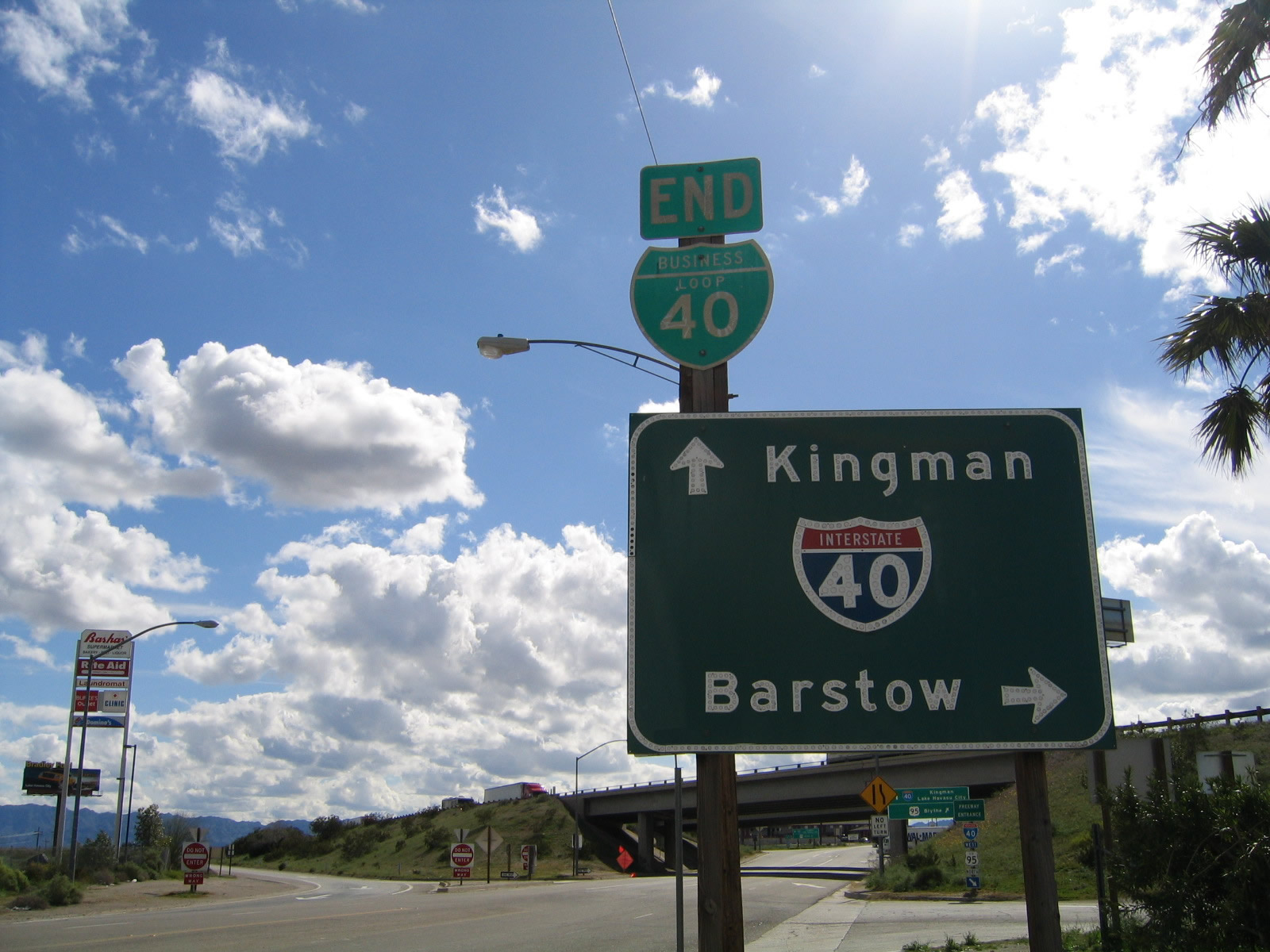
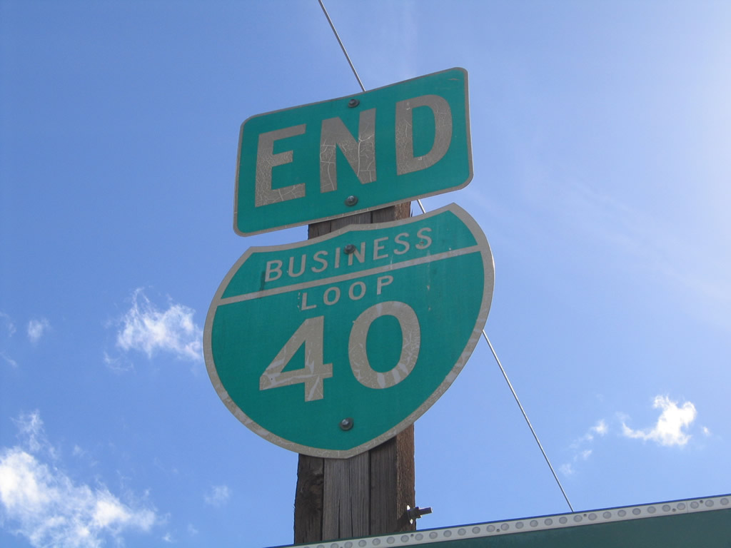
Soon thereafter, Business Loop I-40 and U.S. 66 approach the interchange with Interstate 40 and U.S. 95. An end shield used to be posted for eastbound Business Loop I-40 at its junction with Interstate 40 and U.S. 95 at the east end of Needles; the end shield was gone by 2009. Business Loop I-40 follows the original alignment of U.S. 66 and U.S. 95 through downtown Barstow. Photos taken 02/20/05. |
|
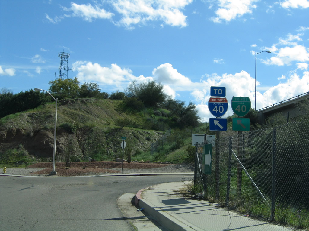
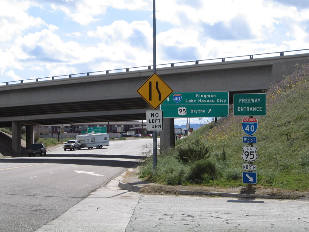
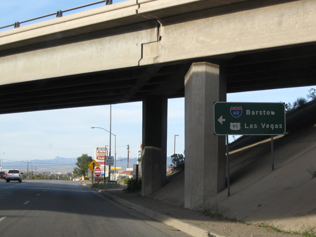
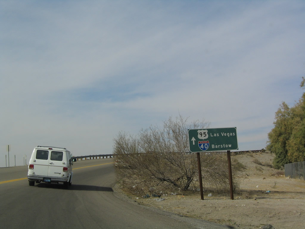
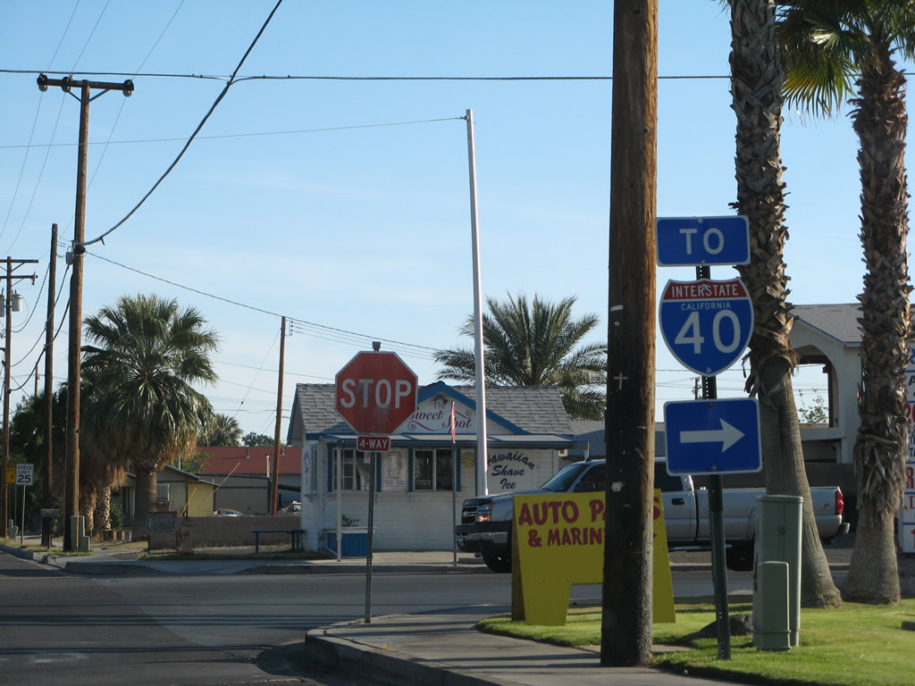
After the end shield, the first right connects to Interstate 40 west and U.S. 95 north to bypass Needles en route to Barstow and Las Vegas. The next left connects to Interstate 40 east to Kingman and Flagstaff in Arizona. Continue straight to follow U.S. 95 south and U.S. 66 east; U.S. 95 will travel through Vidal Junction and Blythe before exiting California to serve southwestern Arizona. Photo taken 02/20/05. |
| Business Loop I-40 and U.S. 66/Broadway west |
|
U.S. 95 leaves Broadway and U.S. 66 to turn onto Interstate 40 east, as shown by this shadowed sign. Ahead, Business Loop I-40 continues east into downtown Needles. Photo taken 03/14/09. |
|
Both Interstate 40 and U.S. 95 are posted on the freeway entrance shield assembly from Business Loop I-40 and U.S. 95 to Interstate 40 west. Photo taken 02/20/05. |
|
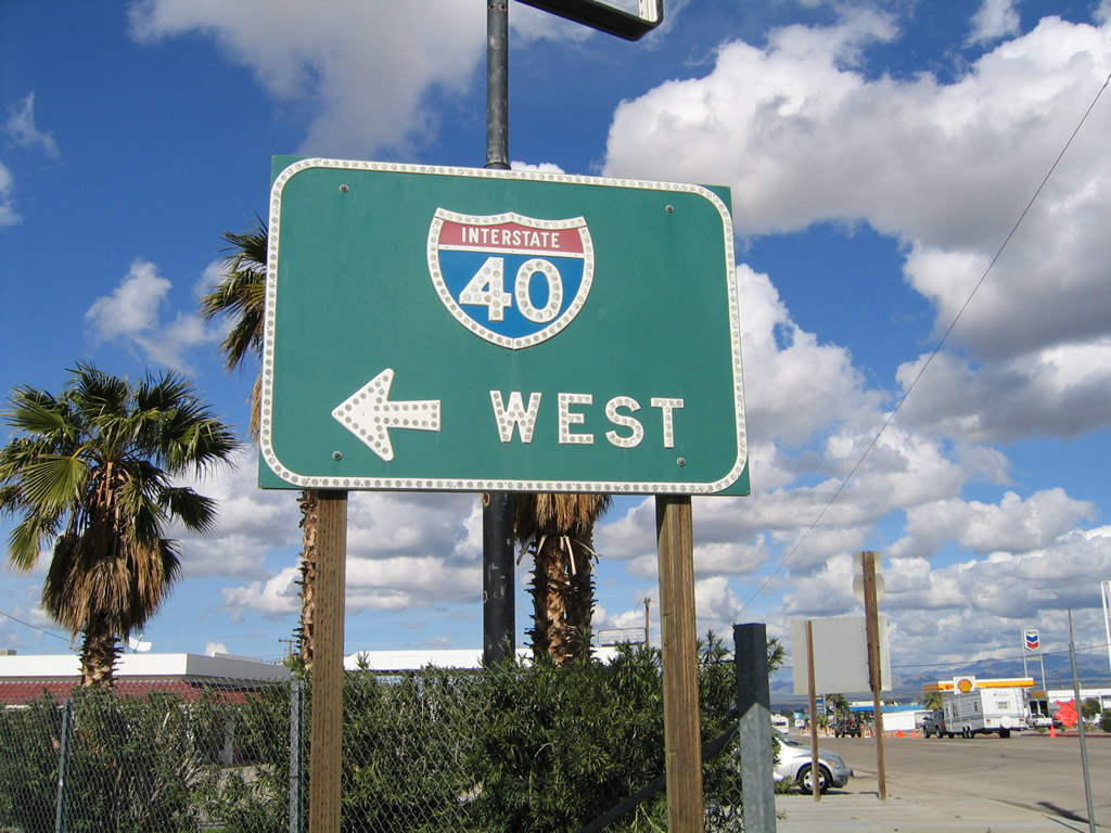
However, the green guide sign only shows Interstate 40 west and not U.S. 95 north. Photo taken 02/20/05. |
|
We begin our westbound journey through the city of Needles at the East Broadway interchange. Needles, which is located in the Mojave Valley through which the Colorado River runs, was founded in 1883 with the coming of the railroad, and incorporated October 30, 1913. Needles had a population of 4,830 people as of the 2000 Census. Business Loop I-40 and U.S. 66 travel through Needles along Broadway, which takes many twists and turns through the city. Photo taken 03/14/09. |
|
The business route starts with four lanes as it parallels the Burlington Northern Santa Fe (BNSF) Railroad into town. Photo taken 03/14/09. |
|
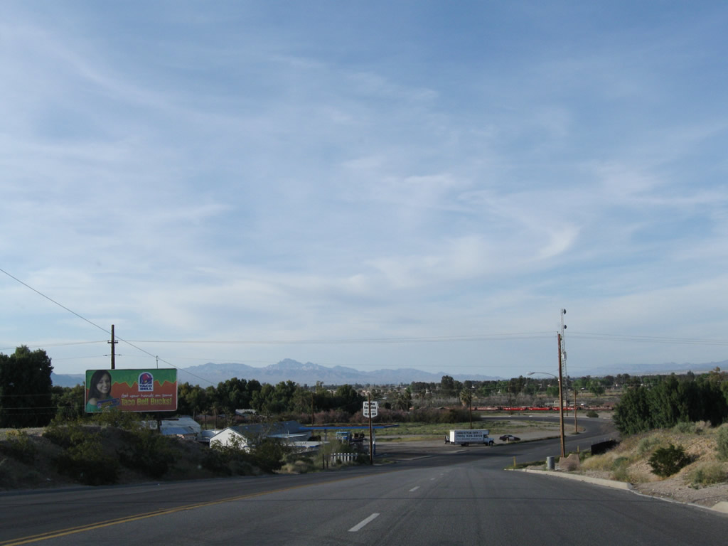
Needles is a welcome oasis in the desert, as all motorist services are available in Needles. Business Loop I-40 and U.S. 66 proceed east along Broadway into downtown Needles. Photo taken 03/14/09. |
|
The first Business Loop I-40 reassurance shield is posted along East Broadway before entering downtown Needles. Photo taken 03/14/09. |
|
Turn left on Desnok Street to the 66 Motel. Photo taken 03/14/09. |
|
Business Loop I-40 and U.S. 66 stay left on Broadway, while a right turn connects to Front Street, which parallels the railroad through downtown. Front Street is the original route of U.S. 66 through town. Photo taken 03/14/09. |
|
Westbound Business Loop I-40 and U.S. 66/Broadway approaches J Street near the center of town. Turn left here to Interstate 40; continue straight to follow Business Loop I-40 and U.S. 66 west. At this intersection, Arizona 95 joins the business route. Arizona 95 used to remain entirely within the state of Arizona, but the section of the state highway between Interstate 40 Exit 1 (Topock) and the Fort Mojave Indian Reservation is no longer maintained by the state. As such, signage directs traffic into California along Interstate 40, then northwest through Needles on J Street and the business loop, then turns north via K Street to cross the Colorado River to return to Arizona. Arizona 95 then continues its northward journey, terminating in Bullhead City. Photo taken 03/14/09. |
|
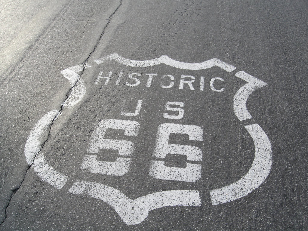
A U.S. 66 shield is painted onto Broadway near the J Street intersection. Photo taken 03/14/09. |
|
Westbound Business Loop I-40 and U.S. 66/Broadway approach L Street, which travels south under the freeway. Photo taken 04/01/07. |
|
After the L Street intersection, a Business Loop I-40 trailblazer is posted before the highway crosses over a bridge. Photo taken 03/14/09. |
|
|
|
Westbound Business Loop I-40 and U.S. 66 cross over the Burlington Northern Santa Fe Railroad on this bridge. A bicyclists dismount porcelain enamel sign dates back to 1965 and is found at either end of the bridge. Photos taken 04/01/07 and 03/14/09. |
|
 |
|
Continuing east, Business Loop I-40, U.S. 66, and To Arizona 95 follow Broadway past the Sage Motel. Photo taken 04/01/07. |
|
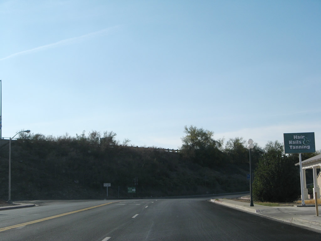
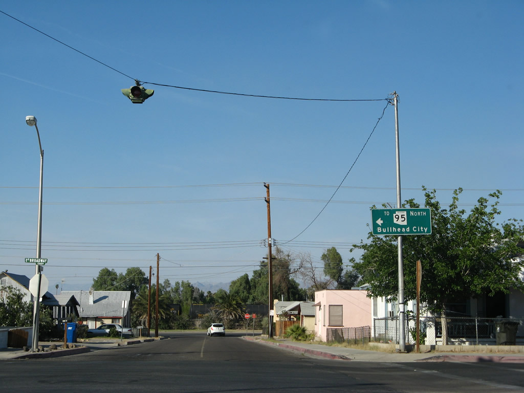
At Market Street, westbound Business Loop I-40 and U.S. 66 make a left turn to stay on Broadway, while Arizona 95 makes a right turn onto Arch Street. A guide sign is posted for the continuation of Arizona 95 north. Photo taken 04/01/07. |
|
The routes divide: turn left to follow Business Loop I-40 and U.S. 66 west to Barstow, or turn right to follow Arizona 95 north to Mohave Valley and Bullhead City. Photo taken 04/01/07. |
|
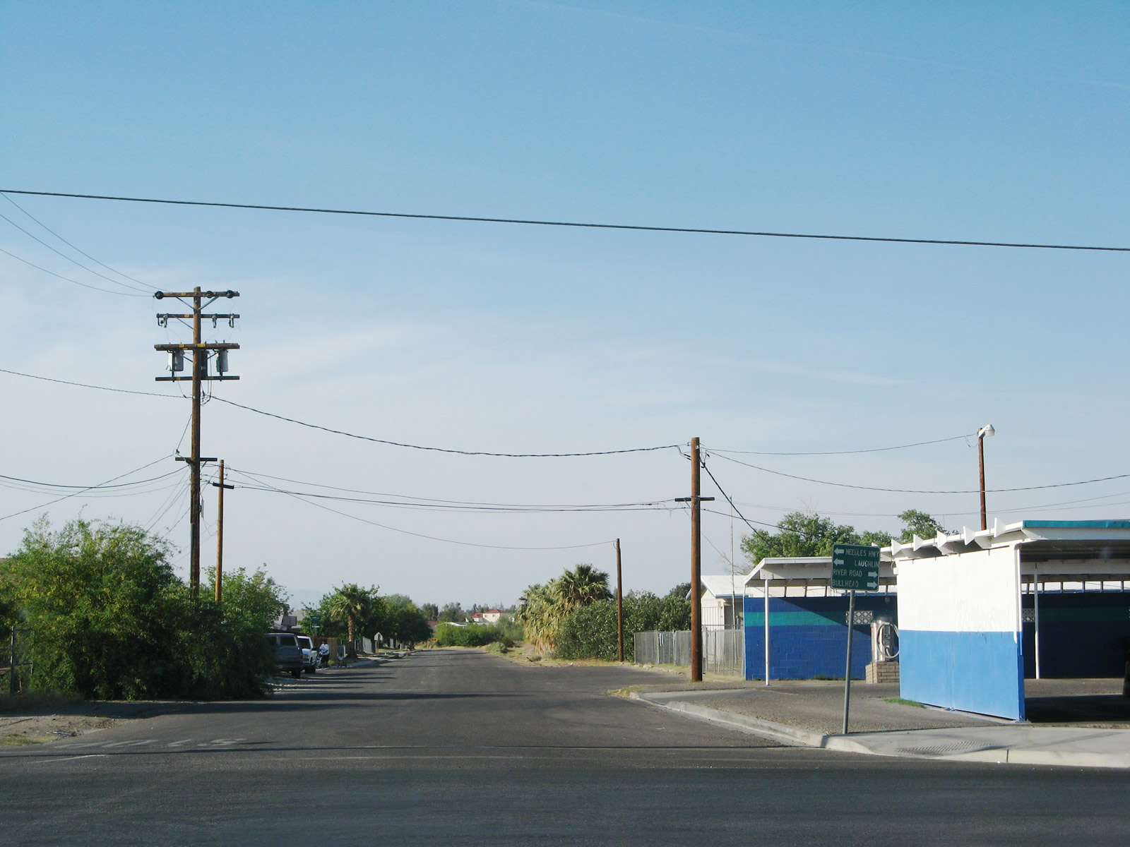
A tiny guide sign directs motorists to Needles Highway north to Laughlin or River Road to Bullhead City. No shields are posted here for Business Loop I-40 or U.S. 66; hopefully motorists know to turn left here to continue west on Broadway. Photo taken 04/01/07. |
|
View of westbound Business Loop I-40/U.S. 66 as it heads through western Needles. Photo taken 02/16/04. |
|
This old-style U.S. 66 shield is located along the westbound business loop near a motel in Needles. Photo taken 02/16/04. |
|
Westbound Business Loop I-40/U.S. 66 approaching its junction with Interstate 40 and U.S. 95. Photo taken 02/16/04. |
|
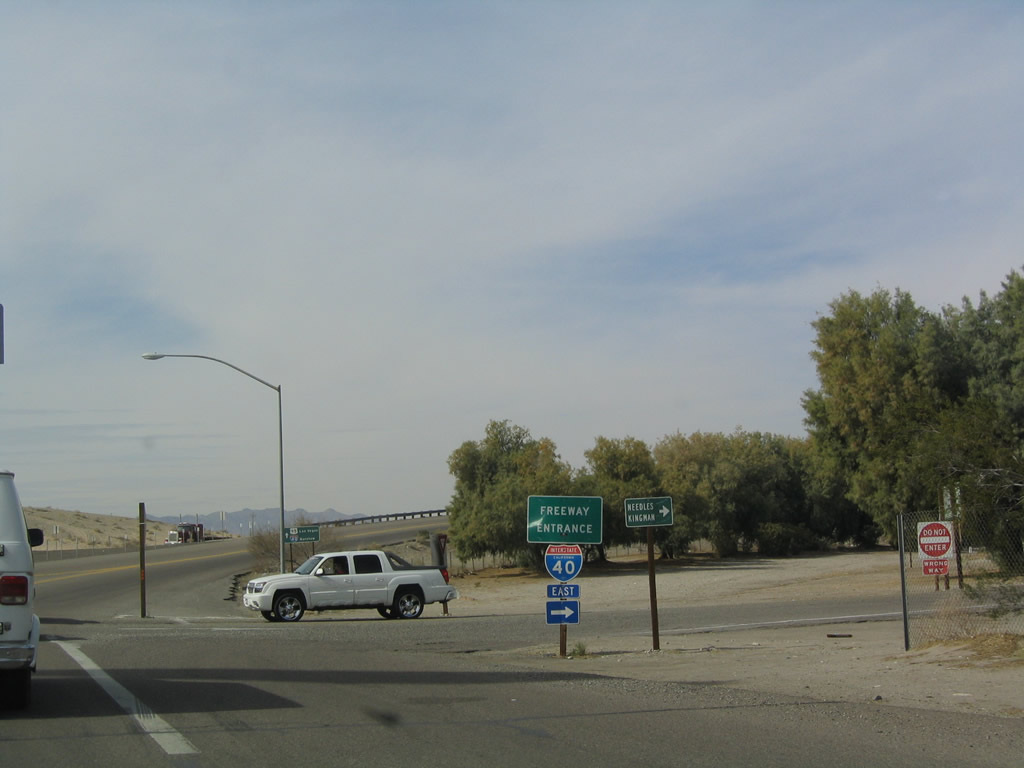
This freeway entrance along the business loop leads to Interstate 40 east and U.S. 95 south. Photo taken 02/16/04. |
|
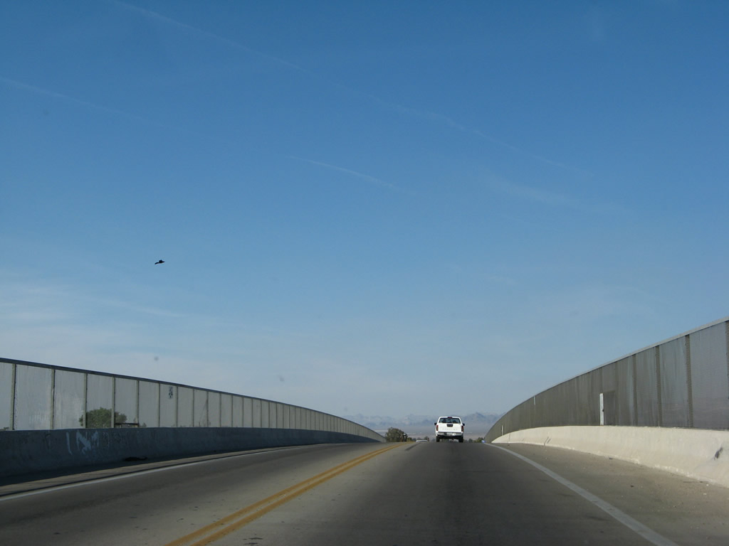
Westbound Business Loop I-40 crosses this bridge over Interstate 40 and U.S. 95 to reach the ramp to westbound. Photo taken 02/16/04. |
|
The business loop comes to its end at the northern end of the diamond interchange, where it returns to Interstate 40 west and U.S. 95 north. U.S. 66 continues west on its old alignment ahead. No end shield is present here. Photo taken 03/14/09. |
| Business Loop I-40 and U.S. 66 scenes |
|
Northbound J Street approaches Business Loop I-40 and U.S. 66/Broadway in downtown Needles. Arizona 95, which has a series of trailblazer signs through Needles, turns left from J Street onto Broadway west. Photo taken 04/01/07. |
|
Again picking up the route of Arizona 95, we follow Arch Street from Business Loop I-40/Broadway east to K Street for the Colorado River crossing back into Arizona. Photo taken 03/14/09. |
|
At the stop sign ahead, turn left from Arch Street onto K Street north to Arizona 95/Harbor Boulevard north over the Colorado River to Bullhead City, Arizona. Photo taken 03/14/09. |
|
Another Arizona 95 north trailblazer sign is posted at the Arch Street and K Street intersection. Turn left here to follow Arizona 95 to Bullhead City. Photo taken 03/14/09. |
|
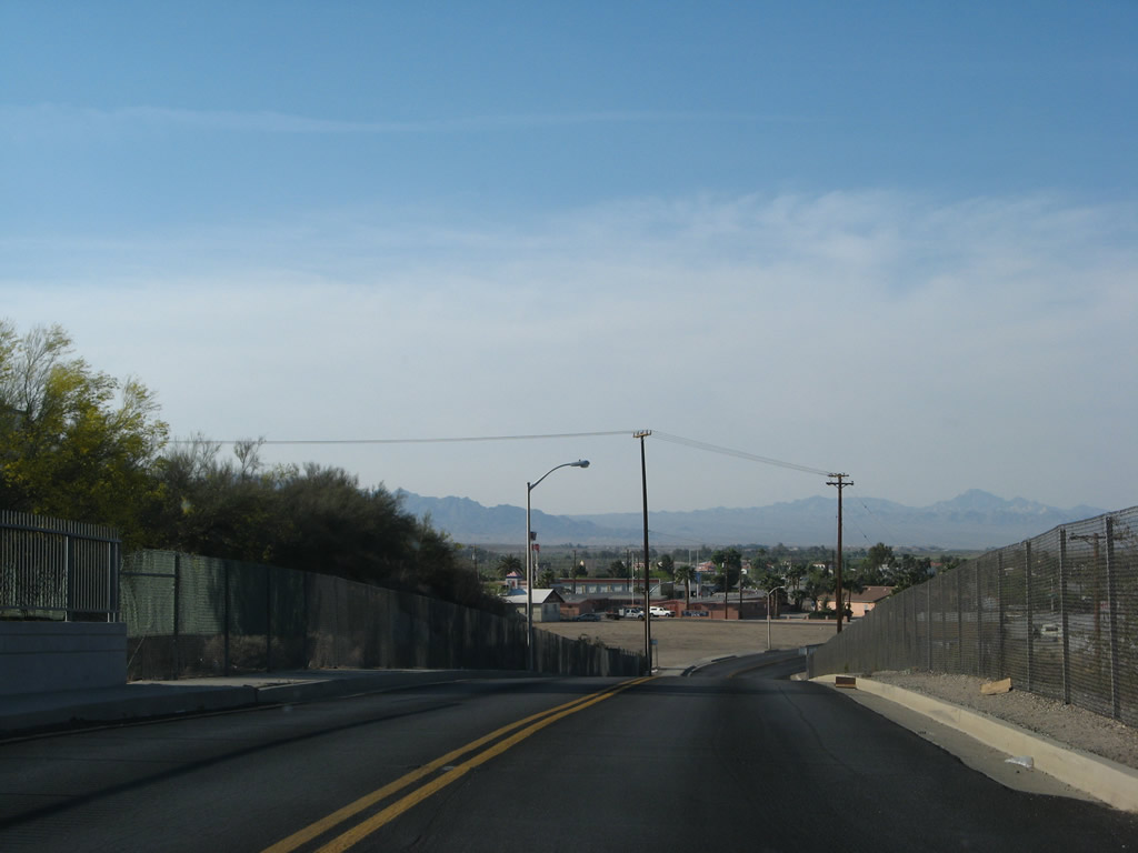
K Street quickly gains elevation as it prepares to cross the Colorado River and become Arizona 95/Harbor Boulevard. Photo taken 04/01/07. |
|
Arizona 95/Harbor Boulevard crosses the Colorado River and leaves Needles, California, and enters Mohave Valley, Arizona. Photo taken 04/01/07. |
|
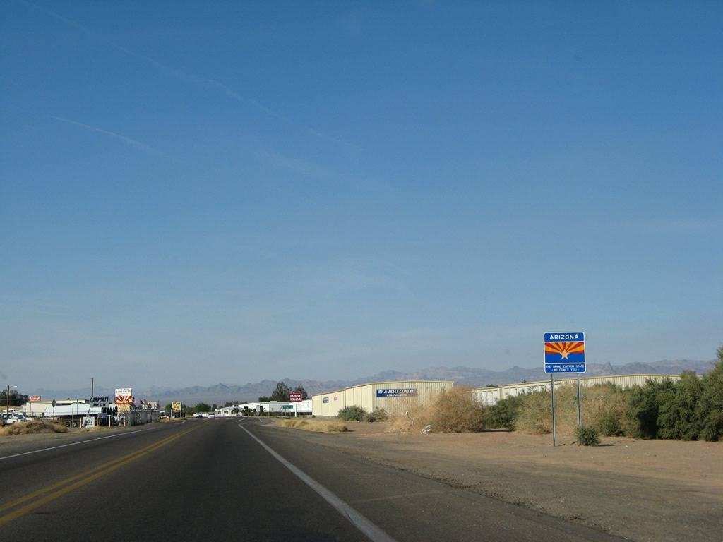
A welcome to Arizona sign is posted after Arizona 95 crosses the Colorado River. Photo taken 04/01/07. |
|
Traveling in the other direction, this Interstate 40 trailblazer is placed at the intersection of K Street and Arch Street. Turn right to follow Arch Street to Business Loop I-40 and ultimately Interstate 40. Photo taken 03/14/09. |
Page Updated July 5, 2009.