

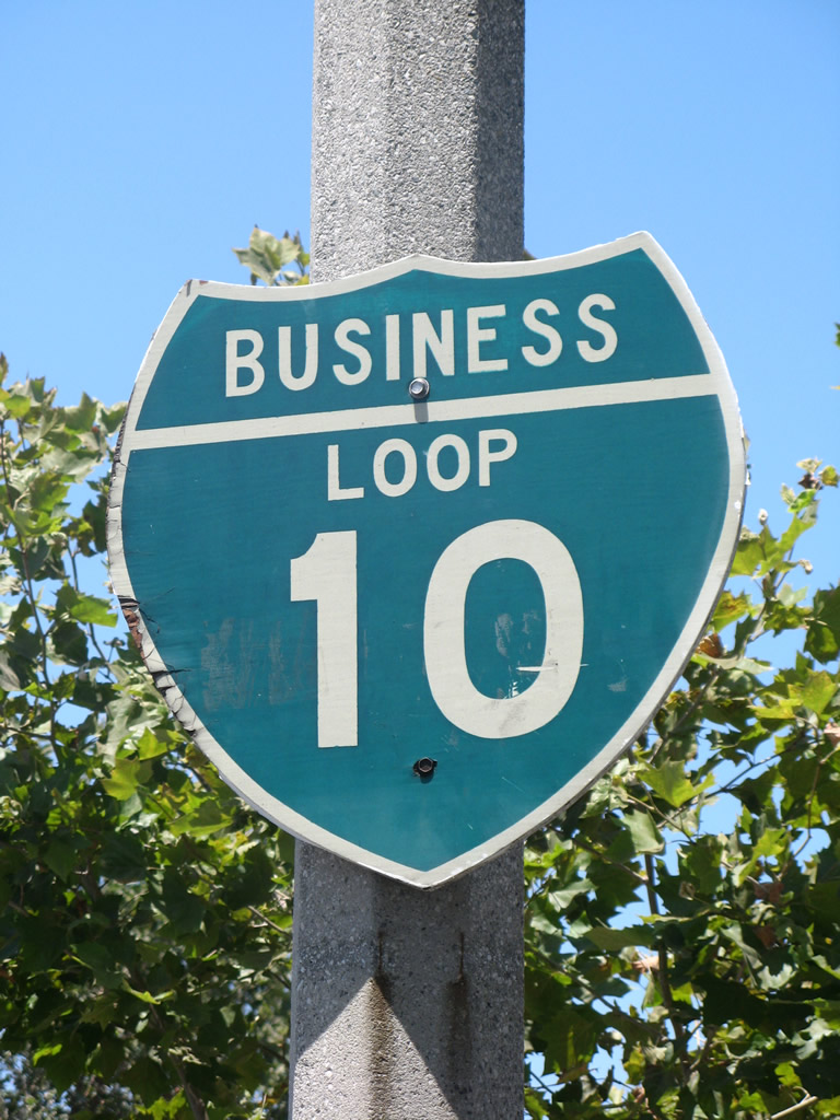
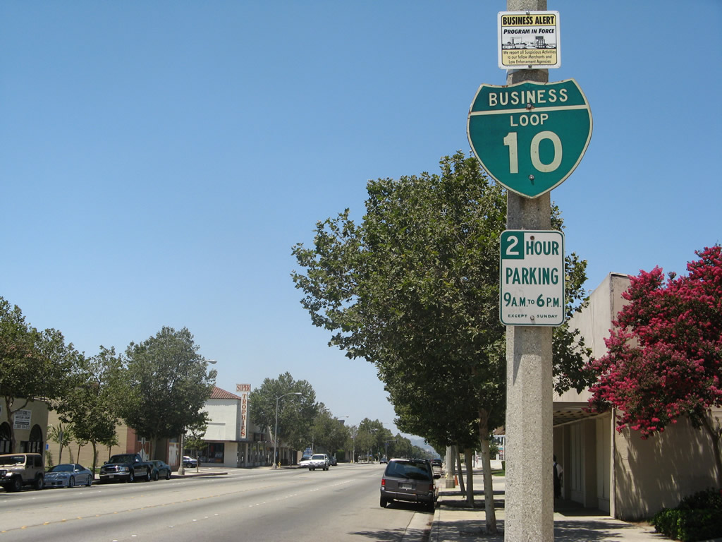
Business Loop I-10 - Pomona and Ontario
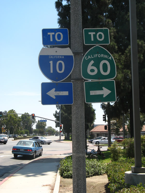
This loop for the most part does not exist anymore, although some remnant signs are still around. It was formerly U.S. 70-99 Business and was signed as Business Loop I-10 in the 1960s along Holt Boulevard. The loop begins at the Kellogg Interchange (Exit 42B to southbound California 71, then east on Holt Avenue at Exit 14 from California 71) and extends east through Pomona into Ontario. Shields still remain along this route, which follows Holt Boulevard between California 71 and just east of the Ontario International Airport. Ali Pezeshkpour wrote on May 1, 2001:
The business shields are only found in Pomona, and even though I have desperately tried to find some sign that would point to a business route, I have found none on California 71 or Interstate 10. The interchanges with these freeways are not optimal, because first of all, only Westbound Interstate 10 can access Holt Boulevard, and only Eastbound Holt Boulevard can access Eastbound Interstate 10, which allows for minimum signage even for Holt Boulevard. [At] the California 71 interchange no signs are here for any loop either. The loop shields were continuous until California 71. The reason I suspect the shields are only in Pomona is because Pomona is Los Angeles County and Ontario and beyond is in San Bernardino County" or in a different city. There are no signs for this business route from mainline Interstate 10.
| Business Loop I-10 east | |
|---|---|
 |
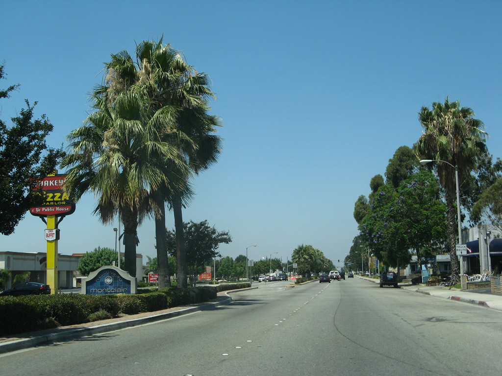
In Montclair, a major signalized intersection on Business Loop I-10 (Holt Boulevard) east is with Central Avenue. Turn left to follow Central Avenue north to Interstate 10 Exit 49 near Montclair Plaza. To the south , Central Avenue connects with California 60 at Exit 33. Photo taken 07/15/07. |
 |
As eastbound Business Loop I-10 and U.S. 70-99/Holt Boulevard approach Mountain Avenue in Ontario, this old "Central Business District" is posted prior to the intersection traffic signal. To the south, Mountain Avenue crosses over the Union Pacific Railroad and offers a grade separation from both Brooks Street and State Street on the north and south sides of the railroad tracks. Photo taken 07/15/07. |
| Business Loop I-10 west | |
 |
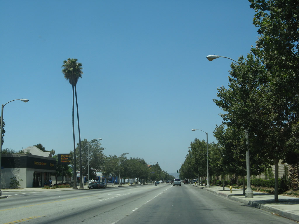
Business Loop I-10 (U.S. 70-99) west on Holt Boulevard in Downtown Ontario after the California 83 (Euclid Avenue) intersection. The city of Ontario has a population of 170,373 as of the 2000 Census. The city is known for Ontario Mills, the largest shopping mall in Southern California. Many visitors to Ontario use the regional Ontario International Airport, which has nationwide service and can be a less stressful airport connection for people of the Inland Empire than using Los Angeles International Airport (LAX). Ontario, with its huge population, is one of the largest cities in the Inland Empire and is growing at a rapid pace. With a warm climate (average median temperature is 83 degrees with 16 inches of precipitation annually) and low elevation (925 feet), people are moving in droves to this area. Photo taken 07/15/07. |
 |
In downtown Ontario, westbound Business Loop I-10 (Holt Boulevard) meets Laurel Avenue at this intersection. Photo taken 07/15/07. |
 |
Westbound Business Loop I-10 (U.S. 70-99) meets Palm Avenue. Photo taken 07/15/07. |
 |
Passing Fern Avenue, Business Loop I-10 carries four through lanes (two in each direction) as well as parking and turn pockets. Photo taken 07/15/07. |
 |
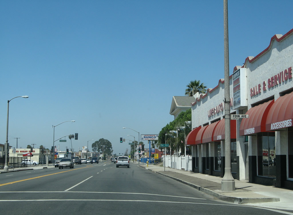
Westbound Business Loop I-10 and U.S. 70-99/Holt Boulevard intersect Vine Avenue at this traffic signal. Photo taken 07/15/07. |
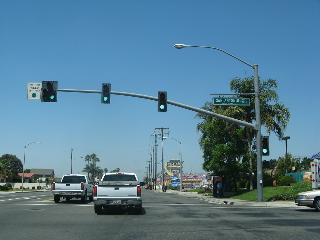 |
The next traffic signal along westbound Business Loop I-10 (Holt Boulevard) is with San Antonio Avenue. Ontario Village shopping plaza is located on the northeast corner of this intersection. To the south, San Antonio Avenue crosses the Union Pacific Railroad and travels south through residential areas toward Ontario High School (via Francis Street west). Photo taken 07/15/07. |
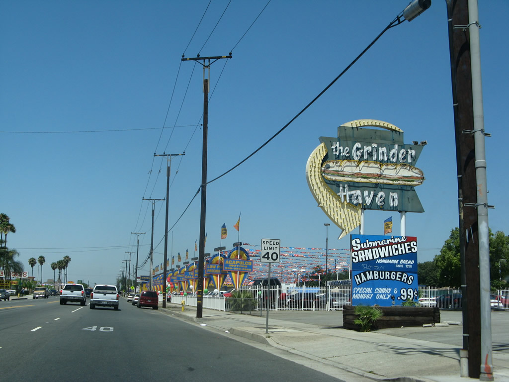 |
A historic sign for the Grinder Haven restaurant is posted alongside old U.S. 70-99. Photo taken 07/15/07. |
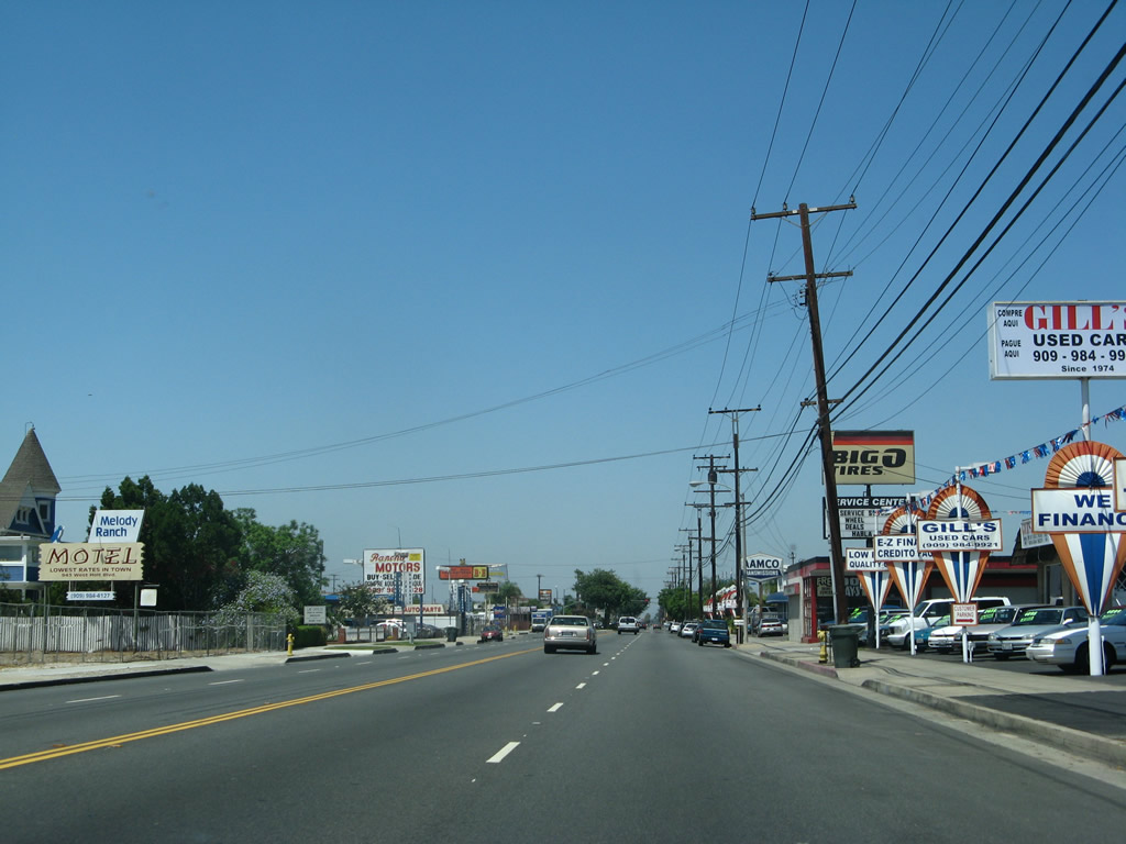 |
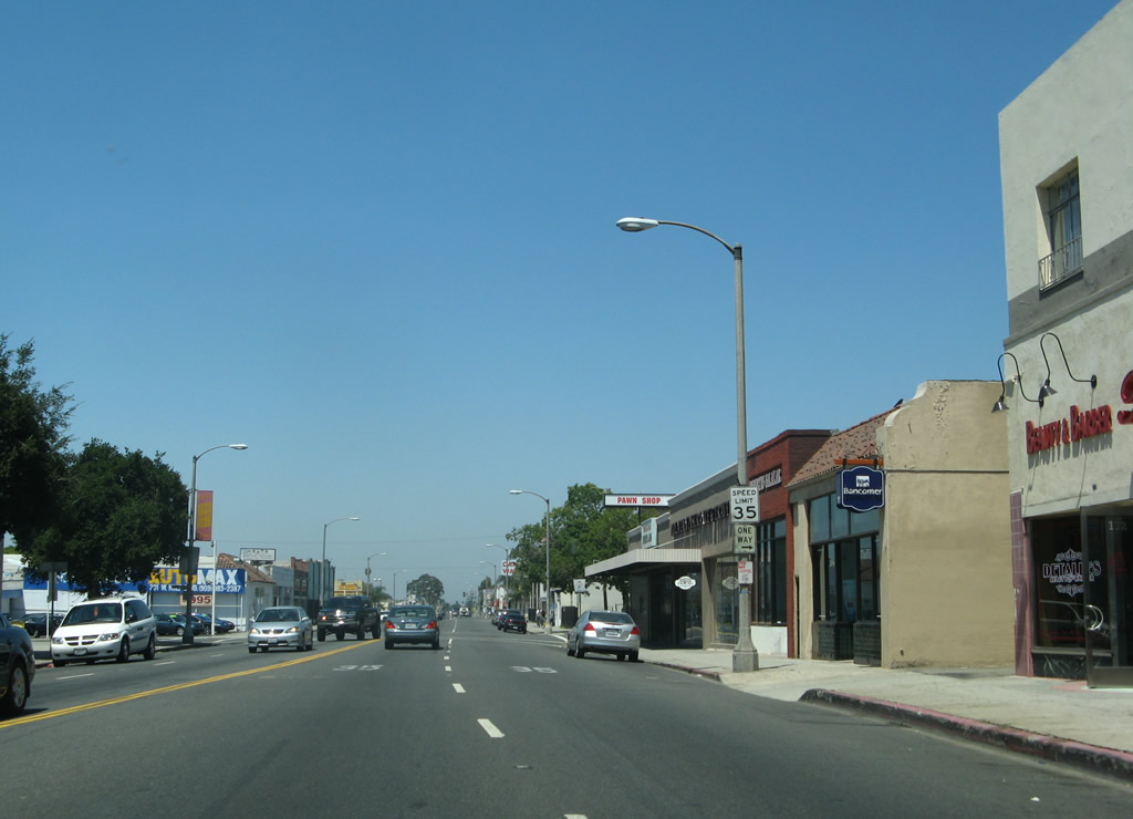
Car dealerships, auto parts stores, and strip malls line this stretch of Holt Boulevard. Photo taken 07/15/07. |
 |
Use Mountain Avenue north to Interstate 10 (San Bernardino Freeway) and south to California 60 (Pomona Freeway). Photo taken 07/15/07. |
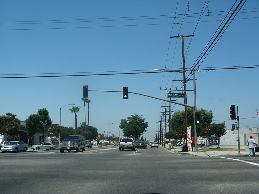 |
Westbound Business Loop I-10 and U.S. 70-99/Holt Boulevard intersect Mountain Avenue at this traffic signal. Photo taken 07/15/07. |
 |
After Mountain Avenue, Holt Boulevard has five lanes (including a middle turn lane). Photo taken 07/15/07. |
 |
Westbound Business Loop I-10 and U.S. 70-99/Holt Boulevard pass by Vince's Spaghetti and an ice skating rink, both of which are identified by older marquee signs. Photo taken 07/15/07. |
 |
At Benson Avenue, westbound Business Loop I-10 and U.S. 70-99/Holt Boulevard leave Ontario and enters the city of Montclair. The population of Montclair was 33,049 as of the 2000 Census, and the city incorporated on April 25, 1956. Photo taken 07/15/07. |
 |
A Montclair welcome monument sign is placed in the planted and landscaped median. The business loop, which has no reassrance shields in Montclair, continues west along Holt Boulevard. Photo taken 07/15/07. |
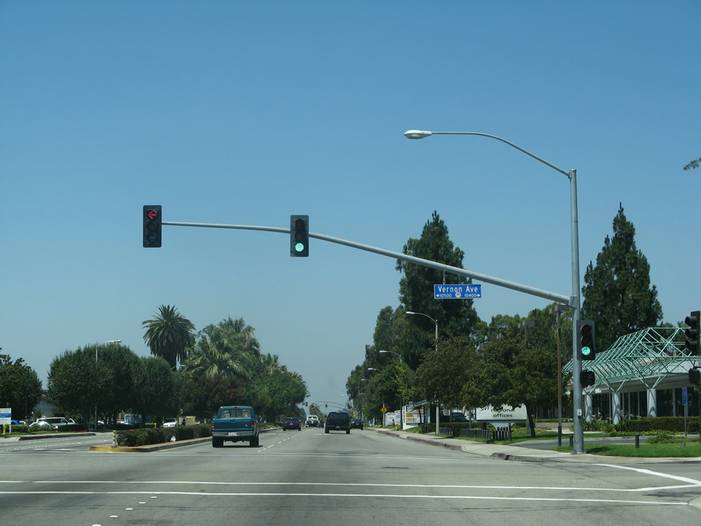 |
Westbound Business Loop I-10 and U.S. 70-99/Holt Boulevard meet Vernon Avenue at this traffic signal. Photo taken 07/15/07. |
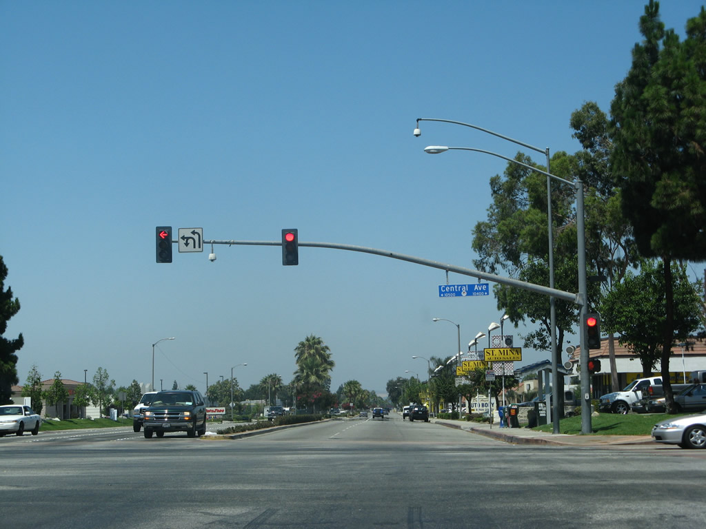 |
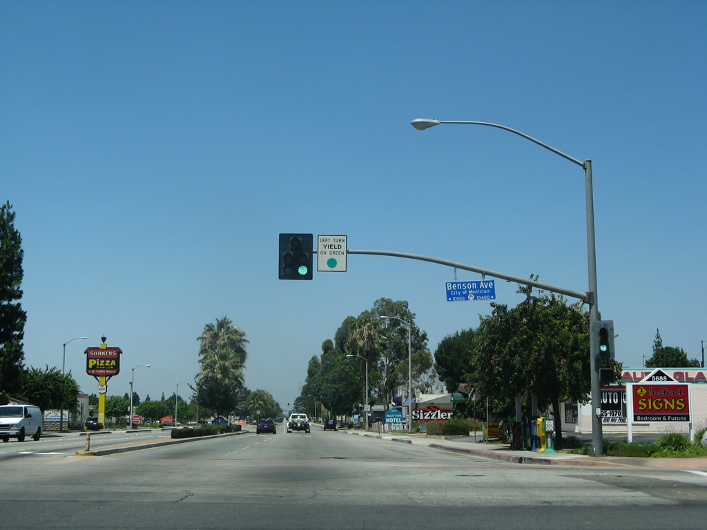
The next signalized major intersection on Holt Boulevard west is with Central Avenue. Turn right to follow Central Avenue north to Interstate 10 Exit 49 near Montclair Plaza. To the south, Central Avenue connects with California 60 at Exit 33. No trailblazers are posted for either route (unlike the other direction of the business loop at this intersection). Photo taken 07/15/07. |
 |
Westbound Business Loop I-10 (Holt Boulevard) meets Monte Vista Avenue at this intersection. Photo taken 07/15/07. |
 |
The next major signalized intersection along westbound Business Loop I-10 (Holt Boulevard) is with Ramona Avenue. Use Ramona Avenue south to the city of Chino and California 60 (Pomona Freeway) at Exit 32. Photo taken 07/15/07. |
 |
Westbound Business Loop I-10 (Holt Boulevard) meets Amherst Avenue at this intersection. Photo taken 07/15/07. |
 |
A 1939 bridge carries Business Loop I-10 (Holt Boulevard) over San Antonio Channel. This bridge was originally in service as part of U.S. 70-99. Note the divoted curbing and the old concrete bridge rail. Photo taken 07/15/07. |
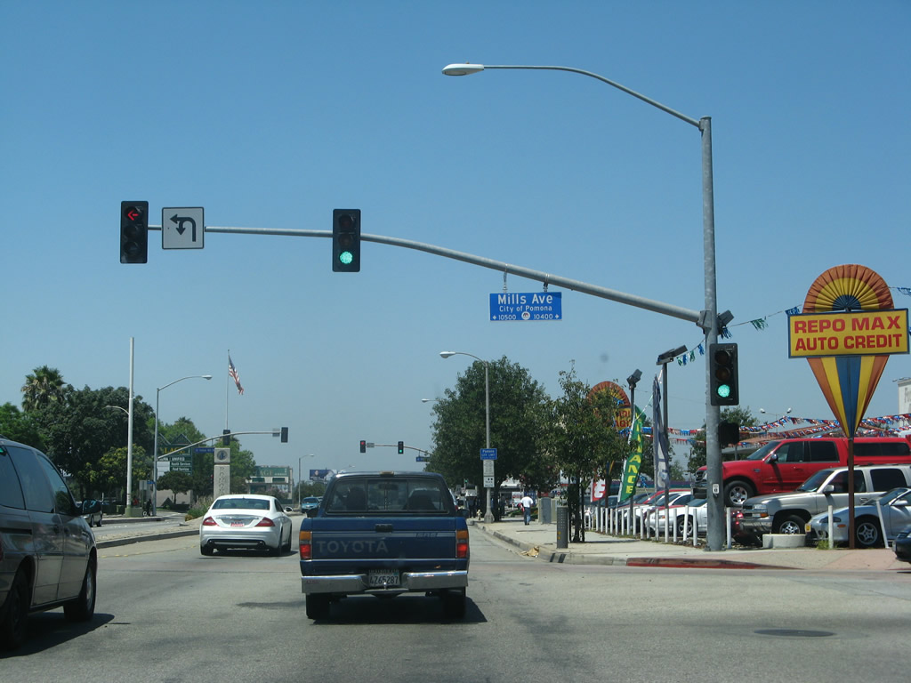 |
Soon thereafter, Holt Boulevard leaves Montclair and becomes Holt Avenue as the old route enters the city of Pomona in Los Angeles County. This intersection is with Mills Avenue, which travels north along the Los Angeles-San Bernardino County Line between Pomona/Claremont and Montclair. Photo taken 07/15/07. |
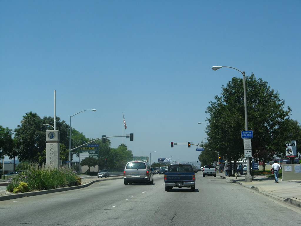 |
The city of Pomona was home to 149,473 people as of the 2000 Census and was incorporated on January 6, 1888. Pomona is one of the larger cities in Los Angeles County and is the convergence point of several freeways, including Interstate 10, California 57, California 60, and California 71. The business route will continue west into the business district. Photo taken 07/15/07. |
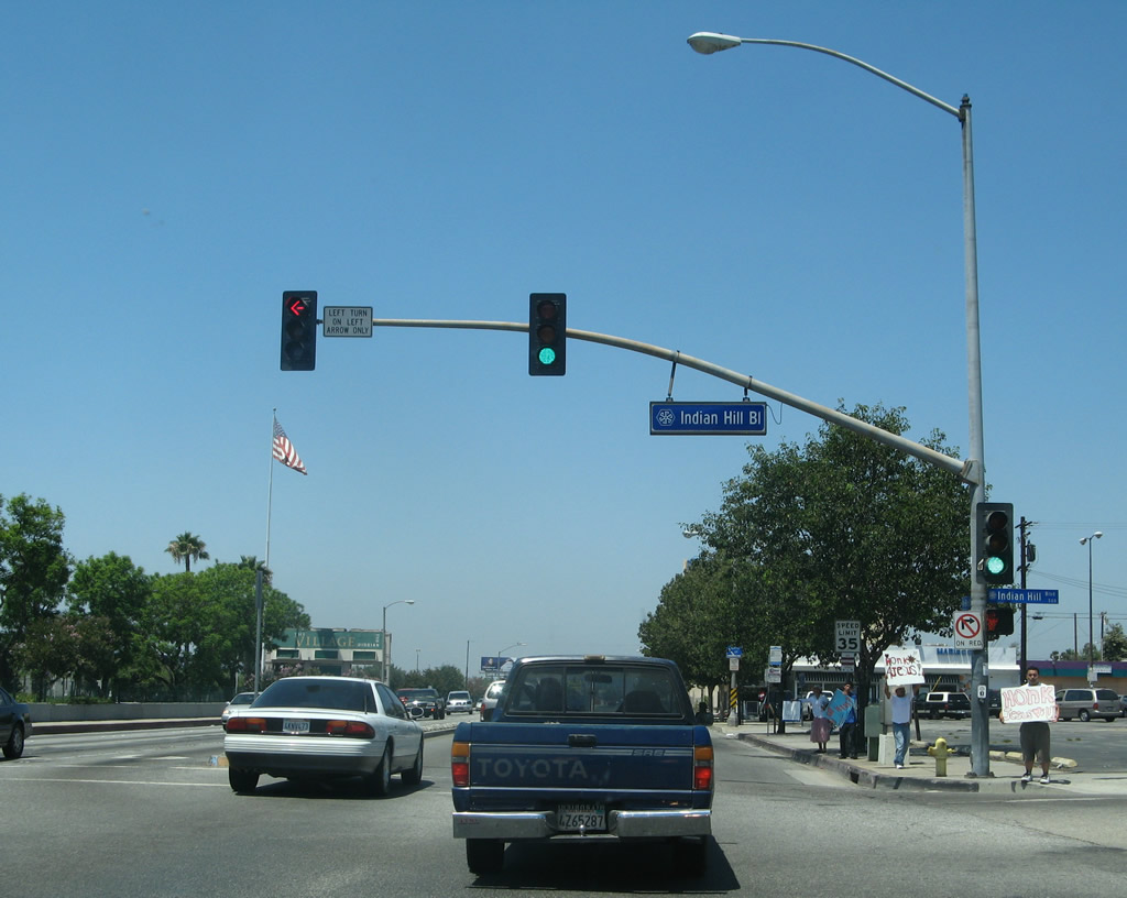 |
Westbound Business Loop I-10 meets Indian Hill Boulevard at this traffic signal. Note the change in street sign identification blade design as compared to those found in Montclair. Photo taken 07/15/07. |
 |
Holt Avenue passes by the Village at Indian Hill education conference center. The Village is described as "a specialized mixed-use facility designed to support K-12 teaching and learning, proessional development and parent education." This former mall was acquired by the school district in 1995 and recreated into a learning center. Photo taken 07/15/07. |
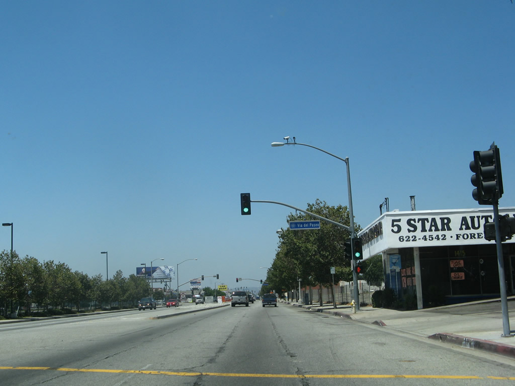 |
Westbound Business Loop I-10 (Holt Avenue) (U.S. 70-99) meets Via del Paseo at this traffic signal. Photo taken 07/15/07. |
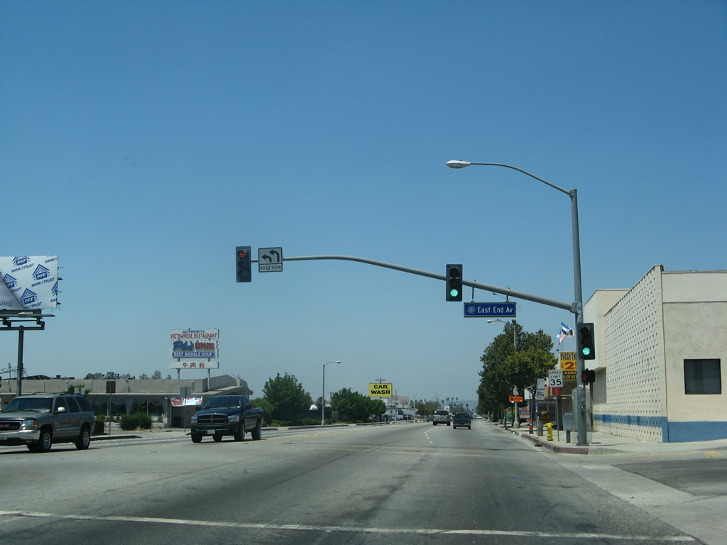 |
The next signalized intersection is with East End Avenue. Photo taken 07/15/07. |
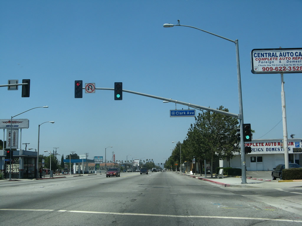 |
Westbound Business Loop I-10 (Holt Avenue) (U.S. 70-99) meets Clark Avenue at this traffic signal. Photo taken 07/15/07. |
 |
The next signalized intersection along westbound Business Loop I-10 (Holt Avenue) (U.S. 70-99) is with Reservoir Street. Photo taken 07/15/07. |
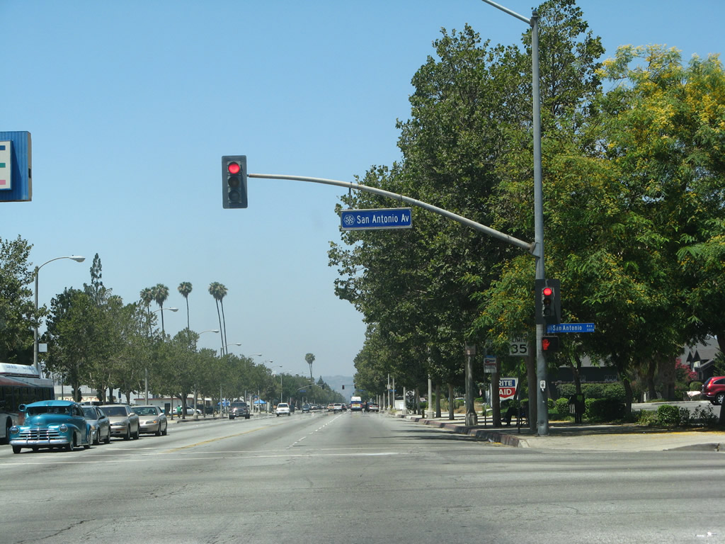 |
Westbound Business Loop I-10 (Holt Avenue) (U.S. 70-99) meets San Antonio Avenue at this traffic signal. Use San Antonio Avenue north to Pomona High School. Photo taken 07/15/07. |
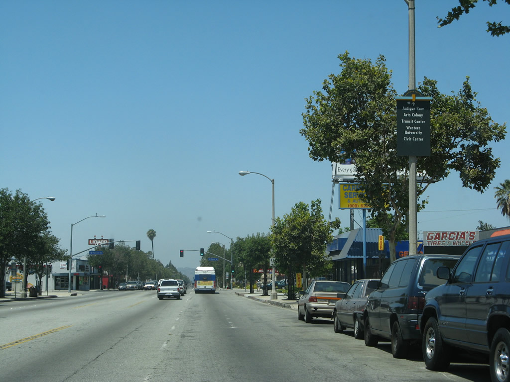 |
Continue west on Business Loop I-10 (Holt Avenue) (U.S. 70-99) to Pomona's antique row, arts colony, transit center, Western University, and civic center. Photo taken 07/15/07. |
 |
The next signalized intersection along westbound Business Loop I-10 (Holt Avenue) (U.S. 70-99) is with Towne Avenue. Use Towne Avenue south to California 71 (Chino Valley Freeway) and north to Interstate 10 Exit 48 and the city of Claremont. Photo taken 07/15/07. |
 |
 |
 |
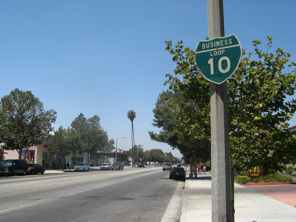
The first reassurance shield for Business Loop I-10 west appears on westbound Holt Avenue (U.S. 70-99) after the Towne Avenue intersection. This old sign is wooden, a rarity in California. Photos taken 07/15/07. |
 |
Holt Avenue carries four lanes with a center turn lane through Pomona. Botts dots act as lane markers. Photo taken 07/15/07. |
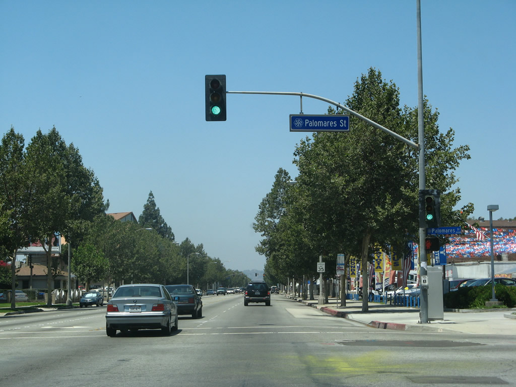 |
The next signalized intersection along westbound Business Loop I-10 (Holt Avenue) (U.S. 70-99) is with Palomares Street. Photo taken 07/15/07. |
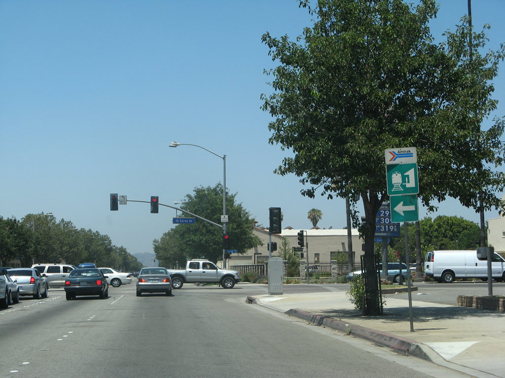 |
Turn left (south) on Garey Avenue to the Amtrak and Metrolink rail station. Both passenger rails run along the Union Pacific Railroad, which parallels Holt Avenue to the south. Photo taken 07/15/07. |
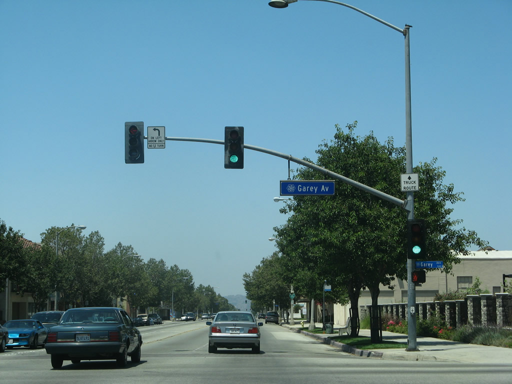 |
Westbound Business Loop I-10 (Holt Avenue) meets Former California 71/Garey Avenue at this intersection. Turn south to follow Garey Avenue to California 71 and north to Interstate 10 Exit 46B. Photo taken 07/15/07. |
 |
After the Garey Avenue intersection, a second Business Loop I-10 reassurance shield is posted along U.S. 70-99/Holt Avenue. Photo taken 07/15/07. |
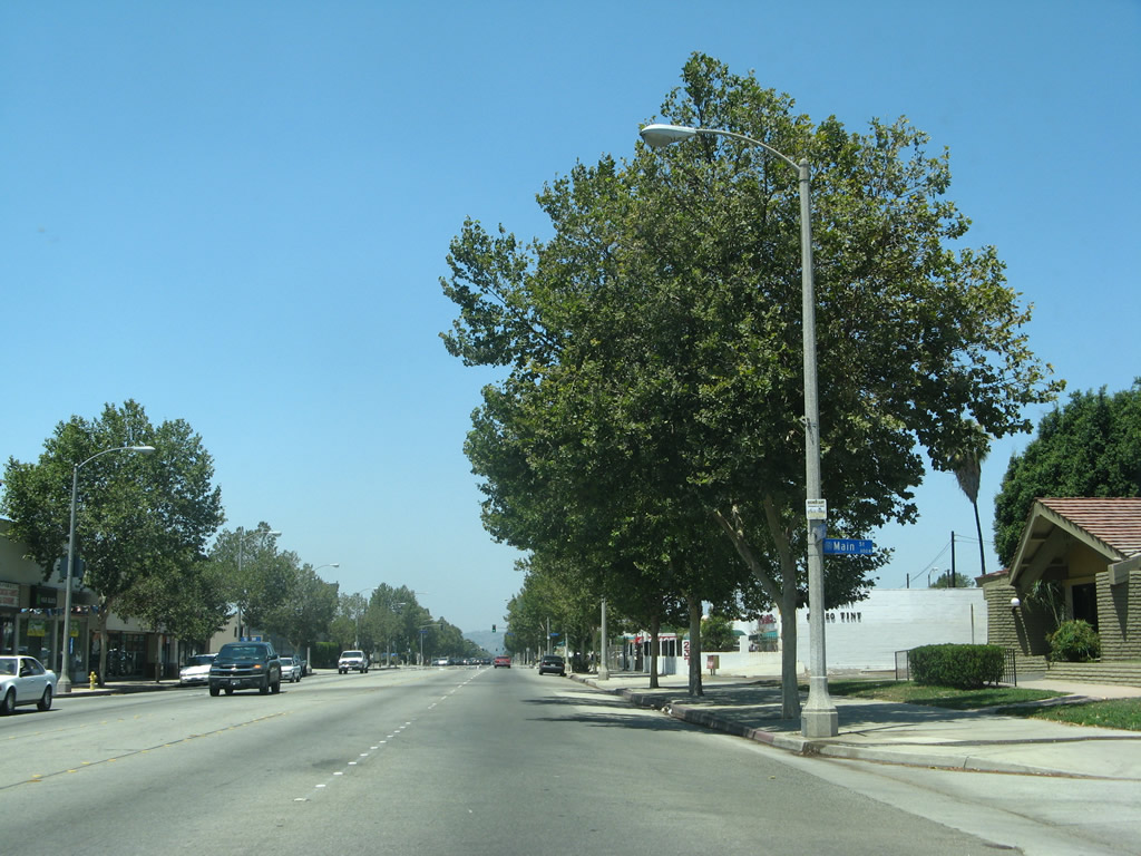 |
The intersection with Main Street in downtown Pomona is not signalized. Photo taken 07/15/07. |
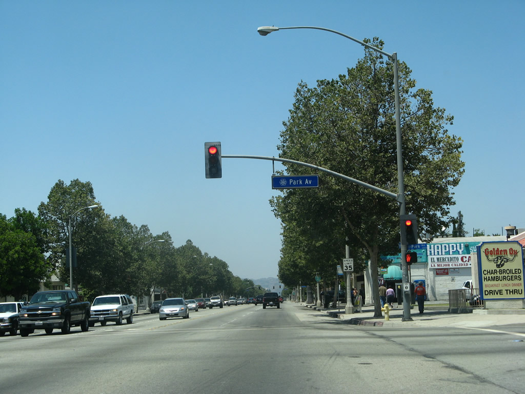 |
Westbound Business Loop I-10 (Holt Avenue) meets Park Avenue at this traffic signal. Photo taken 07/15/07. |
 |
Another Business Loop I-10 reassurance shield is posted prior to Wisconsin Street. Photo taken 07/15/07. |
 |
Westbound Business Loop I-10 (Holt Avenue) meets White Avenue at this traffic signal. Photo taken 07/15/07. |
 |
The business district continues along westbound Business Loop I-10 (Holt Avenue). Here the business route meets Hamilton Boulevard at this traffic signal. Photo taken 07/15/07. |
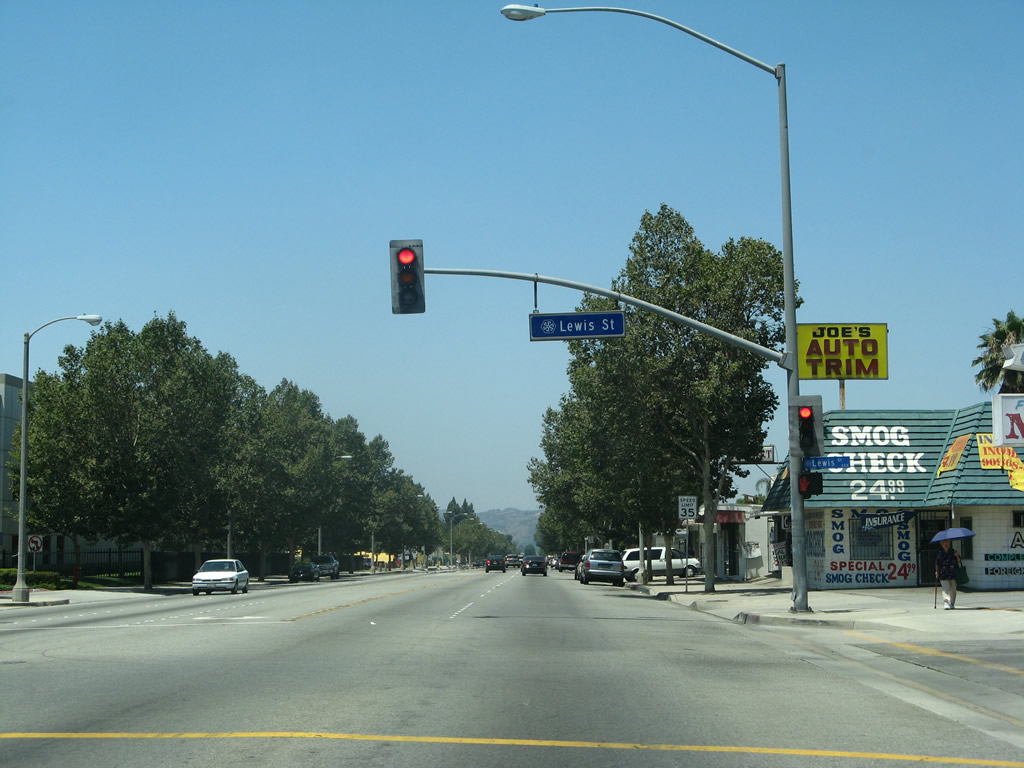 |
Westbound Business Loop I-10 (Holt Avenue) meets Lewis Street at this traffic signal. Photo taken 07/15/07. |
 |
Soon thereafter, westbound Business Loop I-10 (Holt Avenue) meets Dudley Avenue at this traffic signal. Photo taken 07/15/07. |
 |
Westbound Business Loop I-10 (Holt Avenue) meets Erie Street at this traffic signal. Photo taken 07/15/07. |
 |
Soon thereafter, westbound Business Loop I-10 (Holt Avenue) approaches Union Avenue. Photo taken 07/15/07. |
 |
The last traffic signal along Business Loop I-10 west is this signal with Fairplex Drive. Ahead, Business Loop I-10 will interchange with California 71 (Chino Valley Freeway). Photo taken 07/15/07. |
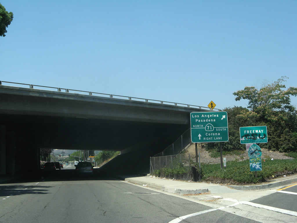 |
At the California 71 interchange, westbound Business Loop I-10 departs from Holt Avenue and turns north to follow California 71 for its return to Interstate 10. The supposed overlap of these two routes is not signed. Plenty of graffiti covers this completely illegible California 71 north freeway entrance shield. Continue straight on Holt Avenue to connect to California 71 south to Corona. Photo taken 07/15/07. |
 |
Turn right to follow a loop ramp onto California 71 south. To the left, Humane Way leads south to join Mission Boulevard. At this point, Holt Avenue ends, and Valley Boulevard begins. Valley Boulevard is not an old U.S. highway alignment, but it offers an alternate route west. Valley Boulevard travels southwest through western Pomona into Walnut and the City of Industry, then turns west to La Puente, then turns northwest to meet Interstate 10 at Exit 29 in El Monte. Turning west again, Valley Boulevard travels through Rosemead, San Gabriel, Alhambra, and finally Los Angeles. At the intersection with Mission Road in the Lincoln Heights community, Valley Boulevard changes into Main Street for the final distance into downtown Los Angeles. Photo taken 07/15/07. |


Page Updated March 14, 2013.
|
About Contact Glossary |
In The News Testimonials Interstate Guide |
Social Media:
 |
|
© 2000-23 AARoads.com | All Rights Reserved | Privacy Policy / Terms of Use
|
||